- National Register of Historic Places listings in Delaware County, Oklahoma
-
 Location of Delaware County in Oklahoma
This is a list of the National Register of Historic Places listings in Delaware County, Oklahoma.
This is intended to be a complete list of the properties on the National Register of Historic Places in Delaware County, Oklahoma, United States. The locations of National Register properties for which the latitude and longitude coordinates are included below, may be seen in a Google map.[1]
There are 6 properties listed on the National Register in the county.
-
- This National Park Service list is complete through NPS recent listings posted November 10, 2011.[2]
Current listings
[3] Landmark name [4] Image Date listed Location City or town Summary 1 Bassett Grove Ceremonial Grounds July 20, 1983 Address Restricted Grove 2 Corey House/Hotel December 17, 1982 N. Main at 2nd St.
36°35′39″N 94°46′09″W / 36.594167°N 94.769167°WGrove 3 Hildebrand Mill 
October 18, 1972 10 miles west of Siloam Springs, Arkansas
36°11′53″N 94°40′16″W / 36.198056°N 94.671111°WDripping Springs 4 Polson Cemetery November 21, 1977 Northeast of Jay
36°31′31″N 94°38′10″W / 36.525278°N 94.636111°WJay 5 Saline District Courthouse 
January 1, 1976 1.5 miles south of the intersection of State Highway 33, Scenic U.S. Route 412, and County Road NS449
36°12′27″N 95°00′36″W / 36.2075°N 95.01°WRose 6 Splitlog Church October 26, 1972 About 9 miles northeast of Grove Grove See also
- List of National Historic Landmarks in Oklahoma
- National Register of Historic Places listings in Oklahoma
References
- ^ The latitude and longitude information provided in this table was derived originally from the National Register Information System, which has been found to be fairly accurate for about 99% of listings. For about 1% of NRIS original coordinates, experience has shown that one or both coordinates are typos or otherwise extremely far off; some corrections may have been made. A more subtle problem causes many locations to be off by up to 150 yards, depending on location in the country: most NRIS coordinates were derived from tracing out latitude and longitudes off of USGS topographical quadrant maps created under the North American Datum of 1927, which differs from the current, highly accurate WGS84 GPS system used by Google maps. Chicago is about right, but NRIS longitudes in Washington are higher by about 4.5 seconds, and are lower by about 2.0 seconds in Maine. Latitudes differ by about 1.0 second in Florida. Some locations in this table may have been corrected to current GPS standards.
- ^ "National Register of Historic Places: Weekly List Actions". National Park Service, United States Department of the Interior. Retrieved on November 10, 2011.
- ^ Numbers represent an ordering by significant words. Various colorings, defined here, differentiate National Historic Landmark sites and National Register of Historic Places Districts from other NRHP buildings, structures, sites or objects.
- ^ "National Register Information System". National Register of Historic Places. National Park Service. . http://nrhp.focus.nps.gov/natreg/docs/All_Data.html.
U.S. National Register of Historic Places Topics Lists by states Alabama • Alaska • Arizona • Arkansas • California • Colorado • Connecticut • Delaware • Florida • Georgia • Hawaii • Idaho • Illinois • Indiana • Iowa • Kansas • Kentucky • Louisiana • Maine • Maryland • Massachusetts • Michigan • Minnesota • Mississippi • Missouri • Montana • Nebraska • Nevada • New Hampshire • New Jersey • New Mexico • New York • North Carolina • North Dakota • Ohio • Oklahoma • Oregon • Pennsylvania • Rhode Island • South Carolina • South Dakota • Tennessee • Texas • Utah • Vermont • Virginia • Washington • West Virginia • Wisconsin • WyomingLists by territories Lists by associated states Other Municipalities and communities of Delaware County, Oklahoma Cities 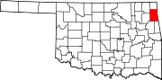
Towns Bernice | Colcord | Kansas | Oaks‡ | West Siloam Springs
CDPs Brush Creek | Bull Hollow | Cayuga | Cleora | Cloud Creek | Copeland | Dennis | Dodge | Dripping Springs | Flint Creek | Leach | New Eucha | Old Eucha | Rocky Ford | Sycamore | Tagg Flats | Twin Oaks | Zena
Unincorporated
communitiesFootnotes ‡This populated place also has portions in an adjacent county or counties
Categories:- Delaware County, Oklahoma
- National Register of Historic Places in Oklahoma by county
-


Wikimedia Foundation. 2010.