- National Register of Historic Places listings in Delta County, Michigan
-
The following is a list of Registered Historic Places in Delta County, Michigan.
-
- This National Park Service list is complete through NPS recent listings posted November 10, 2011.[1]
[2] Site name[3] Image Date listed Location City or Town Summary 1 Bay de Noquet Lumber Company Waste Burner April 8, 2011 South end of River St.
45°50′7″N 86°39′35″W / 45.83528°N 86.65972°W[4]Nahma Township 2 Carnegie Public Library 
July 25, 1977 201 S. 7th St.
45°44′39″N 87°3′22″W / 45.74417°N 87.05611°WEscanaba 3 County Road I-39- Rapid River Bridge December 9, 1999 County Road I-39 over Rapid River
46°1′22″N 86°58′44″W / 46.02278°N 86.97889°WMasonville Township 4 Delta Hotel 
April 9, 1998 624 Ludington St.
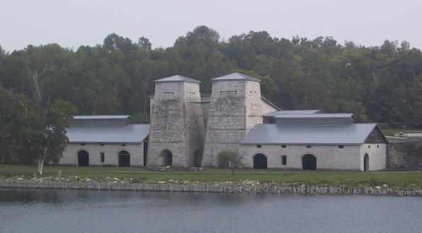
45°44′46″N 87°3′22″W / 45.74611°N 87.05611°WEscanaba 5 Fayette 
February 16, 1970 On a peninsula in Big Bay de Noc, on M-183 in Fayette State Park
45°42′50″N 86°40′0″W / 45.71389°N 86.666667°WFayette Boundary increase (added 1996-12-26): Fayette State Park, end of M-183, Fairbanks Township 6 Minneapolis Shoal Light Station 
November 15, 2006 In northern Green Bay 6.6 mi (10.6 km) south of Peninsula Point, northwest of Lake Michigan
45°32′10″N 86°59′54″W / 45.53611°N 86.99833°WBay de Noc 7 Nahma and Northern Railway Locomotive #5 
January 30, 2007 Main St. at River St.
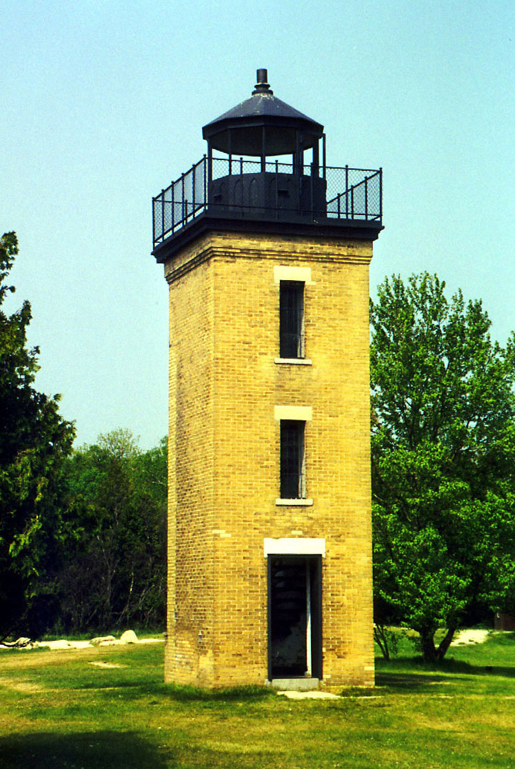
45°50′27″N 86°39′51″W / 45.84083°N 86.66417°WNahma Township 8 Peninsula Point Lighthouse 
April 28, 1975 6.5 mi (10.5 km) southeast of Escanaba in Hiawatha National Forest
45°40′5″N 86°58′0″W / 45.66806°N 86.966667°WEscanaba 9 Poverty Island Light Station 
September 6, 2005 Northwestern Lake Michigan, 5.8 mi (9.3 km) south of Garden Peninsula at Fairport
45°31′38″N 86°39′49″W / 45.52722°N 86.66361°WFairbanks Township 10 Richter Brewery 
April 15, 2009 1615 Ludington St.
45°44′44.67″N 87°4′12.44″W / 45.7457417°N 87.0701222°WEscanaba Historic brewery, built in 1900. 11 Sand Lighthouse 
December 1, 1997 12 Waterplant Rd.
45°44′40″N 87°2′40″W / 45.74444°N 87.04444°WEscanaba 12 Spider Cave April 16, 1971 Address Restricted Fayette 13 St. Martin Island Light Station 
July 19, 1984 St. Martin Island
45°30′10″N 86°45′27″W / 45.50278°N 86.7575°WFairport 14 Summer Island Site September 3, 1971 Address Restricted Summer Island 15 Winter Site May 19, 1976 Address Restricted Garden See also
- List of Registered Historic Places in Michigan
References
- ^ "National Register of Historic Places: Weekly List Actions". National Park Service, United States Department of the Interior. Retrieved on November 10, 2011.
- ^ Numbers represent an ordering by significant words. Various colorings, defined here, differentiate National Historic Landmark sites, a National Historic Site, and several National Register of Historic Places Districts from other NRHP buildings, structures, sites or objects.
- ^ "National Register Information System". National Register of Historic Places. National Park Service. 2008-04-24. http://nrhp.focus.nps.gov/natreg/docs/All_Data.html.
- ^ Geocode coordinates estimated from information in NRHP nomination document.
U.S. National Register of Historic Places Topics Lists by states Alabama • Alaska • Arizona • Arkansas • California • Colorado • Connecticut • Delaware • Florida • Georgia • Hawaii • Idaho • Illinois • Indiana • Iowa • Kansas • Kentucky • Louisiana • Maine • Maryland • Massachusetts • Michigan • Minnesota • Mississippi • Missouri • Montana • Nebraska • Nevada • New Hampshire • New Jersey • New Mexico • New York • North Carolina • North Dakota • Ohio • Oklahoma • Oregon • Pennsylvania • Rhode Island • South Carolina • South Dakota • Tennessee • Texas • Utah • Vermont • Virginia • Washington • West Virginia • Wisconsin • WyomingLists by territories Lists by associated states Other Categories:- National Register of Historic Places in Michigan by county
- Delta County, Michigan
- Buildings and structures in Delta County, Michigan
-


Wikimedia Foundation. 2010.