- National Register of Historic Places listings in Dodge County, Minnesota
-
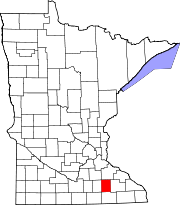
 Location of Dodge County in Minnesota
This is a list of the National Register of Historic Places listings in Dodge County, Minnesota. It is intended to be a complete list of the properties and districts on the National Register of Historic Places in Dodge County, Minnesota, United States. The locations of National Register properties and districts for which the latitude and longitude coordinates are included below, may be seen in a Google map.[1]
There are 10 properties and districts listed on the National Register in the county.
-
- This National Park Service list is complete through NPS recent listings posted November 10, 2011.[2]
Listings county-wide
[3] Landmark name Image Date listed Location City or town Summary 1 Ole Carlson House 
April 16, 1982 Highway 15
43°57′16″N 92°41′52″W / 43.954444°N 92.697778°WKasson 2 Eureka Hotel 
April 16, 1982 101 3rd Ave., SW.
44°01′42″N 92°45′08″W / 44.028333°N 92.752222°WKasson 3 Kasson Municipal Building 
April 16, 1982 12 W. Main
44°01′45″N 92°45′01″W / 44.029167°N 92.750278°WKasson 4 Kasson Public School 
December 6, 2007 101 3rd Ave., NW.
44°01′58″N 92°45′08″W / 44.032778°N 92.752222°WKasson 5 Kasson Water Tower 
June 3, 1976 4th Ave., NW.
44°01′52″N 92°45′10″W / 44.031111°N 92.752778°WKasson 6 Jacob Leuthold Jr. House 
April 16, 1982 108 2nd Ave., NW.
44°01′52″N 92°45′01″W / 44.031111°N 92.750278°WKasson 7 Mantorville and Red Wing Stage Road-Mantorville Section 
August 30, 1991 Northern side of 5th St., east of its junction with Minnesota Highway 57
44°04′02″N 92°45′06″W / 44.067222°N 92.751667°WMantorville 8 Mantorville Historic District 
June 28, 1974 Both sides of Minnesota Highway 57 and 5th St.
44°03′59″N 92°45′20″W / 44.066389°N 92.755556°WMantorville 9 Perry Nelson House 
April 16, 1982 County Highway 22
44°08′20″N 92°48′18″W / 44.138889°N 92.805°WWest Concord 10 Wasioja Historic District 
March 13, 1975 County Highway 16
44°04′44″N 92°49′50″W / 44.078889°N 92.830556°WMantorville See also
- List of National Historic Landmarks in Minnesota
- National Register of Historic Places listings in Minnesota
References
- ^ The latitude and longitude information provided in this table was derived originally from the National Register Information System, which has been found to be fairly accurate for about 99% of listings. For about 1% of NRIS original coordinates, experience has shown that one or both coordinates are typos or otherwise extremely far off; some corrections may have been made. A more subtle problem causes many locations to be off by up to 150 yards, depending on location in the country: most NRIS coordinates were derived from tracing out latitude and longitudes off of USGS topographical quadrant maps created under North American Datum of 1927, which differs from the current, highly accurate GPS system used by Google maps. Chicago is about right, but NRIS longitudes in Washington are higher by about 4.5 seconds, and are lower by about 2.0 seconds in Maine. Latitudes differ by about 1.0 second in Florida. Some locations in this table may have been corrected to current GPS standards.
- ^ "National Register of Historic Places: Weekly List Actions". National Park Service, United States Department of the Interior. Retrieved on November 10, 2011.
- ^ Numbers represent an ordering by significant words. Various colorings, defined here, differentiate National Historic Landmark sites and National Register of Historic Places Districts from other NRHP buildings, structures, sites or objects.
U.S. National Register of Historic Places Topics Lists by states Alabama • Alaska • Arizona • Arkansas • California • Colorado • Connecticut • Delaware • Florida • Georgia • Hawaii • Idaho • Illinois • Indiana • Iowa • Kansas • Kentucky • Louisiana • Maine • Maryland • Massachusetts • Michigan • Minnesota • Mississippi • Missouri • Montana • Nebraska • Nevada • New Hampshire • New Jersey • New Mexico • New York • North Carolina • North Dakota • Ohio • Oklahoma • Oregon • Pennsylvania • Rhode Island • South Carolina • South Dakota • Tennessee • Texas • Utah • Vermont • Virginia • Washington • West Virginia • Wisconsin • WyomingLists by territories Lists by associated states Other  Category:National Register of Historic Places •
  Portal:National Register of Historic Places
Municipalities and communities of Dodge County, Minnesota County seat: Mantorville Cities Blooming Prairie‡ | Claremont | Dodge Center | Hayfield | Kasson | Mantorville | West Concord
Townships Unincorporated
communitiesBerne
Ghost town Rice Lake‡
Footnotes ‡This populated place also has portions in an adjacent county or counties
Categories:- National Register of Historic Places in Minnesota by county
- Dodge County, Minnesota
- Buildings and structures in Dodge County, Minnesota
-


Wikimedia Foundation. 2010.