- National Register of Historic Places listings in Douglas County, Oregon
-
This is a list of properties and districts in Douglas County, Oregon that are listed on the National Register of Historic Places.
Current listings
[1] Landmark name Image Date listed Location City or town Summary 1 35-DO-130-Tahkenitch Landing Site June 10, 2003 Address Restricted Gardiner 2 Charles Applegate House 
March 17, 1975 NE of Yoncalla on Halo Trail
43°36′40″N 123°16′29″W / 43.611111°N 123.274722°WYoncalla 3 Baimbridge-Kanipe Farmstead Historic District January 29, 2008 16513 Elkhead Rd. Oakland 4 Henry Brown House October 30, 1979 W of Elkton off OR 38
43°38′51″N 123°38′57″W / 43.6475°N 123.649167°WElkton 5 Will Q. Brown House and Wash House September 10, 1987 274 S. Main St.
42°56′52″N 123°21′45″W / 42.947778°N 123.3625°WRiddle 6 Canyonville Methodist Church April 5, 1984 2nd and Pine Sts.
42°55′38″N 123°16′44″W / 42.927222°N 123.278889°WCanyonville 7 China Ditch May 22, 1991 Upper reaches of N. Myrtle Cr.
43°08′50″N 123°04′12″W / 43.147222°N 123.07°WMyrtle Creek 8 Nathaniel Curry House November 25, 1983 1458 Quail Lane
43°15′50″N 123°25′50″W / 43.263889°N 123.430556°WRoseburg 9 Charles D. Drain, Jr. House December 12, 1978 100 E. Main St.
43°39′25″N 123°19′29″W / 43.656944°N 123.324722°WDrain 10 English Settlement School September 4, 2007 17455 Elkhead Rd. Oakland 11 First Presbyterian Church of Roseburg July 28, 1988 823 SE Lane St.
43°12′24″N 123°20′41″W / 43.206667°N 123.344722°WRoseburg 12 Creed Floed House December 31, 1974 544 SE Douglas St.
43°12′43″N 123°20′41″W / 43.211944°N 123.344722°WRoseburg 13 Gardiner Historic District 
January 31, 1994 Roughly bounded by 3rd, Camp, 2nd, Pitt, Spring, Front and Garden Sts.
43°43′51″N 124°06′32″W / 43.730833°N 124.108889°WGardiner 14 Glide Ranger Station April 8, 1986 Umpqua National Forest
43°17′54″N 123°05′56″W / 43.298333°N 123.098889°WGlide 15 Judge James Watson Hamilton House February 21, 1997 759 S. E. Kane St.
43°12′24″N 123°20′32″W / 43.206667°N 123.342222°WRoseburg 16 Hershberger Mountain Lookout December 29, 2000 Approx. 7 mi. N of Union Cr.
43°02′01″N 122°27′17″W / 43.033611°N 122.454722°WProspect 17 Howell-Kohlhagen House July 28, 1988 848 SE Jackson St.
43°12′22″N 123°20′42″W / 43.206111°N 123.345°WRoseburg 18 Kohlhagen Building 
June 13, 1997 630 SE. Jackson St.
43°12′31″N 123°20′36″W / 43.208611°N 123.343333°WRoseburg 19 Laurelwood Historic District October 16, 1990 Roughly bounded by the S. Umpqua R., Laurelwood Ct., and Bowden Ave.
43°12′57″N 123°20′57″W / 43.215833°N 123.349167°WRoseburg 20 Methodist Episcopal Church South June 6, 1985 809 SE Main St.
43°12′23″N 123°20′38″W / 43.206389°N 123.343889°WRoseburg 21 Mill-Pine Neighborhood Historic District June 20, 1985 Roughly bounded by Short St., Mosher Ave., Stephens St. and Rice Ave.
43°12′14″N 123°21′01″W / 43.203889°N 123.350278°WRoseburg 22 Miller's Mountain House October 25, 1984 1195 Roberts Mountain Rd.
43°07′14″N 123°22′51″W / 43.120556°N 123.380833°WRoseburg 23 Milo Academy Bridge November 29, 1979 SE of Days Creek
42°56′08″N 123°02′15″W / 42.935556°N 123.0375°WDays Creek 24 C. E. Moyer Nurseries Property July 22, 1988 8374 Old Hwy. 99, S
43°06′44″N 123°24′56″W / 43.112222°N 123.415556°WWinston 25 Oakland Historic District 
March 30, 1979 Roughly bounded by Chestnut, 1st, Cedar, and 8th Sts.
43°25′21″N 123°17′45″W / 43.4225°N 123.295833°WOakland 26 Moses Parrott House November 6, 1980 1772 SE Jackson St.
43°11′55″N 123°21′03″W / 43.198611°N 123.350833°WRoseburg 27 Rice Brothers and Adams Building August 11, 1983 136 Main St.
43°01′29″N 123°17′17″W / 43.024722°N 123.288056°WMyrtle Creek 28 Napoleon Rice House December 9, 1981 709 Kane St.
43°12′24″N 123°20′31″W / 43.206667°N 123.341944°WRoseburg 29 Roseburg Downtown Historic District June 18, 2003 Roughly bounded by SP tracks, Deer Creek, Fowler, Chadwick, Kane & Mosher Sts.
43°12′34″N 123°20′38″W / 43.209444°N 123.343889°WRoseburg 30 Roseburg, Oregon, National Guard Armory May 27, 1993 1034 SE. Oak St.
43°12′31″N 123°20′29″W / 43.208611°N 123.341389°WRoseburg 31 Bernard Pitzer Smith House August 25, 1988 15892 Old Hwy. 99, S
43°03′41″N 123°21′13″W / 43.061389°N 123.353611°WMyrtle Creek 32 Henry Clay Smith House June 27, 1997 275 Winston Section Rd.
43°07′53″N 123°23′49″W / 43.131389°N 123.396944°WWinston 33 Stephens Community Historic District October 25, 1984 Fort McKay and Scott Henry Rds.
43°22′59″N 123°23′28″W / 43.383056°N 123.391111°WSutherlin 34 Susan Creek Indian Mounds Site November 20, 1974 Address Restricted Glide 35 Sutherlin Bank Building 
August 1, 1984 101 W. Central Ave.
43°23′25″N 123°18′45″W / 43.390278°N 123.3125°WSutherlin 36 Tiller Ranger Station 
March 6, 1991 OR 227, Umpqua NF
42°55′39″N 122°56′52″W / 42.9275°N 122.947778°WTiller 37 U.S. Post Office June 18, 1979 704 SE Cass Ave.
43°12′28″N 123°20′46″W / 43.207778°N 123.346111°WRoseburg 38 Umpqua River Bridge No. 01822 
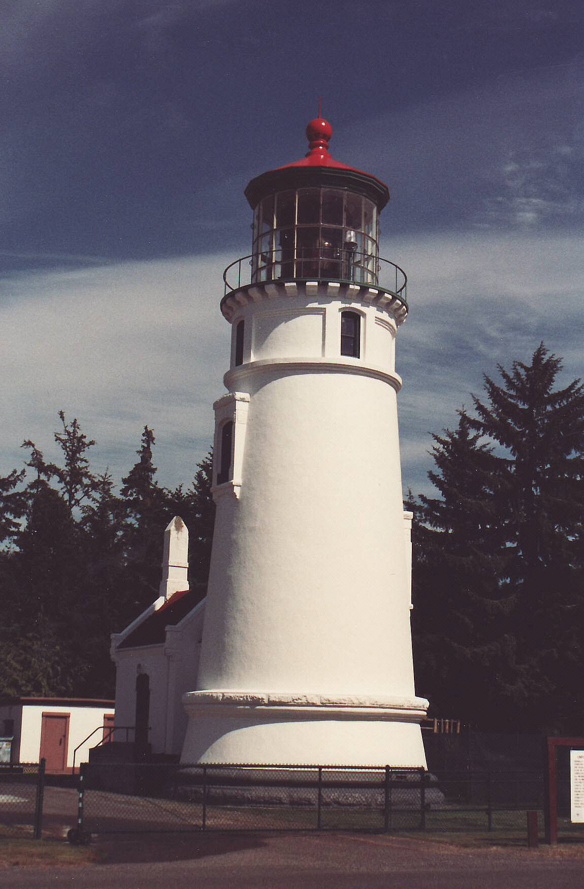
August 5, 2005 Oregon Route Coast 9/U.S. Route 101 at mile post 211.21 Reedsport 39 Umpqua River Light House 
October 21, 1977 SW of Winchester Bay off U.S. 101
43°39′44″N 124°11′49″W / 43.662222°N 124.196944°WWinchester Bay 40 Umpqua-Eden Site January 11, 1996 Address Restricted Reedsport 41 US Coast Guard Station-Umpqua River, Administration and Equipment Buildings 
June 4, 1992 Douglas Co. Rd. 87
43°39′50″N 124°11′49″W / 43.663889°N 124.196944°WWinchester Bay 42 Weaver-Worthington Farmstead August 1, 1984 E of Canyonville
42°58′25″N 123°12′51″W / 42.973611°N 123.214167°WCanyonville 43 Judge William R. Willis House June 5, 1975 744 SE Rose St.
43°12′30″N 123°20′43″W / 43.208333°N 123.345278°WRoseburg 44 James Wimer Octagonal Barn December 2, 1985 1191 Coos Bay Wagon Rd.
43°10′43″N 123°30′21″W / 43.178611°N 123.505833°WLookingglass 45 Winchester Dam June 3, 1996 N. Umpqua River at Hwy. 99
43°17′05″N 123°21′12″W / 43.284722°N 123.353333°WWinchester 46 William C. and Agnes Winston House September 10, 1987 Winston Section Rd.
43°07′52″N 123°23′45″W / 43.131111°N 123.395833°WWinston References
- ^ Numbers represent an ordering by significant words. Various colorings, defined here, differentiate National Historic Landmark sites and National Register of Historic Places Districts from other NRHP buildings, structures, sites or objects.
U.S. National Register of Historic Places in Oregon Lists by county Baker • Benton • Clackamas • Clatsop • Columbia • Coos • Crook • Curry • Deschutes • Douglas • Gilliam • Grant • Harney • Hood River • Jackson • Jefferson • Josephine • Klamath • Lake • Lane • Lincoln • Linn • Malheur • Marion • Morrow • Multnomah: Portland North • Multnomah: Portland Northeast • Multnomah: Portland Northwest • Multnomah: Portland Southeast • Multnomah: Portland Southwest • Multnomah: Other • Polk • Sherman • Tillamook • Umatilla • Union • Wallowa • Wasco • Washington • Wheeler • Yamhill
Other lists Categories:- National Register of Historic Places listings by county in Oregon
- Douglas County, Oregon


Wikimedia Foundation. 2010.