- National Register of Historic Places listings in El Dorado County, California
-
This list includes properties and districts listed on the National Register of Historic Places in El Dorado County, California. Click the "Map of all coordinates" link to the right to view a Google map of all properties and districts with latitude and longitude coordinates in the table below.[1]
-
- This National Park Service list is complete through NPS recent listings posted November 10, 2011.[2]
[3] Landmark name [4] Image Date listed Location City or town Summary 1 Baldwin Estate April 1, 1987 NW of US 50 and CA 89 jct. on N side of CA 89
38°56′16″N 120°02′46″W / 38.937778°N 120.046111°WSouth Lake Tahoe 2 Bayley Hotel December 18, 1978 N of Pilot Hill on CA 49
38°50′39″N 121°00′50″W / 38.844167°N 121.013889°WPilot Hill 3 Coloma 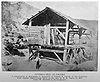
October 15, 1966 7 mi. NW of Placerville on CA 49
38°48′03″N 120°53′29″W / 38.800714°N 120.891444°WPlacerville 4 Combellack-Blair House 
February 14, 1985 3059 Cedar Ravine
38°43′40″N 120°47′42″W / 38.727778°N 120.795°WPlacerville 5 Confidence Hall 
January 4, 1982 487 Main St.
38°43′47″N 120°47′59″W / 38.729722°N 120.799722°WPlacerville 6 Crawford Ditch October 21, 1991 Address Restricted Pleasant Valley 7 Eddy Tree Breeding Station March 31, 1987 2480 and 2500 Carson Rd.
38°44′19″N 120°44′17″W / 38.738611°N 120.738056°WPlacerville 8 Episcopal Church of Our Saviour 
November 17, 1977 2979 Coloma St.
38°43′48″N 120°48′08″W / 38.73°N 120.802222°WPlacerville 15 Ed Z'berg Sugar Pine Point State Park March 30, 1973 3 mi. S of Homewood on CA 90
39°03′05″N 120°06′47″W / 39.051389°N 120.113056°WHomewood 9 Fountain-Tallman Soda Works 
September 13, 1984 524 Main St.
38°43′45″N 120°47′54″W / 38.729167°N 120.798333°WPlacerville 10 Hattie (Gold Bug), Priest and Silver Pine Mines and Stampmill November 15, 1985 2501 Bedford Ave.
38°44′41″N 120°47′50″W / 38.744722°N 120.797222°WPlacerville 11 Heller Estate April 1, 1987 NW of US 50 and CA 89 jct. on N side of CA 89
38°55′59″N 120°02′30″W / 38.933056°N 120.041667°WSouth Lake Tahoe 12 Lombardo Ranch September 30, 1977 1709 Carson Rd.
38°44′35″N 120°46′24″W / 38.743056°N 120.773333°WPlacerville 13 John Pearson Soda Works 
December 12, 1985 594 Main St.
38°43′43″N 120°47′48″W / 38.728611°N 120.796667°WPlacerville 14 Pope Estate April 1, 1987 NW of US 50 and CA 89 jct. on N side of CA 89
38°56′14″N 120°02′37″W / 38.937222°N 120.043611°WSouth Lake Tahoe 16 Tahoe Meadows March 29, 1990 US 50 between Ski Run Blvd. and Park Ave.
38°57′13″N 119°57′05″W / 38.953611°N 119.951389°WSouth Lake Tahoe 17 Vikingsholm 
October 10, 1996 10001 Emerald Bay Rd.
38°57′08″N 120°06′11″W / 38.952222°N 120.103056°WSouth Lake Tahoe 18 Wakamatsu Tea and Silk Colony Farm October 9, 2009 941 Cold Springs Rd.
38°46′15″N 120°53′12″W / 38.770894°N 120.886783°WGold Hill See also
- National Register of Historic Places listings in California
- List of National Historic Landmarks in California
External links
References
- ^ The latitude and longitude information provided in this table was derived originally from the National Register Information System, which has been found to be fairly accurate for about 99% of listings. For about 1% of NRIS original coordinates, experience has shown that one or both coordinates are typos or otherwise extremely far off; some corrections may have been made. A more subtle problem causes many locations to be off by up to 150 yards, depending on location in the country: most NRIS coordinates were derived from tracing out latitude and longitudes off of USGS topographical quadrant maps created under North American Datum of 1927, which differs from the current, highly accurate GPS system used by Google maps. Chicago is about right, but NRIS longitudes in Washington are higher by about 4.5 seconds, and are lower by about 2.0 seconds in Maine. Latitudes differ by about 1.0 second in Florida. Some locations in this table may have been corrected to current GPS standards.
- ^ "National Register of Historic Places: Weekly List Actions". National Park Service, United States Department of the Interior. Retrieved on November 10, 2011.
- ^ Numbers represent an ordering by significant words. Various colorings, defined here, differentiate National Historic Landmark sites and National Register of Historic Places Districts from other NRHP buildings, structures, sites or objects.
- ^ "National Register Information System". National Register of Historic Places. National Park Service. . http://nrhp.focus.nps.gov/natreg/docs/All_Data.html.
U.S. National Register of Historic Places Topics Lists by states Alabama • Alaska • Arizona • Arkansas • California • Colorado • Connecticut • Delaware • Florida • Georgia • Hawaii • Idaho • Illinois • Indiana • Iowa • Kansas • Kentucky • Louisiana • Maine • Maryland • Massachusetts • Michigan • Minnesota • Mississippi • Missouri • Montana • Nebraska • Nevada • New Hampshire • New Jersey • New Mexico • New York • North Carolina • North Dakota • Ohio • Oklahoma • Oregon • Pennsylvania • Rhode Island • South Carolina • South Dakota • Tennessee • Texas • Utah • Vermont • Virginia • Washington • West Virginia • Wisconsin • WyomingLists by territories Lists by associated states Other  Category:National Register of Historic Places •
  Portal:National Register of Historic Places
Municipalities and communities of El Dorado County, California County seat: Placerville Cities 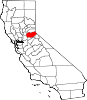
CDPs Auburn Lake Trails | Cameron Park | Camino | Cold Springs | Coloma | Diamond Springs | El Dorado Hills | Georgetown | Grizzly Flats | Pollock Pines | Shingle Springs | Tahoma‡
Unincorporated
communitiesApex | Arroyo Vista | Aukum | Avinsino Corner | Balderson Station | Bonetti | Brandon Corner | Brela | Briarwood Canyon | Bryants | Buckeye | Buffalo Hill | Bullard | Caldor | Cambridge Oaks | Cameron Airpark Estates | Camino Heights | Camp Richardson | Campana | Cedar Grove | Clarksville | Claussenius | Cool | Coyoteville | Crescent Ridge Village | Croft | Crown Village | Darlington | Deer Park | Deer View | Ditch Camp Five | Dugan | Echo Lake | El Dorado | Emerald Bay | Equestrian Village | Fair Play | Fairbanks | Fallen Leaf | Five Mile Terrace | Flonellis | Fornis | Fountain Place | Franciscan Village | Frenchtown | Fresh Pond | Garden Valley | Gilberts | Glenridge Park | Gold Hill | Gold Ridge | Gold Trail Park | Governors Village | Green Springs Ranch | Green Springs Valley | Green Valley Acres | Greenwood | Griminger | Grizzly Peak | Happy Valley | Hickok Ranch | Hidden Valley | Highland Village | Jayhawk | Jones Place | Kelsey | Kingsville | Kiva Beach | Kyburz | La Cresta Village | Lake Hills Estates | Lake Valley | Lakeridge Oaks | Lakewood Sierra | Latrobe | Leonardi | Little Norway | Lotus | Lower Forni | Manzanita Acres | Marble Mountain | Mariemont | Marina Village | McConnel Place | McManus | Meadow Brook | Meeks Bay | Meiss | Melsons Corner | Meyers | Morrison | Motor City | Nashville | Nebelhorn | Newtown | North Placerville | Oak Creek Hills | Oak Ridge Village | Oak Tree Village | Old Fort Jim | Old Pino | Omo Ranch | Outingdale | Pacific | Pacific House | Park Village | Perks Corner | Phillips | Pilliken | Pilot Hill | Pino Grande | Pleasant Valley | Pomins | Quintette | Raffetto | Rancho del Sol | Rescue | Ridgeview Village | Riverton | Saint Andrews Village | Sciots Camp | Short Place | Shrub | Sierra Springs | Skinners | Sly Park | Smithflat | Soapweed | Somerset | Spanish Flat | Sprekelsville | Spring Creek | Spring Valley | Springfield Meadows | Stonegate Village | Strawberry | Summit Village | Sweeneys Crossing | Tallac Village | Tiger Lily | Twin Bridges | Tylers Corner | Upper Forni | Van Vleck | Virner | Volcanoville | Voss | Waterford Village | White Hall | Winterhaven Village | Zee Estates
Former
settlementsAurum City | Bamom | Bennett | Buckeye Flat | Canton | Canyon | Cedar Creek Camp | Chicken Flat | Chili Bar | Cincinnati | Cummings | Dogtown | Dufftown | Euchre Diggings | Flora's | Fornis | Frosts | Golden | Green Springs | Green Valley | Greenwood Camp | Higgins Point | Hitchcock Ranch | Indak | Jacobsen | Jurgens | Koloma | Lava | Lawrenceberg | Live Oak Bar | Middletown | Missouri House | Mormon Tavern | Onchomo | Opok | Peru | Pleasant Flat | Powningville | River Hill | Rodwell | Rubicon | Rubicon Lodge | Rubicon Springs | Sailors Flat | Saint Lawrence | Salmon Falls | Siwim Pakan | Slatington | Snyders Bar | Sportsmans Hall | Stag Flat | Stony Bar | Swift | Texas Bar | Tchikimisi | Union Flat | Uniontown | Uno | Urban | Wentworth Springs | Yalisumni | Youngs | Zodoc
Footnotes ‡This CDP also has portions in an adjacent county or counties
Categories:- History of El Dorado County, California
- History of the Sierra Nevada (U.S.)
- National Register of Historic Places in California by county
- Lists of National Register of Historic Places in California
- El Dorado County, California
- California Gold Rush
-


Wikimedia Foundation. 2010.