- National Register of Historic Places listings in El Paso County, Texas
-
List of Registered Historic Places in Ellis County, Texas
This is intended to be a complete list of properties and districts listed on the National Register of Historic Places in Ellis County, Texas. The locations of National Register properties and districts (at least for all showing latitude and longitude coordinates below) may be seen in a Google map by clicking on "Map of all coordinates".[1]
-
- This National Park Service list is complete through NPS recent listings posted November 10, 2011.[2]
[3] Landmark name [4] Image Date listed Location City or town Summary 1 1800's Mexican Consulate May 23, 1975 612 E. San Antonio St.
31°45′33″N 106°28′58″W / 31.759167°N 106.482778°WEl Paso 2 Abdou Building September 24, 1980 115 N. Mesa St.
31°45′30″N 106°29′13″W / 31.758333°N 106.486944°WEl Paso 3 O. T. Bassett Tower 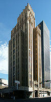
September 24, 1980 301 Texas Ave.
31°45′35″N 106°29′11″W / 31.759722°N 106.486389°WEl Paso 4 Richard Caples Building September 24, 1980 300 E. San Antonio Ave.
31°45′29″N 106°29′12″W / 31.758056°N 106.486667°WEl Paso 5 Castner Range Archeological District April 22, 1976 Address Restricted El Paso 6 Chamizal National Memorial 
February 4, 1974 Paisano Dr.
31°45′35″N 106°29′58″W / 31.759722°N 106.499444°WEl Paso 7 Sgt. Doyle Site April 11, 1977 Address Restricted El Paso 8 El Paso County Water Improvement District No. 1 August 25, 1997 Starting at the jct. of US 80 and US 85, along TX 20 to Alamo Alto
31°33′58″N 106°14′18″W / 31.566111°N 106.238333°WEl Paso 9 El Paso High School November 17, 1980 1600 N. Virginia St.
31°46′21″N 106°29′23″W / 31.7725°N 106.489722°WEl Paso 10 El Paso Union Passenger Station 
April 3, 1975 SW corner of Coldwell at San Francisco St.
31°45′26″N 106°29′45″W / 31.757222°N 106.495833°WEl Paso 11 El Paso US Courthouse 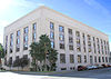
April 25, 2001 511 W. San Antonio Ave.
31°45′33″N 106°29′00″W / 31.759167°N 106.483333°WEl Paso 12 First Mortgage Company Building June 13, 1978 109 N. Oregon St.
31°45′29″N 106°29′17″W / 31.758056°N 106.488056°WEl Paso 13 Fort Bliss Main Post Historic District May 7, 1998 Fort Bliss
31°48′26″N 106°25′56″W / 31.807222°N 106.432222°WEl Paso 14 Franklin Canal June 19, 1992 Roughly, S of the Texas and Pacific-Southern Pacific RR tracks from western El Paso to Fabens
31°40′21″N 106°22′35″W / 31.6725°N 106.376389°WEl Paso 15 Fusselman Canyon Rock Art District June 3, 1976 Address Restricted El Paso 16 W. S. Hills Commercial Structure September 24, 1980 215-219 San Antonio Ave.
31°45′29″N 106°29′13″W / 31.758056°N 106.486944°WEl Paso 17 Hot Well Archeological Site April 30, 1976 Address Restricted El Paso 18 Hotel Cortez September 24, 1980 300 N. Mesa St.
31°45′35″N 106°29′14″W / 31.759722°N 106.487222°WEl Paso 19 Hotel Paso del Norte January 5, 1979 115 El Paso St.
31°45′28″N 106°29′21″W / 31.757778°N 106.489167°WEl Paso 20 House at 912 Magoffin Avenue June 23, 2003 912 Magoffin Ave
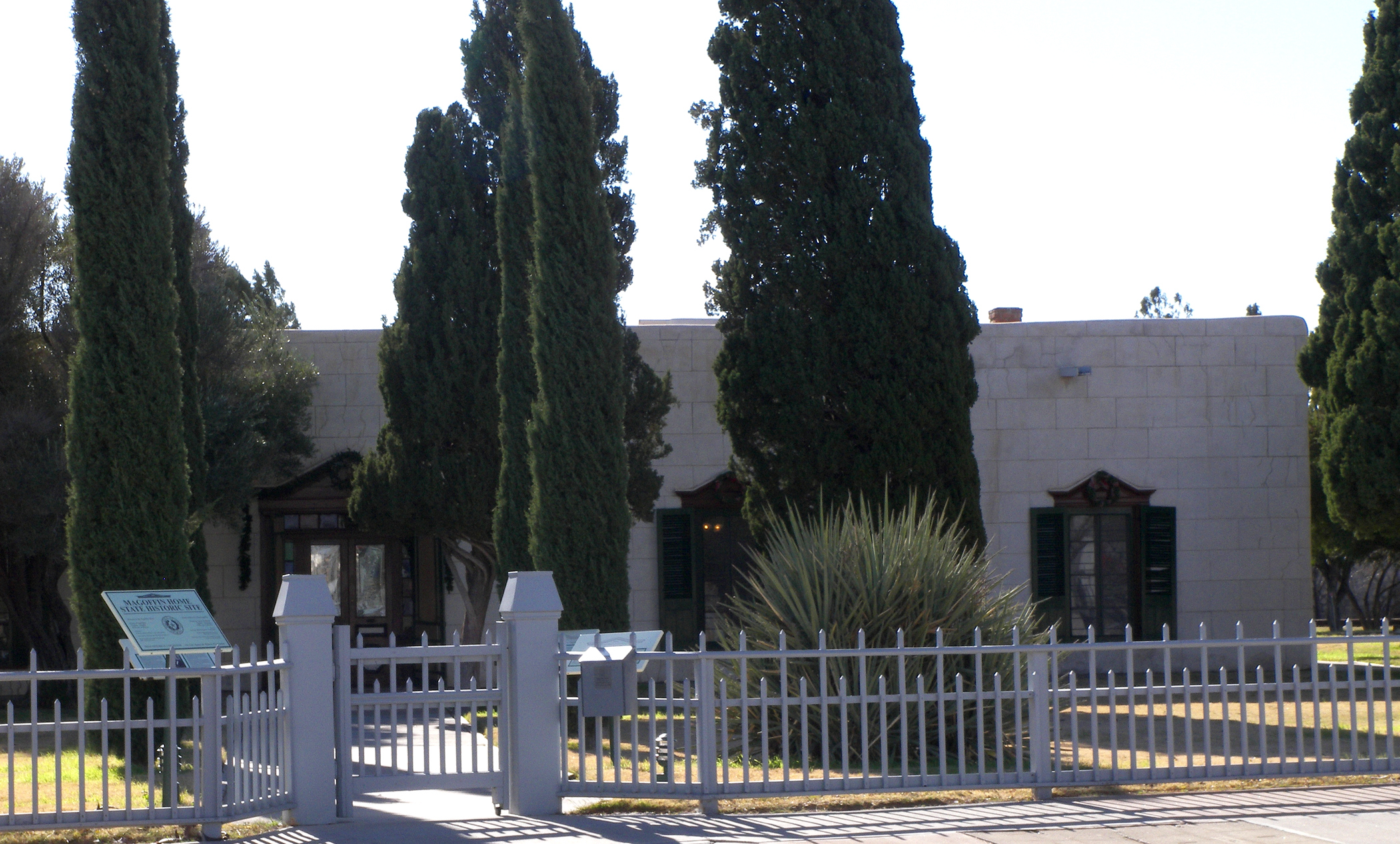
31°45′41″N 106°28′43″W / 31.761389°N 106.478611°WEl Paso 21 Hueco Tanks July 14, 1971 Address Restricted El Paso 22 Magoffin Homestead 
March 31, 1971 1120 Magoffin Ave.
31°45′45″N 106°28′36″W / 31.7625°N 106.476667°WEl Paso 23 Manhattan Heights Historic District September 27, 1980 Roughly bounded by Grant, Louisiana and Richmond Aves.
31°47′26″N 106°27′32″W / 31.790556°N 106.458889°WEl Paso 24 Martin Building August 8, 1984 215 N. Stanton St.
31°45′35″N 106°29′11″W / 31.759722°N 106.486389°WEl Paso 25 Mesa Pump Plant June 19, 2009 4901 Fred Wilson Avenue
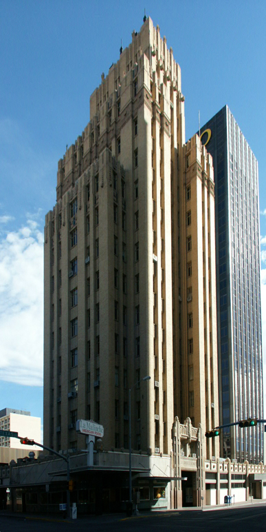
31°49′35″N 106°25′44″W / 31.826389°N 106.42875°WEl Paso 26 Mills Building 
March 21, 2011 303 N. Oregon St.
31°45′33″N 106°29′21″W / 31.759097°N 106.489097°WEl Paso Commercial Structures of El Paso by Henry C. Trost Thematic Group Resource 27 Mission Socorro Archeological Site January 22, 1993 Address Restricted
31°39′03″N 106°17′49″W / 31.650833°N 106.296944°WSocorro 28 Montana Avenue Historic District November 13, 2004 1000 through 1500 Blks of Montana Ave.
31°46′21″N 106°28′52″W / 31.7725°N 106.481111°WEl Paso 29 J. J. Newberry Company September 24, 1980 201-205 N. Stanton St.
31°45′33″N 106°29′10″W / 31.759167°N 106.486111°WEl Paso 30 Northgate Site March 16, 1972 Address Restricted El Paso 31 Old Bnai Zion Synagogue August 16, 1984 906 N. El Paso St.
31°45′37″N 106°29′22″W / 31.760278°N 106.489444°WEl Paso 32 Old Fort Bliss February 23, 1972 1800 block of Doniphan St.
31°45′47″N 106°30′33″W / 31.763056°N 106.509167°WEl Paso 33 Old San Francisco Historic District May 21, 1985 Missouri St. between No. 325 and 527
31°45′33″N 106°29′39″W / 31.759167°N 106.494167°WEl Paso 34 Palace Theatre September 24, 1980 209 S. El Paso St.
31°45′25″N 106°29′19″W / 31.756944°N 106.488611°WEl Paso 35 Plaza Hotel 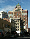
September 24, 1980 Oregon and Mills Sts.
31°45′31″N 106°29′18″W / 31.758611°N 106.488333°WEl Paso 36 Plaza Theatre June 4, 1987 125 Pioneer Plaza
31°45′31″N 106°29′11″W / 31.758611°N 106.486389°WEl Paso 37 Popular Department Store September 24, 1980 102 N. Mesa St.
31°45′30″N 106°29′10″W / 31.758333°N 106.486111°WEl Paso 38 Presidio Chapel of San Elizario September 14, 1972 S side of plaza
31°35′05″N 106°16′22″W / 31.584722°N 106.272778°WSan Elizario 39 Quarters Number 1 April 9, 1987 228 Sheridan Rd.
31°48′29″N 106°26′15″W / 31.808056°N 106.4375°WFort Bliss 40 Rio Grande Avenue Historic District September 9, 1999 Roughly bounded by Rio Grande, Navada, Kansas, and Campbell Sts.
31°46′10″N 106°29′14″W / 31.769444°N 106.487222°WEl Paso 41 Rio Vista Farm Historic District February 22, 1996 800-801 Rio Vista Rd.
31°39′41″N 106°15′52″W / 31.661389°N 106.264444°WSocorro 42 Roberts-Banner Building September 24, 1980 215 N. Mesa St.
31°45′32″N 106°29′14″W / 31.758889°N 106.487222°WEl Paso 43 San Elizario Historic District February 27, 1997 Roughly bounded by Rio Grande St., Socorro and Convent Rds., and the San Elizario Lateral
31°35′07″N 106°16′21″W / 31.585278°N 106.2725°WSan Elizario 44 Silver Dollar Cafe August 14, 1986 1021 S. Mesa
31°44′58″N 106°29′02″W / 31.749444°N 106.483889°WEl Paso 45 Singer Sewing Company September 24, 1980 211 Texas Ave.
31°45′33″N 106°29′12″W / 31.759167°N 106.486667°WEl Paso 46 Socorro Mission 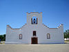
March 16, 1972 Moon Rd. and TX 258
31°39′30″N 106°18′09″W / 31.658333°N 106.3025°WSocorro 47 State National Bank September 24, 1980 114 E. San Antonio Ave.
31°45′27″N 106°29′15″W / 31.7575°N 106.4875°WEl Paso 48 Sunset Heights Historic District December 8, 1988 Roughly bounded by Heisig Ave., River Ave., N. El Paso St., and I-10
31°45′47″N 106°29′53″W / 31.763056°N 106.498056°WEl Paso 49 Toltec Club March 12, 1979 602 Magoffin Ave.
31°45′36″N 106°28′45″W / 31.76°N 106.479167°WEl Paso 50 Henry C. Trost House July 12, 1976 1013 W. Yandell Dr.
31°45′52″N 106°29′58″W / 31.764444°N 106.499444°WEl Paso 51 U.S. Post Office July 19, 1984 219 Mills Ave.
31°45′36″N 106°29′13″W / 31.76°N 106.486944°WEl Paso 52 White House Department Store and Hotel McCoy September 24, 1980 109 Pioneer Plaza
31°45′32″N 106°29′19″W / 31.758889°N 106.488611°WEl Paso 53 Women's Club July 22, 1979 1400 N. Mesa St.
31°46′02″N 106°29′40″W / 31.767222°N 106.494444°WEl Paso 54 Ysleta Mission 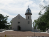
July 31, 1972 TX 20 near jct. with Zaragosa Rd.
31°41′27″N 106°19′38″W / 31.690833°N 106.327222°WYsleta See also
- Registered Historic Places in Texas, Counties D-G
References
- ^ The latitude and longitude information provided in this table was derived originally from the National Register Information System, which has been found to be fairly accurate for about 99% of listings. For about 1% of NRIS original coordinates, experience has shown that one or both coordinates are typos or otherwise extremely far off; some corrections may have been made. A more subtle problem causes many locations to be off by up to 150 yards, depending on location in the country: most NRIS coordinates were derived from tracing out latitude and longitudes off of USGS topographical quadrant maps created under the North American Datum of 1927, which differs from the current, highly accurate WGS84 GPS system used by Google maps. Chicago is about right, but NRIS longitudes in Washington are higher by about 4.5 seconds, and are lower by about 2.0 seconds in Maine. Latitudes differ by about 1.0 second in Florida. Some locations in this table may have been corrected to current GPS standards.
- ^ "National Register of Historic Places: Weekly List Actions". National Park Service, United States Department of the Interior. Retrieved on November 10, 2011.
- ^ Numbers represent an ordering by significant words. Various colorings, defined here, differentiate National Historic Landmark sites and National Register of Historic Places Districts from other NRHP buildings, structures, sites or objects.
- ^ "National Register Information System". National Register of Historic Places. National Park Service. . http://nrhp.focus.nps.gov/natreg/docs/All_Data.html.
U.S. National Register of Historic Places Topics Lists by states Alabama • Alaska • Arizona • Arkansas • California • Colorado • Connecticut • Delaware • Florida • Georgia • Hawaii • Idaho • Illinois • Indiana • Iowa • Kansas • Kentucky • Louisiana • Maine • Maryland • Massachusetts • Michigan • Minnesota • Mississippi • Missouri • Montana • Nebraska • Nevada • New Hampshire • New Jersey • New Mexico • New York • North Carolina • North Dakota • Ohio • Oklahoma • Oregon • Pennsylvania • Rhode Island • South Carolina • South Dakota • Tennessee • Texas • Utah • Vermont • Virginia • Washington • West Virginia • Wisconsin • WyomingLists by territories Lists by associated states Other Categories:- El Paso County, Texas
- National Register of Historic Places in Texas
-


Wikimedia Foundation. 2010.