- National Register of Historic Places listings in Erie County, Pennsylvania
-
 Location of Erie County in Pennsylvania
This is a list of the National Register of Historic Places listings in Erie County, Pennsylvania.
This is intended to be a complete list of the properties and districts on the National Register of Historic Places in Erie County, Pennsylvania, United States. The locations of National Register properties and districts for which the latitude and longitude coordinates are included below, may be seen in a Google map.[1]
There are 41 properties and districts listed on the National Register in the county.
-
- This National Park Service list is complete through NPS recent listings posted November 10, 2011.[2]
Current listings
[3] Landmark name Image Date listed Location City or town Summary 1 Academy Hall 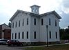
November 21, 2006 Junction of High and Normal Streets, Edinboro University of Pennsylvania
41°52′19″N 80°07′41″W / 41.872028°N 80.128111°WEdinboro 2 Boston Store 
October 24, 1996 716–728 State Street
42°07′40″N 80°05′04″W / 42.127778°N 80.084444°WErie 3 Cashier's House and Coach House 
January 13, 1972 413 State Street
42°07′51″N 80°05′09″W / 42.130833°N 80.085833°WErie 4 Chandlery Corner February 5, 1987 1 and 3 East Fourth Street, and 401–403, and 405 State Street
42°07′53″N 80°05′11″W / 42.131389°N 80.086389°WErie 5 Corry Armory May 9, 1991 205 East Washington Street
41°55′22″N 79°38′20″W / 41.922778°N 79.638889°WCorry 6 Dickson Tavern 
January 18, 1990 201 French Street
42°08′02″N 80°05′11″W / 42.133889°N 80.086389°WErie 7 Eagle Hotel 
October 28, 1977 32 High Street
41°56′25″N 79°58′59″W / 41.940278°N 79.983056°WWaterford 8 Erie Armory December 22, 1989 6th and Parade Streets
42°07′58″N 80°04′38″W / 42.132778°N 80.077222°WErie 9 Erie Federal Courthouse and Post Office 
January 22, 1993 Junction of 6th and State Streets
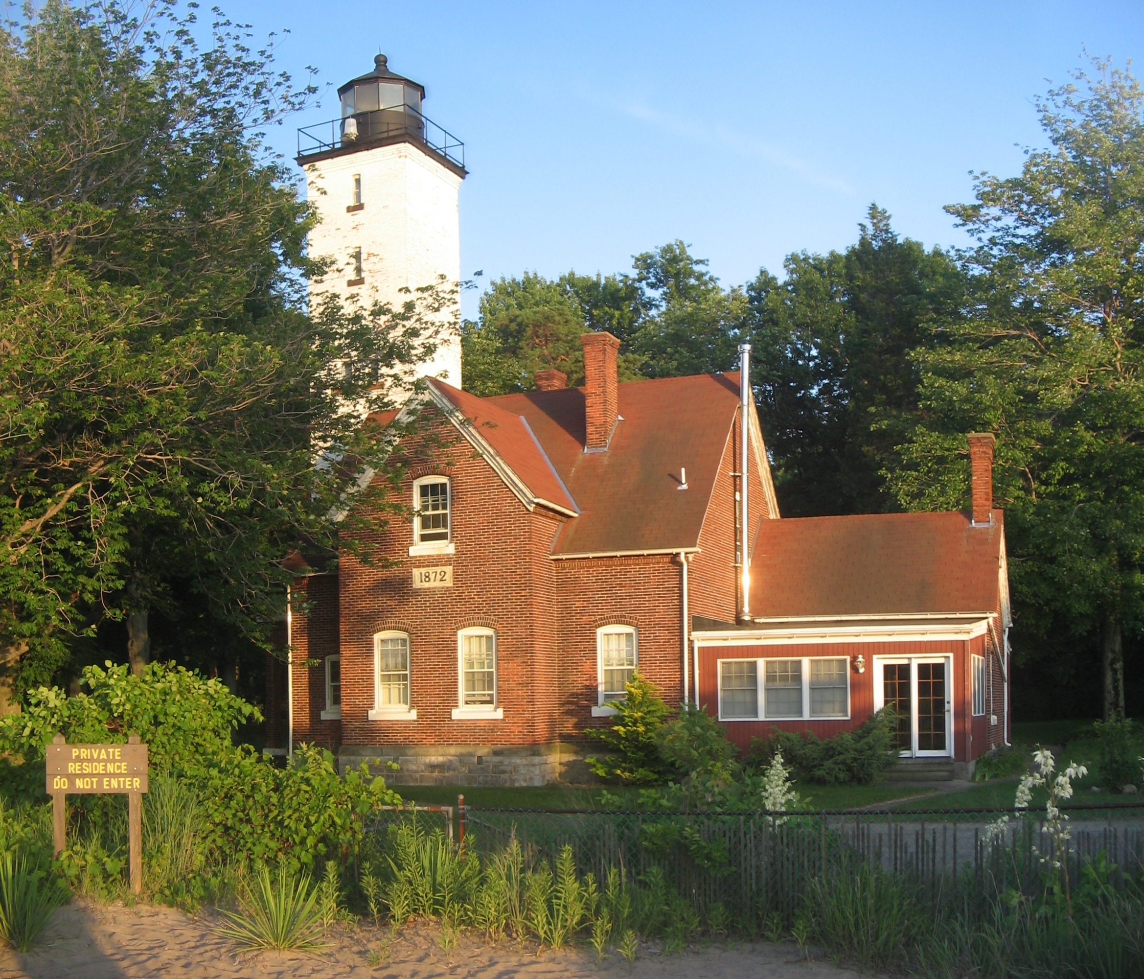
42°07′44″N 80°05′03″W / 42.128889°N 80.084167°WErie 10 Erie Land Lighthouse 
March 30, 1978 Dunn Boulevard, Lighthouse Park
42°08′38″N 80°03′44″W / 42.143889°N 80.062222°WErie 11 Erie Trust Company Building 
August 10, 2000 1001 State Street
42°07′32″N 80°04′56″W / 42.125556°N 80.082222°WErie 12 Federal Row May 17, 1984 146–162 East 5th State; 424–430 Holland Street
42°07′55″N 80°04′57″W / 42.131944°N 80.0825°WErie 13 Gudgeonville Covered Bridge 
September 17, 1980 Southeast of Girard on Township 460
41°58′57″N 80°16′00″W / 41.9825°N 80.266667°WGirard Township 14 Pierre S. V. Hamot House November 14, 1991 302 French Street
42°07′58″N 80°05′09″W / 42.132778°N 80.085833°WErie 15 Harrington Covered Bridge September 17, 1980 Township 338
41°52′09″N 80°25′44″W / 41.869167°N 80.428889°WConneaut Township 16 John Hill House December 17, 1979 230 West 6th Street
42°07′41″N 80°05′25″W / 42.128056°N 80.090278°WErie 17 Hornby School 
August 13, 2008 10000 Station Road
42°00′00″N 79°51′58″W / 42.0°N 79.866111°WGreenfield Township 18 Jackson Koehler Eagle Brewery April 13, 1982 2131 State Street
42°06′55″N 80°04′34″W / 42.115278°N 80.076111°WErie 19 Lovell Manufacturing Company January 16, 1997 1301 French Street
42°07′23″N 80°04′44″W / 42.123056°N 80.078889°WErie 20 Main Library 
April 26, 1979 3 South Perry Street
42°07′45″N 80°05′01″W / 42.129167°N 80.083611°WErie 21 Modern Tool Company March 6, 1987 State and East Fourth Streets
42°07′54″N 80°05′11″W / 42.131667°N 80.086389°WErie 23 Nicholson House and Inn February 26, 1985 4838 West Ridge Road
42°04′13″N 80°11′07″W / 42.070278°N 80.185278°WMillcreek Township 23 North East Historic District 
March 9, 1990 Roughly bounded by Division, North Lake, Eagle, North Pearl, and Gibson Streets
42°12′56″N 79°50′15″W / 42.215556°N 79.8375°WNorth East 24 Old Customshouse 
January 13, 1972 409 State Street
42°07′52″N 80°05′10″W / 42.131111°N 80.086111°WErie 25 Park Dinor March 18, 2004 4019 Main Street, Erie
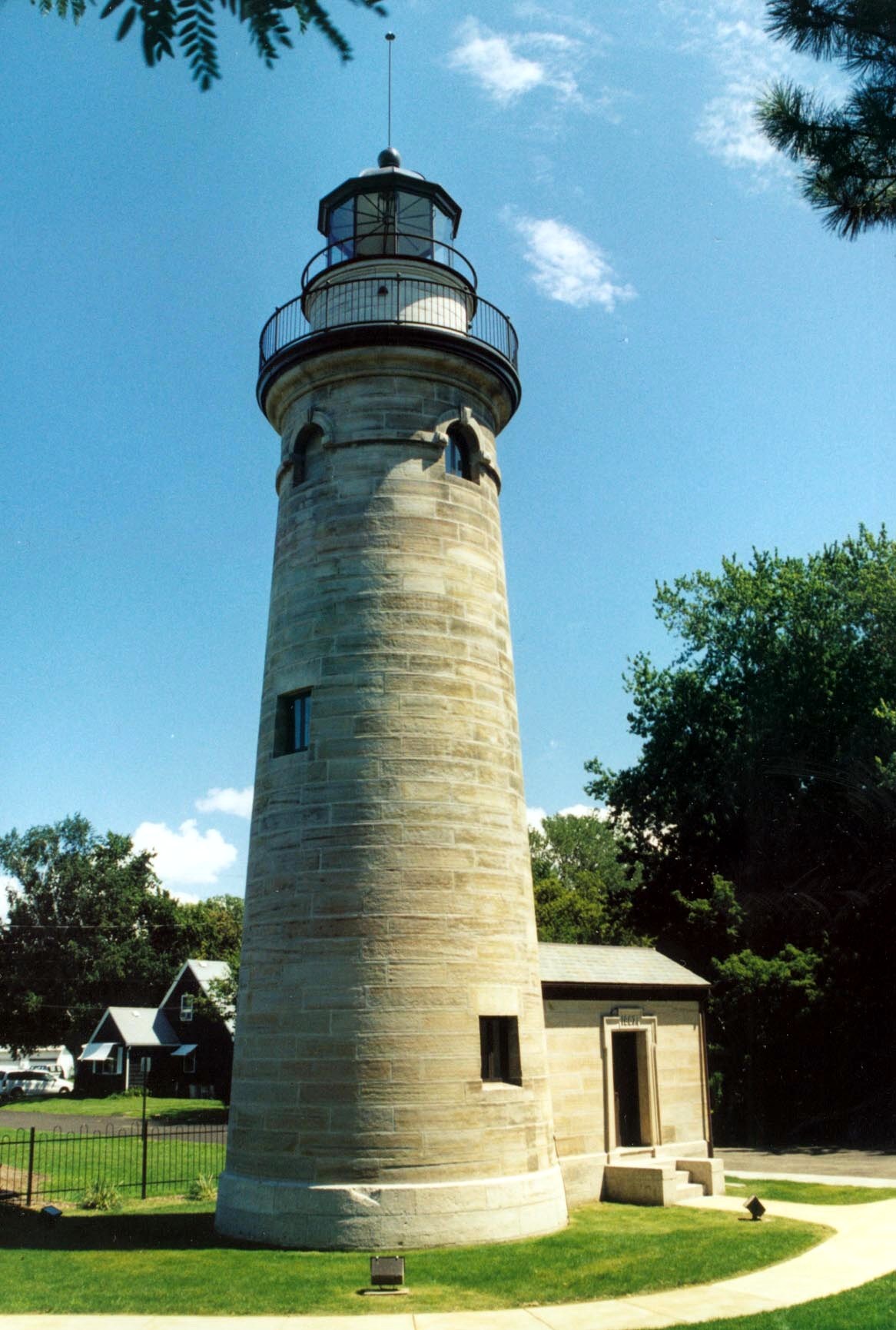
42°09′02″N 80°00′52″W / 42.150556°N 80.014444°WLawrence Park Township 26 Presque Isle Light 
August 4, 1983 Presque Isle Peninsula on Lake Erie
42°09′57″N 80°06′55″W / 42.165833°N 80.115278°WMillcreek Township 27 Charles Manning Reed Mansion 
April 19, 1982 524 Peach Street
42°07′45″N 80°05′14″W / 42.129167°N 80.087222°WErie 28 Short's Hotel 
August 25, 1983 90 South Pearl Street
42°12′38″N 79°50′13″W / 42.210556°N 79.836944°WNorth East 29 Sommerheim Park Archaeological District March 6, 1986 On bluffs above Sommerheim Drive and Presque Isle Bay
42°6′49″N 80°8′42″W / 42.11361°N 80.145°W[4]Millcreek Township 30 Sturgeon House 
December 10, 1980 4302 Avonia Road, Fairview
42°01′43″N 80°15′14″W / 42.028611°N 80.253889°WFairview Township 31 Thayer-Thompson House October 31, 1985 605 West 8th Street
42°07′19″N 80°05′51″W / 42.121944°N 80.0975°WErie 32 U.S.S. NIAGARA 
April 11, 1973 Erie Maritime Museum
42°08′14″N 80°05′15″W / 42.137222°N 80.0875°WErie 33 Union City Historic District March 9, 1990 Roughly bounded by Third, High, Main, and South Streets
41°53′52″N 79°50′52″W / 41.897778°N 79.847778°WUnion City 34 Villa Maria Academy November 8, 1996 819 West 8th Street
42°07′14″N 80°06′05″W / 42.120556°N 80.101389°WErie 35 Warner Theater 
April 13, 1982 811 State Street
42°07′38″N 80°05′00″W / 42.127222°N 80.083333°WErie 36 Waterford Borough Historic District March 9, 1990 Roughly bounded by North Park Row, High, West First, and Walnut Streets
41°56′29″N 79°59′05″W / 41.941389°N 79.984722°WWaterford 37 Waterford Covered Bridge 
September 17, 1980 East of Waterford on Township 459
41°56′28″N 79°57′48″W / 41.941111°N 79.963333°WWaterford Township 38 Watson-Curtze Mansion July 16, 1983 356 West 6th Street
42°07′36″N 80°05′37″W / 42.126667°N 80.093611°WErie 39 West 21st Street Historic District March 9, 1990 125–262 West 21st Street and 2014–2125 Sassafras Street
42°06′52″N 80°04′49″W / 42.114444°N 80.080278°WErie 40 West Park Place September 4, 1980 Bounded by North Park Row, Peach, 5th, and State Streets
42°07′48″N 80°05′11″W / 42.13°N 80.086389°WErie 41 West Sixth Street Historic District November 1, 1984 West 6th Street from Poplar to Peach Street
42°07′35″N 80°05′34″W / 42.126389°N 80.092778°WErie Former listings
[3] Landmark name Image Date listed Location City or town Summary 1 Erie Listed on August 3, 1987 2 Carman Covered Bridge November 29, 1996 Southeast of West Springfield on Township 338 Conneaut and Springfield Townships Burned down See also
- List of National Historic Landmarks in Pennsylvania
- National Register of Historic Places listings in Pennsylvania
- List of Pennsylvania state historical markers in Erie County
References
- ^ The latitude and longitude information provided in this table was derived originally from the National Register Information System, which has been found to be fairly accurate for about 99% of listings. For about 1% of NRIS original coordinates, experience has shown that one or both coordinates are typos or otherwise extremely far off; some corrections may have been made. A more subtle problem causes many locations to be off by up to 150 yards, depending on location in the country: most NRIS coordinates were derived from tracing out latitude and longitudes off of USGS topographical quadrant maps created under North American Datum of 1927, which differs from the current, highly accurate GPS system used by Google maps. Chicago is about right, but NRIS longitudes in Washington are higher by about 4.5 seconds, and are lower by about 2.0 seconds in Maine. Latitudes differ by about 1.0 second in Florida. Some locations in this table may have been corrected to current GPS standards.
- ^ "National Register of Historic Places: Weekly List Actions". National Park Service, United States Department of the Interior. Retrieved on November 10, 2011.
- ^ Numbers represent an ordering by significant words. Various colorings, defined here, differentiate National Historic Landmark sites and National Register of Historic Places Districts from other NRHP buildings, structures, sites or objects.
- ^ Location derived from its NRHP nomination form; the NRIS lists the site as "Address Restricted"
City of Erie Colleges and Universities · County · Demographics · Economy · Historic sites · History · Mayors · Media · Notable people · Parks · Presque Isle · School District · Sports · Transportation
Municipalities and communities of Erie County, Pennsylvania Cities 
Boroughs Albion | Cranesville | Edinboro | Elgin | Girard | Lake City | McKean | Mill Village | North East | Platea | Union City | Waterford | Wattsburg | Wesleyville
Townships Amity | Concord | Conneaut | Elk Creek | Fairview | Franklin | Girard | Greene | Greenfield | Harborcreek | Lawrence Park | LeBoeuf | McKean | Millcreek | North East | Springfield | Summit | Union | Venango | Washington | Waterford | Wayne
CDPs Unincorporated
communitiesFairview | State Line
Categories:- National Register of Historic Places in Pennsylvania by county
- Erie County, Pennsylvania
-


Wikimedia Foundation. 2010.