- National Register of Historic Places listings in Fayette County, Kentucky
-
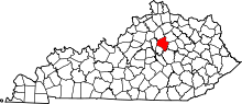 Location of Fayette County in Kentucky
This is a list of the National Register of Historic Places listings in Fayette County, Kentucky.
This is intended to be a complete list of the properties and districts on the National Register of Historic Places in Fayette County, Kentucky, United States. The locations of National Register properties and districts for which the latitude and longitude coordinates are included below, may be seen in a Google map.[1]
There are 166 properties and districts listed on the National Register in the county, of which 3 are National Historic Landmarks.
-
- This National Park Service list is complete through NPS recent listings posted November 10, 2011.[2]
Current listings
[3] Landmark name Image Date listed Location City or town Summary 1 African Cemetery No. 2 March 31, 2004 419 E. 7th St.
38°03′04″N 84°28′41″W / 38.051111°N 84.478056°WLexington 2 James Allen House December 30, 1982 1020 Lane Allen Rd.
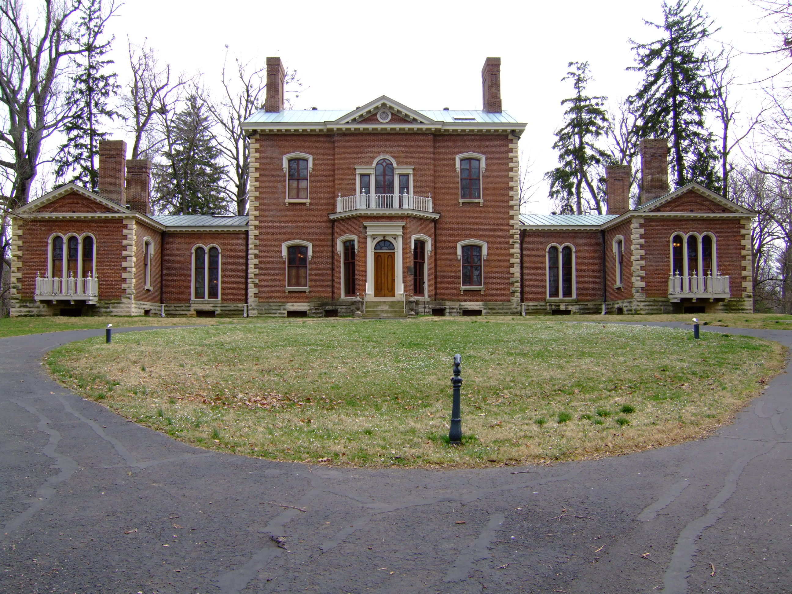
38°01′57″N 84°33′11″W / 38.0325°N 84.553056°WLexington 3 Ashland 
October 15, 1966 2 miles southeast of Lexington on Richmond Rd.
38°01′43″N 84°28′48″W / 38.028611°N 84.48°WLexington 4 Ashland Park Historic District March 31, 1986 Roughly bounded by S. Hanover Ave., Richmond Rd., Woodspoint Rd., and Fontaine Rd. and E. High St.
38°01′45″N 84°28′56″W / 38.029167°N 84.482222°WLexington 5 Athens Historic District October 11, 1979 Athens-Boonesboro Pike
37°56′58″N 84°21′53″W / 37.949444°N 84.364722°WAthens 6 Abraham Barton House August 26, 1977 200 N. Upper St.
38°02′56″N 84°29′42″W / 38.048889°N 84.495°WLexington 7 T.D. Basye House October 22, 1987 3501 Georgetown Rd.
38°07′36″N 84°31′38″W / 38.126667°N 84.527222°WLexington 8 Bates Log House August 26, 1982 5143 Spurr Rd.
38°07′11″N 84°34′11″W / 38.119722°N 84.569722°WLexington 9 James Burnie Beck House August 26, 1982 209 E. High St.
38°02′35″N 84°29′46″W / 38.043056°N 84.496111°WLexington 10 Bell Court Neighborhood Historic District December 8, 1980 Roughly bounded by railroad tracks, Main St., Boonesboro and Walton Aves.
38°02′22″N 84°29′09″W / 38.039444°N 84.485833°WLexington 11 Bell Place February 17, 1978 Sayre Ave.
38°02′20″N 84°29′09″W / 38.038889°N 84.485833°WLexington 12 John Bell House June 23, 1983 Kentucky Route 1978
38°04′59″N 84°31′48″W / 38.083056°N 84.53°WLexington 13 Boone Creek Rural Historic District August 19, 1994 Roughly bounded by Interstate 75, Cleveland Rd., Athens-Boonesboro Rd. and Grimes Rd.
37°56′21″N 84°21′51″W / 37.939167°N 84.364167°WLexington 14 Botherum 
March 7, 1973 341 Madison Pl.
38°02′59″N 84°30′26″W / 38.049722°N 84.507222°WLexington 15 Bowman Houses August 9, 1979 West of Lexington on Bowman's Mill Rd.
38°00′31″N 84°35′55″W / 38.008611°N 84.598611°WLexington 16 Bowman Mill Road Rural Historic District July 28, 1999 Bowman Mill Rd., Parkers Mill Rd., and Cave Hill Ln.
38°00′48″N 84°35′56″W / 38.013333°N 84.598889°WLexington 17 Brand-Barrow House August 11, 1976 203 E. 4th St.
38°02′57″N 84°29′19″W / 38.049167°N 84.488611°WLexington 18 John C. Breckinridge Memorial 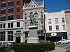
July 17, 1997 Courthouse Lawn, junction of N. Upper and E. Main Sts.
38°02′53″N 84°29′55″W / 38.048056°N 84.498611°WLexington 19 Joshua Brown House December 27, 1979 2705 Tates Creek Rd.
38°00′42″N 84°29′45″W / 38.011667°N 84.495833°WLexington 20 Buenna Hill June 29, 1983 Off Ferguson Rd.
38°10′22″N 84°24′18″W / 38.172778°N 84.405°WCenterville 21 John Burrier House June 23, 1983 Kentucky Route 1966
38°00′47″N 84°37′14″W / 38.013056°N 84.620556°WLexington 22 Cadentown School 
April 5, 2006 705 Caden Ln.
38°00′38″N 84°25′48″W / 38.010556°N 84.43°WLexington 23 Cave Place December 5, 1980 West of Lexington
38°01′07″N 84°35′04″W / 38.018611°N 84.584444°WLexington 24 Cave Spring December 22, 1978 Southeast of Lexington off U.S. Route 25
37°56′53″N 84°23′48″W / 37.948056°N 84.396667°WLexington 25 Central Christian Church September 11, 1979 207 E. Short St.
38°02′43″N 84°29′40″W / 38.045278°N 84.494444°WLexington 26 Central Kentucky Blue Grass Seed Co. August 3, 2005 321 Henry St.
38°02′43″N 84°29′40″W / 38.045278°N 84.494444°WLexington 27 Chandler Normal School Building and Webster Hall December 4, 1980 548 Georgetown St.
38°03′49″N 84°30′06″W / 38.063611°N 84.501667°WLexington 28 Christ Church Episcopal October 21, 1976 Church and Market Sts.
38°02′54″N 84°29′47″W / 38.048333°N 84.496389°WLexington 29 Clark Hardware Company Building July 16, 1979 367-369 W. Short St. and 142 N. Broadway
38°02′58″N 84°29′56″W / 38.049444°N 84.498889°WLexington 30 John Clark House November 25, 1980 Tates Creek Pk.
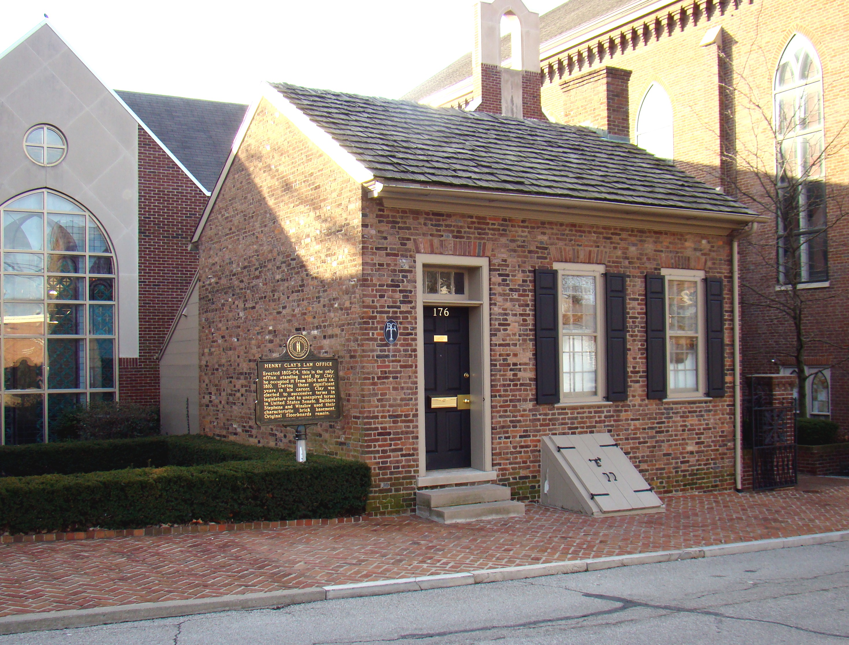
38°00′47″N 84°29′35″W / 38.013056°N 84.493056°WLexington 31 Henry Clay's Law Office 
March 11, 1971 176 N. Mill St.
38°02′58″N 84°29′49″W / 38.049444°N 84.496944°WLexington 32 Cleveland-Rogers House August 26, 1980 Southeast of Lexington at 8151 Richmond Rd.
37°54′09″N 84°21′14″W / 37.9025°N 84.353889°WLexington 33 Cloud House June 17, 1982 3740 Versailles Rd.
38°02′03″N 84°35′17″W / 38.034167°N 84.588056°WLexington 34 William Conant House February 22, 1991 1701 Elkchester Rd.
38°04′42″N 84°36′25″W / 38.078333°N 84.606944°WLexington 35 Confederate Soldier Monument in Lexington 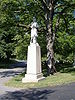
July 17, 1997 833 W. Main St.
38°03′35″N 84°30′34″W / 38.059722°N 84.509444°WLexington 36 Constitution Historic District August 30, 1982 Roughly bounded by E. 3rd., Limestone, Walnut, and Pleasant Stone Sts.
38°02′54″N 84°29′31″W / 38.048333°N 84.491944°WLexington 37 Corinthia June 29, 1983 Off Lemons Mill Rd.
38°10′22″N 84°24′50″W / 38.172778°N 84.413889°WCenterville 38 DeLong Agricultural Implements Warehouse November 25, 1980 Patterson St.
38°03′00″N 84°30′10″W / 38.05°N 84.502778°WLexington 39 Delta August 10, 1978 South of Lexington at 2450 Armstrong Mill Rd.
37°57′08″N 84°27′57″W / 37.952222°N 84.465833°WLexington 40 Douglass School August 14, 1998 465 Price Rd.
38°04′12″N 84°30′22″W / 38.07°N 84.506111°WLexington 41 Downtown Commercial District 
August 25, 1983 Roughly bounded by Main, Church, Walnut Sts., and Broadway
38°02′50″N 84°29′50″W / 38.047222°N 84.497222°WLexington 42 Elam Mound Archeological Site October 10, 1975 Address Restricted Lexington 43 Elley Villa January 9, 1978 320 Linden Walk
38°02′18″N 84°29′48″W / 38.038333°N 84.496667°WLexington 44 Elsmere Park Historic District April 26, 1976 Off N. Broadway, between W. 6th and 7th Sts.
38°03′22″N 84°29′13″W / 38.056111°N 84.486944°WLexington 45 Episcopal Burying Ground and Chapel 
June 24, 1976 251 E. 3rd St.
38°02′49″N 84°29′21″W / 38.046944°N 84.489167°WLexington 46 Fairlawn October 14, 1976 6 miles northeast of Lexington on U.S. Route 68
38°06′55″N 84°23′34″W / 38.115278°N 84.392778°WLexington 47 Fayette National Bank Building 
February 27, 1980 159-167 W. Main St.
38°02′50″N 84°29′53″W / 38.047222°N 84.498056°WLexington 48 Fayette Safety Vault and Trust Company Building August 11, 1980 111-113 Cheapside St.
38°02′52″N 84°29′54″W / 38.047778°N 84.498333°WLexington 49 Featherston, Edmonson and Clark Houses July 21, 1983 218, 226, and 232 E. Maxwell St.
38°02′25″N 84°29′54″W / 38.040278°N 84.498333°WLexington 50 First African Baptist Church April 24, 1986 264-272 E. Short St.
38°02′35″N 84°27′31″W / 38.043056°N 84.458611°WLexington 51 First Presbyterian Church, Lexington December 30, 1974 174 N. Mill St.
38°02′57″N 84°29′49″W / 38.049167°N 84.496944°WLexington 52 Floral Hall August 29, 1977 847 S. Broadway
38°02′27″N 84°31′03″W / 38.040833°N 84.5175°WLexington 53 George W. Grant House October 24, 1980 519 W. 4th St.
38°03′27″N 84°29′48″W / 38.0575°N 84.496667°WLexington 54 Gratz Park Historic District 
March 14, 1973 Bounded by 2nd and 3rd Sts., the Byway, and Bark Alley
38°03′00″N 84°29′46″W / 38.05°N 84.496111°WLexington 55 Graves Tavern June 23, 1983 Off U.S. Route 60
38°02′28″N 84°37′37″W / 38.041111°N 84.626944°WVersailles 56 Grimes House and Mill Complex June 21, 1982 Grimes Mill Rd.
37°54′57″N 84°20′34″W / 37.915833°N 84.342778°WLexington 57 Guilfoil Village Site (15FA176) December 5, 1985 Address Restricted Athens 58 Hartland April 2, 1987 2230 Armstrong Mill Rd.
37°57′35″N 84°28′21″W / 37.959722°N 84.4725°WLexington 59 Samuel T. Hayes House March 19, 1980 Southeast of Lexington on Sulphur Well Rd.
37°58′57″N 84°21′23″W / 37.9825°N 84.356389°WLexington 60 George Headley House March 4, 1991 4435 Old Frankfort Pike
38°05′42″N 84°36′34″W / 38.095°N 84.609444°WLexington 61 Hal Price Headley Sr. House November 15, 2010 1236 Standish Way
38°02′37″N 84°33′44″W / 38.043611°N 84.562222°WLexington 62 Helm Place August 3, 1978 Southwest of Lexington on Bowman Mill Rd.
38°00′10″N 84°35′19″W / 38.002778°N 84.588611°WLexington 63 Higgins Block 
August 12, 1977 145-151 W. Main St.
38°02′49″N 84°29′52″W / 38.046944°N 84.497778°WLexington 64 Highland Hall December 16, 1977 6208 Richmond Rd.
37°56′03″N 84°23′49″W / 37.934167°N 84.396944°WLexington 65 Hollywood Terrace Historic District July 8, 2008 Tates Creek Rd. and the rear property lines of the properties facing Euclid, Tremont, and Park Ave. Lexington A historic residential suburb[4] 66 Hurricane Hall April 22, 1976 North of Lexington off U.S. Route 25
38°08′09″N 84°32′11″W / 38.135833°N 84.536389°WLexington 67 Innes House June 29, 1983 Off Lemons Mill Rd.
38°10′23″N 84°24′30″W / 38.173056°N 84.408333°WCenterville 68 Thomas January House December 27, 1974 437 W. 2nd St.
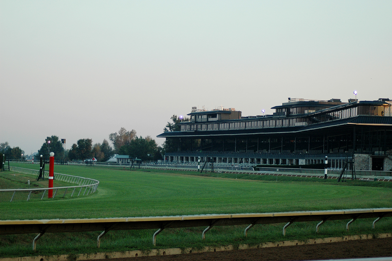
38°03′08″N 84°29′55″W / 38.052222°N 84.498611°WLexington 69 Keeneland-Keeneland Racetrack 
September 24, 1986 Off Versailles and Rice Rds.
38°02′57″N 84°36′22″W / 38.049167°N 84.606111°WLexington 70 Matthew Kennedy House June 19, 1973 216 N. Limestone St.
38°02′54″N 84°29′38″W / 38.048333°N 84.493889°WLexington 71 Kinkead House June 29, 1982 362 Walnut St.
38°02′56″N 84°29′21″W / 38.048889°N 84.489167°WLexington 72 Henry P. Kinkead House July 12, 1984 403 Walnut St.
38°02′58″N 84°29′19″W / 38.049444°N 84.488611°WLexington 73 Ladies' Confederate Memorial 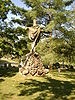
July 17, 1997 833 W. Main St.
38°03′34″N 84°30′32″W / 38.059444°N 84.508889°WLexington 74 Lemon Hill November 20, 1978 East of Lexington off U.S. Route 60
38°03′16″N 84°20′37″W / 38.054444°N 84.343611°WLexington 75 James Lemon Houses November 21, 1974 329-331 S. Mill St.
38°02′47″N 84°30′06″W / 38.046389°N 84.501667°WLexington 76 Lewis Manor April 26, 1976 Northwest of Lexington on Viley Rd.
38°04′36″N 84°33′07″W / 38.076667°N 84.551944°WLexington 77 Lexington Cemetery and Henry Clay Monument 
July 12, 1976 833 W. Main St.
38°03′43″N 84°30′41″W / 38.061944°N 84.511389°WLexington 78 Lexington City National Bank Building 
April 1, 1980 259-265 W. Main St.
38°02′52″N 84°29′55″W / 38.047778°N 84.498611°WLexington 79 Lexington Dry Goods Company Building May 31, 1988 249-251 E. Main St.
38°02′37″N 84°29′38″W / 38.043611°N 84.493889°WLexington 80 Lexington Herald Building October 29, 1982 121 Walnut St.
38°02′43″N 84°29′40″W / 38.045278°N 84.494444°WLexington 81 Lexington National Cemetery 
September 3, 1998 833 W. Main St.
38°03′28″N 84°30′40″W / 38.057778°N 84.511111°WLexington 82 Lexington-Fayette County Government Building Block May 19, 1983 200-228 E. Main St.
38°02′40″N 84°29′43″W / 38.044444°N 84.495278°WLexington 83 Liggett and Myers Tobacco Re-handling Facility April 11, 2003 200 Bolivar St.
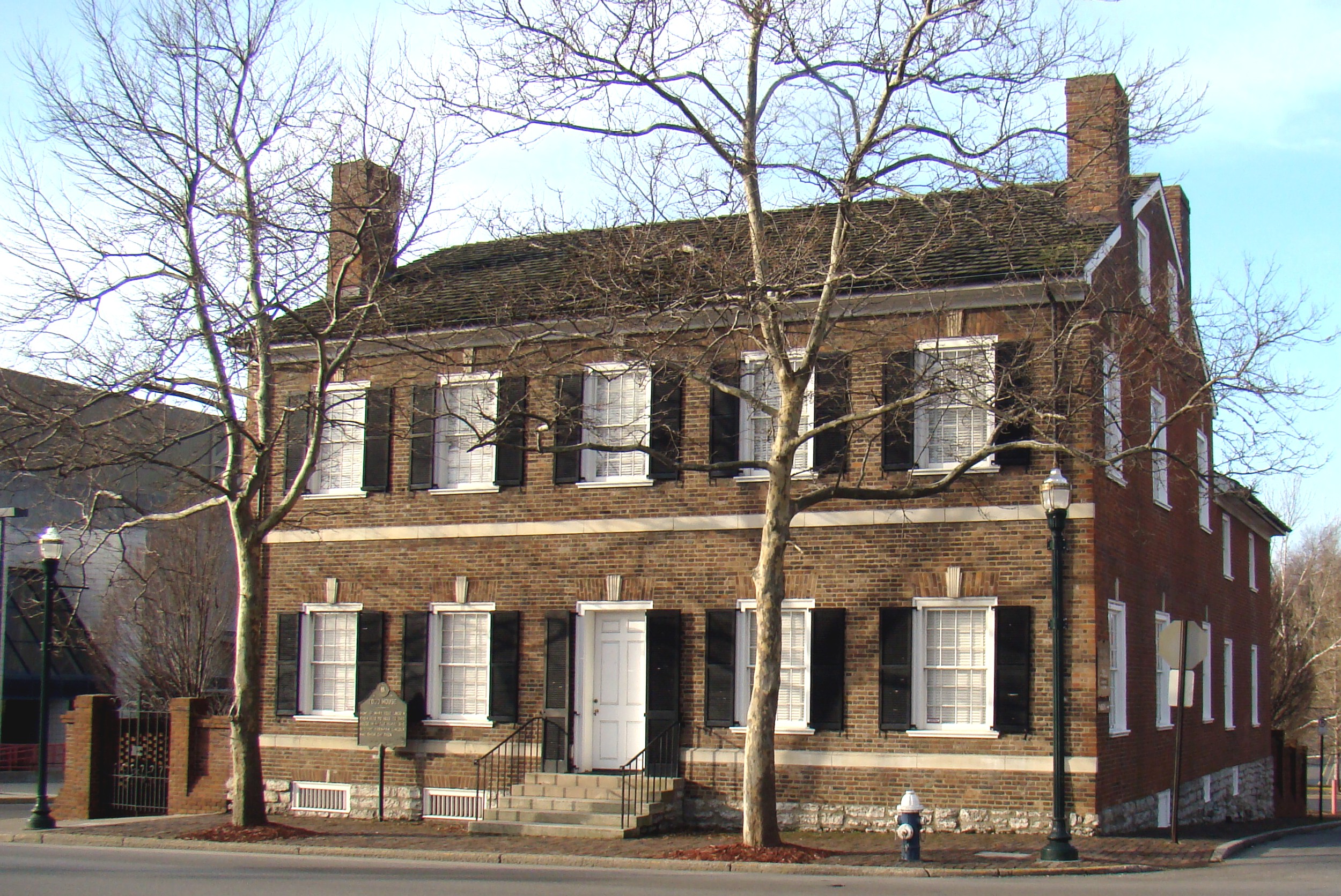
38°02′32″N 84°30′23″W / 38.042222°N 84.506389°WLexington 84 Mary Todd Lincoln House 
August 12, 1971 574 W. Main St.
38°03′05″N 84°30′10″W / 38.051389°N 84.502778°WLexington 85 Loudoun House 
February 6, 1973 Corner of Bryan Ave. and Castlewood Dr.
38°03′19″N 84°28′33″W / 38.055278°N 84.475833°WLexington 86 Mansfield August 19, 1982 Richmond Rd.
38°01′09″N 84°28′03″W / 38.019167°N 84.4675°WLexington 87 Courtney Mathews House August 18, 2011 547 Breckinridge St.
38°02′53″N 84°28′37″W / 38.048056°N 84.476944°WLexington 88 Maxwell Place October 29, 1982 Rose St., University of Kentucky
38°02′11″N 84°30′11″W / 38.036389°N 84.503056°WLexington 89 McAdams and Morford Building 
October 25, 1973 200-210 W. Main St.
38°02′50″N 84°29′54″W / 38.047222°N 84.498333°WLexington 90 Benjamin McCann House June 3, 1982 Old Richmond Pike
37°57′51″N 84°25′01″W / 37.964167°N 84.416944°WLexington 91 Neal McCann House June 3, 1982 5364 Todds Rd.
37°59′37″N 84°21′07″W / 37.993611°N 84.351944°WLexington 92 John McCauley House December 4, 1980 319 Lexington Ave.
38°02′28″N 84°30′01″W / 38.041111°N 84.500278°WLexington 93 McConnell Springs 
January 17, 1976 Address Restricted Lexington 94 James McConnell House June 23, 1983 Old Frankfort Pike
38°03′27″N 84°31′28″W / 38.0575°N 84.524444°WLexington 95 William McConnell House June 23, 1983 Forbes Rd.
38°03′27″N 84°31′28″W / 38.0575°N 84.524444°WLexington 96 McCracken-Wilgus House December 22, 1978 327 Wilgus St.
38°02′42″N 84°29′10″W / 38.045°N 84.486111°WLexington 97 Dr. John McGarvey House May 15, 1974 362 S. Mill St.
38°02′44″N 84°30′08″W / 38.045556°N 84.502222°WLexington 98 Charles McPheeters House May 15, 1974 352 S. Mill St.
38°02′45″N 84°30′06″W / 38.045833°N 84.501667°WLexington 99 Mentelle Park November 27, 1985 Mentelle Pk.
38°02′06″N 84°28′48″W / 38.035°N 84.48°WLexington 100 Middle Reaches of Boone Creek Rural Historic District May 31, 1996 Roughly bounded by U.S. Route 421, Jones Nursery, Coombs Ferry, Sulpher Well Rds., and U.S. Route 25
37°57′34″N 84°19′17″W / 37.959444°N 84.321389°WLexington 101 Miller Brothers Building April 2, 1980 359-361 W. Main St.
38°02′56″N 84°29′58″W / 38.048889°N 84.499444°WLexington 102 Monsieur Giron's Confectionary December 27, 1974 125 N. Mill St.
38°02′55″N 84°29′55″W / 38.048611°N 84.498611°WLexington 103 Moore-Redd-Frazer House 
October 21, 1976 Georgetown Pike
38°04′48″N 84°30′47″W / 38.08°N 84.513056°WLexington 104 John Hunt Morgan Memorial 
July 17, 1997 Courthouse Lawn, junction of N. Upper and E. Main St.
38°02′51″N 84°29′55″W / 38.0475°N 84.498611°WLexington 105 Will Morton Tavern Stand January 3, 1978 137 S. Limestone St.
38°02′44″N 84°29′54″W / 38.045556°N 84.498333°WLexington 106 William Morton House June 10, 1975 518 Limestone St.
38°03′08″N 84°29′14″W / 38.052222°N 84.487222°WLexington 107 Mt. Horeb Archeological District February 12, 1998 Address Restricted Lexington 108 Mt. Horeb Earthworks, Unit A October 10, 1975 Address Restricted Lexington 109 New Zion Historic District December 4, 2008 4972 Newtown Pike through 5200 Newtown Pike, and 103-135 New Zion Rd.
38°10′43″N 84°29′20″W / 38.178704°N 84.488779°WGeorgetown Extends into Scott County 110 North Broadway-Short Street Historic District September 15, 1983 N. Broadway and W. Short St.
38°03′00″N 84°29′56″W / 38.05°N 84.498889°WLexington 111 North Limestone Commercial District November 3, 1983 N. Limestone St. between Church and 3rd Sts.
38°02′56″N 84°29′41″W / 38.048889°N 84.494722°WLexington 112 Northeast Residential Historic District October 17, 1985 Roughly bounded by E. 5th St., Kleiser Ave. and Campsie Pl., E. 4th St., and Humbard Alley; also 337-371 N. Limestone, 400-465 N. Limestone, and 356 Morris St.
38°02′58″N 84°29′18″W / 38.049444°N 84.488333°WLexington Second group of streets represents a boundary increase 113 Northside Historic Residential District August 28, 1979 Roughly bounded by railroad tracks, N. Limestone, W. Short, and Newtown Sts.
38°03′17″N 84°29′37″W / 38.054722°N 84.493611°WLexington 114 Odd Fellows Temple 
February 27, 1980 115-119 W. Main St.
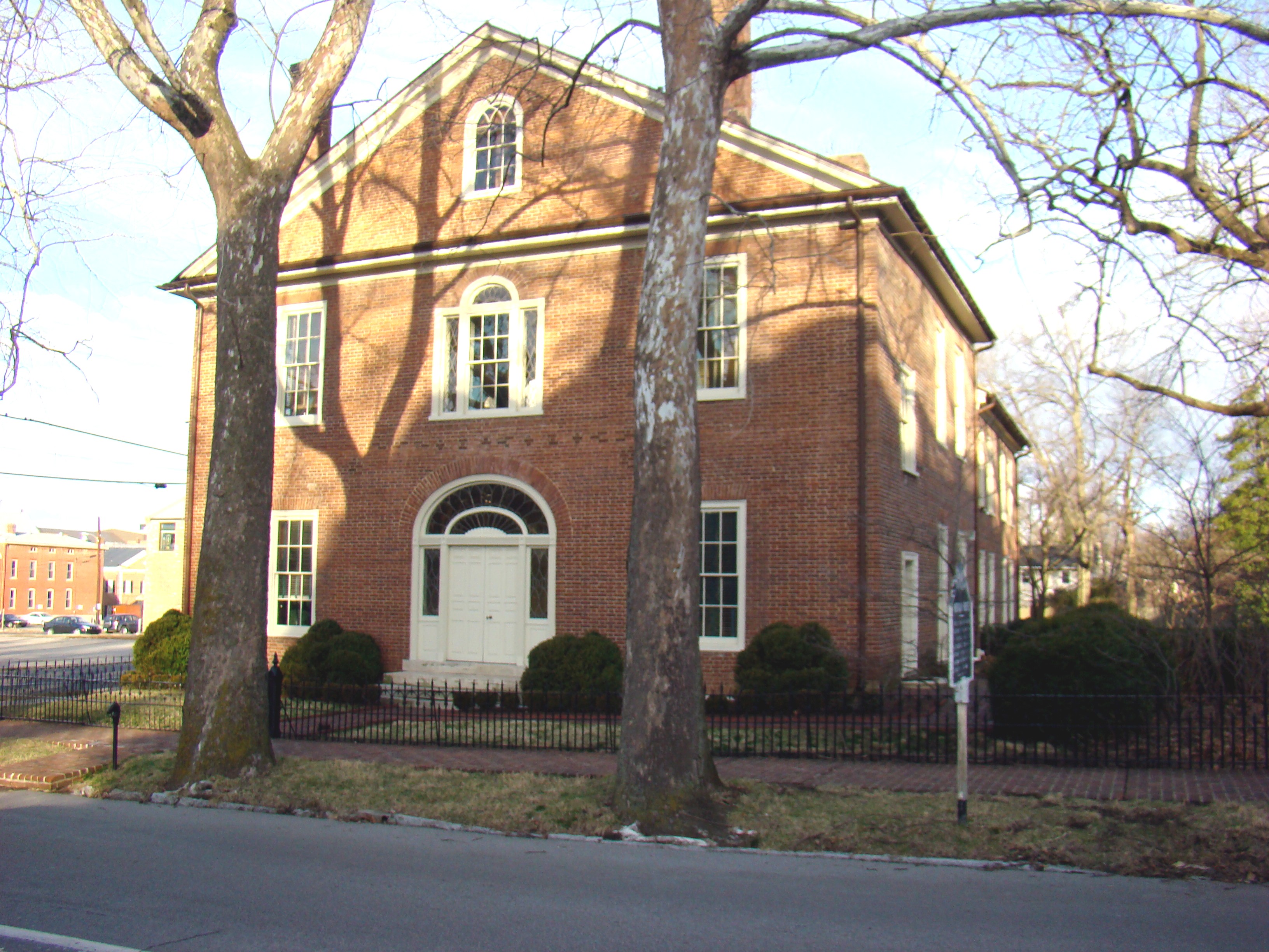
38°02′48″N 84°29′52″W / 38.046667°N 84.497778°WLexington 115 Old Morrison, Transylvania College 
October 15, 1966 W. 3rd St. between Upper St. and Broadway
38°03′05″N 84°29′36″W / 38.051389°N 84.493333°WLexington 116 Opera House and Yates Bookshop Building June 11, 1975 141 and 145 N. Broadway
38°03′00″N 84°29′56″W / 38.05°N 84.498889°WLexington 117 Henry Payne House June 23, 1983 Off U.S. Route 421
38°06′56″N 84°37′01″W / 38.115556°N 84.616944°WLexington 118 James E. Pepper Distillery February 11, 2009 1200 Manchester St.
38°03′23″N 84°31′08″W / 38.056455°N 84.518766°WLexington 119 James Pettit's Mill June 23, 1983 Kentucky Route 418
37°55′56″N 84°20′24″W / 37.932222°N 84.34°WFord 120 Pisgah Rural Historic District February 10, 1989 Area northeast of Versailles roughly bounded by S. Elkhorn Creek, U.S. Route 60, and Big Sink Rd.
38°05′08″N 84°39′40″W / 38.085556°N 84.661111°WLexington 121 William Poindexter House May 15, 1974 359 S. Mill St.
38°02′45″N 84°30′09″W / 38.045833°N 84.5025°WLexington 122 Poplar Grove August 19, 1982 2088 Parkers Mill Rd.
38°01′42″N 84°34′27″W / 38.028333°N 84.574167°WLexington 123 Pugh Price House September 25, 1979 2245 Liberty Rd.
38°01′40″N 84°26′36″W / 38.027778°N 84.443333°WLexington 124 Williamson Price House September 25, 1979 2497 Liberty Rd.
38°01′14″N 84°26′09″W / 38.020556°N 84.435833°WLexington 125 Ramey Mound February 12, 1998 Address Restricted Lexington 126 Lewis Ramsey, Jr., House March 6, 1991 3797 Old Frankfort Pike
38°05′17″N 84°35′36″W / 38.088056°N 84.593333°WLexington 127 Randall Building Bogaert's Jewelry Store 
September 9, 1982 127-129 W. Main St.
38°02′50″N 84°29′50″W / 38.047222°N 84.497222°WLexington 128 Redd Road Rural Historic District February 28, 1991 Area largely south and east of the junction of Redd and Frankfort Roads
38°05′30″N 84°37′34″W / 38.091667°N 84.626111°WLexington 129 Ridgely House May 7, 1973 190 Market St.
38°02′57″N 84°29′46″W / 38.049167°N 84.496111°WLexington 130 Rockefeller Mound February 12, 1998 Address Restricted Lexington 131 Joseph Hale Rogers House November 15, 1979 East of Lexington on Bryan Station Pike
38°04′37″N 84°24′53″W / 38.076944°N 84.414722°WLexington 132 Rose Hill 
December 30, 1974 461 N. Limestone St.
38°03′08″N 84°29′22″W / 38.052222°N 84.489444°WLexington 133 Robert Russel House June 23, 1983 Off Kentucky Route 353
38°08′55″N 84°25′43″W / 38.148611°N 84.428611°WCenterville 134 Russell School April 5, 2006 201 W. 5th St.
38°03′14″N 84°29′22″W / 38.053889°N 84.489444°WLexington 135 Sayre Female Institute August 19, 1982 194 N. Limestone St.
38°02′53″N 84°29′39″W / 38.048056°N 84.494167°WLexington 136 Scott and Wilson Houses District December 31, 1974 324, 328, 330, 336 S. Mill St.
38°02′47″N 84°30′02″W / 38.046389°N 84.500556°WLexington 137 Second Presbyterian Church August 11, 1980 460 E. Main St.
38°02′23″N 84°29′26″W / 38.039722°N 84.490556°WLexington 138 Shady Side November 7, 1976 4 miles east of Lexington on U.S. Route 68
38°05′27″N 84°25′45″W / 38.090833°N 84.429167°WLexington 139 Shelby Family Houses November 17, 1978 Southeast of Lexington on Richmond Rd., Shelby Lane, and Jacks Creek Pike
37°56′11″N 84°25′24″W / 37.936389°N 84.423333°WLexington 140 Frederick Shryack House June 23, 1983 Off Kentucky Route 859
38°03′44″N 84°20′03″W / 38.062222°N 84.334167°WClintonville 141 Mitchell Baker Smith Company Building August 26, 1980 230-232 W. Main St.
38°02′49″N 84°29′50″W / 38.046944°N 84.497222°WLexington 142 South Hill Historic District June 13, 1978 Roughly bounded by S. Broadway, W. High, S. Limestone, and Pine Sts.
38°02′42″N 84°30′07″W / 38.045°N 84.501944°WLexington 143 Southeast Lexington Residential and Commercial District August 1, 1984 Roughly bounded by High St., Rose Lane, and Lexington and Woodland Aves.
38°02′18″N 84°29′46″W / 38.038333°N 84.496111°WLexington 144 Southern Railway Passenger Depot August 13, 1987 701 S. Broadway
38°02′34″N 84°30′37″W / 38.042778°N 84.510278°WLexington 145 Spring Hill Farm February 17, 1978 1401 Old Frankfort Pike
38°03′30″N 84°31′55″W / 38.058333°N 84.531944°WLexington 146 Drewsilla Steele House February 22, 1991 3951 Old Frankfort Pike
38°05′22″N 84°35′55″W / 38.089444°N 84.598611°WLexington 147 Stony Point August 7, 1979 4935 Parkers Mill Rd.
38°01′34″N 84°37′10″W / 38.026111°N 84.619444°WLexington 148 William Lytle Todd House July 17, 1979 West of Lexington at 3725 Bowman Mill
38°01′19″N 84°35′40″W / 38.021944°N 84.594444°WLexington 149 Trotter's Warehouse June 18, 1976 122-124 S. Mill St.
38°02′51″N 84°29′58″W / 38.0475°N 84.499444°WLexington 150 United States Post Office and Court House March 18, 1999 101 Barr St.
38°02′49″N 84°29′32″W / 38.046944°N 84.492222°WLexington 151 Victorian Commercial Block 
July 21, 1978 Bounded by Broadway, Main, Short, and Spring Sts.
38°02′58″N 84°30′00″W / 38.049444°N 84.5°WLexington 152 Walnut Hill Presbyterian Church May 7, 1973 East of Lexington off U.S. Route 25
37°58′07″N 84°25′29″W / 37.968611°N 84.424722°WLexington 153 Dr. Walter Warfield Building August 11, 1980 122-124 N. Upper St. and 140-160 W. Short St.
38°02′50″N 84°29′50″W / 38.047222°N 84.497222°WLexington 154 Thomas B. Watkins House June 29, 1982 1008 S. Broadway
38°02′18″N 84°30′54″W / 38.038333°N 84.515°WLexington 155 Henry Watt House December 16, 1977 703 W. High St.
38°03′01″N 84°30′17″W / 38.050278°N 84.504722°WLexington 156 Waveland August 12, 1971 5 miles south of Lexington off U.S. Route 27
37°58′17″N 84°32′14″W / 37.971389°N 84.537222°WLexington 157 West Fayette County Rural Historic District February 28, 1991 Roughly bounded by Rice, Van Meter, Elk Chester, Yarnallton, Leestown, and Viley Rds., and U.S. Route 60
38°04′02″N 84°35′00″W / 38.067222°N 84.583333°WLexington 158 West High Street Historic District July 10, 1969 Northern side of the 100-300 blocks of W. High St.
38°02′47″N 84°30′00″W / 38.046389°N 84.5°WLexington 159 Western Suburb Historic District June 18, 1976 Irregular pattern along W. Short St. from Saunter to Kentucky Route 922
38°03′07″N 84°30′09″W / 38.051944°N 84.5025°WLexington 160 Wolf Wile Department Store Building July 31, 1996 248-250 E. Main St.
38°02′37″N 84°29′40″W / 38.043611°N 84.494444°WLexington 161 Woodland August 28, 1975 1 mile east of Lexington on Squires Rd. off U.S. Route 421
37°58′25″N 84°27′37″W / 37.973611°N 84.460278°WLexington 162 Woodlands Historic District August 18, 1983 Roughly bounded by Main and High Sts., Ashland and Woodland Aves.
38°02′06″N 84°29′21″W / 38.035°N 84.489167°WLexington 163 Woodstock May 12, 1975 Todds Rd.
37°59′23″N 84°21′25″W / 37.989722°N 84.356944°WLexington 164 Woodward Heights Neighborhood Historic District December 1, 1980 Roughly bounded by High, Merino, and Pine Sts.
38°03′00″N 84°30′25″W / 38.05°N 84.506944°WLexington 165 F.W. Woolworth Building September 6, 2002 106 Main St.
38°02′49″N 84°30′06″W / 38.046944°N 84.501667°WLexington (Nonextant) 166 Allen Worley and Foushee Houses January 20, 1976 355, 361, and 367 S. Broadway
38°02′48″N 84°30′12″W / 38.046667°N 84.503333°WLexington See also
- List of National Historic Landmarks in Kentucky
- National Register of Historic Places listings in Kentucky
References
- ^ The latitude and longitude information provided in this table was derived originally from the National Register Information System, which has been found to be fairly accurate for about 99% of listings. For about 1% of NRIS original coordinates, experience has shown that one or both coordinates are typos or otherwise extremely far off; some corrections may have been made. A more subtle problem causes many locations to be off by up to 150 yards, depending on location in the country: most NRIS coordinates were derived from tracing out latitude and longitudes off of USGS topographical quadrant maps created under North American Datum of 1927, which differs from the current, highly accurate GPS system used by Google maps. Chicago is about right, but NRIS longitudes in Washington are higher by about 4.5 seconds, and are lower by about 2.0 seconds in Maine. Latitudes differ by about 1.0 second in Florida. Some locations in this table may have been corrected to current GPS standards.
- ^ "National Register of Historic Places: Weekly List Actions". National Park Service, United States Department of the Interior. Retrieved on November 10, 2011.
- ^ Numbers represent an ordering by significant words. Various colorings, defined here, differentiate National Historic Landmark sites and National Register of Historic Places Districts from other NRHP buildings, structures, sites or objects.
- ^ Historic Residential Suburbs in the United States, 1830-1960 MPS
U.S. National Register of Historic Places Topics Lists by states Alabama • Alaska • Arizona • Arkansas • California • Colorado • Connecticut • Delaware • Florida • Georgia • Hawaii • Idaho • Illinois • Indiana • Iowa • Kansas • Kentucky • Louisiana • Maine • Maryland • Massachusetts • Michigan • Minnesota • Mississippi • Missouri • Montana • Nebraska • Nevada • New Hampshire • New Jersey • New Mexico • New York • North Carolina • North Dakota • Ohio • Oklahoma • Oregon • Pennsylvania • Rhode Island • South Carolina • South Dakota • Tennessee • Texas • Utah • Vermont • Virginia • Washington • West Virginia • Wisconsin • WyomingLists by territories Lists by associated states Other  Category:National Register of Historic Places •
  Portal:National Register of Historic Places
 Commonwealth of Kentucky
Frankfort (capital) Topics Regions Allegheny Plateau · The Bluegrass · Central Kentucky · Cumberland Mountains · Cumberland Plateau · Eastern Mountain Coal Fields · Highland Rim · The Knobs · Mississippi Plain · Northern Kentucky · Pennyroyal Plateau · The Purchase · Ridge-and-Valley · South Central Kentucky · Tennessee Valley · Western Coal Fields
25 Largest
citiesLouisville · Lexington · Bowling Green · Owensboro · Covington · Richmond · Hopkinsville · Florence · Henderson · Frankfort · Nicholasville · Jeffersontown · Paducah · Elizabethtown · Radcliff · Independence · Georgetown · Ashland · Madisonville · St. Matthews · Erlanger · Winchester · Murray · Shively · Newport
Metropolitan
areasAshland · Bowling Green · Clarksville · Elizabethtown · Evansville · Lexington–Fayette · Louisville – Jefferson County · Northern Kentucky · Owensboro
Counties Adair · Allen · Anderson · Ballard · Barren · Bath · Bell · Boone · Bourbon · Boyd · Boyle · Bracken · Breathitt · Breckinridge · Bullitt · Butler · Caldwell · Calloway · Campbell · Carlisle · Carroll · Carter · Casey · Christian · Clark · Clay · Clinton · Crittenden · Cumberland · Daviess · Edmonson · Elliott · Estill · Fayette · Fleming · Floyd · Franklin · Fulton · Gallatin · Garrard · Grant · Graves · Grayson · Green · Greenup · Hancock · Hardin · Harlan · Harrison · Hart · Henderson · Henry · Hickman · Hopkins · Jackson · Jefferson · Jessamine · Johnson · Kenton · Knott · Knox · LaRue · Laurel · Lawrence · Lee · Leslie · Letcher · Lewis · Lincoln · Livingston · Logan · Lyon · Madison · Magoffin · Marion · Marshall · Martin · Mason · McCracken · McCreary · McLean · Meade · Menifee · Mercer · Metcalfe · Monroe · Montgomery · Morgan · Muhlenberg · Nelson · Nicholas · Ohio · Oldham · Owen · Owsley · Pendleton · Perry · Pike · Powell · Pulaski · Robertson · Rockcastle · Rowan · Russell · Scott · Shelby · Simpson · Spencer · Taylor · Todd · Trigg · Trimble · Union · Warren · Washington · Wayne · Webster · Whitley · Wolfe · Woodford
Categories:- National Register of Historic Places in Kentucky by county
- Fayette County, Kentucky
- National Register of Historic Places in Lexington, Kentucky
-


Wikimedia Foundation. 2010.