- National Register of Historic Places listings in Fremont County, Colorado
-
 Location of Fremont County in Colorado
This is a list of the National Register of Historic Places listings in Fremont County, Colorado.
This is intended to be a complete list of the properties and districts on the National Register of Historic Places in Fremont County, Colorado, United States. The locations of National Register properties and districts for which the latitude and longitude coordinates are included below, may be seen in a Google map.[1]
There are 22 properties and districts listed on the National Register in the county. Another property was once listed but has been removed.
-
- This National Park Service list is complete through NPS recent listings posted November 10, 2011.[2]
Contents
Current listings
[3] Landmark name Image Date listed Location City or town Summary 1 Samuel H. Atwater House March 7, 1996 821 Macon Ave.
38°26′36″N 105°14′12″W / 38.443333°N 105.236667°WCanon City 2 Bridge No. 10/Adelaide Bridge February 4, 1985 Fremont County Road
38°34′17″N 105°05′10″W / 38.571389°N 105.086111°WFlorence 3 Canon City Downtown Historic District 
None Roughly Main St. from 3rd to 9th Sts. and Macon Ave.; also 602 Macon Ave.
38°26′29″N 105°14′17″W / 38.441389°N 105.238056°WCanon City 602 Macon Ave. is a boundary increase 4 Canon City Municipal Building August 18, 1983 612 Royal Gorge Boulevard
38°26′57″N 105°14′16″W / 38.449167°N 105.237778°WCanon City 5 Canon City State Armory August 20, 1999 110 Main St.
38°26′17″N 105°14′42″W / 38.438056°N 105.245°WCanon City 6 Christ Episcopal Church August 19, 1994 802 Harrison Ave.
38°26′41″N 105°14′16″W / 38.444722°N 105.237778°WCanon City 7 Colorado Women's Prison March 5, 1999 201 N. 1st St.
38°26′21″N 105°14′48″W / 38.439167°N 105.246667°WCanon City 8 Deputy Warden's House May 2, 2001 105 Main
38°26′18″N 105°14′45″W / 38.438333°N 105.245833°WCanon City 9 First Presbyterian Church September 1, 1983 Macon and 7th Sts.
38°26′35″N 105°14′18″W / 38.443056°N 105.238333°WCanon City 10 Holy Cross Abbey August 18, 1983 U.S. Route 50
38°26′56″N 105°12′01″W / 38.448889°N 105.200278°WCanon City 11 Main Street Bridge October 15, 2002 State Highway 115 at milepost 8.90
38°23′21″N 105°06′48″W / 38.389167°N 105.113333°WFlorence 12 McClure House September 14, 1979 323-331 Main St.
38°26′24″N 105°14′30″W / 38.44°N 105.241667°WCanon City 13 Mount Saint Scholastica Academy, East Building January 15, 1998 615 Pike Ave.
38°26′50″N 105°14′30″W / 38.447222°N 105.241667°WCanon City 14 Oil Spring February 16, 1996 Address Restricted Canon City 15 Portland Bridge February 4, 1985 State Highway 120
38°23′19″N 105°00′56″W / 38.388611°N 105.015556°WPortland 16 Rio Grande Railroad Viaduct October 15, 2002 State Highway 120 at milepost 0.17
38°23′10″N 105°04′18″W / 38.386111°N 105.071667°WFlorence 17 Robison Mansion October 11, 1984 12 Riverside Dr.
38°26′02″N 105°14′39″W / 38.433889°N 105.244167°WCanon City 18 Rouch Gulch Bridge November 27, 2002 U.S. Route 50 at milepost 230.12
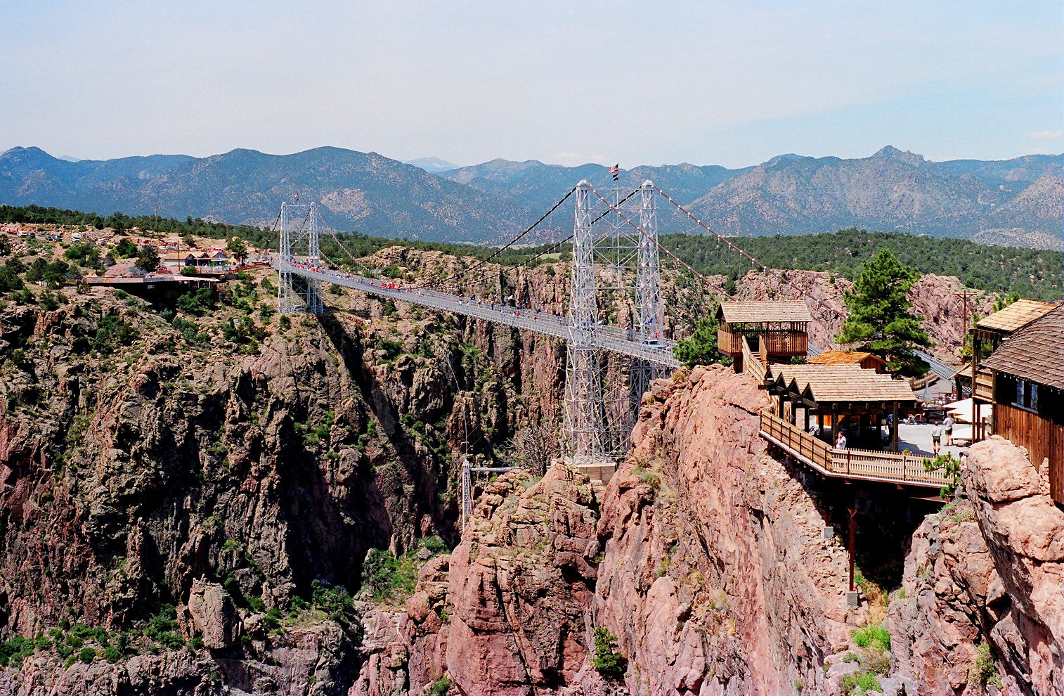
38°28′20″N 105°52′38″W / 38.472222°N 105.877222°WSwissvale 19 Royal Gorge Bridge and Incline Railway 
September 2, 1983 Northwest of Canon City
38°27′53″N 105°19′32″W / 38.464722°N 105.325556°WCanon City 20 South Canon High School October 24, 2005 1020 Park Ave.
38°26′07″N 105°13′43″W / 38.435278°N 105.228611°WCanon City 21 US Post Office and Federal Building-Canon City Main January 22, 1986 5th St. and Macon Ave.
38°26′29″N 105°14′27″W / 38.441389°N 105.240833°WCanon City 22 US Post Office-Florence Main January 22, 1986 121 N. Pikes Peak St.
38°23′27″N 105°07′03″W / 38.390833°N 105.1175°WFlorence Former listing
Landmark name Image Date removed Location City or Town Summary 1 Fourth Street Bridge January 14, 2010 4th St.
38°26′22″N 105°13′52″W / 38.43944°N 105.23111°WCanon City Listed February 4, 1985 See also
- List of National Historic Landmarks in Colorado
- National Register of Historic Places listings in Colorado
References
- ^ The latitude and longitude information provided in this table was derived originally from the National Register Information System, which has been found to be fairly accurate for about 99% of listings. For about 1% of NRIS original coordinates, experience has shown that one or both coordinates are typos or otherwise extremely far off; some corrections may have been made. A more subtle problem causes many locations to be off by up to 150 yards, depending on location in the country: most NRIS coordinates were derived from tracing out latitude and longitudes off of USGS topographical quadrant maps created under the North American Datum of 1927, which differs from the current, highly accurate WGS84 GPS system used by Google maps. Chicago is about right, but NRIS longitudes in Washington are higher by about 4.5 seconds, and are lower by about 2.0 seconds in Maine. Latitudes differ by about 1.0 second in Florida. Some locations in this table may have been corrected to current GPS standards.
- ^ "National Register of Historic Places: Weekly List Actions". National Park Service, United States Department of the Interior. Retrieved on November 10, 2011.
- ^ Numbers represent an ordering by significant words. Various colorings, defined here, differentiate National Historic Landmark sites and National Register of Historic Places Districts from other NRHP buildings, structures, sites or objects.
U.S. National Register of Historic Places Topics Lists by states Alabama • Alaska • Arizona • Arkansas • California • Colorado • Connecticut • Delaware • Florida • Georgia • Hawaii • Idaho • Illinois • Indiana • Iowa • Kansas • Kentucky • Louisiana • Maine • Maryland • Massachusetts • Michigan • Minnesota • Mississippi • Missouri • Montana • Nebraska • Nevada • New Hampshire • New Jersey • New Mexico • New York • North Carolina • North Dakota • Ohio • Oklahoma • Oregon • Pennsylvania • Rhode Island • South Carolina • South Dakota • Tennessee • Texas • Utah • Vermont • Virginia • Washington • West Virginia • Wisconsin • WyomingLists by territories Lists by associated states Other Municipalities and communities of Fremont County, Colorado Cities 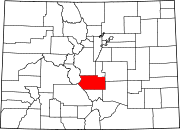
Towns CDPs Coaldale | Cotopaxi | Howard | Lincoln Park | Penrose
Unincorporated
communityCategories:- National Register of Historic Places in Colorado by county
- Fremont County, Colorado
- Buildings and structures in Fremont County, Colorado
-


Wikimedia Foundation. 2010.