National Register of Historic Places listings in Garfield County, Utah

National Register of Historic Places listings in Garfield County, Utah
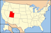
Location of Garfield County in Utah

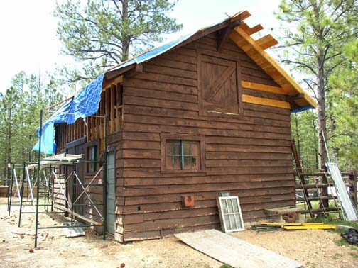
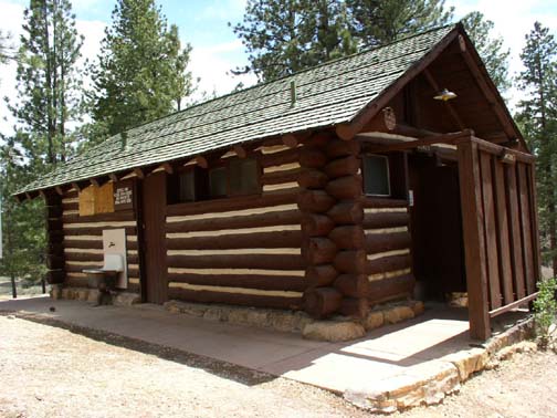
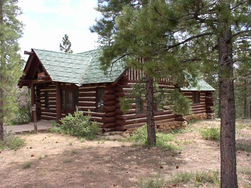
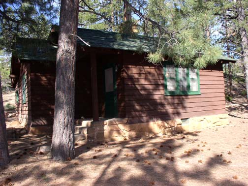
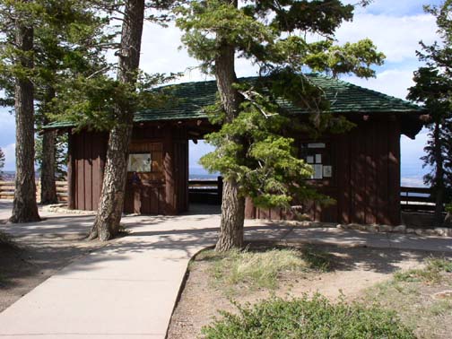
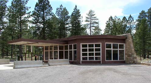
This is a list of the National Register of Historic Places listings in Garfield County, Utah.

This is intended to be a complete list of the properties and districts on the National Register of Historic Places in Garfield County, Utah, United States. Latitude and longitude coordinates are provided for many National Register properties and districts; these locations may be seen together in a Google map.[1]

There are 27 properties and districts listed on the National Register in the county, including 1 National Historic Landmark.

This National Park Service list is complete through NPS recent listings posted November 10, 2011.[2]


Contents

Current listings

[3] Landmark name [4] Image Date listed Location City or town Summary
1 Boulder Elementary School 01985-04-01April 1, 1985 50 School House Ln.
37°54′32″N 111°25′22″W / 37.908889°N 111.422778°W / 37.908889; -111.422778 (Boulder Elementary School)
Boulder
2 Bryce Canyon Airport
Bryce Canyon Airport
01978-10-19October 19, 1978 Southeast of Panguitch off State Route 12
37°42′04″N 112°09′15″W / 37.701111°N 112.154167°W / 37.701111; -112.154167 (Bryce Canyon Airport)
Panguitch
3 Bryce Canyon Lodge and Deluxe Cabins
Bryce Canyon Lodge and Deluxe Cabins
01987-05-28May 28, 1987 State Route 63
37°37′41″N 112°10′00″W / 37.628056°N 112.166667°W / 37.628056; -112.166667 (Bryce Canyon Lodge and Deluxe Cabins)
Bryce Canyon National Park Expanded 1995 with regular NRHP overlay
4 Bryce Canyon Lodge Historic District
Bryce Canyon Lodge Historic District
01995-04-25April 25, 1995 Bryce Canyon National Park
37°37′37″N 112°10′02″W / 37.626944°N 112.167222°W / 37.626944; -112.167222 (Bryce Canyon Lodge Historic District)
Bryce Canyon National Park Expands district around Bryce Canyon Lodge, but is not National Historic Landmark-designated
5 Bryce Canyon National Park Scenic Trails Historic District
Bryce Canyon National Park Scenic Trails Historic District
01995-04-25April 25, 1995 Bryce Canyon National Park
37°37′33″N 112°09′23″W / 37.625833°N 112.156389°W / 37.625833; -112.156389 (Bryce Canyon National Park Scenic Trails Historic District)
Bryce Canyon National Park Comprises five contiguous trails: Navajo Loop Trail, Queen's Garden Trail, Peekaboo Loop Trail, Fairyland Loop Trail, Rim Trail
6 Bryce Inn
Bryce Inn
01995-04-25April 25, 1995 Bryce Canyon National Park
37°38′08″N 112°09′51″W / 37.635556°N 112.164167°W / 37.635556; -112.164167 (Bryce Inn)
Bryce Canyon National Park
7 Coombs Village Site
Coombs Village Site
01976-01-01January 1, 1976 State Route 117
37°54′38″N 111°25′21″W / 37.910556°N 111.4225°W / 37.910556; -111.4225 (Coombs Village Site)
Boulder A partially excavated Puebloan village, now part of Anasazi Indian State Park
8 Friendship Cove Pictograph
Friendship Cove Pictograph
01978-12-21December 21, 1978 Address Restricted[5]
Escalante
9 William Jasper, Jr., and Elizabeth Henderson House
William Jasper, Jr., and Elizabeth Henderson House
02006-04-05April 5, 2006 85 N. Main St. (Kodachrome Highway)
37°34′28″N 112°03′44″W / 37.574444°N 112.062222°W / 37.574444; -112.062222 (William Jasper, Jr., and Elizabeth Henderson House)
Cannonville
10 Hole-in-the-Rock Trail
Hole-in-the-Rock Trail
01982-08-09August 9, 1982 A trail commencing at Escalante and terminating at Bluff
37°25′18″N 110°39′51″W / 37.421667°N 110.664167°W / 37.421667; -110.664167 (Hole-in-the-Rock Trail)
Escalante Split between Garfield, Kane, and San Juan counties
11 Horse Barn
Horse Barn
01995-04-25April 25, 1995 Bryce Canyon National Park
37°37′35″N 112°10′53″W / 37.626389°N 112.181389°W / 37.626389; -112.181389 (Horse Barn)
Bryce Canyon National Park
12 Kolb Brothers "Cat Camp" Inscription 01988-10-07October 7, 1988 Big Drop #2 vicinity, Canyonlands National Park
38°04′57″N 110°02′32″W / 38.0825°N 110.042222°W / 38.0825; -110.042222 (Kolb Brothers "Cat Camp" Inscription)
Moab
13 Loop C Comfort Station
Loop C Comfort Station
01995-04-25April 25, 1995 North Campground, Bryce Canyon National Park
37°38′10″N 112°09′54″W / 37.636111°N 112.165°W / 37.636111; -112.165 (Loop C Comfort Station)
Bryce Canyon National Park
14 Loop D Comfort Station
Loop D Comfort Station
01995-04-25April 25, 1995 North Campground, Bryce Canyon National Park
37°38′05″N 112°09′58″W / 37.634722°N 112.166111°W / 37.634722; -112.166111 (Loop D Comfort Station)
Bryce Canyon National Park
15 Oak Creek Dam 01999-09-13September 13, 1999 Oak Creek, north of North Coleman Canyon
38°05′00″N 111°08′15″W / 38.083333°N 111.1375°W / 38.083333; -111.1375 (Oak Creek Dam)
Torrey
16 Old Administration Building
Old Administration Building
01995-04-24April 24, 1995 Bryce Canyon National Park
37°37′53″N 112°09′52″W / 37.631389°N 112.164444°W / 37.631389; -112.164444 (Old Administration Building)
Bryce Canyon National Park
17 Old National Park Service Housing Historic District
Old National Park Service Housing Historic District
01995-04-25April 25, 1995 Bryce Canyon National Park
37°37′50″N 112°10′06″W / 37.630556°N 112.168333°W / 37.630556; -112.168333 (Old National Park Service Housing Historic District)
Bryce Canyon National Park
18 William T., Jr., and Mary Isabell R. Owens House
William T., Jr., and Mary Isabell R. Owens House
01999-03-25March 25, 1999 95 N. 100 East
37°49′26″N 112°26′00″W / 37.823889°N 112.433333°W / 37.823889; -112.433333 (William T., Jr., and Mary Isabell R. Owens House)
Panguitch
19 Panguitch Carnegie Library
Panguitch Carnegie Library
01984-10-25October 25, 1984 75 E. Center St.
37°49′23″N 112°26′01″W / 37.823056°N 112.433611°W / 37.823056; -112.433611 (Panguitch Carnegie Library)
Panguitch
20 Panguitch Historic District
Panguitch Historic District
02006-11-16November 16, 2006 Roughly bounded by 500 North, 400 East, 500 South, and 300 West
37°49′25″N 112°26′00″W / 37.823611°N 112.433333°W / 37.823611; -112.433333 (Panguitch Historic District)
Panguitch
21 Panguitch Social Hall
Panguitch Social Hall
01998-11-12November 12, 1998 50 E. Center St.
37°49′21″N 112°25′58″W / 37.8225°N 112.432778°W / 37.8225; -112.432778 (Panguitch Social Hall)
Panguitch
22 Pole Hollow Archeological Site
Pole Hollow Archeological Site
01981-07-16July 16, 1981 Address Restricted[5]
Panguitch
23 Rainbow Point Comfort Station and Overlook Shelter
Rainbow Point Comfort Station and Overlook Shelter
01995-04-25April 25, 1995 Bryce Canyon National Park
37°28′31″N 112°14′21″W / 37.475278°N 112.239167°W / 37.475278; -112.239167 (Rainbow Point Comfort Station and Overlook Shelter)
Bryce Canyon National Park
24 Riggs Spring Fire Trail 01995-04-25April 25, 1995 Bryce Canyon National Park
37°27′47″N 112°14′15″W / 37.463056°N 112.2375°W / 37.463056; -112.2375 (Riggs Spring Fire Trail)
Bryce Canyon National Park
25 Starr Ranch 01976-04-23April 23, 1976 46 miles south of Hanksville
37°51′03″N 110°39′53″W / 37.850833°N 110.664722°W / 37.850833; -110.664722 (Starr Ranch)
Hanksville
26 Under-the-Rim Trail 01995-04-25April 25, 1995 Bryce Canyon National Park
37°33′44″N 112°12′57″W / 37.562222°N 112.215833°W / 37.562222; -112.215833 (Under-the-Rim Trail)
Bryce Canyon National Park
27 Utah Parks Company Service Station
Utah Parks Company Service Station
01995-04-25April 25, 1995 Bryce Canyon National Park
37°37′45″N 112°09′59″W / 37.629167°N 112.166389°W / 37.629167; -112.166389 (Utah Parks Company Service Station)
Bryce Canyon National Park

See also

References

  1. ^ The latitude and longitude information provided in this table was derived originally from the National Register Information System, which has been found to be fairly accurate for about 99% of listings. For about 1% of NRIS original coordinates, experience has shown that one or both coordinates are typos or otherwise extremely far off; some corrections may have been made. A more subtle problem causes many locations to be off by up to 150 yards, depending on location in the country: most NRIS coordinates were derived from tracing out latitude and longitudes off of USGS topographical quadrant maps created under the North American Datum of 1927, which differs from the current, highly accurate WGS84 GPS system used by Google maps. Chicago is about right, but NRIS longitudes in Washington are higher by about 4.5 seconds, and are lower by about 2.0 seconds in Maine. Latitudes differ by about 1.0 second in Florida. Some locations in this table may have been corrected to current GPS standards.
  2. ^ "National Register of Historic Places: Weekly List Actions". National Park Service, United States Department of the Interior. Retrieved on November 10, 2011.
  3. ^ Numbers represent an ordering by significant words. Various colorings, defined here, differentiate National Historic Landmark sites and National Register of Historic Places Districts from other NRHP buildings, structures, sites or objects.
  4. ^ "National Register Information System". National Register of Historic Places. National Park Service. . http://nrhp.focus.nps.gov/natreg/docs/All_Data.html. 
  5. ^ a b Some listings on the NRHP are highly sensitive sites and may be subject to looting or vandalism. The NRHP lists this site as "Address Restricted."

External links

Media related to National Register of Historic Places in Garfield County, Utah at Wikimedia Commons


Wikimedia Foundation. 2010.

Игры ⚽ Поможем решить контрольную работу

Look at other dictionaries:

Share the article and excerpts

Direct link
Do a right-click on the link above
and select “Copy Link”