- National Register of Historic Places listings in Goodhue County, Minnesota
-
This is a complete list of the 59 historic properties and districts in Goodhue County, Minnesota that are entered on the National Register of Historic Places.
Goodhue County is a county located in the southeastern part of the U.S. state of Minnesota, bounded on the northeast by the Mississippi River and Wisconsin, the southeast by Wabasha County and Olsted County, the southwest by Dodge County, the west by Rice County, and the northwest by Dakota County. Red Wing is the county seat.
-
- This National Park Service list is complete through NPS recent listings posted November 10, 2011.[1]
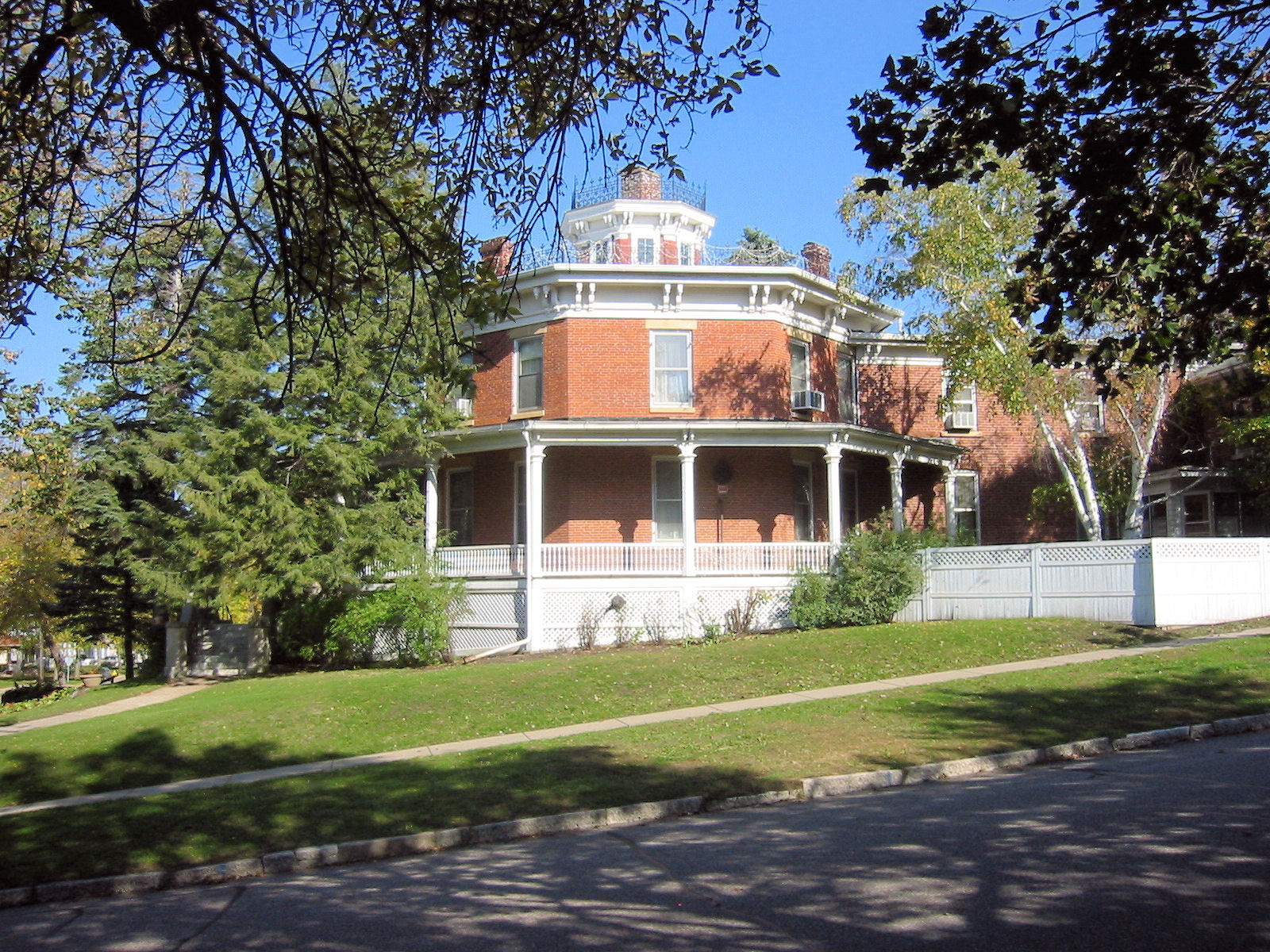
[2] Landmark name [3] Image Date listed Location City or town Summary 1 Alexander P. Anderson Estate-Tower View April 13, 1977 West of Red Wing on U.S. 61
44°34′13″N 92°38′19″W / 44.570278°N 92.638611°WRed Wing 2 Barn Bluff 
August 3, 1990 Junction of U.S. 61 and 63
44°34′10″N 92°31′32″W / 44.569444°N 92.525556°WRed Wing 3 Bartron Site October 15, 1970 Address Restricted Red Wing 4 George Baslington Farmhouse February 12, 1980 Off U.S. 52
44°15′09″N 92°37′16″W / 44.2525°N 92.621111°WPine Island 5 Bridge No. 12 November 6, 1989 Township Road 43 over Bullard Creek
44°32′31″N 92°26′19″W / 44.541944°N 92.438611°WRed Wing Profile 6 Jacob Bringghold House February 12, 1980 314 2nd Street SW
44°12′04″N 92°38′59″W / 44.201111°N 92.649722°WPine Island 7 Cannon Falls Commercial Historic District January 7, 2000 4th Street between Mill and Main Streets
44°30′27″N 92°54′21″W / 44.5075°N 92.905833°WCannon Falls 8 Cannon Falls School February 12, 1980 115 West Minnesota Street
44°30′39″N 92°54′07″W / 44.510833°N 92.901944°WCannon Falls 9 Carleton Airport July 21, 2004 1235 Minnesota Highway 19
44°28′27″N 93°00′54″W / 44.474167°N 93.015°WStanton Profile 10 G.A. Carlson Lime Kiln 
September 27, 1976 East 5th Street
44°34′16″N 92°31′13″W / 44.571111°N 92.520278°WRed Wing 11 Chicago Great Western Depot 
June 4, 1980 West Main and Fulton Streets
44°33′52″N 92°32′22″W / 44.564444°N 92.539444°WRed Wing 12 Church of the Redeemer-Episcopal 
February 12, 1980 123 North 3rd Street
44°30′28″N 92°54′14″W / 44.507778°N 92.903889°WCannon Falls 13 Cross of Christ Lutheran Church February 12, 1980 U.S. 61
44°36′00″N 92°43′47″W / 44.6°N 92.729722°WRed Wing 14 Dammon Round Barn 
February 12, 1980 U.S. 61
44°32′49″N 92°27′36″W / 44.546944°N 92.46°WRed Wing Property overview Property website 15 District No. 20 School February 12, 1980 Minnesota 58
44°29′20″N 92°32′57″W / 44.488889°N 92.549167°WRed Wing 16 Ellsworth Hotel Livery Stable February 12, 1980 4th Street
44°30′31″N 92°54′20″W / 44.508611°N 92.905556°WCannon Falls 17 Firemen's Hall 
February 12, 1980 206 West Mill Street
44°30′29″N 92°54′11″W / 44.508056°N 92.903056°WCannon Falls 18 First Congregational Church of Zumbrota 
February 12, 1980 455 East Avenue
44°17′31″N 92°40′02″W / 44.291944°N 92.667222°WZumbrota 19 Florence Town Hall July 20, 2000 33923 Minnesota Highway 61 Boulevard
44°30′37″N 92°21′06″W / 44.510278°N 92.351667°WFlorence Township 20 Fort Sweeney Site August 5, 1970 Address Restricted Red Wing 21 E.J. Fryk Barn February 12, 1980 Off U.S. 61
44°31′28″N 92°27′16″W / 44.524444°N 92.454444°WRed Wing 22 Capt. Charles Gellett House February 12, 1980 311 North 6th Street
44°30′34″N 92°54′27″W / 44.509444°N 92.9075°WCannon Falls 23 Gladstone Building 
November 14, 1979 309 Bush Street
44°33′55″N 92°32′00″W / 44.565278°N 92.533333°WRed Wing 24 Martin T. Gunderson House June 10, 1975 107 Gunderson Boulevard
44°16′18″N 92°59′41″W / 44.271667°N 92.994722°WKenyon 25 Hauge Lutheran Church February 12, 1980 Off Minnesota Highway 60
44°15′20″N 93°01′18″W / 44.255556°N 93.021667°WKenyon 26 Dr. Charles Hewitt Laboratory November 15, 1979 216 Dakota Street
44°33′50″N 92°32′15″W / 44.563889°N 92.5375°WRed Wing 27 Holden Lutheran Church Parsonage February 12, 1980 County Highway 60
44°19′13″N 92°54′08″W / 44.320278°N 92.902222°WKenyon 28 E.S. Hoyt House 
June 5, 1975 300 Hill Street
44°33′42″N 92°32′30″W / 44.561667°N 92.541667°WRed Wing Prairie School house designed by Purcell & Elmslie 29 Immanuel Lutheran Church February 12, 1980 Off Minnesota Highway 58
44°29′30″N 92°32′11″W / 44.491667°N 92.536389°WRed Wing 30 Kappel Wagon Works November 14, 1979 221 West 3rd Street
44°33′59″N 92°31′56″W / 44.566389°N 92.532222°WRed Wing 31 Keystone Building 
November 14, 1979 409 Main Street
44°33′55″N 92°32′07″W / 44.565278°N 92.535278°WRed Wing 32 James L. Lawther House 
May 21, 1975 927 West 3rd Street
44°33′44″N 92°32′25″W / 44.562222°N 92.540278°WRed Wing 33 Mendota to Wabasha Military Road: Cannon River Section February 7, 1991 Cannon Bottom Road
44°34′48″N 92°38′36″W / 44.58°N 92.643333°WRed Wing NRHP listing data 34 Harrison Miller Farmhouse May 22, 1978 Minnesota Highway 19
44°29′11″N 92°59′48″W / 44.486389°N 92.996667°WCannon Falls 35 John Miller Farmhouse February 12, 1980 County Highway 1
44°26′27″N 92°48′25″W / 44.440833°N 92.806944°WCannon Falls 36 Minnesota State Training School 
June 4, 1973 East 7th Street
44°33′40″N 92°29′52″W / 44.561111°N 92.497778°WRed Wing 37 Minnesota Stoneware Company 
December 26, 1979 1997 West Main Street
44°33′51″N 92°33′33″W / 44.564167°N 92.559167°WRed Wing 38 Nansen Agricultural Historic District November 15, 2000 Vicinity of Minnesota Highway 56 and County Highways 14 and 49
44°21′18″N 92°57′04″W / 44.355°N 92.951111°WHolden 39 Old Frontenac Historic District 
June 4, 1973 Roughly bounded by Winona Drive, Burr Oak Street, and Lake and Westervelt Avenues
44°31′24″N 92°19′50″W / 44.523333°N 92.330556°WRed Wing Profile 40 Opera Block House February 12, 1980 Main Street
44°12′04″N 92°38′46″W / 44.201111°N 92.646111°WPine Island 41 Oxford Mill Ruin February 12, 1980 West of U.S. 52
44°28′28″N 92°55′52″W / 44.474444°N 92.931111°WCannon Falls 42 Pine Island City Hall and Fire Station 
February 12, 1980 Main and 3rd Streets
44°12′02″N 92°38′46″W / 44.200556°N 92.646111°WPine Island 43 Pratt-Tabor House 
November 14, 1979 706 West 4th Street
44°33′45″N 92°32′13″W / 44.5625°N 92.536944°WRed Wing 44 Red Wing City Hall 
November 14, 1979 West 4th Street
44°33′53″N 92°31′55″W / 44.564722°N 92.531944°WRed Wing 45 Red Wing Iron Works 
November 14, 1979 401 Levee Street
44°33′58″N 92°32′09″W / 44.566111°N 92.535833°WRed Wing 46 Red Wing Mall Historic District 
January 8, 1980 Along East and West Avenues and Broadway between 6th Street and the levee
44°33′52″N 92°32′05″W / 44.564444°N 92.534722°WRed Wing 47 Red Wing Residential Historic District 
April 15, 1982 Roughly bounded by West 5th, West Main, Cedar, and Dakota Streets
44°33′42″N 92°32′22″W / 44.561667°N 92.539444°WRed Wing 48 Roscoe Butter and Cheese Factory 
February 12, 1980 County Highway 11
44°13′30″N 92°46′08″W / 44.225°N 92.768889°WPine Island 49 T.B. Sheldon Memorial Auditorium 
June 3, 1976 443 West 3rd Street
44°33′52″N 92°32′05″W / 44.564444°N 92.534722°WRed Wing 50 Theodore B. Sheldon House 
June 7, 1976 805 West 4th Street
44°33′39″N 92°32′55″W / 44.560833°N 92.548611°WRed Wing 51 Spring Creek Petroglyphs November 14, 1996 Address Restricted Red Wing 52 St. James Hotel 
September 15, 1977 Bush and Main Streets
44°33′55″N 92°32′03″W / 44.565278°N 92.534167°WRed Wing 53 Third Street Bridge November 6, 1989 3rd Street over the Cannon River
44°30′49″N 92°54′14″W / 44.513611°N 92.903889°WCannon Falls Profile 54 Towne-Akenson House November 15, 1979 1121 West 3rd Street
44°33′41″N 92°32′35″W / 44.561389°N 92.543056°WRed Wing 55 Vasa Historic District 
May 30, 1975 Off Minnesota Highway 19
44°30′13″N 92°43′06″W / 44.503611°N 92.718333°WRed Wing 56 Fred Wallauer Farmhouse February 12, 1980 Minnesota 58
44°31′50″N 92°31′27″W / 44.530556°N 92.524167°WRed Wing 57 Yale Hardware Store February 12, 1980 139 North 4th Street
44°30′28″N 92°54′18″W / 44.507778°N 92.905°WCannon Falls 58 Darwin E. Yale House February 12, 1980 421 North 6th Street
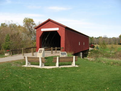
44°30′39″N 92°54′25″W / 44.510833°N 92.906944°WCannon Falls 59 Zumbrota Covered Bridge 
February 20, 1975 West Avenue over the North Fork of the Zumbro River
44°17′47″N 92°40′12″W / 44.296389°N 92.67°WZumbrota See also
References
- ^ "National Register of Historic Places: Weekly List Actions". National Park Service, United States Department of the Interior. Retrieved on November 10, 2011.
- ^ Numbers represent an ordering by significant words. Various colorings, defined here, differentiate National Historic Landmark sites and National Register of Historic Places Districts from other NRHP buildings, structures, sites or objects.
- ^ "National Register Information System". National Register of Historic Places. National Park Service. . http://nrhp.focus.nps.gov/natreg/docs/All_Data.html.
Nord, Mary Ann (2003). The National Register of Historic Places in Minnesota. Minnesota Historical Society. ISBN 0-87351-448-3.
External links
- A list of the above sites, with street addresses and other information, is available at Goodhue County, MN listing of National Register of Historic Places.com, a private site serving up NRHP information.
U.S. National Register of Historic Places Topics Lists by states Alabama • Alaska • Arizona • Arkansas • California • Colorado • Connecticut • Delaware • Florida • Georgia • Hawaii • Idaho • Illinois • Indiana • Iowa • Kansas • Kentucky • Louisiana • Maine • Maryland • Massachusetts • Michigan • Minnesota • Mississippi • Missouri • Montana • Nebraska • Nevada • New Hampshire • New Jersey • New Mexico • New York • North Carolina • North Dakota • Ohio • Oklahoma • Oregon • Pennsylvania • Rhode Island • South Carolina • South Dakota • Tennessee • Texas • Utah • Vermont • Virginia • Washington • West Virginia • Wisconsin • WyomingLists by territories Lists by associated states Other Categories:- Goodhue County, Minnesota
- National Register of Historic Places in Minnesota by county
- Buildings and structures in Goodhue County, Minnesota
-


Wikimedia Foundation. 2010.