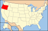
- National Register of Historic Places listings in Grant County, Oregon
-
This is a list of properties and districts in Grant County, Oregon that are listed on the National Register of Historic Places.
Current listings
[1] Landmark name[2] Image Date listed[2] Location[3] City or Town[4] Summary 1 Advent Christian Church image pending 1992-06-10 261 W. Main Street
44°24′59″N 118°57′19″W / 44.41652°N 118.9552°WJohn Day 2 James Cant Ranch Historic District 
June 21, 1984 Along Oregon Route 19
44°33′19″N 119°38′41″W / 44.55528°N 119.64472°W[5]Dayville 3 Fremont Powerhouse image pending August 19, 1983 Along Forest Road 10
44°46′54″N 118°34′15″W / 44.78175°N 118.5709°WGranite 4 John Day Compound, Supervisor's Warehouse image pending April 11, 1986 Malheur National Forest
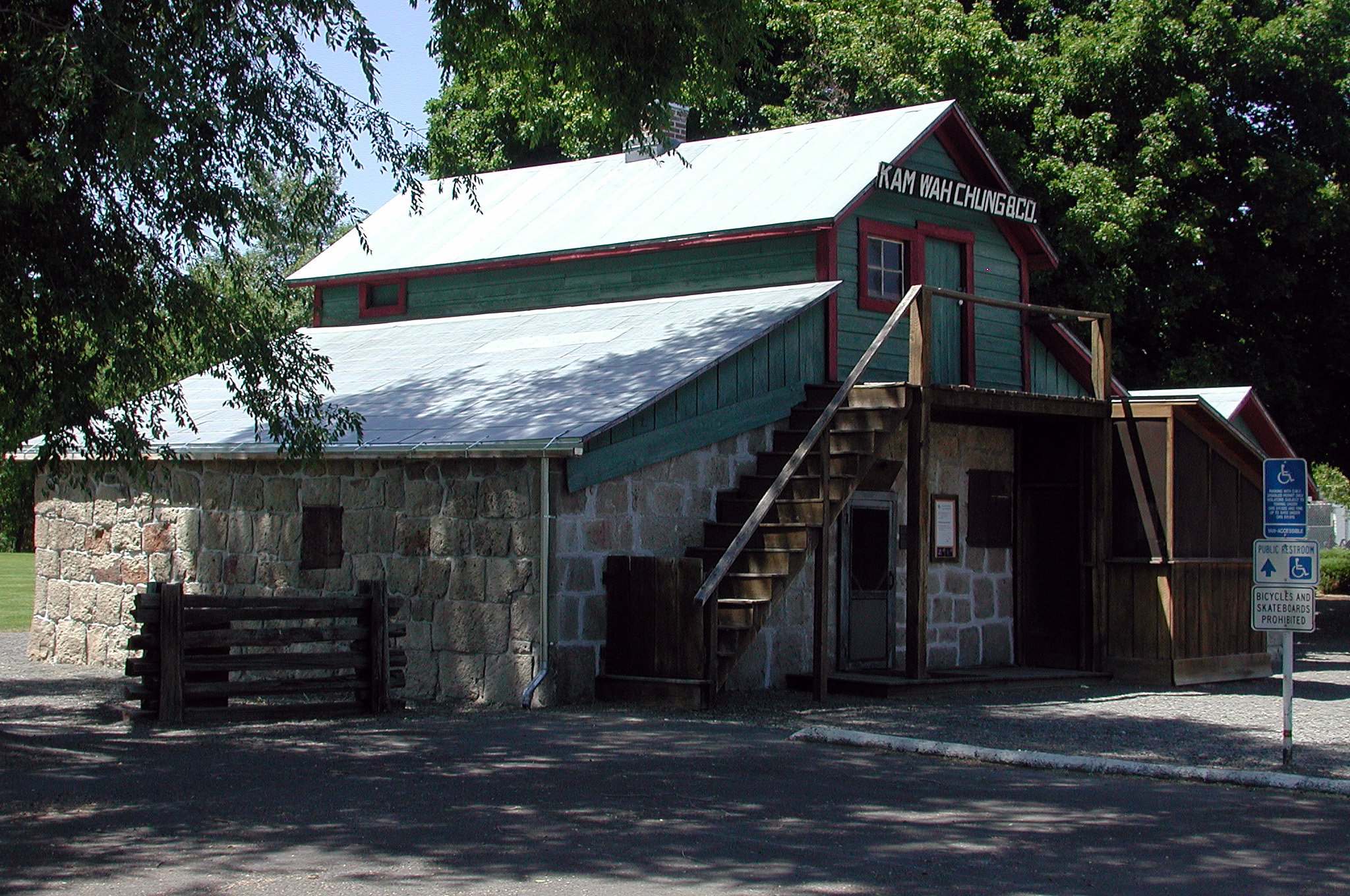
44°25′06″N 118°57′35″W / 44.41825°N 118.9598°WJohn Day 5 Kam Wah Chung Company Building 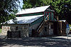
March 20, 1973 John Day City Park
44°25′07″N 118°57′25″W / 44.41861°N 118.95694°W[5]John Day The best known example of a Chinese mercantile and herb store in the United States. It embodies the role of immigrant Chinese in the post-Civil War expansion period of the western United States.[6] 6 St. Thomas' Episcopal Church 
November 21, 1974 135 Washington Street
44°23′18″N 118°56′57″W / 44.38828°N 118.9492°WCanyon City 7 Sumpter Valley Railway Historic District 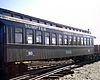
August 3, 1987 Roughly between Baker and Prairie City starting near the McEwen station site and west to the Dixie Pass area
44°37′13″N 118°20′07″W / 44.62038°N 118.3352°WPrairie City to Baker City[2] 8 Sumpter Valley Railway Passenger Station 
May 5, 1981 Main and Bridge Streets
44°27′27″N 118°42′27″W / 44.45739°N 118.7075°WPrairie City 9 Sumpter Valley Railway, Middle Fork–John Day River image pending August 3, 1987 Sumpter Valley Railway's Middle Fork Spur between Bates and Susanville
44°38′28″N 118°41′49″W / 44.64102°N 118.6969°WBates to Susanville[2] 10 Supervisor's House No. 1001 image pending April 11, 1986 Malheur National Forest
44°24′42″N 118°57′00″W / 44.41166°N 118.95°WJohn Day References
- ^ Numbers represent an ordering by significant words (e.g. last name). Various colorings (defined here) differentiate standalone NRHP sites from NRHP sites that also hold status as National Historic Landmarks, historic districts, National Historical Parks, or hold other historic designations.
- ^ a b c d National Park Service. "National Register Information System". Archived from the original on 2008-05-28. http://web.archive.org/web/20080528011404/http://www.cr.nps.gov/NR/research/nris.htm. Retrieved 2008-10-09.
- ^ Text: Except as otherwise noted, all entries are drawn from: Oregon Parks and Recreation Department (2008-08-08). "Oregon National Register List". http://www.oregonheritage.org/OPRD/HCD/NATREG/docs/oregon_nr_list.pdf..
Coordinates: Except as otherwise noted, all entries are drawn from Google Earth KMZ files available at: National Park Service. "National Register Information System". http://www.cr.nps.gov/NR/research/nris.htm. - ^ Except as otherwise noted, all entries are drawn from: Oregon Parks and Recreation Department (2008-08-08). "Oregon National Register List". http://www.oregonheritage.org/OPRD/HCD/NATREG/docs/oregon_nr_list.pdf. Retrieved 2008-10-09.
- ^ a b Coordinates adjusted for accuracy by editor.
- ^ National Park Service. "National Historic Landmark Program: NHL Database". http://tps.cr.nps.gov/nhl/default.cfm. Retrieved 2007-10-10.
U.S. National Register of Historic Places in Oregon Lists by county Baker • Benton • Clackamas • Clatsop • Columbia • Coos • Crook • Curry • Deschutes • Douglas • Gilliam • Grant • Harney • Hood River • Jackson • Jefferson • Josephine • Klamath • Lake • Lane • Lincoln • Linn • Malheur • Marion • Morrow • Multnomah: Portland North • Multnomah: Portland Northeast • Multnomah: Portland Northwest • Multnomah: Portland Southeast • Multnomah: Portland Southwest • Multnomah: Other • Polk • Sherman • Tillamook • Umatilla • Union • Wallowa • Wasco • Washington • Wheeler • Yamhill
Other lists Categories:- National Register of Historic Places listings by county in Oregon
- Grant County, Oregon


Wikimedia Foundation. 2010.