- National Register of Historic Places listings in Huntsville, Alabama
-
 Huntsville and its surrounding area
This is a list of the National Register of Historic Places listings in Huntsville, Alabama.
This is intended to be a complete list of the properties and districts on the National Register of Historic Places in Huntsville, Alabama, United States. Latitude and longitude coordinates are provided for many National Register properties and districts; these locations may be seen together in a Google map.[1]
There are 81 properties and districts listed on the National Register in Madison County, including 6 National Historic Landmarks. 70 of these sites, including all of the National Historic Landmarks, are located in Huntsville, and are listed here; the remaining 11 sites are listed separately.
-
- This National Park Service list is complete through NPS recent listings posted November 10, 2011.[2]
Current listings
[3] Site name[4] Image Date listed Location Summary 1 Alabama Agricultural and Mechanical University Historic District 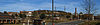
December 31, 2001 Chase Rd.
34°46′43″N 86°34′18″W / 34.77861°N 86.57167°W2 Beckers Block 
September 22, 1980 105-111 N. Jefferson St.
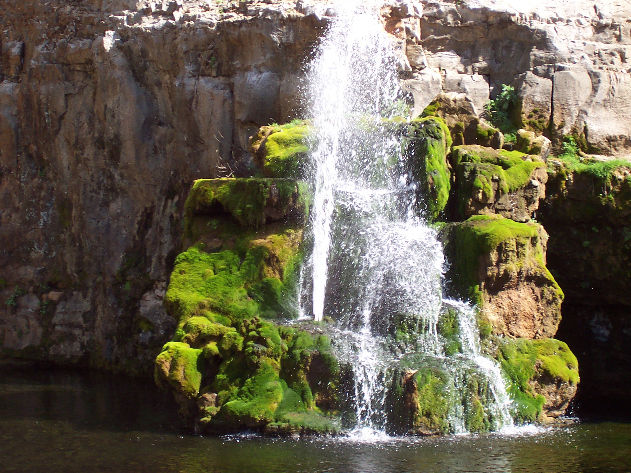
34°43′53″N 86°35′13″W / 34.73139°N 86.58694°W3 Big Spring 
September 22, 1980 W. Side Sq.
34°43′47″N 86°35′9″W / 34.72972°N 86.58583°W4 Building at 105 N. Washington Street May 23, 1984 105 S. Washington St.
34°43′53″N 86°35′7″W / 34.73139°N 86.58528°W5 Building at 305 Jefferson 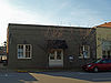
November 15, 2003 305 Jefferson St.
34°44′0″N 86°35′18″W / 34.733333°N 86.58833°W6 Buildings at 104-128 S. Side Sq. 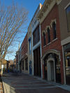
September 22, 1980 104-128 S. Side Sq.
34°43′46″N 86°35′6″W / 34.72944°N 86.585°W7 William Burritt Mansion 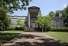
May 29, 1992 3101 Burritt Dr., SE.
34°42′57″N 86°32′22″W / 34.71583°N 86.53944°W8 Church of the Visitation 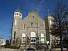
September 22, 1980 222 N. Jefferson St.
34°43′58″N 86°35′14″W / 34.73278°N 86.58722°W9 Clemens House 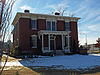
October 16, 1974 Pratt Ave. at Meridian St.
34°44′19″N 86°35′3″W / 34.73861°N 86.58417°WMoved from its original location (Clinton Ave. at Church St.) in 2004[5] 10 Dallas Mill 
September 18, 1978 701 Dallas Ave.
34°44′50″N 86°34′49″W / 34.74722°N 86.58028°WDestroyed by fire in 1991 11 Dallas Mill Village Historic District 
June 27, 2011 Bounded by Dickson St. NE. to Russell St. NE., Rison Ave. NE. to Pratt Ave. NE.
34°44′33″N 86°34′44″W / 34.7425°N 86.57889°W12 Domestic Science Building 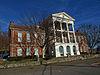
April 11, 1973 Alabama Agricultural and Mechanical University campus
34°47′7″N 86°34′9″W / 34.78528°N 86.56917°W13 Donegan Block 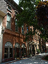
September 22, 1980 105-109 N. Side Sq.
34°43′51″N 86°35′8″W / 34.73083°N 86.58556°W14 Downtown Chevron Station 
September 22, 1980 300 E. Clinton Ave.
34°43′56″N 86°35′4″W / 34.73222°N 86.58444°W15 Dunnavant's Building 
September 22, 1980 100 N. Washington St.
34°43′55″N 86°35′8″W / 34.73194°N 86.58556°W16 Episcopal Church of the Nativity 
October 9, 1974 212 Eustis St.
34°43′48″N 86°35′0″W / 34.73°N 86.583333°W17 Everett Building 
September 22, 1980 115-123 N. Washington St.
34°43′56″N 86°35′10″W / 34.73222°N 86.58611°W18 First National Bank 
October 25, 1974 West Side Sq.
34°43′47″N 86°35′9″W / 34.72972°N 86.58583°W19 Flint River Place 
January 18, 1982 1997 Jordan Rd.
34°47′1″N 86°29′32″W / 34.78361°N 86.49222°W20 Fowler's Department Store 
May 30, 1996 116 Washington and 214 Holmes Sts.
34°43′57″N 86°35′9″W / 34.7325°N 86.58583°W21 Halsey Grocery Warehouse 
September 22, 1980 301 N. Jefferson St.
34°43′59″N 86°35′18″W / 34.73306°N 86.58833°W22 W.L. Halsey Warehouse 
September 22, 1980 300 N. Jefferson St.
34°44′0″N 86°35′17″W / 34.733333°N 86.58806°W23 Henderson National Bank 
September 22, 1980 118 S. Jefferson St.
34°43′50″N 86°35′10″W / 34.73056°N 86.58611°W24 Hotel Russel Erskine 
September 22, 1980 123 W. Clinton Ave.
34°43′50″N 86°35′14″W / 34.73056°N 86.58722°W25 David C. Humphreys House 
August 3, 1977 109 Gates Ave.
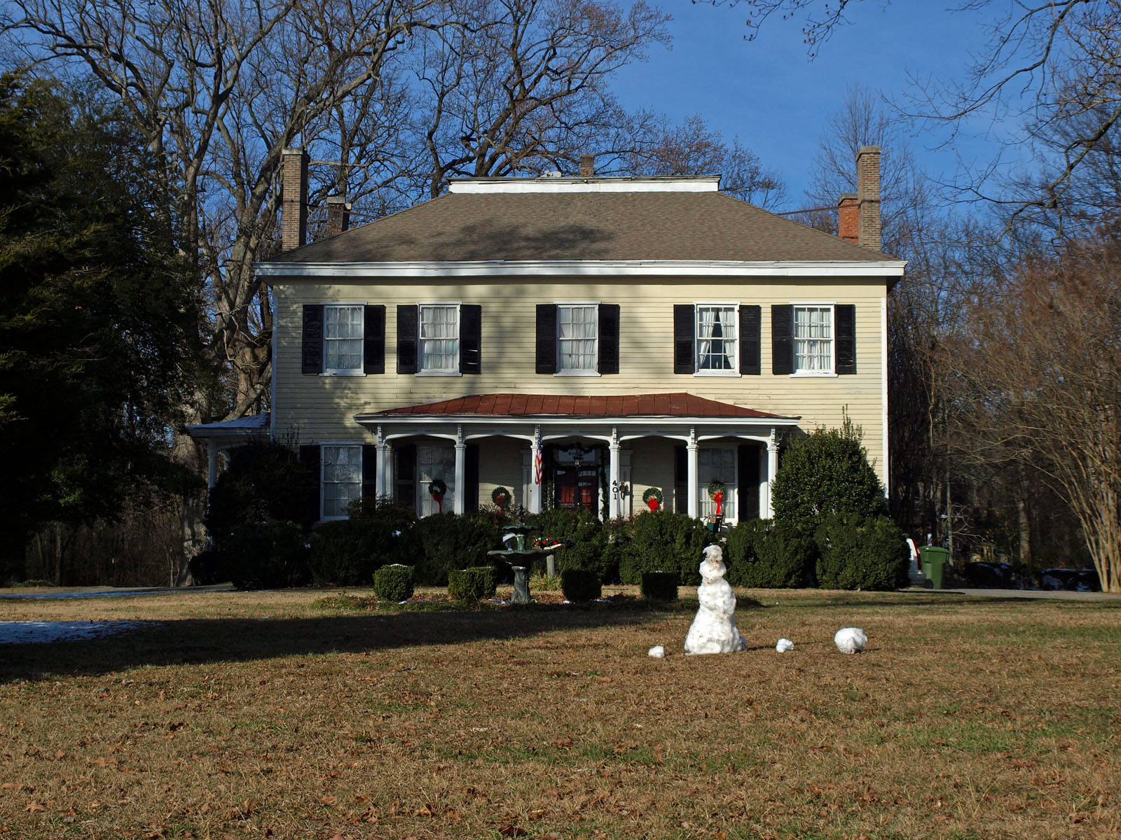
34°43′41″N 86°35′7″W / 34.72806°N 86.58528°WOriginally located at 510 W. Clinton Ave. W. 26 Hundley House 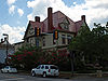
May 22, 1978 401 Madison St.
34°43′43″N 86°35′4″W / 34.72861°N 86.58444°W27 Hundley Rental Houses 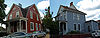
September 22, 1980 108 Gates St. and 400 Franklin St.
34°43′44″N 86°35′2″W / 34.72889°N 86.58389°W28 Terry Hutchens Building 
September 22, 1980 102 W. Clinton Ave.
34°43′52″N 86°35′13″W / 34.73111°N 86.58694°W29 W.T. Hutchens Building 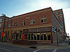
December 28, 1983 100-104 S. Jefferson St.
34°43′51″N 86°35′12″W / 34.73083°N 86.58667°W30 George Jude House 
February 24, 2000 2132 Winchester Rd.
34°47′37″N 86°35′12″W / 34.79361°N 86.58667°W31 Kelly Brothers and Rowe Building 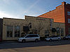
September 22, 1980 307 N. Jefferson St.
34°44′0″N 86°35′18″W / 34.733333°N 86.58833°W32 Kildare-McCormick House 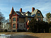
July 15, 1982 2005 Kildare St.
34°44′59″N 86°35′6″W / 34.74972°N 86.585°W33 Kress Building 
September 22, 1980 107 S. Washington St.
34°43′53″N 86°35′7″W / 34.73139°N 86.58528°W34 William Lanford House May 20, 1994 7400 Old Madison Pike
34°43′0″N 86°41′47″W / 34.716667°N 86.69639°W35 Leech-Hauer House December 8, 1978 502 Governors Dr.
34°43′14″N 86°35′13″W / 34.72056°N 86.58694°WDemolished, now a medical office building on site 36 Lincoln Mill and Mill Village Historic District 
April 26, 2010 Bounded by Meridian St., Oakwood Ave., Front St., Mountain View Dr., Davidson St., Cottage St, and King Ave.
34°44′52.05″N 86°34′55.23″W / 34.7477917°N 86.5820083°W37 Lincoln School 
December 27, 1982 1110 N. Meridian St.
34°44′43″N 86°35′2″W / 34.74528°N 86.58389°W38 Lombardo Building 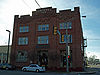
September 22, 1980 315 N. Jefferson St.
34°44′1″N 86°35′19″W / 34.73361°N 86.58861°W39 Lowe Mill and Mill Village Historic District 
June 24, 2011 Bounded by Triana Blvd. SW., 10th Ave. SW., Summer St. & Governor's Dr.
34°43′2″N 86°36′11″W / 34.71722°N 86.60306°W40 Lowry House 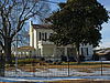
October 29, 2001 1205 Kildare Ave.
34°44′49″N 86°35′8″W / 34.74694°N 86.58556°W41 Mason Building 
September 22, 1980 115 E. Clinton Ave.
34°43′54″N 86°35′9″W / 34.73167°N 86.58583°W42 May and Cooney Dry Goods Company 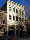
September 22, 1980 205 E. Side Sq.
34°43′51″N 86°35′4″W / 34.73083°N 86.58444°W43 McCrary House June 1, 1982 Northeast of Huntsville
34°50′41″N 86°29′13″W / 34.84472°N 86.48694°W44 Merrimack Mill Village Historic District 
April 16, 2010 Alpine St., Triana Blvd., Dunn Dr., Cobb Rd., Drake Ave., & Grote St.
34°42′15.33″N 86°36′41.06″W / 34.7042583°N 86.6114056°W45 Milligan Block 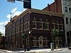
September 22, 1980 201-203 E. Side Sq.
34°43′51″N 86°35′5″W / 34.73083°N 86.58472°W46 Monte Sano Railroad Workers' House August 14, 1998 4119 Shelby Ave.
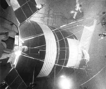
34°44′29″N 86°31′26″W / 34.74139°N 86.52389°W47 Neutral Buoyancy Space Simulator 
October 3, 1985 George C. Marshall Space Flight Center
34°39′14″N 86°40′41″W / 34.65389°N 86.67806°W48 Old Town Historic District 
July 18, 1978 Roughly bounded by Dement and Lincoln Sts. and Randolph and Walker Aves.
34°44′7″N 86°34′50″W / 34.73528°N 86.58056°W49 Phelps-Jones House 
February 19, 1982 6112 Pulaski Pike
34°48′2″N 86°37′10″W / 34.80056°N 86.61944°W50 Propulsion and Structural Test Facility 
October 3, 1985 George C. Marshall Space Flight Center
34°37′31″N 86°39′31″W / 34.62528°N 86.65861°W51 Rand Building 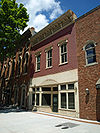
September 22, 1980 113 N. Side Sq.
34°43′51″N 86°35′7″W / 34.73083°N 86.58528°W52 Randolph Street Church of Christ 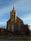
September 22, 1980 210 Randolph Ave.
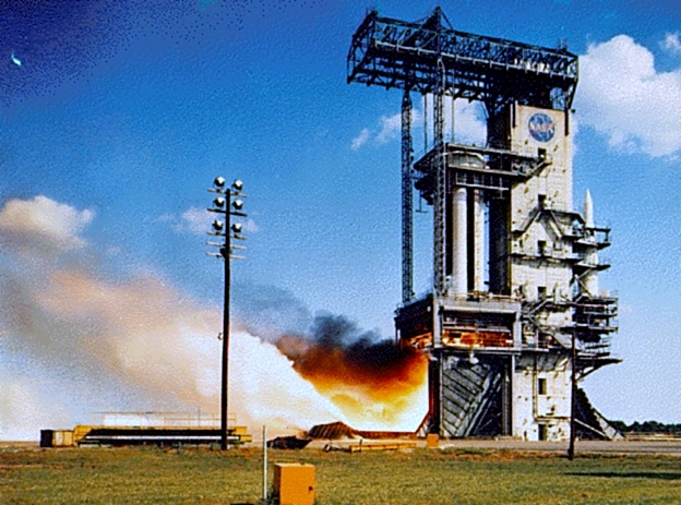
34°43′52″N 86°35′3″W / 34.73111°N 86.58417°W53 Redstone Test Stand 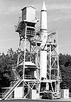
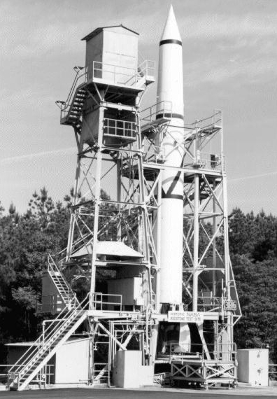
May 13, 1976 George C. Marshall Space Flight Center
34°37′58″N 86°40′0″W / 34.63278°N 86.666667°W54 John Robinson House 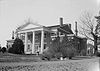
October 6, 1977 2709 Meridian St., N.
34°45′38″N 86°34′38″W / 34.76056°N 86.57722°W55 Mrs. William Robinson House 
February 4, 1982 401 Quietdale Dr., NE.
34°45′25″N 86°34′26″W / 34.75694°N 86.57389°W56 Saturn V Dynamic Test Stand 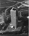
October 3, 1985 George C. Marshall Space Flight Center
34°37′51″N 86°39′40″W / 34.63083°N 86.66111°W57 Saturn V Space Vehicle 
November 22, 1978 Tranquility Base
34°42′36″N 86°39′21″W / 34.71°N 86.65583°W58 Schiffman Building 
September 22, 1980 231 E. Side Sq.
34°43′49″N 86°35′3″W / 34.73028°N 86.58417°W59 Southern Railway System Depot 
September 10, 1971 330 Church St.
34°44′4″N 86°35′27″W / 34.73444°N 86.59083°W60 Steele-Fowler House 
June 20, 1974 808 Maysville Rd.
34°44′40″N 86°33′52″W / 34.74444°N 86.56444°W61 Steger House 
June 1, 1982 3141 Maysville Rd.
34°45′44″N 86°25′47″W / 34.76222°N 86.42972°W62 Struve-Hay Building 
September 22, 1980 117-123 N. Jefferson St.
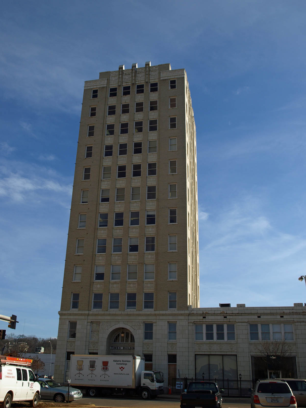
34°43′55″N 86°35′14″W / 34.73194°N 86.58722°W63 Times Building 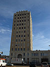
September 22, 1980 228 E. Holmes Ave.
34°43′59″N 86°35′7″W / 34.73306°N 86.58528°W64 Twickenham Historic District 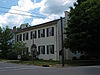
January 4, 1973 Roughly bounded by Clinton Ave., California St., Newman Ave. and S. Green St., and Franklin St.
34°43′47″N 86°34′43″W / 34.72972°N 86.57861°W65 U.S. Courthouse and Post Office 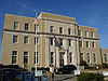
February 24, 1981 101 E. Holmes Ave.
34°43′57″N 86°35′13″W / 34.7325°N 86.58694°W66 Urguhart House 
February 13, 1992 8042 Pulaski Pike
34°51′0″N 86°38′13″W / 34.85°N 86.63694°W67 Vaught House 
December 15, 1981 701 Ward Ave.
34°44′24″N 86°34′36″W / 34.74°N 86.57667°W68 White-Turner-Sanford House 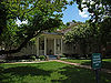
April 12, 1984 601 Madison St.
34°43′33″N 86°34′54″W / 34.72583°N 86.58167°W69 Withers-Chapman House December 8, 1978 2409 Gaboury Lane, NE.
34°45′24″N 86°33′42″W / 34.75667°N 86.56167°W70 Yarbrough Hotel 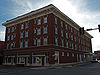
September 22, 1980 127-129 N. Washington St.
34°43′57″N 86°35′11″W / 34.7325°N 86.58639°WSee also
- List of National Historic Landmarks in Alabama
- National Register of Historic Places listings in Alabama
References
- ^ The latitude and longitude information provided in this table was derived originally from the National Register Information System, which has been found to be fairly accurate for about 99% of listings. For about 1% of NRIS original coordinates, experience has shown that one or both coordinates are typos or otherwise extremely far off; some corrections may have been made. A more subtle problem causes many locations to be off by up to 150 yards, depending on location in the country: most NRIS coordinates were derived from tracing out latitude and longitudes off of USGS topographical quadrant maps created under North American Datum of 1927, which differs from the current, highly accurate GPS system used by Google maps. Chicago is about right, but NRIS longitudes in Washington are higher by about 4.5 seconds, and are lower by about 2.0 seconds in Maine. Latitudes differ by about 1.0 second in Florida. Some locations in this table may have been corrected to current GPS standards.
- ^ "National Register of Historic Places: Weekly List Actions". National Park Service, United States Department of the Interior. Retrieved on November 10, 2011.
- ^ Numbers represent an ordering by significant words. Various colorings, defined here, differentiate National Historic Landmark sites, a National Historic Site, and several National Register of Historic Places Districts from other NRHP buildings, structures, sites or objects.
- ^ "National Register Information System". National Register of Historic Places. National Park Service. 2009-03-13. http://nrhp.focus.nps.gov/natreg/docs/All_Data.html.
- ^ "Wins - The Clemens House". Alabama's Preservation Scoreboard. University of West Alabama. http://preservationscoreboard.uwa.edu/win/clemens.htm. Retrieved 19 March 2011.
U.S. National Register of Historic Places in Alabama Lists by county Autauga • Baldwin • Barbour • Bibb • Blount • Bullock • Butler • Calhoun • Chambers • Cherokee • Chilton • Choctaw • Clarke • Clay • Cleburne • Coffee • Colbert • Conecuh • Coosa • Covington • Crenshaw • Cullman • Dale • Dallas • DeKalb • Elmore • Escambia • Etowah • Fayette • Franklin • Geneva • Greene • Hale • Henry • Houston • Jackson • Jefferson • Lamar • Lauderdale • Lawrence • Lee • Limestone • Lowndes • Macon • Madison • Marengo • Marion • Marshall • Mobile • Monroe • Montgomery • Morgan • Perry • Pickens • Pike • Randolph • Russell • St. Clair • Shelby • Sumter • Talladega • Tallapoosa • Tuscaloosa • Walker • Washington • Wilcox • Winston

Lists by city Other lists Keeper of the Register • History of the National Register of Historic Places • Property types • Historic district • Contributing property Categories:- National Register of Historic Places in Huntsville, Alabama
-


Wikimedia Foundation. 2010.