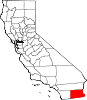
- National Register of Historic Places listings in Imperial County, California
-
This list includes properties and districts listed on the National Register of Historic Places in Imperial County, California. Click the "Map of all coordinates" link to the right to view a Google map of all properties and districts with latitude and longitude coordinates in the table below.[1]
-
- This National Park Service list is complete through NPS recent listings posted November 10, 2011.[2]
[3] Landmark name [4] Image Date listed Location City or town Summary 1 Calexico Carnegie Library September 28, 2005 420 Heber Ave.
32°40′10″N 115°29′33″W / 32.669444°N 115.4925°WCalexico 2 Desert View Tower August 29, 1980 SW of Ocotillo
32°39′33″N 116°05′57″W / 32.659167°N 116.099167°WOcotillo 3 Fages-De Anza Trail-Southern Emigrant Road January 29, 1973 Anza-Borrego State Park Borrego Springs 4 Southwest Lake Cahuilla Recessional Shoreline Archeological District December 30, 1999 Address Restricted Salton City 5 Spoke Wheel Rock Alignment September 29, 2003 Address Restricted Ocotillo 6 Stonehead (L-7) May 1, 1987 Address Restricted Yuma 7 US Inspection Station-Calexico February 14, 1992 12 Heffernan Ave.
32°39′55″N 115°29′41″W / 32.665139°N 115.494847°WCalexico 8 US Post Office-El Centro Main January 11, 1985 230 S. 5th St.
32°47′27″N 115°33′14″W / 32.790833°N 115.553889°WEl Centro 9 Winterhaven Anthropomorph (L-8) May 1, 1987 Address Restricted Yuma 10 Winterhaven Anthropomorph and Bowknot, L-9 October 25, 1985 Address Restricted Winterhaven 11 Yuha Basin Discontiguous District May 24, 1982 Address Restricted Plaster City 12 Yuma Crossing and Associated Sites 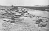
November 13, 1966 Banks of the Colorado River
32°43′48″N 114°37′05″W / 32.73°N 114.618056°WWinterhaven See also
- National Register of Historic Places listings in California
- List of National Historic Landmarks in California
References
- ^ The latitude and longitude information provided in this table was derived originally from the National Register Information System, which has been found to be fairly accurate for about 99% of listings. For about 1% of NRIS original coordinates, experience has shown that one or both coordinates are typos or otherwise extremely far off; some corrections may have been made. A more subtle problem causes many locations to be off by up to 150 yards, depending on location in the country: most NRIS coordinates were derived from tracing out latitude and longitudes off of USGS topographical quadrant maps created under North American Datum of 1927, which differs from the current, highly accurate GPS system used by Google maps. Chicago is about right, but NRIS longitudes in Washington are higher by about 4.5 seconds, and are lower by about 2.0 seconds in Maine. Latitudes differ by about 1.0 second in Florida. Some locations in this table may have been corrected to current GPS standards.
- ^ "National Register of Historic Places: Weekly List Actions". National Park Service, United States Department of the Interior. Retrieved on November 10, 2011.
- ^ Numbers represent an ordering by significant words. Various colorings, defined here, differentiate National Historic Landmark sites and National Register of Historic Places Districts from other NRHP buildings, structures, sites or objects.
- ^ "National Register Information System". National Register of Historic Places. National Park Service. . http://nrhp.focus.nps.gov/natreg/docs/All_Data.html.
U.S. National Register of Historic Places Topics Lists by states Alabama • Alaska • Arizona • Arkansas • California • Colorado • Connecticut • Delaware • Florida • Georgia • Hawaii • Idaho • Illinois • Indiana • Iowa • Kansas • Kentucky • Louisiana • Maine • Maryland • Massachusetts • Michigan • Minnesota • Mississippi • Missouri • Montana • Nebraska • Nevada • New Hampshire • New Jersey • New Mexico • New York • North Carolina • North Dakota • Ohio • Oklahoma • Oregon • Pennsylvania • Rhode Island • South Carolina • South Dakota • Tennessee • Texas • Utah • Vermont • Virginia • Washington • West Virginia • Wisconsin • WyomingLists by territories Lists by associated states Other  Category:National Register of Historic Places •
  Portal:National Register of Historic Places
Municipalities and communities of Imperial County, California County seat: El Centro Cities Brawley | Calexico | Calipatria | El Centro | Holtville | Imperial | Westmorland
CDPs Bombay Beach | Desert Shores | Heber | Niland | Ocotillo | Palo Verde | Salton City | Salton Sea Beach | Seeley | Winterhaven
Unincorporated
communitiesAcolita | Alamorio | Amos | Andrade | Anza | Araz Junction | Bard | Bertram | Bonds Corner | Boulder Park | Cactus | Citrus View | Clyde | Coolidge Springs | Coyote Wells | Curlew | Date City | Dixieland | Dunes | Edgar | Elmore Desert Ranch | Estelle | Felicity | Fondo | Frink | Fuller | Glamis | Gordons Well | Hovley | Imperial Gables | Iris | Kane Spring | Meloland | Mesquite | Moss | Mount Signal | Mundo | Munyon | Obregon | Ogilby | Orita | Paymaster Landing | Perrys Corner | Picacho | Plaster City | Pope | Rico | Rockwood | Ross Corner | Ruthven | Sandia | Slab City | Tortuga | Truckhaven | Verdant | Watermans Corner | Wiest | Wilsie | Wister
Indian
reservationsFort Yuma Indian Reservation | Torres-Martinez Indian Reservation
Ghost towns Araz | Barnes | Bernice | Bradtmoore | Butlers | Colorado | Concepcíon | Eastside | Gleason | Hazelwood | Highline | Indian Wells | Keystone | Laguna | Laparra | Lano | Mayflower | Mobile | No Mirage | Paringa | Picacho Basin | Potholes | Sackett's Wells | Sellew | Shamrock | Silsbee | Squeaky Springs
Categories:- National Register of Historic Places listings in Imperial County, California
- Imperial County, California
- Lists of National Register of Historic Places in California
- National Register of Historic Places in California by county
- History of Southern California
-


Wikimedia Foundation. 2010.