- National Register of Historic Places listings in Jackson County, North Carolina
-

This list includes properties and districts listed on the National Register of Historic Places in Jackson County, North Carolina. Click the "Map of all coordinates" link to the right to view a Google map of all properties and districts with latitude and longitude coordinates in the table below.[1]
-
- This National Park Service list is complete through NPS recent listings posted November 10, 2011.[2]
Landmark name Image Date listed Location City or Town Summary 1 E. M. Backus Lodge June 9, 1988 Cold Mountain Gap Rd.
35°9′38″N 82°59′51″W / 35.16056°N 82.9975°WLake Toxaway 2 Balsam Mountain Inn 
July 15, 1982 SR 1700 and SR 1701
35°25′31″N 83°5′14″W / 35.42528°N 83.08722°WBalsam 3 Camp Merrie-Woode 
June 2, 1995 US 64 N side, 1.6 miles N of jct. with NC 1120, at end of 1-miles-long dirt rd.
35°7′59″N 83°2′38″W / 35.13306°N 83.04389°WCashiers 4 Church of the Good Shepherd 
February 20, 1986 NC 107 at SR 1118
35°5′49″N 83°5′7″W / 35.09694°N 83.08528°WCashiers 5 Fairfield Inn 
June 14, 1982 U.S. 64
35°7′26″N 83°2′39″W / 35.12389°N 83.04417°WCashiers Demolished[3] 6 Lucius Coleman Hall House March 9, 1990 Off NC 116, 0.1 miles E of jct. with SR 1367
35°20′40″N 83°13′43″W / 35.34444°N 83.22861°WWebster 7 Elisha Calor Hedden House December 21, 1989 Main St. and Old Webster-Sylva Rd.
35°20′47″N 83°13′8″W / 35.34639°N 83.21889°WWebster 8 High Hampton Inn Historic District 
September 26, 1991 NC 107 E side, 1.5 miles S of US 64
35°5′56″N 83°4′57″W / 35.09889°N 83.0825°WCashiers 9 Dr. D. D. Hooper House 
April 21, 2000 773 W. Main St.
35°22′25″N 83°13′37″W / 35.37361°N 83.22694°WSylva 10 Jackson County Courthouse 
May 10, 1979 Main St.
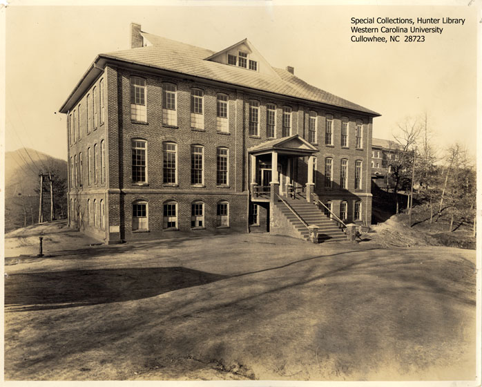
35°22′26″N 83°13′41″W / 35.37389°N 83.22806°WSylva 11 Joyner Building 
December 8, 1978 Western Carolina University Campus
35°18′40″N 83°10′40″W / 35.31111°N 83.17778°WCullowhee Burned[3] 12 Elias Brendle Monteith House and Outbuildings 
August 13, 2008 111 Hometown Place Rd.
35°22′22.45″N 83°14′41.29″W / 35.3729028°N 83.2448028°WDillsboro 13 Walter E. Moore House February 23, 1990 Main St.
35°20′43.72″N 83°13′10.96″W / 35.3454778°N 83.2197111°WWebster 14 Mount Beulah Hotel 
March 1, 1984 US 23 and 441
35°22′11″N 83°15′7″W / 35.36972°N 83.25194°WDillsboro 15 Webster Baptist Church 
December 21, 1989 NC 116 and SR 1340
35°20′22.97″N 83°13′35.9″W / 35.3397139°N 83.226639°WWebster 16 Webster Methodist Church 
December 21, 1989 NC 116/Main St.
35°20′38″N 83°13′22″W / 35.34389°N 83.22278°WWebster 17 Webster Rock School 
January 4, 1990 Main St.
35°20′36.55″N 83°13′23.48″W / 35.3434861°N 83.2231889°WWebster 18 Mordecai Zachary House 
December 31, 1998 NC 107, 0.2 miles S of NC 1107
35°5′28″N 83°4′51″W / 35.09111°N 83.08083°WCashiers See also
- National Register of Historic Places listings in North Carolina
- List of National Historic Landmarks in North Carolina
References
- ^ The latitude and longitude information provided in this table was derived originally from the National Register Information System, which has been found to be fairly accurate for about 99% of listings. For about 1% of NRIS original coordinates, experience has shown that one or both coordinates are typos or otherwise extremely far off; some corrections may have been made. A more subtle problem causes many locations to be off by up to 150 yards, depending on location in the country: most NRIS coordinates were derived from tracing out latitude and longitudes off of USGS topographical quadrant maps created under the North American Datum of 1927, which differs from the current, highly accurate WGS84 GPS system used by Google maps. Chicago is about right, but NRIS longitudes in Washington are higher by about 4.5 seconds, and are lower by about 2.0 seconds in Maine. Latitudes differ by about 1.0 second in Florida. Some locations in this table may have been corrected to current GPS standards.
- ^ "National Register of Historic Places: Weekly List Actions". National Park Service, United States Department of the Interior. Retrieved on November 10, 2011.
- ^ a b "North Carolina Listings in the National Register of Historic Places by County". North Carolina State Historic Preservation Office. 22 October 2008. http://www.hpo.ncdcr.gov/nrlist.htm. Retrieved 14 July 2009.
U.S. National Register of Historic Places Topics Lists by states Alabama • Alaska • Arizona • Arkansas • California • Colorado • Connecticut • Delaware • Florida • Georgia • Hawaii • Idaho • Illinois • Indiana • Iowa • Kansas • Kentucky • Louisiana • Maine • Maryland • Massachusetts • Michigan • Minnesota • Mississippi • Missouri • Montana • Nebraska • Nevada • New Hampshire • New Jersey • New Mexico • New York • North Carolina • North Dakota • Ohio • Oklahoma • Oregon • Pennsylvania • Rhode Island • South Carolina • South Dakota • Tennessee • Texas • Utah • Vermont • Virginia • Washington • West Virginia • Wisconsin • WyomingLists by territories Lists by associated states Other Municipalities and communities of Jackson County, North Carolina Towns 
Village CDPs Unincorporated
communitiesFootnotes ‡This populated place also has portions in an adjacent county or counties
Categories:- Jackson County, North Carolina
- National Register of Historic Places in North Carolina
- Buildings and structures in Jackson County, North Carolina
-


Wikimedia Foundation. 2010.