- National Register of Historic Places listings in Jackson County, Oklahoma
-
 Location of Jackson County in Oklahoma
This is a list of the National Register of Historic Places listings in Jackson County, Oklahoma.
This is intended to be a complete list of the properties on the National Register of Historic Places in Jackson County, Oklahoma, United States. The locations of National Register properties for which the latitude and longitude coordinates are included below, may be seen in a Google map.[1]
There are 9 properties listed on the National Register in the county.
-
- This National Park Service list is complete through NPS recent listings posted November 10, 2011.[2]
Current listings
[3] Landmark name [4] Image Date listed Location City or town Summary 1 W.C. Baker House 
December 16, 2005 301 E. Commerce
34°38′21″N 99°19′50″W / 34.639167°N 99.330556°WAltus 2 Cross S Ranch Headquarters March 8, 2006 1.3 miles west and 0.4 miles north of the junction of County Roads N199 and E1750
34°29′05″N 99°26′11″W / 34.484722°N 99.436389°WOlustee 3 Frazer Cemetery June 8, 2011 1/2 mile south of junction of County Rd. 202 & US 62, 2 miles west of the Jackson County Courthouse
34°37′49″N 99°22′10″W / 34.630278°N 99.369444°WAltus vicinity 4 Fullerton Dam November 7, 1976 7 miles northwest of Olustee
34°37′27″N 99°29′27″W / 34.624167°N 99.490833°WOlustee 5 Elmer and Lela Garnett House June 8, 2011 801 E. Commerce St.
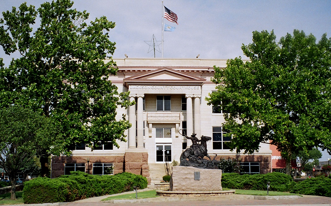
34°38′21″N 99°19′28″W / 34.639167°N 99.324444°WAltus 6 Jackson County Courthouse 
August 23, 1984 Main St. and Broadway
34°38′18″N 99°20′03″W / 34.638333°N 99.334167°WAltus 7 Olustee Public Library and Park March 8, 2006 Southern side of 4th St. between C and D Sts.
34°32′53″N 99°25′22″W / 34.548056°N 99.422778°WOlustee 8 Perryman Ranch Headquarters April 4, 2007 0.2 miles east of the junction of County Roads N193 and E159
34°42′39″N 99°31′29″W / 34.710833°N 99.524722°WEast Duke 9 Wichita Falls & Northwestern Railroad Passenger Depot None 523 S. Main St.
34°38′00″N 99°20′02″W / 34.63341°N 99.33395°WAltus See also
- List of National Historic Landmarks in Oklahoma
- National Register of Historic Places listings in Oklahoma
References
- ^ The latitude and longitude information provided in this table was derived originally from the National Register Information System, which has been found to be fairly accurate for about 99% of listings. For about 1% of NRIS original coordinates, experience has shown that one or both coordinates are typos or otherwise extremely far off; some corrections may have been made. A more subtle problem causes many locations to be off by up to 150 yards, depending on location in the country: most NRIS coordinates were derived from tracing out latitude and longitudes off of USGS topographical quadrant maps created under North American Datum of 1927, which differs from the current, highly accurate GPS system used by Google maps. Chicago is about right, but NRIS longitudes in Washington are higher by about 4.5 seconds, and are lower by about 2.0 seconds in Maine. Latitudes differ by about 1.0 second in Florida. Some locations in this table may have been corrected to current GPS standards.
- ^ "National Register of Historic Places: Weekly List Actions". National Park Service, United States Department of the Interior. Retrieved on November 10, 2011.
- ^ Numbers represent an ordering by significant words. Various colorings, defined here, differentiate National Historic Landmark sites and National Register of Historic Places Districts from other NRHP buildings, structures, sites or objects.
- ^ "National Register Information System". National Register of Historic Places. National Park Service. . http://nrhp.focus.nps.gov/natreg/docs/All_Data.html.
U.S. National Register of Historic Places Topics Lists by states Alabama • Alaska • Arizona • Arkansas • California • Colorado • Connecticut • Delaware • Florida • Georgia • Hawaii • Idaho • Illinois • Indiana • Iowa • Kansas • Kentucky • Louisiana • Maine • Maryland • Massachusetts • Michigan • Minnesota • Mississippi • Missouri • Montana • Nebraska • Nevada • New Hampshire • New Jersey • New Mexico • New York • North Carolina • North Dakota • Ohio • Oklahoma • Oregon • Pennsylvania • Rhode Island • South Carolina • South Dakota • Tennessee • Texas • Utah • Vermont • Virginia • Washington • West Virginia • Wisconsin • WyomingLists by territories Lists by associated states Other Municipalities and communities of Jackson County, Oklahoma City 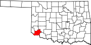
Towns Unincorporated
communitiesHess | Humphreys | Victory | Warren
Ghost town Aaron
Categories:- Jackson County, Oklahoma
- National Register of Historic Places in Oklahoma by county
- Buildings and structures in Jackson County, Oklahoma
-


Wikimedia Foundation. 2010.