- National Register of Historic Places listings in James City County, Virginia
-
This list includes properties and districts listed on the National Register of Historic Places in James City County, Virginia. Click the "Map of all coordinates" link to the right to view a Google map of all properties and districts with latitude and longitude coordinates in the table below.[1]
-
- This National Park Service list is complete through NPS recent listings posted November 10, 2011.[2]
[3] Landmark name [4] Image Date listed Location City or town Summary 1 Archeological Site No. 44JC308 June 26, 1993 Address Restricted Williamsburg Paspahegh settlement site 2 Carter's Grove 
November 12, 1969 SE of jct. of Rte. 667 and U.S. 60
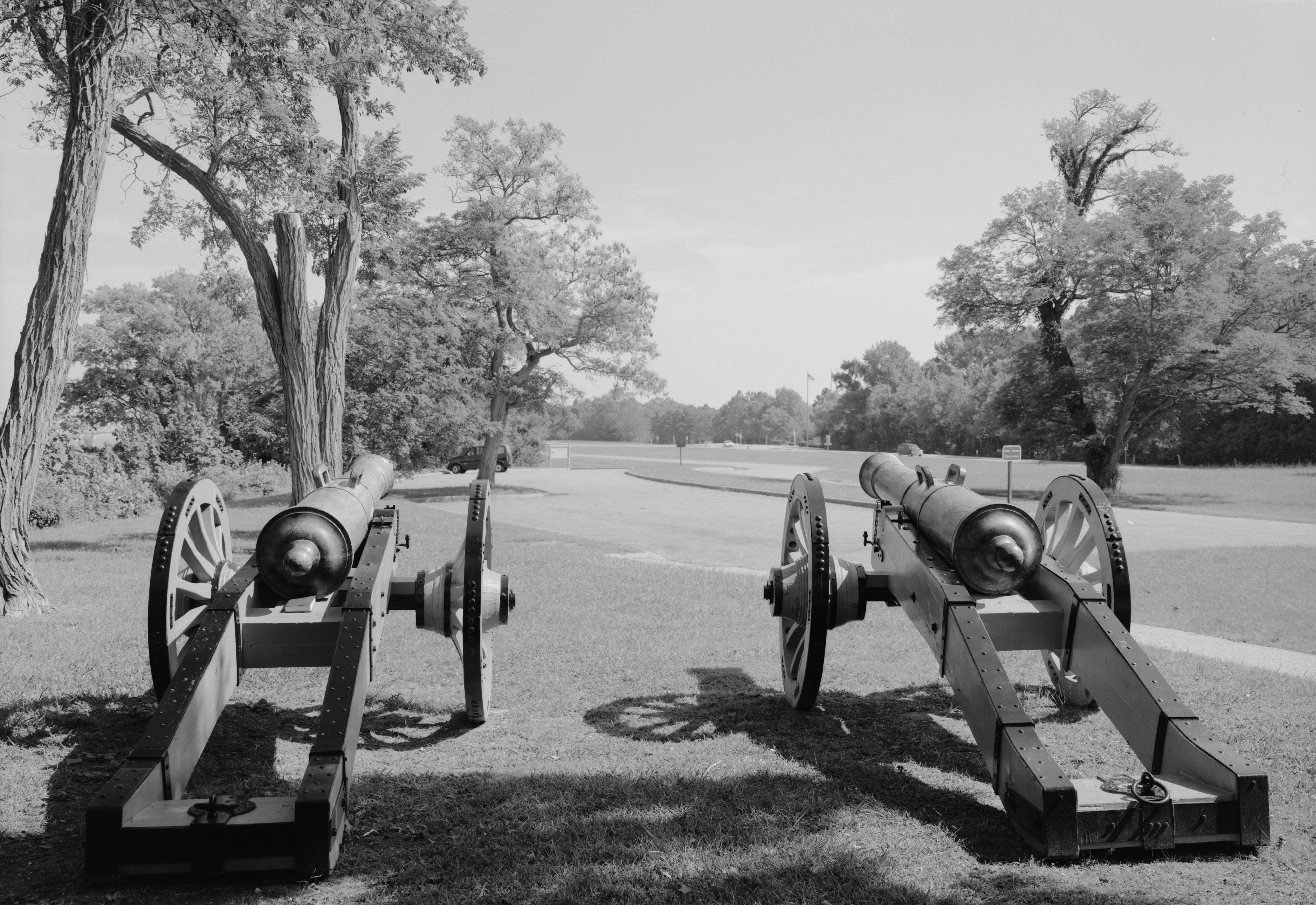
37°12′32″N 76°37′39″W / 37.208889°N 76.6275°WWilliamsburg Georgian country house and plantation near Williamsburg, recently closed and sold to a private owner 3 Chickahominy Shipyard Archeological Site June 28, 1979 Address Restricted Toano 4 Colonial National Historical Park 
October 15, 1966 VA 359
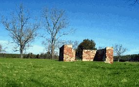
37°12′57″N 76°31′42″W / 37.21583°N 76.52833°WJamestown 5 Croaker Landing Archaeological Site (44JC70) May 14, 1987 Address Restricted Croaker 6 Governor's Land Archeological District September 21, 1973 Address Restricted Jamestown 7 Green Spring 
December 29, 1978 Address Restricted Williamsburg 8 Hickory Neck Church 
July 2, 1973 N of Toano on U.S. 60
37°23′35″N 76°48′16″W / 37.393056°N 76.804444°WToano 9 Jamestown National Historic Site 
October 15, 1966 Jamestown Island
37°12′22.44″N 76°46′21.86″W / 37.2062333°N 76.7727389°WJamestown 10 Kingsmill Plantation 
April 26, 1972 5 mi. S of Williamsburg
37°13′37″N 76°40′46″W / 37.226944°N 76.679444°WWilliamsburg 11 Norge Train Depot May 5, 2009 7770 Croaker Rd.
37°22′39″N 76°46′15″W / 37.377483°N 76.770844°WWilliamsburg 12 Pinewoods November 12, 1971 1.4 mi. SW of jct. of VA 613 and 614
37°16′18″N 76°49′38″W / 37.271667°N 76.827222°WLightfoot 13 Powhatan 
September 15, 1970 N of jct. of Rtes. 615 and 5
37°15′47″N 76°46′08″W / 37.263056°N 76.768889°WFive Forks 14 Riverview December 6, 1996 Address Restricted Williamsburg 15 Stone House Site August 14, 1973 Address Restricted Toano 16 White Hall March 30, 2007 3200 Rochambeau Rd.
37°24′07″N 76°48′17″W / 37.401883°N 76.804819°WToano 17 Windsor Castle 
December 14, 1987 1812 Forge Rd.
37°22′38″N 76°51′14″W / 37.377222°N 76.853889°WToano See also
- National Register of Historic Places listings in Virginia
- National Register of Historic Places listings in Williamsburg, Virginia
- List of National Historic Landmarks in Virginia
References
- ^ The latitude and longitude information provided in this table was derived originally from the National Register Information System, which has been found to be fairly accurate for about 99% of listings. For about 1% of NRIS original coordinates, experience has shown that one or both coordinates are typos or otherwise extremely far off; some corrections may have been made. A more subtle problem causes many locations to be off by up to 150 yards, depending on location in the country: most NRIS coordinates were derived from tracing out latitude and longitudes off of USGS topographical quadrant maps created under the North American Datum of 1927, which differs from the current, highly accurate WGS84 GPS system used by Google maps. Chicago is about right, but NRIS longitudes in Washington are higher by about 4.5 seconds, and are lower by about 2.0 seconds in Maine. Latitudes differ by about 1.0 second in Florida. Some locations in this table may have been corrected to current GPS standards.
- ^ "National Register of Historic Places: Weekly List Actions". National Park Service, United States Department of the Interior. Retrieved on November 10, 2011.
- ^ Numbers represent an ordering by significant words. Various colorings, defined here, differentiate National Historic Landmark sites and National Register of Historic Places Districts from other NRHP buildings, structures, sites or objects.
- ^ "National Register Information System". National Register of Historic Places. National Park Service. . http://nrhp.focus.nps.gov/natreg/docs/All_Data.html.
U.S. National Register of Historic Places Topics Lists by states Alabama • Alaska • Arizona • Arkansas • California • Colorado • Connecticut • Delaware • Florida • Georgia • Hawaii • Idaho • Illinois • Indiana • Iowa • Kansas • Kentucky • Louisiana • Maine • Maryland • Massachusetts • Michigan • Minnesota • Mississippi • Missouri • Montana • Nebraska • Nevada • New Hampshire • New Jersey • New Mexico • New York • North Carolina • North Dakota • Ohio • Oklahoma • Oregon • Pennsylvania • Rhode Island • South Carolina • South Dakota • Tennessee • Texas • Utah • Vermont • Virginia • Washington • West Virginia • Wisconsin • WyomingLists by territories Lists by associated states Other Municipalities and communities of James City County, Virginia Unincorporated
communities Categories:
- James City County, Virginia
- National Register of Historic Places in Virginia
- Virginia-related lists
-


Wikimedia Foundation. 2010.