- National Register of Historic Places listings in Juneau, Alaska
-
 Location of Juneau in Alaska
This is a list of the National Register of Historic Places listings in Juneau, Alaska.
This is intended to be a complete list of the properties and districts on the National Register of Historic Places in Juneau, Alaska, United States. The locations of National Register properties and districts for which the latitude and longitude coordinates are included below, may be seen in a Google map.[1]
There are 22 properties and districts listed on the National Register in the city, including one National Historic Landmark.
-
- This National Park Service list is complete through NPS recent listings posted November 10, 2011.[2]
Current listings
[3] Landmark name[4] Image Date listed Location Summary 1 Alaska Governor's Mansion 
November 7, 1976 716 Calhoun Street
58°18′10″N 134°24′53″W / 58.30278°N 134.41472°W2 Alaska Steam Laundry 
February 17, 1978 174 South Franklin Street
58°18′1″N 134°24′12″W / 58.30028°N 134.40333°W3 Alaskan Hotel 
October 25, 1978 167 South Franklin Street
58°18′1.65″N 134°24′18″W / 58.3004583°N 134.405°W4 Bergmann Hotel 
July 28, 1977 434 3rd Street
58°18′11″N 134°24′29″W / 58.30306°N 134.40806°W5 Chicken Ridge Historic District October 12, 1995 Roughly along Seventh Street, Goldbelt Avenue, Dixon Street, and Basin Road
58°18′15″N 134°24′40″W / 58.30417°N 134.41111°W6 J. M. Davis House 
August 31, 1982 202 Sixth Street
58°18′11″N 134°24′32″W / 58.30306°N 134.40889°W7 Fort Durham Site May 5, 1978 Address Restricted 8 Frances House 
June 7, 1985 137 Sixth Street
58°18′6″N 134°24′29″W / 58.30167°N 134.40806°W9 Fries Miners' Cabins September 8, 1988 500 block of Kennedy Street
58°18′17″N 134°24′13″W / 58.30472°N 134.40361°W10 Ernest Gruening Cabin June 8, 1992 Mile 26 on the Glacier Highway northwest of Juneau
58°29′38″N 134°47′9″W / 58.49389°N 134.78583°W11 Holy Trinity Church October 19, 1978 325 Gold Street
58°18′10″N 134°24′16″W / 58.30278°N 134.40444°W12 Jualpa Mining Camp August 5, 1993 1001 Basin Road
58°18′22″N 134°23′4″W / 58.30611°N 134.38444°W13 Juneau Downtown Historic District 
June 17, 1994 Roughly Franklin Street from Second Street to south of Ewing Way, Second and First Streets from Franklin to Main Streets, and Front Street
58°18′0″N 134°24′15″W / 58.3°N 134.40417°W14 Juneau Memorial Library 
June 7, 2006 114 West Fourth Street
58°18′13″N 134°24′41″W / 58.30361°N 134.41139°W15 MacKinnon Apartments 
February 24, 2000 236 Third Street
58°18′10″N 134°24′17″W / 58.30278°N 134.40472°W16 Mayflower School November 21, 1988 St. Ann's and Savikko Streets, Douglas townsite, Douglas Island
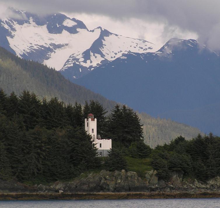
58°16′32″N 134°23′26″W / 58.27556°N 134.39056°W17 Point Retreat Light Station 
June 19, 2003 On the Mansfield Peninsula at the northern end of Admiralty Island, near the junction of Lynn Canal and Stephens Passage
58°24′40″N 134°57′11″W / 58.41111°N 134.95306°W18 St. Nicholas Russian Orthodox Church 
September 19, 1973 326 Fifth Street
58°18′11.65″N 134°24′32.39″W / 58.3032361°N 134.4089972°W19 Sentinel Island Light Station 
December 2, 2002 Sentinel Island
58°32′46″N 134°55′13″W / 58.54611°N 134.92028°W20 Twin Glacier Camp May 20, 1988 Along the Taku River
58°29′26″N 133°56′21″W / 58.49056°N 133.93917°W21 Valentine Building 
May 30, 1985 202 Front Street
58°18′5″N 134°24′15″W / 58.30139°N 134.40417°WAssociated with Emery Valentine 22 Wickersham House 
November 21, 1976 213 Seventh Street
58°18′13″N 134°24′38″W / 58.30361°N 134.41056°WSee also
- List of National Historic Landmarks in Alaska
- National Register of Historic Places listings in Alaska
References
- ^ The latitude and longitude information provided in this table was derived originally from the National Register Information System, which has been found to be fairly accurate for about 99% of listings. For about 1% of NRIS original coordinates, experience has shown that one or both coordinates are typos or otherwise extremely far off; some corrections may have been made. A more subtle problem causes many locations to be off by up to 150 yards, depending on location in the country: most NRIS coordinates were derived from tracing out latitude and longitudes off of USGS topographical quadrant maps created under the North American Datum of 1927, which differs from the current, highly accurate WGS84 GPS system used by Google maps. Chicago is about right, but NRIS longitudes in Washington are higher by about 4.5 seconds, and are lower by about 2.0 seconds in Maine. Latitudes differ by about 1.0 second in Florida. Some locations in this table may have been corrected to current GPS standards.
- ^ "National Register of Historic Places: Weekly List Actions". National Park Service, United States Department of the Interior. Retrieved on November 10, 2011.
- ^ Numbers represent an ordering by significant words. Various colorings, defined here, differentiate National Historic Landmark sites and National Register of Historic Places Districts from other NRHP buildings, structures, sites or objects.
- ^ "National Register Information System". National Register of Historic Places. National Park Service. 2008-04-24. http://nrhp.focus.nps.gov/natreg/docs/All_Data.html.
U.S. National Register of Historic Places Topics Lists by states Alabama • Alaska • Arizona • Arkansas • California • Colorado • Connecticut • Delaware • Florida • Georgia • Hawaii • Idaho • Illinois • Indiana • Iowa • Kansas • Kentucky • Louisiana • Maine • Maryland • Massachusetts • Michigan • Minnesota • Mississippi • Missouri • Montana • Nebraska • Nevada • New Hampshire • New Jersey • New Mexico • New York • North Carolina • North Dakota • Ohio • Oklahoma • Oregon • Pennsylvania • Rhode Island • South Carolina • South Dakota • Tennessee • Texas • Utah • Vermont • Virginia • Washington • West Virginia • Wisconsin • WyomingLists by territories Lists by associated states Other Properties on the National Register of Historic Places in Alaska  Boroughs
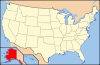 Aleutians East • Anchorage • Bristol Bay • Denali • Fairbanks North Star • Haines • Juneau • Kenai Peninsula • Ketchikan Gateway • Kodiak Island • Lake and Peninsula • Matanuska-Susitna • North Slope • Northwest Arctic • Sitka • Skagway • Wrangell • YakutatCensus areasAleutians West • Bethel • Dillingham • Hoonah-Angoon • Nome • Petersburg • Prince of Wales-Hyder • Southeast Fairbanks • Valdez-Cordova • Yukon-KoyukukThere are no sites listed on the National Register of Historic Places in Wade Hampton Census Area
 State of Alaska
Topics - Index
- Geography
- Climate
- Wildlife
- History
- People
- Transportation
- Government
- Delegations
- Music
- Visitor attractions
Society - Culture
- Crime
- Demographics
- Economy
- Education
- Health (Rural dentistry)
- Politics
Regions - Aleutian Islands
- Arctic Alaska
- Bush Alaska
- Inside Passage
- Interior
- Kenai Peninsula
- Mat‑Su Valley
- North Slope
- Southeast
- Seward Peninsula
- Southcentral
- Southwest
- Tanana Valley
- Yukon–Kuskokwim Delta
Largest cities Boroughs Census Areas - Aleutians West
- Bethel
- Dillingham
- Hoonah‑Angoon
- Nome
- Petersburg
- Prince of Wales‑Hyder
- Southeast Fairbanks
- Valdez‑Cordova
- Wade Hampton
- Yukon‑Koyukuk
Categories:- National Register of Historic Places in Alaska by borough and census area
- Buildings and structures in Juneau City and Borough, Alaska
-


Wikimedia Foundation. 2010.