- National Register of Historic Places listings in Kane County, Illinois
-
See also: List of Registered Historic Places in Illinois
Contents: List of Registered Historic Places in Kane County, Illinois, USA:
-
- This National Park Service list is complete through NPS recent listings posted November 10, 2011.[1]
Landmark name Image Date listed Location City or Town Summary 1 Arcada Theater Building 
August 16, 1994 105 E. Main St. and 1st Ave.
41°54′49″N 88°18′43″W / 41.91361°N 88.31194°WSt. Charles 2 Aurora College Complex February 16, 1984 347 S. Gladstone Ave.
41°45′17″N 88°20′52″W / 41.75472°N 88.34778°WAurora Eckhart, Davis, and Wilkinson Halls were the first buildings at Aurora College. The school, which moved to Aurora from Mendota, was long affiliated with the Advent Christian Church. Eckhart was the main hall, and the other two served as dormitories. 3 Aurora Elks Lodge No. 705 
March 31, 1980 77 S. Stolp Ave.
41°45′23″N 88°19′2″W / 41.75639°N 88.31722°WAurora 4 Batavia Institute 
August 13, 1976 333 S. Jefferson St.
41°50′40″N 88°18′59″W / 41.84444°N 88.31639°WBatavia 5 William Beith House 
December 7, 1983 6 Indiana St.
41°54′40″N 88°18′46″W / 41.91111°N 88.31278°WSt. Charles 6 Campana Factory 
April 6, 1979 Roughly along Illinois Route 31 and Campana Rd.
41°51′54″N 88°18′58″W / 41.865°N 88.31611°WBatavia A state-of-the-art factory built in 1936 for The Campana Company, a cosmetics manufacturer. It is an example of the 1930s Streamline Moderne trend. The factory incorporated many innovative elements, such as air conditioning and a unique assembly line method. 7 Campton Town Hall 
November 24, 1980 W of Wasco at Town Hall Rd. and IL 64
41°55′56″N 88°25′45″W / 41.93222°N 88.42917°WCampton Hills 8 Central Geneva Historic District 
September 10, 1979 Roughly bounded by Fox River, South, 6th and W. State Sts.
41°53′8″N 88°18′30″W / 41.88556°N 88.30833°WGeneva 9 Chicago, Burlington, & Quincy Roundhouse and Locomotive Shop 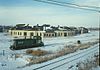
February 16, 1978 Broadway and Spring Sts.
41°45′39″N 88°18′30″W / 41.76083°N 88.30833°WAurora The roundhouse for the Chicago and Aurora Railroad (later Chicago, Burlington and Quincy Railroad) was a major employer in Aurora from 1856 to 1974. After it sat vacant for twenty-one years, a group of investors led by Walter Payton converted it into an entertainment complex. It is the oldest standing limestone roundhouse in the United States. 10 Chicago, Burlington, and Quincy Railroad Depot 
June 6, 1979 155 Houston St.
41°51′5″N 88°18′37″W / 41.85139°N 88.31028°WBatavia The 1854 Gothic Revival train station was the first built for the Chicago, Burlington, and Quincy Railroad. It was redicated as a museum in 1974. 11 City Building 
March 21, 1979 15 N. Riverside Ave.
41°54′51″N 88°18′46″W / 41.91417°N 88.31278°WSt. Charles 12 Col. Ira C. Copley Mansion March 29, 1978 434 W. Downer Pl.
41°45′33″N 88°19′27″W / 41.75917°N 88.32417°WAurora 13 Country Tea Room 
February 25, 1999 14N630 IL 25
42°4′36″N 88°15′36″W / 42.07667°N 88.26°WDundee Township A historic restaurant built along future Illinois Route 25. Max McGraw, the inventor of the Toastmaster, purchased the building in 1926 and thrived as a tearoom. It was later converted to a full restaurant to meet the changing demands of travellers. 14 Dundee Township Historic District 
March 7, 1975 Both sides of Fox River, including sections of E. Dundee, W. Dundee, and Carpentersville
42°6′7″N 88°16′55″W / 42.10194°N 88.28194°WEast Dundee
West Dundee
Carpentersville15 Durant House 
June 18, 1976 NW of St. Charles off Dean St.
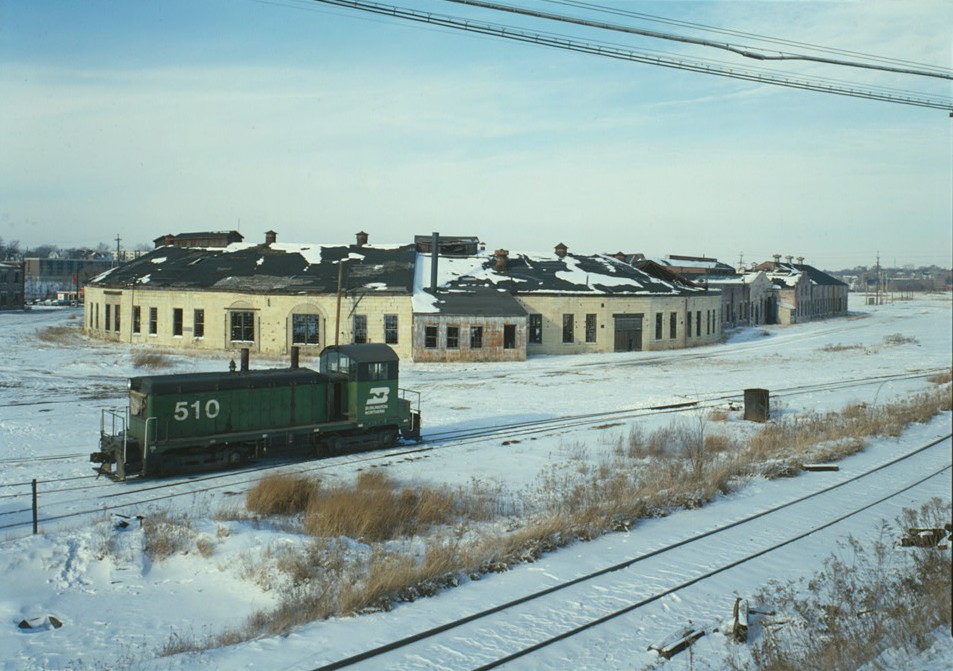
41°55′38″N 88°20′50″W / 41.92722°N 88.34722°WSt. Charles Township 16 Dutch Mill 
June 4, 1979 N of Batavia off IL 25
41°52′17″N 88°18′19″W / 41.87139°N 88.30528°WBatavia 17 Elgin Academy 
October 8, 1976 350 Park St.
42°2′29″N 88°16′40″W / 42.04139°N 88.27778°WElgin 18 Elgin Historic District 
May 9, 1983 Roughly bounded by Villa, Center, Park, N. Liberty, and S. Channing Sts.
42°2′11″N 88°16′28″W / 42.03639°N 88.27444°WElgin 19 Elgin National Watch Company Observatory 
August 16, 1994 312 Watch St.
42°1′48″N 88°16′24″W / 42.03°N 88.27333°WElgin 20 Elgin Tower Building 
May 22, 2002 100 E. Chicago St.
42°2′22″N 88°17′4″W / 42.03944°N 88.28444°WElgin 21 Elizabeth Place 
May 12, 2008 316 Elizabeth Pl.
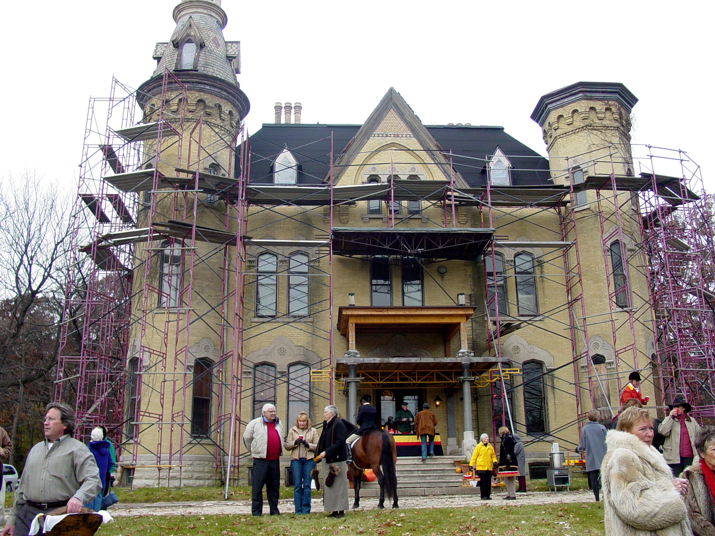
41°52′46″N 88°18′39″W / 41.87944°N 88.31083°WGeneva 22 Fabyan Villa 
February 9, 1984 1511 S. Batavia Ave.
41°52′16″N 88°18′43″W / 41.87111°N 88.31194°WGeneva 23 Fire Barn 5 
August 5, 1991 533 St. Charles Rd.
42°1′32″N 88°16′10″W / 42.02556°N 88.26944°WElgin 24 First Methodist Church of Batavia 
March 19, 1982 355 1st St.
41°50′54″N 88°18′50″W / 41.84833°N 88.31389°WBatavia 25 First Universalist Church 
November 7, 1980 55 Villa St.
42°2′10″N 88°16′48″W / 42.03611°N 88.28°WElgin 26 Fox River House 
May 4, 1976 166 W. Galena
41°45′32″N 88°19′4″W / 41.75889°N 88.31778°WAurora 27 GAR Memorial Building 
August 23, 1984 23 E. Downer Pl.
41°45′24″N 88°18′56″W / 41.75667°N 88.31556°WAurora 28 Garfield Farm and Tavern 
June 23, 1978 W of St. Charles at IL 38 and Garfield Rd.
41°54′36″N 88°24′1″W / 41.91°N 88.40028°WCampton Hills 29 Geneva Country Day School 
August 21, 1989 1250 South St.
41°52′59″N 88°19′13″W / 41.88306°N 88.32028°WGeneva 30 Gifford-Davidson House 
May 31, 1980 363-365 Prairie St.
42°2′3″N 88°16′39″W / 42.03417°N 88.2775°WElgin 31 Graham Building 
March 19, 1982 33 S. Stolp Ave.
41°45′26″N 88°18′57″W / 41.75722°N 88.31583°WAurora 32 Gray–Watkins Mill December 17, 1979 211 N. River St.
41°43′46″N 88°20′25″W / 41.72944°N 88.34028°WMontgomery 33 Mrs. A. W. Gridley House 
February 3, 1993 637 N. Batavia Ave.
41°51′36″N 88°18′49″W / 41.86°N 88.31361°WBatavia 34 Healy Chapel 
February 28, 1985 332 W. Downer Pl.
41°45′33″N 88°19′23″W / 41.75917°N 88.32306°WAurora 35 Holy Cross Church 
May 20, 1999 14 N. Van Buren St.
41°51′1″N 88°18′10″W / 41.85028°N 88.30278°WBatavia 36 Hotel Arthur 
March 15, 2005 2-4 N. Broadway
41°45′33″N 88°18′47″W / 41.75917°N 88.31306°WAurora 37 Hotel Aurora 
June 3, 1982 2 N. Stolp Ave.
41°45′30″N 88°18′54″W / 41.75833°N 88.315°WAurora 38 Hotel Baker 
December 8, 1978 100 W. Main St.
41°54′49″N 88°18′54″W / 41.91361°N 88.315°WSt. Charles 39 Joel H. Hubbard House 
May 4, 2011 304 N. 2nd Ave.
41°54′59″N 88°18′43″W / 41.91639°N 88.31194°WSt. Charles 40 Hunt House 
November 12, 1982 304 Cedar Ave.
41°54′54″N 88°18′38″W / 41.915°N 88.31056°WSt. Charles 41 Keystone Building 
March 18, 1980 30 S. Stolp Ave.
41°45′26″N 88°18′57″W / 41.75722°N 88.31583°WAurora 42 LaSalle Street Auto Row Historic District 
August 1, 1996 56-84 LaSalle St. and 57-83 S. LaSalle St.
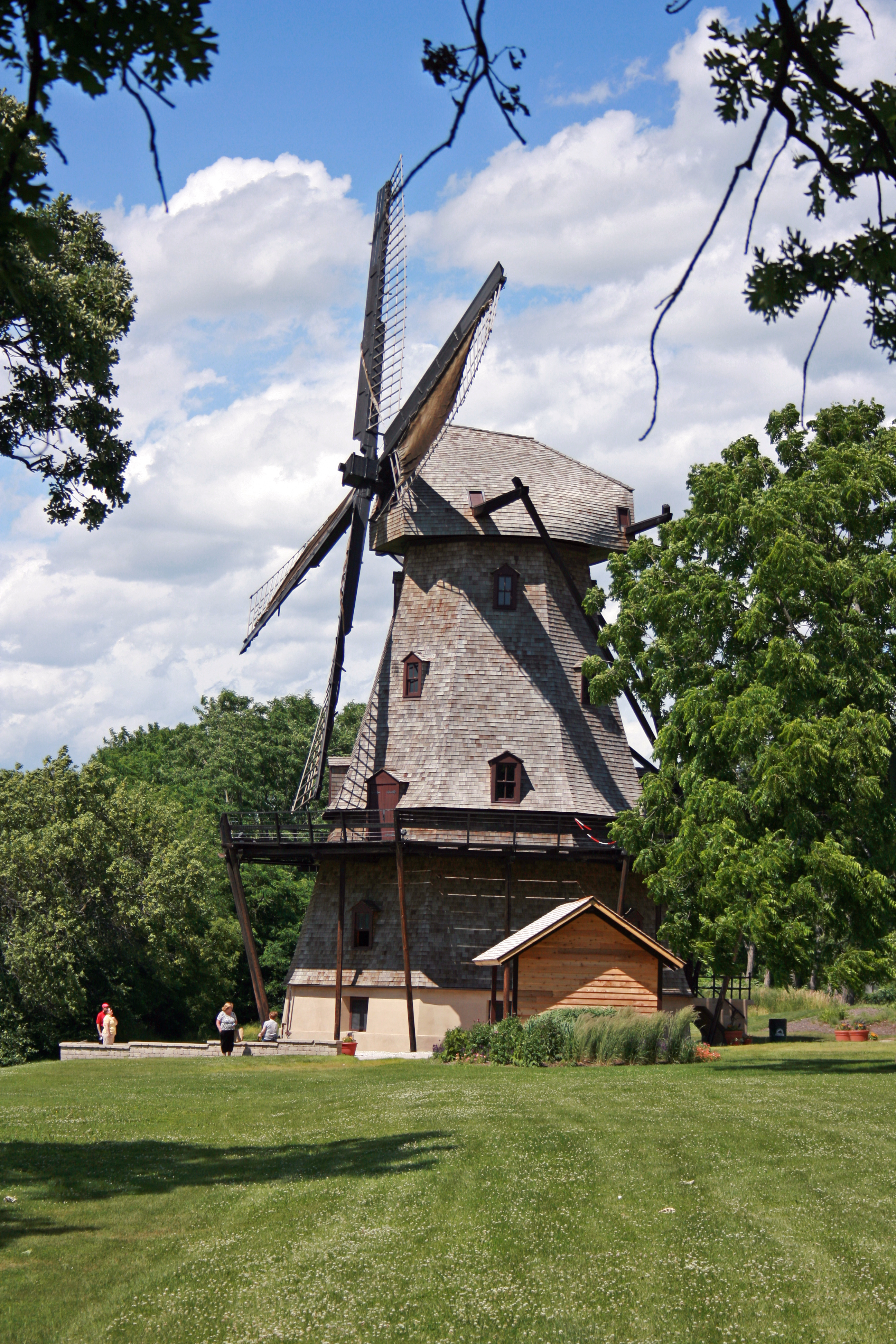
41°45′18″N 88°18′48″W / 41.755°N 88.31333°WAurora 43 Library Hall 
August 14, 1973 21 N. Washington St.
42°6′37″N 88°17′16″W / 42.11028°N 88.28778°WCarpentersville 44 Masonic Temple 
March 19, 1982 104 S. Lincoln Ave.
41°45′12″N 88°18′46″W / 41.75333°N 88.31278°WAurora 45 Memorial Washington Reformed Presbyterian Church November 19, 1980 W of Elgin on W. Highland Ave. Rd.
42°3′51″N 88°23′28″W / 42.06417°N 88.39111°WElgin 46 North Geneva Historic District 
March 25, 1982 Roughly bounded by RR tracks, Fox River, Stevens and W. State Sts.
41°53′23″N 88°18′30″W / 41.88972°N 88.30833°WGeneva 47 Oaklawn Farm 
July 26, 1979 Army Trail and Dunham Rds.
41°57′2″N 88°16′10″W / 41.95056°N 88.26944°WWayne 48 Old Second National Bank 
May 8, 1979 37 S. River St.
41°45′28″N 88°19′6″W / 41.75778°N 88.31833°WAurora 49 Paramount Theatre 
March 18, 1980 23 E. Galena Blvd.
41°45′25″N 88°18′54″W / 41.75694°N 88.315°WAurora 50 Ora Pelton House 
August 12, 1982 214 S. State St.
42°1′49″N 88°17′1″W / 42.03028°N 88.28361°WElgin 51 Riverbank Laboratories 
November 28, 2003 1512 Batavia Ave.
41°52′18″N 88°18′50″W / 41.87167°N 88.31389°WGeneva 52 St. Charles Hospital 
June 7, 2010 400 E New York St.
41°45′24.56″N 88°18′26.73″W / 41.7568222°N 88.307425°WAurora 53 St. Charles Municipal Building 
February 21, 1991 2 E. Main St.
41°54′50″N 88°18′46″W / 41.91389°N 88.31278°WSt. Charles 54 St. Mary's Church of Gilberts 
August 18, 1992 10 Mattesen St.
42°6′23″N 88°22′30″W / 42.10639°N 88.375°WGilberts 55 Ephraim Smith House 
June 6, 1980 NE of Sugar Grove
41°47′12″N 88°26′52″W / 41.78667°N 88.44778°WSugar Grove Township 56 Spring–Douglas Historic District 
April 28, 2000 Roughly Spring St. and Douglas Ave., bet. River Bluff Rd. and Kimball Ave.
42°3′3″N 88°17′4″W / 42.05083°N 88.28444°WElgin 57 Stearns–Wadsworth House March 19, 1982 1 S. 570 Bliss Rd.
41°50′40″N 88°24′26″W / 41.84444°N 88.40722°WBlackberry Township 58 Stolp Island Historic District 
September 10, 1986 Stolp Island
41°45′27″N 88°18′56″W / 41.7575°N 88.31556°WAurora 59 Stolp Woolen Mill Store 
September 1, 1983 2 W. Downer Pl.
41°45′25″N 88°18′59″W / 41.75694°N 88.31639°WAurora 60 William A. Tanner House 
August 19, 1976 304 Oak Ave.
41°45′49″N 88°19′6″W / 41.76361°N 88.31833°WAurora 61 Teeple Barn 
December 10, 1979 NW of Elgin on Randall Rd.
42°4′39″N 88°20′6″W / 42.0775°N 88.335°WElgin Destroyed in a 2007 storm.[2] 62 United Methodist Church of Batavia 
July 28, 1983 8 N. Batavia Ave.
41°51′2″N 88°18′42″W / 41.85056°N 88.31167°WBatavia 63 Andrew Weisel House 
February 26, 1982 312 N. 2nd Ave.
41°54′59″N 88°18′42″W / 41.91639°N 88.31167°WSt. Charles 64 West Side Historic District August 13, 1986 Roughly bounded by W. Downer Pl., Lake St., Garfield Ave., and S. Highland St.
41°45′11″N 88°19′31″W / 41.75306°N 88.32528°WAurora 65 Louise White School 
November 7, 1980 Washington Ave.
41°51′3″N 88°18′14″W / 41.85083°N 88.30389°WBatavia 66 Judge Isaac Wilson House 
May 9, 1985 406 E. Wilson St.
41°51′0″N 88°18′4″W / 41.85°N 88.30111°WBatavia 67 Wing Park Golf Course February 18, 2009 1000 Wing St.
42°2′50.95″N 88°18′16.64″W / 42.0474861°N 88.3046222°WElgin See also
- List of National Historic Landmarks in Illinois
- National Register of Historic Places listings in Illinois
References
- ^ "National Register of Historic Places: Weekly List Actions". National Park Service, United States Department of the Interior. Retrieved on November 10, 2011.
- ^ http://www.dailyherald.com/story/?id=141928
U.S. National Register of Historic Places Topics Lists by states Alabama • Alaska • Arizona • Arkansas • California • Colorado • Connecticut • Delaware • Florida • Georgia • Hawaii • Idaho • Illinois • Indiana • Iowa • Kansas • Kentucky • Louisiana • Maine • Maryland • Massachusetts • Michigan • Minnesota • Mississippi • Missouri • Montana • Nebraska • Nevada • New Hampshire • New Jersey • New Mexico • New York • North Carolina • North Dakota • Ohio • Oklahoma • Oregon • Pennsylvania • Rhode Island • South Carolina • South Dakota • Tennessee • Texas • Utah • Vermont • Virginia • Washington • West Virginia • Wisconsin • WyomingLists by territories Lists by associated states Other  Category:National Register of Historic Places •
  Portal:National Register of Historic PlacesCategories:
- Kane County, Illinois
- National Register of Historic Places in Illinois by county
- National Register of Historic Places in Kane County, Illinois
-


Wikimedia Foundation. 2010.