- National Register of Historic Places listings in Kent County, Michigan
-
The following is a list of Registered Historic Places in Kent County, Michigan.
-
- This National Park Service list is complete through NPS recent listings posted November 10, 2011.[1]
Current listings
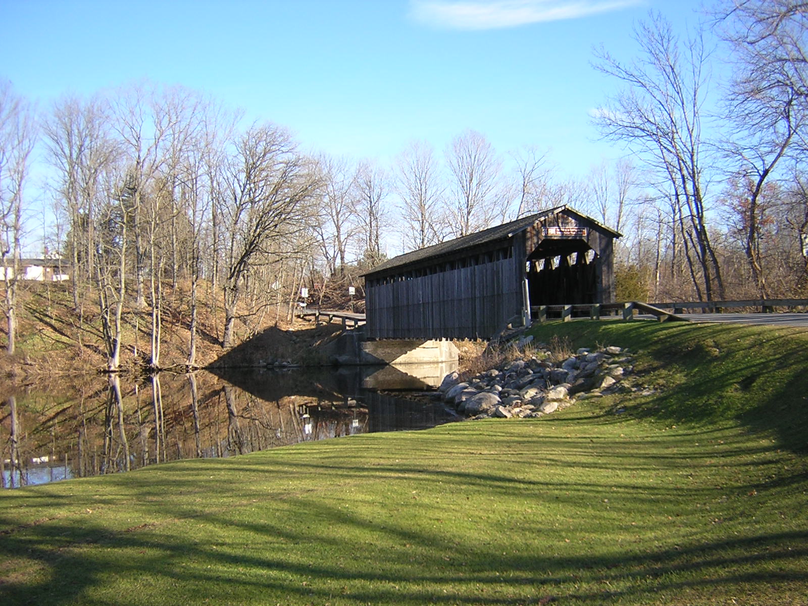
[2] Landmark name [3] Image Date listed Location City or town Summary 1 Ada Covered Bridge 
February 16, 1970 Across the Thornapple River
42°57′08″N 85°29′10″W / 42.952222°N 85.486111°WAda 2 Aldrich Building 
November 12, 1982 98 Monroe Center, NW.
42°57′55″N 85°40′12″W / 42.965278°N 85.67°WGrand Rapids 3 Godfrey Aldrich and White Block 
January 27, 1999 89-99 Monroe Center
42°57′53″N 85°40′13″W / 42.964722°N 85.670278°WGrand Rapids 4 Mathias Alten House and Studio June 23, 2009 1593 East Fulton Street
42°57′47″N 85°37′50″W / 42.963056°N 85.630417°WGrand Rapids 5 American Seating Company Factory Complex July 25, 2003 801 Broadway Ave., NW.
42°58′40″N 85°40′46″W / 42.977814°N 85.679506°WGrand Rapids 6 Berkey and Gay Furniture Company Factory December 20, 2000 940 Monroe Ave., NW.
42°58′44″N 85°40′18″W / 42.978889°N 85.671667°WGrand Rapids 7 John W. Blodgett Estate July 28, 1983 250 Plymouth Rd., SE.
42°57′26″N 85°37′25″W / 42.957222°N 85.623611°WEast Grand Rapids 8 Business Route M-21 – Plaster Creek Bridge December 17, 1999 Business Loop Interstate 196/Chicago Drive over Plaster Creek
42°56′09″N 85°41′14″W / 42.935833°N 85.687222°WWyoming 9 Division Avenue – Plaster Creek Bridge December 17, 1999 Division Ave. over Plaster Creek
42°55′05″N 85°39′58″W / 42.918056°N 85.666111°WGrand Rapids 10 Downtown Lowell Historic District December 9, 1999 Roughly along Main St. between Hudson and Washington
42°56′04″N 85°20′16″W / 42.934444°N 85.337778°WLowell 11 Fallasburg Covered Bridge 
March 16, 1972 Covered Bridge Rd.
42°58′51″N 85°19′38″W / 42.980833°N 85.327222°WLowell 12 Fallasburg Historic District March 31, 1999 Covered Bridge Rd.
42°58′56″N 85°19′24″W / 42.982222°N 85.323333°WVergennes Township 13 Fine Arts Building 
November 12, 1982 220 Lyon St., NW.
42°58′01″N 85°40′26″W / 42.966944°N 85.673889°WGrand Rapids 14 First (Park) Congregational Church 
November 12, 1982 10 E. Park Pl., NE.
42°57′51″N 85°39′56″W / 42.964167°N 85.665556°WGrand Rapids 15 President Gerald R. Ford, Jr. Boyhood Home February 27, 1995 649 Union Ave., SE.
42°57′02″N 85°39′15″W / 42.950556°N 85.654167°WGrand Rapids 16 Goodspeed Brothers Building 
April 17, 1980 188 Monroe St., NW.
42°58′00″N 85°40′19″W / 42.966667°N 85.671944°WGrand Rapids 17 Graham House January 13, 1972 323-325 Main St.
42°56′04″N 85°20′31″W / 42.934444°N 85.341944°WLowell 18 Grand Rapids Cycle Company Factory June 16, 2004 514 Butterworth St. SW.
42°57′35″N 85°40′53″W / 42.959722°N 85.681389°WGrand Rapids 19 Grand Rapids Savings Bank Building 
December 28, 1990 60 Monroe Center, NW.
42°57′52″N 85°40′07″W / 42.964444°N 85.668611°WGrand Rapids 20 Heartside Historic District 
March 2, 1982 Division, Commerce, and Ionia Aves., Fulton, Weston, Oakes, and Cherry Sts.
42°57′42″N 85°40′09″W / 42.961667°N 85.669167°WGrand Rapids 21 Heritage Hill Historic District 
March 11, 1971 Bounded by Michigan Ave. on the north, Pleasant St. on the south, Union Ave. on the east, and Clarendon Pl. and Jefferson Ave. on the west
42°57′35″N 85°39′25″W / 42.959722°N 85.656944°WGrand Rapids 22 Kent County Civil War Monument 
July 14, 2004 Division Ave. at Monroe Ave.
42°57′49″N 85°40′04″W / 42.963611°N 85.667778°WGrand Rapids 23 Ladies' Literary Club 
October 26, 1971 61 Sheldon St., SE.
42°57′45″N 85°40′01″W / 42.9625°N 85.666944°WGrand Rapids 24 Ledyard Block Historic District 
September 8, 1983 123-145 Ottawa Ave., and 104-124 Monroe Center, NW.
42°57′57″N 85°40′14″W / 42.965833°N 85.670556°WGrand Rapids 25 Loraine Building 
November 24, 1982 124 E. Fulton St.
42°57′47″N 85°39′56″W / 42.963056°N 85.665556°WGrand Rapids 26 Medical Arts Building 
May 18, 2000 26 Sheldon Blvd. SE.
42°57′44″N 85°39′58″W / 42.962222°N 85.666111°WGrand Rapids 27 Metal Office Furniture Company (Steelcase) Plants No. 2 and 3 July 17, 2004 401 Hall St. SW.
42°56′34″N 85°40′41″W / 42.942778°N 85.678056°WGrand Rapids 28 Michigan Trust Company Building 
February 24, 1983 40 Pearl St., NW.
42°57′58″N 85°40′12″W / 42.966111°N 85.67°WGrand Rapids 29 Monroe Avenue Water Filtration Plant July 31, 2002 1430 Monroe Ave. NW.
42°59′14″N 85°40′12″W / 42.987222°N 85.67°WGrand Rapids 30 Mt. Mercy Academy and Convent August 5, 1993 1425 Bridge St., NW.
42°58′22″N 85°42′11″W / 42.972778°N 85.703056°WGrand Rapids 31 Norton Mound Group October 15, 1966 Between I-196 and Indian Mound Road
42°56′12″N 85°43′19″W / 42.93667°N 85.72194°W[4]Grand Rapids 32 Augustus Paddock House September 12, 1985 1033 Lake Dr., SE.
42°57′36″N 85°38′34″W / 42.96°N 85.642778°WGrand Rapids 33 Peck Block 
December 7, 2000 34-50 Monroe Center NW.
42°57′51″N 85°40′07″W / 42.964167°N 85.668611°WGrand Rapids 34 Abram W. Pike House 
July 8, 1970 230 Fulton St., E.
42°57′42″N 85°39′47″W / 42.961667°N 85.663056°WGrand Rapids 35 Porter Hollow Embankment and Culvert September 24, 2001 White Pine Strail at Stegman Creek, west of Summit Ave.
43°09′57″N 85°34′01″W / 43.165833°N 85.566944°WAlgoma Township 36 Rood Building March 4, 1988 Near intersection of Pearl and Monroe
42°57′59″N 85°40′19.9″W / 42.96639°N 85.672194°W[5]Grand Rapids 37 Sixth Street Bridge 
August 13, 1976 Spans Grand River between Newberry and 6th St.
42°58′36″N 85°40′27″W / 42.976667°N 85.674167°WGrand Rapids 38 St. Cecilia Society Building 
December 9, 1971 24-30 Ransom Ave., NE.
42°57′49″N 85°39′53″W / 42.963611°N 85.664722°WGrand Rapids 39 Third Reformed Church April 22, 1982 1009 Hermitage St., SE.
42°57′40″N 85°38′39″W / 42.961111°N 85.644167°WGrand Rapids 40 Thornapple River Drive Bridge April 18, 1990 Thornapple River Dr. over Thornapple River
42°56′23″N 85°29′29″W / 42.939722°N 85.491389°WCascade Township 41 Turner House 
July 8, 1970 731 Front St., NW.
42°58′35″N 85°40′35″W / 42.976389°N 85.676389°WGrand Rapids 42 U.S. Post Office 
July 10, 1974 Ionia and Pearl Sts.
42°57′58″N 85°40′06″W / 42.966111°N 85.668333°WGrand Rapids 43 Villa Maria March 27, 1987 1315 Walker NW.
42°59′01″N 85°42′02″W / 42.983611°N 85.700556°WGrand Rapids 44 Whitney Tavern Stand 
February 1, 2007 5283 Whitneyville Ave.
42°52′08″N 85°27′34″W / 42.868889°N 85.459444°WCascade Township See also
References
- ^ "National Register of Historic Places: Weekly List Actions". National Park Service, United States Department of the Interior. Retrieved on November 10, 2011.
- ^ Numbers represent an ordering by significant words. Various colorings, defined here, differentiate National Historic Landmark sites and National Register of Historic Places Districts from other NRHP buildings, structures, sites or objects.
- ^ "National Register Information System". National Register of Historic Places. National Park Service. . http://nrhp.focus.nps.gov/natreg/docs/All_Data.html.
- ^ Location is given by NPS on their website, maps show it in "Indian Mound Park"; the NRIS lists the property as "Address Restricted"
- ^ Location is derived from the Construction News Service; the NRIS lists the property as "Address Restricted"
U.S. National Register of Historic Places Topics Lists by states Alabama • Alaska • Arizona • Arkansas • California • Colorado • Connecticut • Delaware • Florida • Georgia • Hawaii • Idaho • Illinois • Indiana • Iowa • Kansas • Kentucky • Louisiana • Maine • Maryland • Massachusetts • Michigan • Minnesota • Mississippi • Missouri • Montana • Nebraska • Nevada • New Hampshire • New Jersey • New Mexico • New York • North Carolina • North Dakota • Ohio • Oklahoma • Oregon • Pennsylvania • Rhode Island • South Carolina • South Dakota • Tennessee • Texas • Utah • Vermont • Virginia • Washington • West Virginia • Wisconsin • WyomingLists by territories Lists by associated states Other Categories:- National Register of Historic Places in Michigan by county
- Kent County, Michigan
- Buildings and structures in Kent County, Michigan
-


Wikimedia Foundation. 2010.