- National Register of Historic Places listings in Kittitas County, Washington
-
List of entries on the National Register of Historic Places in Kittitas County, Washington
-
- This National Park Service list is complete through NPS recent listings posted November 10, 2011.[1]
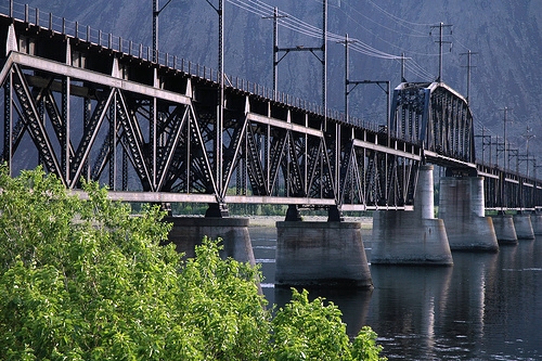
[2] Landmark name [3] Image Date listed Location City or town Summary 1 Beverly Railroad Bridge 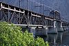
July 16, 1982 Spans Columbia River
46°49′52″N 119°56′54″W / 46.831111°N 119.948333°WBeverly Historic Bridges and Tunnels in Washington TR 2 Cabin Creek Historic District August 17, 1979 W of Easton
47°14′24″N 121°13′46″W / 47.24°N 121.229444°WEaston 3 Chicago, Milwaukee, St. Paul & Pacific Railroad-Kittitas Depot November 19, 1992 Jct. of Railroad Ave. and Main St.
46°59′03″N 120°25′05″W / 46.984167°N 120.418056°WKittitas Historic Resources of the Milwaukee Road in Washington, 1909-1945 MPS 4 Chicago, Milwaukee, St. Paul and Pacific Railroad: South Cle Elum Yard April 25, 2003 Near Milwaukee Rd. and Reservoir Canyon Rd.
47°10′58″N 120°57′24″W / 47.182778°N 120.956667°WSouth Cle Elum Historic Resources of the Milwaukee Road in Washington, 1909-1945 MPS 5 Cle Elum-Roslyn Beneficial Association Hospital December 3, 1980 505 Power St.
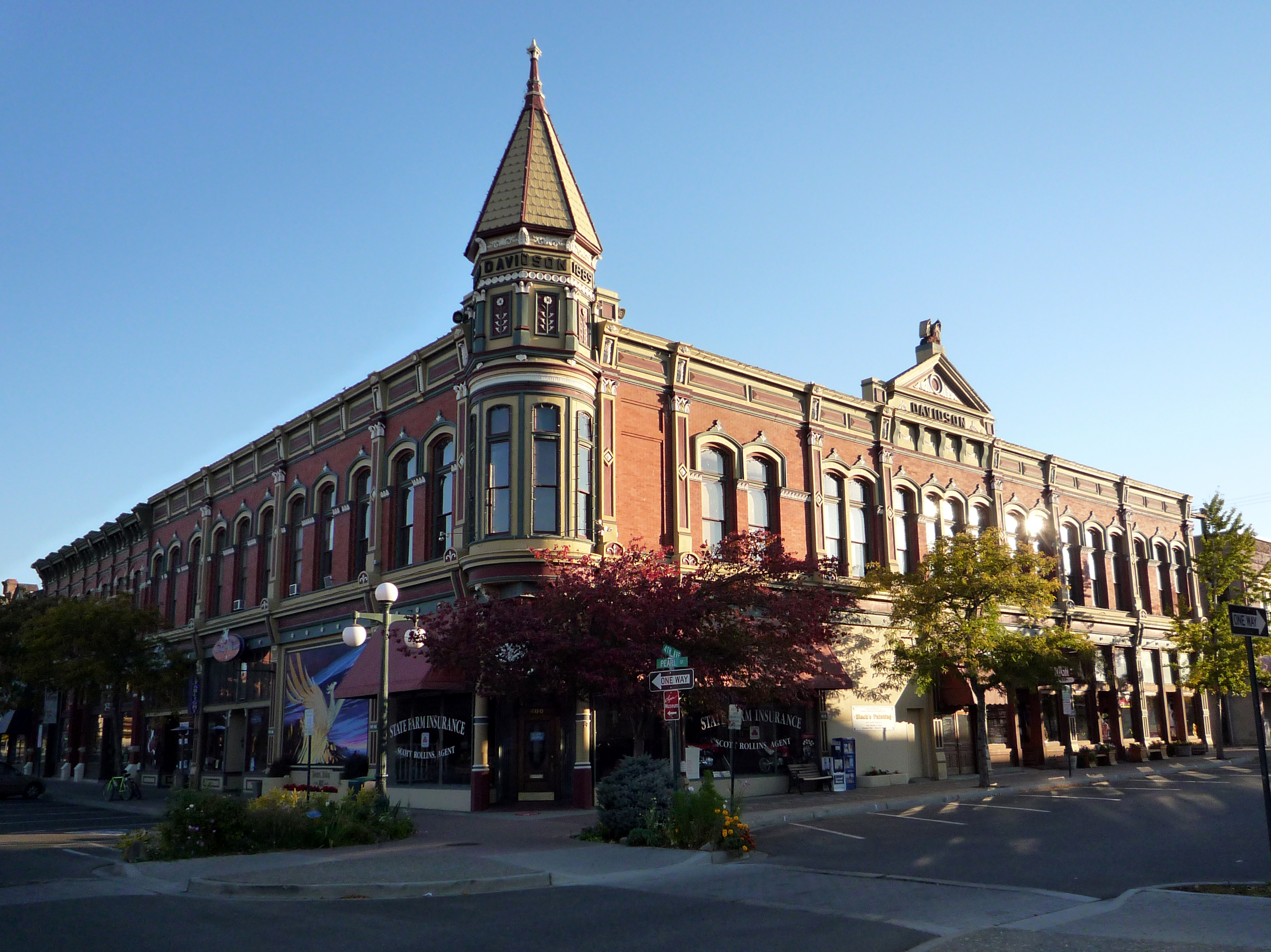
47°11′48″N 120°56′40″W / 47.196667°N 120.944444°WCle Elum 6 Downtown Ellensburg Historic District 
July 1, 1977 Roughly bounded by 3rd and 6th Aves., and Main and Ruby Sts.
46°59′46″N 120°32′45″W / 46.996111°N 120.545833°WEllensburg 7 First Railroad Addition Historic District May 8, 1987 Roughly bounded by Tenth Ave., D St., Ninth Ave., and A St.
47°00′05″N 120°32′41″W / 47.001389°N 120.544722°WEllensburg 8 Dr. Paschal and Agnes Gray House August 29, 1997 606 N. Main St.
46°58′16″N 120°32′55″W / 46.971111°N 120.548611°WEllensburg 9 Kittitas County Fairgrounds January 8, 1999 512 N. Poplar St.
46°59′55″N 120°31′58″W / 46.99872°N 120.53286°WEllensburg 10 Lake Keechelus Snowshed Bridge 
May 24, 1995 I-90 near Snoqualmie Pass
47°21′20″N 121°21′53″W / 47.355556°N 121.364722°WHyak Bridges of Washington State MPS 11 Liberty Historic District 
October 15, 1974 Both sides of Williams Creek Wagon Rd.
47°15′15″N 120°39′53″W / 47.254167°N 120.664722°WLiberty 12 Milwaukee Road Bunkhouse March 31, 1989 526 Marie
47°10′58″N 120°57′12″W / 47.182778°N 120.953333°WSouth Cle Elum 13 Albert Nelson Farmstead February 25, 1982 Manastash Rd.
46°58′17″N 120°36′38″W / 46.971389°N 120.610556°WEllensburg 14 Northern Pacific Railway Passenger Depot 
September 26, 1991 606 W. Third St.
46°59′40″N 120°33′25″W / 46.994444°N 120.556944°WEllensburg 15 Northwestern Improvement Company Store April 13, 1973 1st St. and Pennsylvania Ave.
47°13′25″N 120°59′29″W / 47.223611°N 120.991389°WRoslyn 16 Olmstead Place State Park March 31, 1971 4 mi. E of Ellensburg near the Kittitas Hwy.
46°58′42″N 120°28′15″W / 46.978333°N 120.470833°WEllensburg 17 Ramsay House May 2, 1986 215 E. Ninth
47°00′06″N 120°34′06″W / 47.001667°N 120.568333°WEllensburg 18 Roslyn Historic District 
February 14, 1978 WA 2E
47°13′19″N 120°59′28″W / 47.221944°N 120.991111°WRoslyn 19 Salmon la Sac Guard Station July 15, 1974 N of Cle Elum in Wenatchee National Forest
47°24′07″N 121°05′39″W / 47.401944°N 121.094167°WCle Elum 20 Shoudy House November 12, 1992 309 W. Fifth Ave.
46°59′49″N 120°32′59″W / 46.996944°N 120.549722°WEllensburg 21 Springfield Farm April 13, 1977 9 mi. N of Ellensburg
47°07′53″N 120°35′10″W / 47.131389°N 120.586111°WEllensburg 22 Tekison Cave 
November 24, 1978 Address Restricted Wenatchee 23 Thorp Grade School 
July 16, 2009 10831 N. Thorp Hwy.
47°04′14″N 120°40′37″W / 47.070561°N 120.6769°WThorp Rural Public Schools of Washington State MPS 24 Thorp Mill November 23, 1977 Thorp Highway off U.S. 10
47°04′23″N 120°40′47″W / 47.073056°N 120.679722°WThorp 25 Washington State Normal School Building December 12, 1976 8th Ave.
47°00′01″N 120°32′27″W / 47.000278°N 120.540833°WEllensburg References
- ^ "National Register of Historic Places: Weekly List Actions". National Park Service, United States Department of the Interior. Retrieved on November 10, 2011.
- ^ Numbers represent an ordering by significant words. Various colorings, defined here, differentiate National Historic Landmark sites and National Register of Historic Places Districts from other NRHP buildings, structures, sites or objects.
- ^ "National Register Information System". National Register of Historic Places. National Park Service. . http://nrhp.focus.nps.gov/natreg/docs/All_Data.html.
U.S. National Register of Historic Places Topics Lists by states Alabama • Alaska • Arizona • Arkansas • California • Colorado • Connecticut • Delaware • Florida • Georgia • Hawaii • Idaho • Illinois • Indiana • Iowa • Kansas • Kentucky • Louisiana • Maine • Maryland • Massachusetts • Michigan • Minnesota • Mississippi • Missouri • Montana • Nebraska • Nevada • New Hampshire • New Jersey • New Mexico • New York • North Carolina • North Dakota • Ohio • Oklahoma • Oregon • Pennsylvania • Rhode Island • South Carolina • South Dakota • Tennessee • Texas • Utah • Vermont • Virginia • Washington • West Virginia • Wisconsin • WyomingLists by territories Lists by associated states Other Categories:- National Register of Historic Places in Washington (state) by county
- Kittitas County, Washington
-


Wikimedia Foundation. 2010.