- National Register of Historic Places listings in Lake and Peninsula Borough, Alaska
-
 Location of the Lake and Peninsula Borough in Alaska
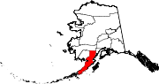
This is a list of the National Register of Historic Places listings in Lake and Peninsula Borough, Alaska.
This is intended to be a complete list of the properties and districts on the National Register of Historic Places in Lake and Peninsula Borough, Alaska, United States. The locations of National Register properties and districts for which the latitude and longitude coordinates are included below, may be seen in a Google map.[1]
There are 12 properties and districts listed on the National Register in the borough, including 1 National Historic Landmark.
-
- This National Park Service list is complete through NPS recent listings posted November 4, 2011.[2]
Current listings
[3] Landmark name[4] Image Date listed Location Community Summary 1 Dr. Elmer Bly House April 12, 2006 Hardenburg Bay
60°12′19″N 154°18′13″W / 60.20528°N 154.30361°WPort Alsworth 2 Fure's Cabin 
February 7, 1985 Katmai National Park and Preserve
58°40′14″N 155°25′37″W / 58.67056°N 155.42694°WKing Salmon 3 Kasna Creek Mining District February 17, 2010 Address Restricted Port Alsworth 4 Kijik Archeological District 
October 12, 1994 On the shores of Lake Clark, approximately 50 kilometres (31 mi) northeast of Nondalton
60°17′33″N 154°15′1″W / 60.2925°N 154.25028°W[5]Nondalton 5 Kijik Historic District January 29, 1979 On the western shore of Lake Clark near the mouth of the Kijik River
60°17′28″N 154°13′0″W / 60.29111°N 154.216667°W[6]Nondalton An Eskimo village[4] 6 Kukak Cannery Archeological Historic District April 7, 2003 Katmai National Park and Preserve
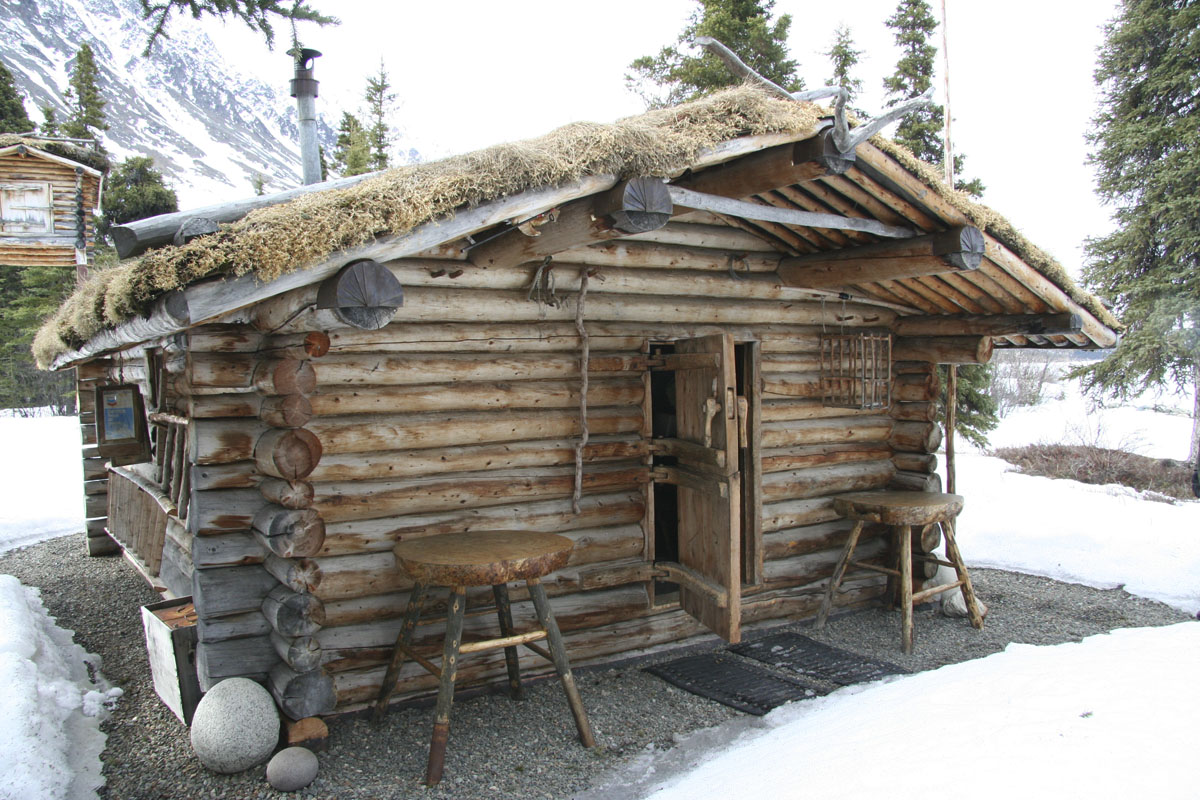
58°19′4″N 154°11′11″W / 58.31778°N 154.18639°WKukak Bay 7 Richard Proenneke Site 
March 8, 2007 Southeastern end of upper Twin Lakes, Lake Clark National Park and Preserve
60°38′45″N 153°49′6″W / 60.64583°N 153.81833°WPort Alsworth 8 St. John the Theologian Church June 6, 1980 In Perryville
55°54′45″N 159°8′35″W / 55.9125°N 159.14306°WPerryville 9 St. Nicholas Chapel June 6, 1980 In Nondalton
59°57′57″N 154°51′12″W / 59.96583°N 154.85333°WNondalton 10 St. Nicholas Chapel June 6, 1980 In Pedro Bay
59°47′7″N 154°6′9″W / 59.78528°N 154.1025°WPedro Bay 11 St. Nicholas Church 
June 6, 1980 In Pilot Point
56°54′52″N 157°36′5″W / 56.91444°N 157.60139°WPilot Point 12 Savonoski River Archeological District February 14, 1978 Address Restricted Brooks Camp The Lake and Peninsula Borough portion of this district represents a boundary increase See also
- List of National Historic Landmarks in Alaska
- National Register of Historic Places listings in Alaska
References
- ^ The latitude and longitude information provided in this table was derived originally from the National Register Information System, which has been found to be fairly accurate for about 99% of listings. For about 1% of NRIS original coordinates, experience has shown that one or both coordinates are typos or otherwise extremely far off; some corrections may have been made. A more subtle problem causes many locations to be off by up to 150 yards, depending on location in the country: most NRIS coordinates were derived from tracing out latitude and longitudes off of USGS topographical quadrant maps created under North American Datum of 1927, which differs from the current, highly accurate GPS system used by Google maps. Chicago is about right, but NRIS longitudes in Washington are higher by about 4.5 seconds, and are lower by about 2.0 seconds in Maine. Latitudes differ by about 1.0 second in Florida. Some locations in this table may have been corrected to current GPS standards.
- ^ "National Register of Historic Places: Weekly List Actions". National Park Service, United States Department of the Interior. Retrieved on November 4, 2011.
- ^ Numbers represent an ordering by significant words. Various colorings, defined here, differentiate National Historic Landmark sites and National Register of Historic Places Districts from other NRHP buildings, structures, sites or objects.
- ^ a b "National Register Information System". National Register of Historic Places. National Park Service. 2008-04-24. http://nrhp.focus.nps.gov/natreg/docs/All_Data.html.
- ^ Location derived from its NHL profile; the NRIS lists the site as "Address Restricted"
- ^ Location derived from the GNIS feature record for Kijik; the NRIS lists the site as "Address Restricted"
U.S. National Register of Historic Places Topics Lists by states Alabama • Alaska • Arizona • Arkansas • California • Colorado • Connecticut • Delaware • Florida • Georgia • Hawaii • Idaho • Illinois • Indiana • Iowa • Kansas • Kentucky • Louisiana • Maine • Maryland • Massachusetts • Michigan • Minnesota • Mississippi • Missouri • Montana • Nebraska • Nevada • New Hampshire • New Jersey • New Mexico • New York • North Carolina • North Dakota • Ohio • Oklahoma • Oregon • Pennsylvania • Rhode Island • South Carolina • South Dakota • Tennessee • Texas • Utah • Vermont • Virginia • Washington • West Virginia • Wisconsin • WyomingLists by territories Lists by associated states Other  Category:National Register of Historic Places •
  Portal:National Register of Historic Places
Properties on the National Register of Historic Places in Alaska  Boroughs
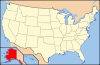 Aleutians East • Anchorage • Bristol Bay • Denali • Fairbanks North Star • Haines • Juneau • Kenai Peninsula • Ketchikan Gateway • Kodiak Island • Lake and Peninsula • Matanuska-Susitna • North Slope • Northwest Arctic • Sitka • Skagway • Wrangell • YakutatCensus areasAleutians West • Bethel • Dillingham • Hoonah-Angoon • Nome • Petersburg • Prince of Wales-Hyder • Southeast Fairbanks • Valdez-Cordova • Yukon-KoyukukThere are no sites listed on the National Register of Historic Places in Wade Hampton Census Area
Municipalities and communities of Lake and Peninsula Borough, Alaska Borough seat: King Salmon Cities Chignik | Egegik | Newhalen | Nondalton | Pilot Point | Port Heiden
CDPs Chignik Lagoon | Chignik Lake | Igiugig | Iliamna | Ivanof Bay | Kokhanok | Levelock | Pedro Bay | Perryville | Pope-Vannoy Landing | Port Alsworth | Ugashik
Ghost town Kijik
Categories:- National Register of Historic Places in Alaska by borough and census area
- Lake and Peninsula Borough, Alaska
-


Wikimedia Foundation. 2010.