- National Register of Historic Places listings in Larimer County, Colorado
-
 Location of Larimer County in Colorado
This is a list of the National Register of Historic Places listings in Larimer County, Colorado. It is intended to be a complete list of the properties and districts on the National Register of Historic Places in Larimer County, Colorado, United States. The locations of National Register properties and districts for which the latitude and longitude coordinates are included below, may be seen in a Google map.[1]
There are 96 properties and districts listed on the National Register in the county, including 2 National Historic Landmarks. Two sites that were once listed have been removed.
-
- This National Park Service list is complete through NPS recent listings posted November 10, 2011.[2]
Current listings
[3] Landmark name Image Date listed Location City or town Summary 1 Ammons Hall 
June 15, 1978 Colorado State University campus
40°34′40″N 105°04′52″W / 40.577778°N 105.081111°WFort Collins 2 Peter Anderson House October 25, 1979 300 S. Howes St.
40°35′02″N 105°04′47″W / 40.583889°N 105.079722°WFort Collins 3 Armstrong Hotel August 31, 2000 249-261 S. College Ave.
40°35′04″N 105°04′36″W / 40.584444°N 105.076667°WFort Collins 4 Arrowhead Lodge May 27, 1992 34500 Poudre Canyon Highway in the Roosevelt National Forest
40°42′13″N 105°38′09″W / 40.703611°N 105.635833°WBellvue 5 Avery House 
June 24, 1972 328 W. Mountain Ave.
40°35′14″N 105°04′53″W / 40.587222°N 105.081389°WFort Collins 6 Baker House 
July 20, 1978 304-304½ E. Mulberry St.
40°34′54″N 105°04′24″W / 40.581667°N 105.073333°WFort Collins 7 Baldpate Inn January 11, 1996 4900 S. State Highway 7
40°18′30″N 105°32′04″W / 40.308333°N 105.534444°WEstes Park 8 Bear Lake Comfort Station 
January 29, 1988 Bear Lake
40°18′44″N 105°38′42″W / 40.312222°N 105.645°WEstes Park 9 Bee Farm November 25, 2002 4320 E. County Road 58
40°40′17″N 104°59′42″W / 40.671389°N 104.995°WFort Collins 10 A. S. Benson House January 6, 2004 463 W. 5th St.
40°23′48″N 105°04′56″W / 40.396667°N 105.082222°WLoveland 11 Big Thompson River Bridge III October 15, 2002 U.S. Route 34 at milepost 85.15
40°24′54″N 105°11′42″W / 40.415°N 105.195°WLoveland 12 Big Thompson River Bridge IV October 15, 2002 U.S. Route 34 at milepost 86.04
40°25′07″N 105°10′47″W / 40.418611°N 105.179722°WLoveland 13 Bimson Blacksmith Shop July 23, 1981 224 Mountain St.
40°18′21″N 105°04′32″W / 40.305833°N 105.075556°WBerthoud 14 Maude Stanfield Harter Borland House July 6, 2004 610 N. Jefferson Ave.
40°23′52″N 105°04′16″W / 40.397778°N 105.071111°WLoveland 15 Botanical and Horticultural Laboratory 
September 18, 1978 Colorado State University campus
40°34′40″N 105°04′40″W / 40.577778°N 105.077778°WFort Collins Now called Routt Hall. 16 Jay H. Bouton House December 18, 1978 113 N. Sherwood St.
40°35′15″N 105°05′04″W / 40.5875°N 105.084444°WFort Collins 17 Buckeye School June 26, 2008 Off W. County Road 80
40°49′35″N 105°05′36″W / 40.82648°N 105.09339°WWellington 18 Chasteen's Grove September 6, 1978 West of Loveland off U.S. Route 34
40°25′23″N 105°12′13″W / 40.423056°N 105.203611°WLoveland 19 Clatworthy Place 
July 14, 2004 225 Cyteworth Rd.
40°22′21″N 105°31′17″W / 40.3725°N 105.521389°WEstes Park 20 Colorado and Southern Railway Depot June 14, 1982 405 Railroad Ave.
40°23′46″N 105°04′31″W / 40.396111°N 105.075278°WLoveland 21 Crags Lodge July 1, 1998 300 Riverside Dr.
40°22′12″N 105°31′25″W / 40.37°N 105.523611°WEstes Park 22 East Longs Peak Trail-Longs Peak Trail-Keyhole Route-Shelf Trail 
July 10, 2007 West of State Highway 7
40°16′20″N 105°36′2″W / 40.27222°N 105.60056°W[4]Allenspark 23 Edgemont July 15, 1998 1861 Mary's Lake Rd.
40°21′02″N 105°32′21″W / 40.350556°N 105.539167°WEstes Park 24 Elkhorn Lodge December 27, 1978 530 W. Elkhorn Ave.
40°22′38″N 105°32′00″W / 40.377222°N 105.533333°WEstes Park 25 Fall River Entrance Historic District 
January 29, 1988 Fall River Entrance
40°24′11″N 105°35′13″W / 40.40312°N 105.58707°WEstes Park 26 Fall River Pass Ranger Station 
January 29, 1988 Fall River Pass
40°26′27″N 105°45′13″W / 40.440833°N 105.753611°WEstes Park 27 Fall River Pump House and Catchment Basin 
August 30, 2006 Near the top of Fall River Road in Rocky Mountain National Park
40°26′15″N 105°44′50″W / 40.4375°N 105.747222°WEstes Park 28 Fall River Road 
July 20, 1987 Fall River Rd.
40°25′47″N 105°42′43″W / 40.429722°N 105.711944°WEstes Park 29 Fern Lake Patrol Cabin 
January 29, 1988 Fern Lake
40°20′17″N 105°40′34″W / 40.338056°N 105.676111°WEstes Park 30 Fern Lake Trail 
February 28, 2005 Rocky Mountain National Park
40°20′34″N 105°39′48″W / 40.342778°N 105.663333°WEstes Park 31 First National Bank Building 
August 10, 2000 3728 Cleveland Ave.
40°42′15″N 105°00′20″W / 40.704167°N 105.005556°WWellington 32 First United Presbyterian Church 
July 7, 2004 400 E. 4th St.
40°23′43″N 105°04′16″W / 40.395278°N 105.071111°WLoveland 33 Flattop Mountain Trail 
September 27, 2007 Rocky Mountain National Park
40°18′50″N 105°40′42″W / 40.31389°N 105.67833°W[5]Estes Park 34 Jacob and Elizabeth Flowers House March 1, 2007 5200 W. County Road 52E
40°37′48″N 105°10′19″W / 40.63°N 105.171944°WBellvue 35 Fort Collins Armory October 15, 2002 314 E. Mountain Ave.
40°35′14″N 105°04′21″W / 40.587222°N 105.0725°WFort Collins 36 Fort Collins Municipal Railway Birnery Safety Streetcar No. 21 January 5, 1984 1801 W. Mountain Ave.
40°35′12″N 105°06′32″W / 40.586667°N 105.108889°WFort Collins 37 Fort Collins Post Office 
January 30, 1978 201 S. College Ave.
40°35′07″N 105°04′37″W / 40.585278°N 105.076944°WFort Collins Now used as the Ft. Collins Museum of Contemporary Art 38 Montezuma Fuller House December 15, 1978 226 W. Magnolia St.
40°34′58″N 105°04′47″W / 40.582778°N 105.079722°WFort Collins 39 Gem Lake Trail 
January 29, 2008 North of Devils Gulch Rd. to Gem Lake
40°24′40″N 105°30′13″W / 40.41111°N 105.50361°W[6]Estes Park 40 Glacier Basin Campground Ranger Station 
July 20, 1987 Glacier Basin
40°19′48″N 105°35′40″W / 40.33°N 105.594444°WEstes Park 41 Greeley, Salt Lake and Pacific Railroad-Stout Branch April 16, 2008 Approximately ½ mile south of the junction of U.S. Route 287 and County Road 28 Laporte 42 Harmony Mill November 22, 1995 131 Lincoln Ave.
40°35′18″N 105°04′13″W / 40.588333°N 105.070278°WFort Collins 43 Hewes-Kirkwood Inn October 28, 1994 465 Long Peak Rd.
40°16′18″N 105°33′15″W / 40.271667°N 105.554167°WEstes Park 44 Homestead Meadows Discontiguous District October 4, 1990 At the end of Lion Gulch
40°18′36″N 105°27′0″W / 40.31°N 105.45°W[7]Estes Park 45 Kaplan-Hoover Site April 18, 2003 Address Restricted Windsor 46 Kissock Block Building May 16, 1985 115-121 E. Mountain Ave.
40°35′12″N 105°04′33″W / 40.586667°N 105.075833°WFort Collins 47 Lake Haiyaha Trail March 5, 2008 Roughly along Bear, Nymph, and Dream Lakes, then up Chaos Canyon
40°18′17″N 105°39′44″W / 40.30472°N 105.66222°W[8]Estes Park 48 Laurel School Historic District October 3, 1980 Off U.S. Route 287
40°34′40″N 105°04′20″W / 40.577778°N 105.072222°WFort Collins 49 Leiffer House 
August 2, 1978 South of Estes Park off State Highway 7
40°16′34″N 105°32′42″W / 40.276111°N 105.545°WEstes Park 50 Lindenmeier Site 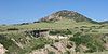
October 15, 1966 Address Restricted Fort Collins 51 Livermore Hotel and General Store September 14, 2001 2140 Red Feather Lakes Road
40°47′15.828″N 105°15′14.148″W / 40.78773°N 105.25393°W[9]Livermore 52 Lost Lake Trail March 5, 2008 Roughly along the North Fork of the Big Thompson River
40°29′56″N 105°33′2″W / 40.49889°N 105.55056°W[10]Estes Park 53 Loveland State Armory April 12, 2001 201 S. Lincoln Ave.
40°23′28″N 105°04′23″W / 40.391111°N 105.073056°WLoveland 54 R.G. Maxwell House September 29, 1980 2340 W. Mulberry St.
40°35′44″N 105°08′24″W / 40.595556°N 105.14°WFort Collins 55 MacGregor Ranch 
July 31, 1989 180 MacGregor Ave.
40°23′45″N 105°31′58″W / 40.395833°N 105.532778°WEstes Park 56 William H. McCreery House 
May 2, 2001 746 N. Washington Ave.
40°23′57″N 105°04′10″W / 40.399167°N 105.069444°WLoveland 57 McGraw Ranch 
September 17, 1998 McGraw Ranch Rd.
40°25′53″N 105°30′06″W / 40.431389°N 105.501667°WEstes Park 58 McHugh-Andrews House December 27, 1978 202 Remington St.
40°35′08″N 105°04′29″W / 40.585556°N 105.074722°WFort Collins 59 Enos Mills Homestead Cabin May 11, 1973 South of Estes Park off State Highway 7
40°16′54″N 105°32′24″W / 40.281667°N 105.54°WEstes Park 60 Moraine Lodge 
October 8, 1976 West of Estes Park off U.S. Route 36 on Bear Lake Rd.
40°21′31″N 105°34′59″W / 40.358611°N 105.583056°WEstes Park 61 Moraine Park Museum and Amphitheater 
June 15, 2005 Rocky Mountain National Park
40°21′31″N 105°35′02″W / 40.358611°N 105.583889°WEstes Park 62 Mosman House December 15, 1978 324 E. Oak St.
40°35′08″N 105°04′21″W / 40.585556°N 105.0725°WFort Collins 63 Mountainside Lodge July 20, 2000 2515 Tunnel Rd.
40°20′05″N 105°35′20″W / 40.334722°N 105.588889°WEstes Park 64 North Inlet Trail 
March 5, 2008 Roughly along North Inlet and Hallett Creek to Flattop Mountain
40°15′50″N 105°47′22″W / 40.26389°N 105.78944°W[11]Grand Lake Extends into Grand County 65 Old Town Fort Collins 
August 2, 1978 Roughly bounded by College Ave. and Mountain, Pine, Willow, and Walnut Sts.
40°35′22″N 105°04′27″W / 40.589444°N 105.074167°WFort Collins 66 Opera House Block/Central Block Building February 8, 1985 117-131 N. College Ave.
40°35′15″N 105°04′37″W / 40.5875°N 105.076944°WFort Collins 67 Park Theatre 
June 14, 1984 130 Moraine Ave.
40°22′35″N 105°31′22″W / 40.376389°N 105.522778°WEstes Park 68 Peep O Day Park August 10, 2011 5445 Wild Ln.
40°24′36″N 105°09′17″W / 40.41°N 105.154722°WLoveland 69 Pleasant Valley School October 11, 2003 4032 N. County Road 25E
40°38′51″N 105°11′07″W / 40.6475°N 105.185278°WBellvue 70 Plummer School April 29, 1999 2524 E. Vine Dr.
40°35′47″N 105°01′46″W / 40.596389°N 105.029444°WFort Collins 71 Preston Farm May 10, 2001 4605 S. Ziegler Rd.
40°31′19″N 105°01′14″W / 40.521944°N 105.020556°WFort Collins 72 Provost Homestead-Herring Farm Rural Historic Landscape December 27, 2010 2405 North Overland Trail
40°37′20″N 105°08′33″W / 40.622222°N 105.1425°WLaporte 73 Rialto Theater 
February 17, 1988 228-230 E. 4th Ave.
40°23′43″N 105°04′24″W / 40.395278°N 105.073333°WLoveland 74 T.H. Robertson House July 2, 1992 420 W. Mountain Ave.
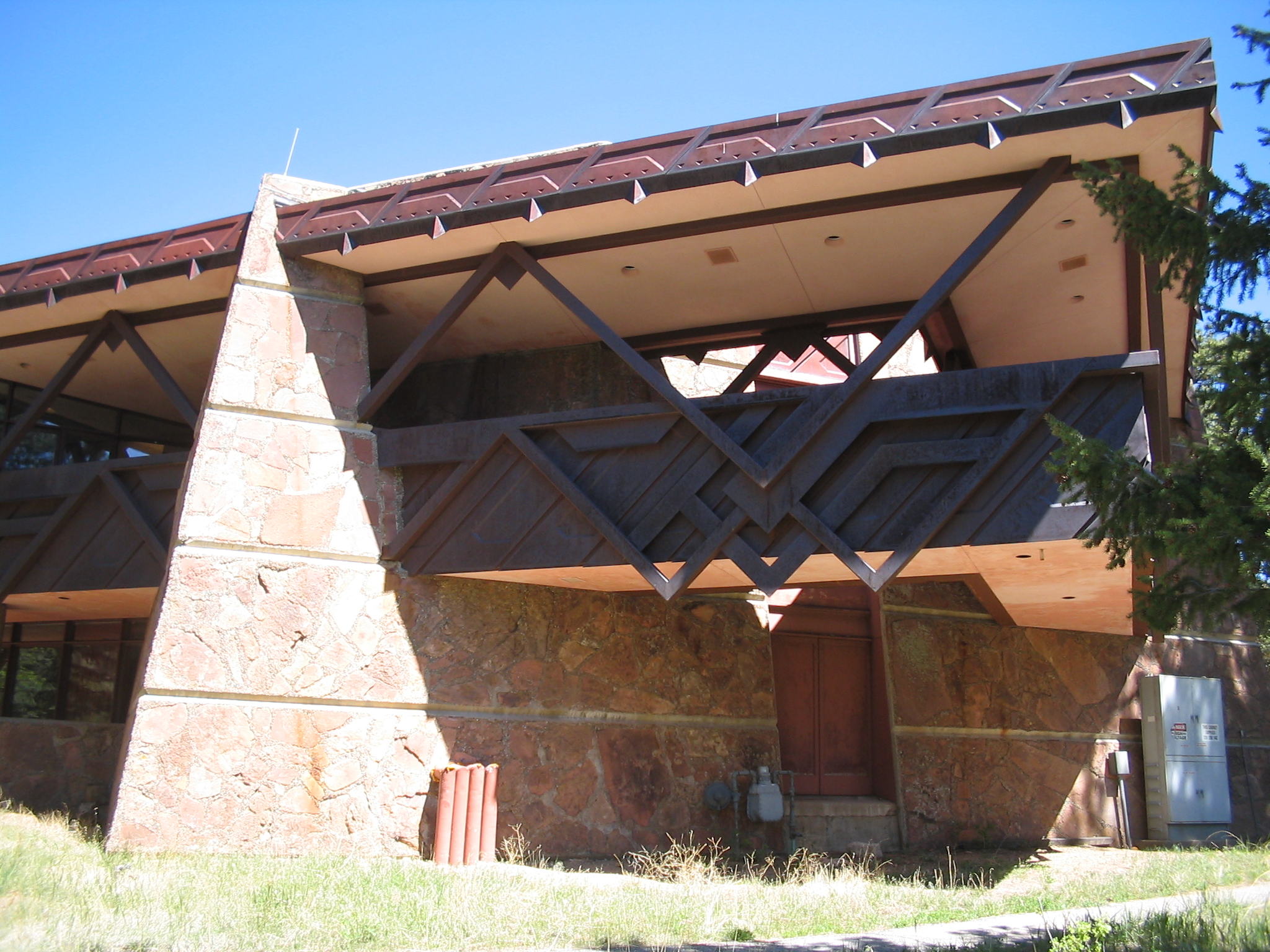
40°35′15″N 105°04′59″W / 40.5875°N 105.083056°WFort Collins 75 Rocky Mountain National Park Administration Building 
January 3, 2001 U.S. Route 36 Estes Park 76 Rocky Mountain National Park Utility Area Historic District 
March 18, 1982 Beaver Meadows Entrance Rd.
40°21′50″N 105°33′38″W / 40.363889°N 105.560556°WEstes Park 77 Henry K. and Mary E. Shaffer House January 9, 2007 1302 N. Grant Ave.
40°24′22″N 105°04′42″W / 40.406111°N 105.078333°WLoveland 78 Snogo Snow Plow 
October 4, 2006 Rocky Mountain National Park
40°21′51″N 105°33′34″W / 40.364167°N 105.559444°WEstes Park 79 Soloman Batterson Ranch October 15, 2010 603 Mount Moriah Rd.
40°44′18″N 105°24′19″W / 40.738333°N 105.405278°WLivermore 80 Spruce Hall January 9, 1977 Colorado State University campus
40°34′38″N 105°04′40″W / 40.577222°N 105.077778°WFort Collins 81 Stanley Hotel 
May 26, 1977 333 Wonder View Ave.
40°23′00″N 105°31′02″W / 40.383333°N 105.517222°WEstes Park 82 Stanley Hotel District 
June 20, 1985 333 Wonder View Ave.
40°23′00″N 105°31′06″W / 40.383333°N 105.518333°WEstes Park 83 Stanley Power Plant April 14, 1998 Fish Hatchery Rd. at the Fall River
40°23′50″N 105°34′08″W / 40.397194°N 105.568889°WEstes Park A boundary increase of the Stanley Hotel District 84 Gustav and Annie Swanson Farm October 5, 2005 1932 N. State Highway 287
40°22′03″N 105°04′21″W / 40.3675°N 105.0725°WBerthoud 85 Tonahutu Creek Trail 
March 5, 2008 Roughly along Tonahutu Creek to Flattop Mountain
40°19′10″N 105°46′32″W / 40.31944°N 105.77556°W[12]Grand Lake Extends into Grand County 86 Trail Ridge Road 
November 14, 1984 Rocky Mountain National Park
40°21′30″N 105°45′47″W / 40.358333°N 105.763056°WEstes Park Extends into Grand County 87 Twin Sisters Lookout 
December 24, 1992 On the Twin Sisters Peaks in Rocky Mountain National Park
40°17′21″N 105°31′03″W / 40.289167°N 105.5175°WEstes Park 88 Agnes Vaille Shelter 
December 24, 1992 Northwest of Longs Peak along the East Longs Peak Trail in Rocky Mountain National Park
40°15′38″N 105°37′13″W / 40.260556°N 105.620278°WEstes Park 89 Virginia Dale Stage Station September 26, 1985 Off U.S. Route 287
40°58′24″N 105°21′54″W / 40.973333°N 105.365°WVirginia Dale 90 Ernest Waycott House December 2, 1993 1501 W. Mountain Ave.
40°35′13″N 105°06′13″W / 40.586944°N 105.103611°WFort Collins 91 William Allen White Cabins 
October 25, 1973 West of Estes Park of Moraine Park Visitor Center in Rocky Mountain National Park
40°21′22″N 105°34′55″W / 40.356111°N 105.581944°WEstes Park 92 Beatrice Willard Alpine Tundra Research Plots October 25, 2007 U.S. Route 34 at Rock Cut and Forest Canyon
40°23′43″N 105°42′40″W / 40.395278°N 105.711111°WEstes Park 93 Willow Park Patrol Cabin 
July 20, 1987 Fall River Rd.
40°25′59″N 105°44′01″W / 40.433056°N 105.733611°WEstes Park 94 Willow Park Stable 
July 20, 1987 Fall River Pass
40°26′01″N 105°43′59″W / 40.433611°N 105.733056°WEstes Park 95 Wind Ridge October 15, 2002 1397 Clara Dr.
40°23′41″N 105°30′36″W / 40.394722°N 105.51°WEstes Park 96 Ypsilon Lake Trail March 5, 2008 Along a ridge between Chiquita Creek and the Roaring River Estes Park Former listings
[3] Landmark name Image Date listed Location City or town Summary 1 Bear Lake Ranger Station 
Listed: January 29, 1988
Removed: April 9, 2009Bear Lake
40°18′44″N 105°38′46″W / 40.31222°N 105.64611°WEstes Park 2 Big Thompson River Bridge I Listed: October 15, 2002
Removed: November 29, 2010U.S. Route 34 at milepost 65.53
40°22′49″N 105°28′19″W / 40.38028°N 105.47194°WEstes Park Highway Bridges in Colorado MPS 3 Big Thompson River Bridge II Listed: October 15, 2002
Removed: November 29, 2010U.S. Route 34 at milepost 66.22
40°23′22″N 105°27′49″W / 40.38944°N 105.46361°WEstes Park Highway Bridges in Colorado MPS See also
- List of National Historic Landmarks in Colorado
- National Register of Historic Places listings in Colorado
References
- ^ The latitude and longitude information provided in this table was derived originally from the National Register Information System, which has been found to be fairly accurate for about 99% of listings. For about 1% of NRIS original coordinates, experience has shown that one or both coordinates are typos or otherwise extremely far off; some corrections may have been made. A more subtle problem causes many locations to be off by up to 150 yards, depending on location in the country: most NRIS coordinates were derived from tracing out latitude and longitudes off of USGS topographical quadrant maps created under the North American Datum of 1927, which differs from the current, highly accurate WGS84 GPS system used by Google maps. Chicago is about right, but NRIS longitudes in Washington are higher by about 4.5 seconds, and are lower by about 2.0 seconds in Maine. Latitudes differ by about 1.0 second in Florida. Some locations in this table may have been corrected to current GPS standards.
- ^ "National Register of Historic Places: Weekly List Actions". National Park Service, United States Department of the Interior. Retrieved on November 10, 2011.
- ^ Numbers represent an ordering by significant words. Various colorings, defined here, differentiate National Historic Landmark sites and National Register of Historic Places Districts from other NRHP buildings, structures, sites or objects.
- ^ Coordinates are those of the East Longs Peak Trail as provided by its GNIS record; the NRIS gives no coordinates
- ^ Coordinates are derived from its GNIS record; the NRIS gives no coordinates
- ^ Coordinates are those of Gem Lake as provided by its GNIS record; the NRIS gives no coordinates
- ^ Location derived from Fogelberg, Ben, and Steve Grinstead. Walking Into Colorado's Past: 50 Front Range History Hikes. Neenah: Big Earth, 2006, 67. The NRIS lists the site as "Address Restricted".
- ^ Coordinates are those of Lake Haiyaha, derived from its GNIS record; the NRIS gives no coordinates
- ^ Coords are for the address on the building, shown on a picture at this website; the NRIS lists the site as "Address Restricted"
- ^ Coordinates are derived from its GNIS record; the NRIS gives no coordinates
- ^ Coordinates are those of the Grand Lake end of the trail as provided by its GNIS record; the NRIS gives no coordinates
- ^ Coordinates are those of the Grand Lake end of the trail as provided by its GNIS record; the NRIS gives no coordinates
U.S. National Register of Historic Places Topics Lists by states Alabama • Alaska • Arizona • Arkansas • California • Colorado • Connecticut • Delaware • Florida • Georgia • Hawaii • Idaho • Illinois • Indiana • Iowa • Kansas • Kentucky • Louisiana • Maine • Maryland • Massachusetts • Michigan • Minnesota • Mississippi • Missouri • Montana • Nebraska • Nevada • New Hampshire • New Jersey • New Mexico • New York • North Carolina • North Dakota • Ohio • Oklahoma • Oregon • Pennsylvania • Rhode Island • South Carolina • South Dakota • Tennessee • Texas • Utah • Vermont • Virginia • Washington • West Virginia • Wisconsin • WyomingLists by territories Lists by associated states Other Municipalities and communities of Larimer County, Colorado Cities 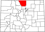
Towns Berthoud‡ | Estes Park | Johnstown‡ | Timnath | Wellington | Windsor‡
CDPs Unincorporated
communitiesBellvue | Buckeye | Campion | Drake | Glen Haven | Kinikinik | Livermore | Manhattan | Masonville | Waverly
Ghost towns Manhattan | Old Roach | Stout | Virginia Dale
Footnotes ‡This populated place also has portions in an adjacent county or counties
Categories:- National Register of Historic Places in Colorado by county
- Larimer County, Colorado
-


Wikimedia Foundation. 2010.