- National Register of Historic Places listings in Lawrence County, Mississippi
-
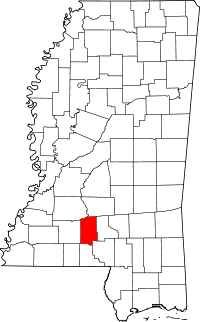 Location of Lawrence County in Mississippi
This is a list of the National Register of Historic Places listings in Lawrence County, Mississippi.
This is intended to be a complete list of the properties and districts on the National Register of Historic Places in Lawrence County, Mississippi, United States. Latitude and longitude coordinates are provided for many National Register properties and districts; these locations may be seen together in a Google map.[1]
There are 31 properties and districts listed on the National Register in the county.
-
- This National Park Service list is complete through NPS recent listings posted November 10, 2011.[2]
Current listings
[3] Landmark name [4] Image Date listed Location City or town Summary 1 Armstrong-Lee House September 29, 1980 Mississippi Highway 43
31°30′26″N 90°01′57″W / 31.507222°N 90.0325°WMonticello 2 Bahala Creek Bridge November 16, 1988 Spans Bahala Creek on a county road, southwest of Oma
31°42′17″N 90°12′00″W / 31.704722°N 90.2°WOma 3 Boyd-Cothern House September 29, 1980 West of Jayess
31°21′34″N 90°13′29″W / 31.359444°N 90.224722°WJayess 4 Buckley House September 29, 1980 West of New Hebron
31°44′09″N 90°00′13″W / 31.735833°N 90.003611°WNew Hebron 5 Bush House September 29, 1980 East of New Hebron on Mississippi Highway 42
31°43′36″N 89°58′49″W / 31.726667°N 89.980278°WNew Hebron 6 Cannon House September 29, 1980 Mississippi Highway 43
31°30′51″N 90°02′09″W / 31.514167°N 90.035833°WMonticello 7 Crane-Mason House September 29, 1980 Southwest of Monticello
31°29′09″N 90°14′24″W / 31.485833°N 90.24°WMonticello 8 Douglas House September 29, 1980 East of Sontag
31°38′53″N 90°10′30″W / 31.648056°N 90.175°WSontag 9 Fox House September 29, 1980 Northeast of Wanilla
31°39′14″N 90°07′34″W / 31.653889°N 90.126111°WWanilla 10 George Mound (22LW591) March 1, 1987 Address Restricted Oma 11 Gunnell House September 29, 1980 West of Topeka
31°25′35″N 90°14′25″W / 31.426389°N 90.240278°WJayess 12 Hilliard House September 29, 1980 Northeast of Wanilla
31°39′55″N 90°07′23″W / 31.665278°N 90.123056°WWanilla 13 Johnson-White House September 29, 1980 East of Sontag
31°38′52″N 90°11′06″W / 31.647778°N 90.185°WSontag 14 Knapp-Stephens House September 29, 1980 Southwest of New Hebron
31°39′02″N 90°01′28″W / 31.650556°N 90.024444°WNew Hebron 15 Lawrence County Courthouse 
March 4, 1993 Northern side of Broad St. between Jefferson and Washington Sts.
31°33′14″N 90°06′17″W / 31.553889°N 90.104722°WMonticello 16 Longino House August 21, 1972 Caswell St.
31°33′13″N 90°06′10″W / 31.553611°N 90.102778°WMonticello 17 Lowe-Steen Site (22LW511) March 1, 1987 Address Restricted Monticello 18 Mill Creek Site June 9, 1978 Address Restricted Monticello 19 Monticello Consolidated School July 9, 1991 125 E. Broad St.
31°33′14″N 90°06′29″W / 31.553889°N 90.108056°WMonticello 20 New Orleans Great Northern Railroad Depot October 31, 1995 Bounded by Mississippi Highway 84 and the former Gulf, Mobile and Ohio railroad tracks
31°33′19″N 90°06′45″W / 31.555278°N 90.1125°WMonticello 21 Newsom-Lane House September 29, 1980 Mississippi Highway 43
31°43′15″N 89°59′01″W / 31.720833°N 89.983611°WNew Hebron 22 Newsom-Smith House September 29, 1980 Mississippi Highway 43
31°44′26″N 89°58′42″W / 31.740556°N 89.978333°WNew Hebron 23 Price-Stephens House September 29, 1980 Mississippi Highway 43
31°40′01″N 90°03′28″W / 31.666944°N 90.057778°WNew Hebron 24 River Road March 11, 2011 Between Mississippi Highway 43 and Conerly Rd.
31°28′19″N 90°01′46″W / 31.471944°N 90.029444°WOak Vale vicinity 25 Robbins House September 29, 1980 East of Topeka
31°24′51″N 90°06′15″W / 31.414167°N 90.104167°WJayess 26 Rogers House September 29, 1980 South of Silver Creek
31°32′47″N 90°00′05″W / 31.546389°N 90.001389°WSilver Creek 27 A.L. Smith House September 29, 1980 North of Monticello on Mississippi Highway 27
31°35′42″N 90°06′08″W / 31.595°N 90.102222°WMonticello 28 Stringer House September 29, 1980 Southwest of New Hebron
31°41′47″N 90°02′53″W / 31.696389°N 90.048056°WNew Hebron 29 June and Nora Thompson House July 27, 2005 Sutton Rd., 0.3 miles (0.48 km) north of its junction with Crooked Creek Rd.
31°43′37″N 90°01′15″W / 31.726944°N 90.020833°WNew Hebron 30 Tynes House September 29, 1980 East of Topeka
31°25′00″N 90°10′03″W / 31.416667°N 90.1675°WJayess 31 Wilson House September 29, 1980 Southwest of Monticello
31°29′16″N 90°13′56″W / 31.487778°N 90.232222°WMonticello See also
- List of National Historic Landmarks in Mississippi
- National Register of Historic Places listings in Mississippi
References
- ^ The latitude and longitude information provided in this table was derived originally from the National Register Information System, which has been found to be fairly accurate for about 99% of listings. For about 1% of NRIS original coordinates, experience has shown that one or both coordinates are typos or otherwise extremely far off; some corrections may have been made. A more subtle problem causes many locations to be off by up to 150 yards, depending on location in the country: most NRIS coordinates were derived from tracing out latitude and longitudes off of USGS topographical quadrant maps created under the North American Datum of 1927, which differs from the current, highly accurate WGS84 GPS system used by Google maps. Chicago is about right, but NRIS longitudes in Washington are higher by about 4.5 seconds, and are lower by about 2.0 seconds in Maine. Latitudes differ by about 1.0 second in Florida. Some locations in this table may have been corrected to current GPS standards.
- ^ "National Register of Historic Places: Weekly List Actions". National Park Service, United States Department of the Interior. Retrieved on November 10, 2011.
- ^ Numbers represent an ordering by significant words. Various colorings, defined here, differentiate National Historic Landmark sites and National Register of Historic Places Districts from other NRHP buildings, structures, sites or objects.
- ^ "National Register Information System". National Register of Historic Places. National Park Service. . http://nrhp.focus.nps.gov/natreg/docs/All_Data.html.
U.S. National Register of Historic Places Topics Lists by states Alabama • Alaska • Arizona • Arkansas • California • Colorado • Connecticut • Delaware • Florida • Georgia • Hawaii • Idaho • Illinois • Indiana • Iowa • Kansas • Kentucky • Louisiana • Maine • Maryland • Massachusetts • Michigan • Minnesota • Mississippi • Missouri • Montana • Nebraska • Nevada • New Hampshire • New Jersey • New Mexico • New York • North Carolina • North Dakota • Ohio • Oklahoma • Oregon • Pennsylvania • Rhode Island • South Carolina • South Dakota • Tennessee • Texas • Utah • Vermont • Virginia • Washington • West Virginia • Wisconsin • WyomingLists by territories Lists by associated states Other Municipalities and communities of Lawrence County, Mississippi Towns 
Unincorporated
communitiesJayess | Nola | Oak Vale‡ | Oma | Sontag
Footnotes ‡This community also has portions in adjacent county or counties
Categories:- Lawrence County, Mississippi
- National Register of Historic Places in Mississippi by county
- Buildings and structures in Lawrence County, Mississippi
-


Wikimedia Foundation. 2010.