- National Register of Historic Places listings in Lewis and Clark County, Montana
-
 Location of Lewis and Clark County in Montana
This is a list of the National Register of Historic Places listings in Lewis and Clark County, Montana.
This is intended to be a complete list of the properties and districts on the National Register of Historic Places in Lewis and Clark County, Montana, United States. The locations of National Register properties and districts for which the latitude and longitude coordinates are included below, may be seen in a Google map.[1]
There are 63 properties and districts listed on the National Register in the county.
-
- This National Park Service list is complete through NPS recent listings posted November 10, 2011.[2]
Current listings
[3] Landmark name Image Date listed Location City or town Summary 1 Algeria Shrine Temple April 14, 1988 Neill and Park Aves.
46°35′43″N 112°02′21″W / 46.595278°N 112.039167°WHelena 2 Alice Creek Historic District June 6, 2007 Helena National Forest
47°8′22″N 112°27′30″W / 47.13944°N 112.45833°W[4]Lincoln 3 Appleton House No. 9 November 7, 1995 1999 Euclid Ave.
46°36′20″N 112°03′52″W / 46.605556°N 112.064444°WHelena 4 Appleton House No. 13 October 25, 1982 2200 Cannon
46°36′24″N 112°04′05″W / 46.606667°N 112.068056°WHelena 5 Joshua and Martha Armitage House May 10, 2005 1117 E. Broadway
46°35′04″N 112°01′13″W / 46.584444°N 112.020278°WHelena 6 Benton Avenue Cemetery July 24, 2003 1800 N. Benton Ave.
46°36′16″N 112°02′31″W / 46.604444°N 112.041944°WHelena 7 Charles A. Broadwater House August 27, 2008 1104 Williams St.
46°36′21″N 112°05′19″W / 46.605703°N 112.088561°WHelena 8 Cathedral of Saint Helena 
April 30, 1980 530 N. Ewing St.
46°35′25″N 112°01′57″W / 46.590278°N 112.0325°WHelena 9 Childs Carriage House November 7, 1995 318 E. 6th Ave.
46°35′15″N 112°02′00″W / 46.5875°N 112.033333°WHelena 10 William C. Crum House May 30, 1997 535 5th Ave.
46°35′09″N 112°01′50″W / 46.585833°N 112.030556°WHelena 11 D.H. Cuthbert House May 4, 1995 602 N. Ewing
46°35′28″N 112°01′53″W / 46.591111°N 112.031389°WHelena 12 Dearborn River High Bridge 
December 18, 2003 15 miles southwest of Augusta on Bean Lake Rd.
47°16′52″N 112°23′25″W / 47.281111°N 112.390278°WAugusta 13 Donovan-Mayer House December 28, 2005 46 S. Howie St.
46°35′14″N 112°02′38″W / 46.587222°N 112.043889°WHelena 14 Eagle's Site October 7, 1993 Address Restricted Helena 15 Christmas Gift Evans House April 16, 1980 404 N. Benton Ave.
46°35′27″N 112°02′27″W / 46.590833°N 112.040833°WHelena 16 Robert and Elizabeth Fisk House January 17, 2007 319 N. Rodney St.
46°35′15″N 112°01′56″W / 46.5875°N 112.032222°WHelena 17 Forestvale Cemetery February 21, 1990 490 Forestvale Rd.
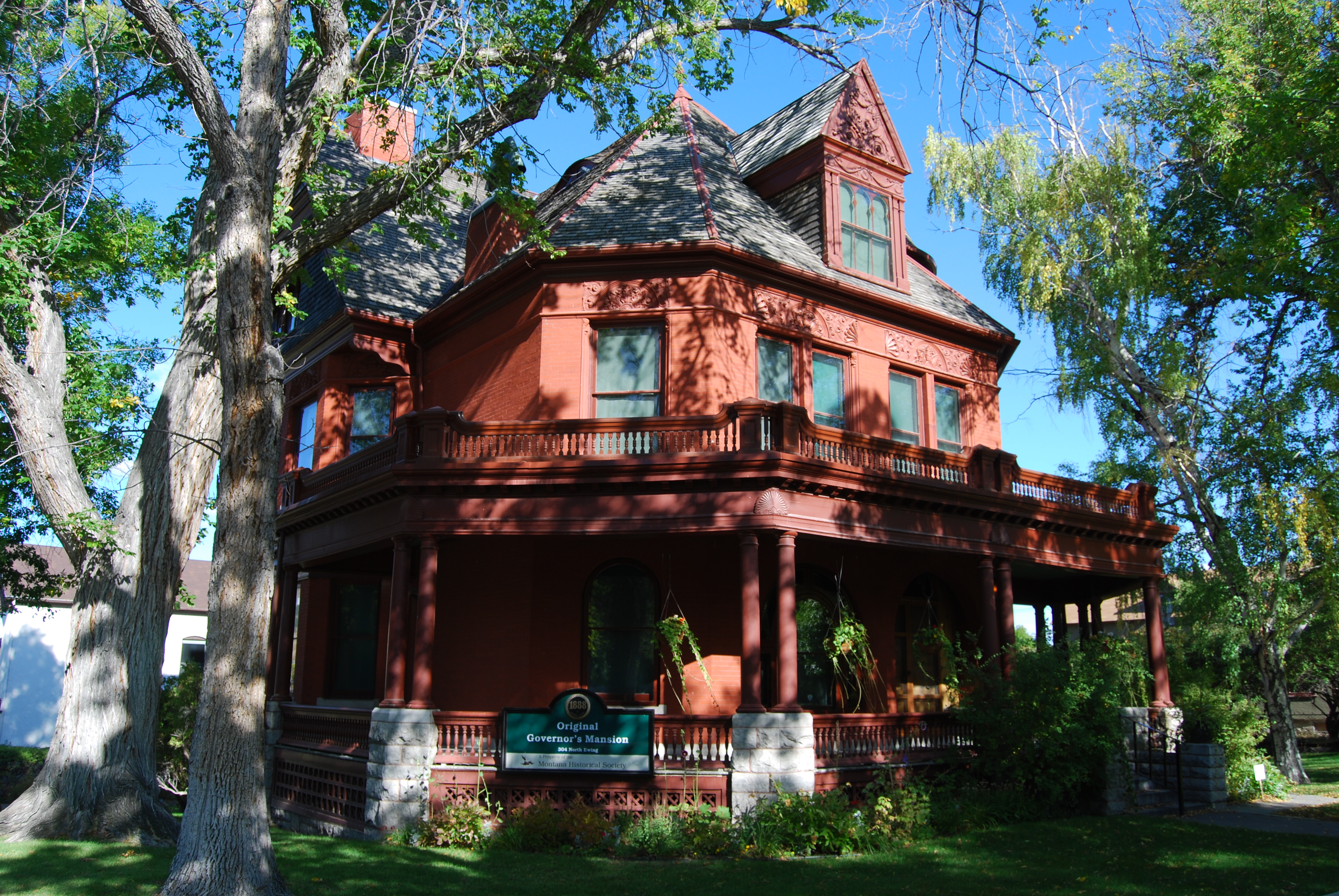
46°39′22″N 112°02′09″W / 46.656111°N 112.035833°WHelena 18 Former Montana Executive Mansion 
April 28, 1970 6th Ave. and Ewing St.
46°35′16″N 112°02′03″W / 46.587778°N 112.034167°WHelena 19 Gilman State Bank December 1, 1983 Main St.
47°30′35″N 112°21′34″W / 47.509722°N 112.359444°WGilman 20 Gilpatrick-Root House August 10, 2005 604 Dearborn Ave.
46°35′35″N 112°02′32″W / 46.593056°N 112.042222°WHelena 21 Hauser Mansion 
February 12, 1979 720 Madison Ave.
46°35′43″N 112°02′39″W / 46.595278°N 112.044167°WHelena 22 Helena Historic District 
June 2, 1972 Irregular pattern from Hauser Boulevard to Acropolis and between Garfield and Rodney Sts.; also roughly bounded by Cruse, Neill and Park Aves., and Lawrence; also bounded by E. 6th, N. Davis, Broadway, and N. Rodney Sts.
46°34′34″N 112°02′26″W / 46.576111°N 112.040556°WHelena Second and third sets of boundaries represent boundary increases, added on June 14, 1990 and October 7, 1993 23 Helena Railroad Depot Historic District December 15, 2004 Roughly bounded by Railroad and Helena Aves., Gallatin St., N. Sanders St., and N. Harris St.
46°35′58″N 112°00′52″W / 46.599444°N 112.014444°WHelena 24 Helena South-Central Historic District July 28, 1986 Roughly bounded by Broadway, S. Davis St., the city limits, and S. Warren St.
46°34′52″N 112°02′15″W / 46.581111°N 112.0375°WHelena 25 Helena West Main Street Historic District February 22, 1996 500-600 blocks of W. Main St.
46°34′43″N 112°03′03″W / 46.578611°N 112.050833°WHelena 26 Joe and Carrie Hilger Ranch August 31, 2001 Sleeping Giant Ranch, 20 miles north of Helena
46°49′30″N 111°57′44″W / 46.825°N 111.96222°W[5]Helena 27 Home of Peace May 24, 2006 Alexander St. between Brady St. and Custer Ave.
46°36′53″N 112°03′01″W / 46.614722°N 112.050278°WHelena 28 House of the Good Shepherd Historic District December 23, 1993 Area surrounding the junction of 9th Ave. and N. Hoback St.
46°35′15″N 112°01′30″W / 46.5875°N 112.025°WHelena 29 Herman Kemna House August 18, 1992 635 1st St.
46°34′47″N 112°01′45″W / 46.579722°N 112.029167°WHelena 30 T.H. Kleinschmidt House August 6, 1980 1823 Highland Ave.
46°34′58″N 112°00′25″W / 46.582778°N 112.006944°WHelena 31 Kluge House 
April 28, 1970 540 W. Main St.
46°35′22″N 111°55′47″W / 46.58948°N 111.9297°WHelena 32 Lewis and Clark County Hospital Historic District November 19, 2002 3404 Cooney Dr.
46°37′20″N 112°02′12″W / 46.622222°N 112.036667°WHelena 33 Lincoln Community Hall January 22, 1987 Montana Highway 200
46°57′20″N 112°41′11″W / 46.955556°N 112.686389°WLincoln 34 Lincoln Lodge October 23, 1986 Stemple Pass Rd.
46°57′23″N 112°40′50″W / 46.956389°N 112.680556°WLincoln 35 Mann Gulch Wildfire Historic District May 19, 1999 Mann Gulch, a tributary of the Missouri River
46°53′09″N 111°53′58″W / 46.885833°N 111.899444°WHelena 36 Methodist-Episcopal Church of Marysville January 5, 1984 3rd St.
46°45′05″N 112°17′58″W / 46.751389°N 112.299444°WMarysville 37 Missouri River Bridge January 4, 2010 Milepost 11 on Old U.S. Route 91
47°01′08″N 112°00′44″W / 47.018958°N 112.012114°WWolf Creek 38 Montana State Arsenal, Armory and Drill Hall February 14, 2002 1100 N. Main
46°35′54″N 112°01′55″W / 46.598219°N 112.031864°WHelena 39 Montana State Capitol Building 
February 17, 1981 Central Ave. and Main St.
46°35′09″N 112°01′12″W / 46.585833°N 112.02°WHelena 40 Montana State Fairgrounds Racetrack December 20, 2006 98 W. Custer Ave.
46°37′17″N 112°03′22″W / 46.621389°N 112.056111°WHelena 41 Montana Veterans and Pioneers Memorial Building December 15, 2004 225 N. Roberts
46°35′11″N 112°00′55″W / 46.586389°N 112.015278°WHelena 42 Mount Helena Historic District January 9, 1997 Promontory roughly bounded by LeGrande Canon Boulevard, Last Chance and Grizzly Gulches, and the Helena National Forest boundary
46°35′15″N 112°03′28″W / 46.5875°N 112.057778°WHelena 43 John T. Murphy House August 1, 1984 418 N. Benton Ave.
46°35′28″N 112°02′25″W / 46.591111°N 112.040278°WHelena 44 Olsen House March 22, 1991 516 N. Park
46°35′33″N 112°02′23″W / 46.5925°N 112.039722°WHelena 45 Francis and Hannah Pope House June 27, 2007 327 N. Rodney
46°35′16″N 112°01′55″W / 46.587778°N 112.031944°WHelena 46 Porter Flats Apartments January 14, 1993 335 N. Ewing St.
46°35′15″N 112°02′02″W / 46.5875°N 112.033889°WHelena 47 C.B. Power Bungalow April 7, 1995 1.2 miles north of Interstate 15 and 1 mile west of U.S. Route 287
47°02′48″N 112°03′52″W / 47.046667°N 112.064444°WWolf Creek 48 Thomas P. Regan Cabin January 8, 2003 McDonald Pass
46°34′42″N 112°18′12″W / 46.578333°N 112.303333°WHelena 49 Sheep Creek Bridge April 28, 2011 Milepost 5 on Recreation Rd.
46°58′39″N 112°04′53″W / 46.9775°N 112.081389°WWolf Creek vicinity (Reinforced Concrete Bridges in Montana, 1900-1958 MPS 50 Silver Creek School August 11, 1980 North of Helena on Sierra Rd.
46°39′37″N 112°00′27″W / 46.660278°N 112.0075°WHelena 51 Silver King Ranch March 10, 1992 Roughly 15 miles northeast of Lincoln in the Helena National Forest
47°04′26″N 112°33′30″W / 47.073889°N 112.558333°WLincoln 52 Morris Silverman House June 14, 1982 412 N. Rodney St.
46°35′20″N 112°01′52″W / 46.588889°N 112.031111°WHelena 53 Spalding-Gunn House December 27, 2006 433 Clarke St.
46°35′29″N 112°02′41″W / 46.591389°N 112.044722°WHelena 54 Stearns Hall April 7, 1995 2 miles north of the junction of Montana Highways 200 and 434
47°12′27″N 112°16′33″W / 47.2075°N 112.275833°WWolf Creek 55 Stedman Foundry and Machine Company April 4, 1996 2650 Euclid Ave.
46°36′32″N 112°04′30″W / 46.608889°N 112.075°WHelena 56 Summit Lodge May 17, 1990 30 miles northwest of Helena in the Helena National Forest
46°47′50″N 112°27′11″W / 46.797222°N 112.453056°WHelena 57 Temple Emanu-El July 11, 2002 515 N. Ewing St.
46°35′24″N 112°01′54″W / 46.59°N 112.031667°WHelena 58 Wassweiler Hotel and Bath Houses August 1, 1978 West of Helena on U.S. Route 12
46°35′51″N 112°06′18″W / 46.5975°N 112.105°WHelena 59 Western Clay Manufacturing Company May 9, 1985 2915 Country Club Rd.
46°36′53″N 112°04′53″W / 46.614722°N 112.081389°WHelena 60 Wick-Seiler House August 2, 2000 729 11th Ave.
46°35′22″N 112°01′38″W / 46.589444°N 112.027222°WHelena 61 Williams Street Bridge November 29, 2006 Williams St. crossing Ten Mile Creek, north of the junction of Williams St. and Broadwater Ave.
46°36′19″N 112°05′14″W / 46.605278°N 112.087222°WHelena 62 Wolf Creek Hotel November 7, 1997 Junction of Main St. and Bissonmett St.
47°00′23″N 112°04′09″W / 47.006389°N 112.069167°WWolf Creek 63 Young Women's Christian Association (Independent) December 27, 1984 501 N. Park St.
46°35′49″N 112°02′35″W / 46.596944°N 112.043056°WHelena See also
- List of National Historic Landmarks in Montana
- National Register of Historic Places listings in Montana
References
- ^ The latitude and longitude information provided in this table was derived originally from the National Register Information System, which has been found to be fairly accurate for about 99% of listings. For about 1% of NRIS original coordinates, experience has shown that one or both coordinates are typos or otherwise extremely far off; some corrections may have been made. A more subtle problem causes many locations to be off by up to 150 yards, depending on location in the country: most NRIS coordinates were derived from tracing out latitude and longitudes off of USGS topographical quadrant maps created under the North American Datum of 1927, which differs from the current, highly accurate WGS84 GPS system used by Google maps. Chicago is about right, but NRIS longitudes in Washington are higher by about 4.5 seconds, and are lower by about 2.0 seconds in Maine. Latitudes differ by about 1.0 second in Florida. Some locations in this table may have been corrected to current GPS standards.
- ^ "National Register of Historic Places: Weekly List Actions". National Park Service, United States Department of the Interior. Retrieved on November 10, 2011.
- ^ Numbers represent an ordering by significant words. Various colorings, defined here, differentiate National Historic Landmark sites and National Register of Historic Places Districts from other NRHP buildings, structures, sites or objects.
- ^ Coordinates derived from the GNIS feature record for the Alice Creek Ranger Cabin
- ^ Coordinates derived from its GNIS feature record
U.S. National Register of Historic Places Topics Lists by states Alabama • Alaska • Arizona • Arkansas • California • Colorado • Connecticut • Delaware • Florida • Georgia • Hawaii • Idaho • Illinois • Indiana • Iowa • Kansas • Kentucky • Louisiana • Maine • Maryland • Massachusetts • Michigan • Minnesota • Mississippi • Missouri • Montana • Nebraska • Nevada • New Hampshire • New Jersey • New Mexico • New York • North Carolina • North Dakota • Ohio • Oklahoma • Oregon • Pennsylvania • Rhode Island • South Carolina • South Dakota • Tennessee • Texas • Utah • Vermont • Virginia • Washington • West Virginia • Wisconsin • WyomingLists by territories Lists by associated states Other Municipalities and communities of Lewis and Clark County, Montana City 
Town CDPs Unincorporated
communitiesCraig | Marysville | Wolf Creek
Categories:- National Register of Historic Places in Montana by county
- Lewis and Clark County, Montana
-


Wikimedia Foundation. 2010.