- National Register of Historic Places listings in Logan County, Colorado
-
 Location of Logan County in Colorado
This is a list of the National Register of Historic Places listings in Logan County, Colorado. It is intended to be a complete list of the properties and districts on the National Register of Historic Places in Logan County, Colorado, United States. The locations of National Register properties and districts for which the latitude and longitude coordinates are included below, may be seen in a Google map.[1]
There are 10 properties and districts listed on the National Register in the county.
-
- This National Park Service list is complete through NPS recent listings posted November 10, 2011.[2]
Listings county-wide
[3] Landmark name [4] Image Date listed Location City or town Summary 1 First United Presbyterian Church 
June 3, 1982 130 S. 4th St.
40°37′25″N 103°12′37″W / 40.623611°N 103.210278°WSterling 2 W.C. Harris House 
May 17, 1984 102 Taylor St.
40°37′08″N 103°12′38″W / 40.618889°N 103.210556°WSterling 3 I and M Building 
June 3, 1982 223 Main St.
40°37′25″N 103°12′28″W / 40.623611°N 103.207778°WSterling 4 Logan County Courthouse 
February 28, 1979 Main St.
40°37′25″N 103°12′32″W / 40.623611°N 103.208889°WSterling 5 Conrad Luft, Sr. House 
May 17, 1984 1429 State Highway 14
40°37′29″N 103°14′03″W / 40.624722°N 103.234167°WSterling 6 Powell and Blair Stone Ranch April 6, 2004 Approximately 1 mile north of the junction of U.S. Route 138 and 65 Rd.
40°48′55″N 102°57′03″W / 40.815278°N 102.950833°WProctor 7 St. Anthony's Roman Catholic Church 
June 3, 1982 329 S. 3rd St.
40°37′14″N 103°12′36″W / 40.620556°N 103.21°WSterling 8 Sterling Public Library 
October 20, 2001 210 S. 4th St.
40°37′23″N 103°12′38″W / 40.623056°N 103.210556°WSterling 9 Sterling Union Pacific Railroad Depot 
February 6, 1986 113 N. Front St.
40°37′29″N 103°12′15″W / 40.624722°N 103.204167°WSterling 10 US Post Office, Federal Building, and Federal Courthouse-Sterling Main 
January 22, 1986 3rd and Popular Sts.
40°37′29″N 103°12′27″W / 40.624722°N 103.2075°WSterling See also
- List of National Historic Landmarks in Colorado
- National Register of Historic Places listings in Colorado
References
- ^ The latitude and longitude information provided in this table was derived originally from the National Register Information System, which has been found to be fairly accurate for about 99% of listings. For about 1% of NRIS original coordinates, experience has shown that one or both coordinates are typos or otherwise extremely far off; some corrections may have been made. A more subtle problem causes many locations to be off by up to 150 yards, depending on location in the country: most NRIS coordinates were derived from tracing out latitude and longitudes off of USGS topographical quadrant maps created under North American Datum of 1927, which differs from the current, highly accurate GPS system used by Google maps. Chicago is about right, but NRIS longitudes in Washington are higher by about 4.5 seconds, and are lower by about 2.0 seconds in Maine. Latitudes differ by about 1.0 second in Florida. Some locations in this table may have been corrected to current GPS standards.
- ^ "National Register of Historic Places: Weekly List Actions". National Park Service, United States Department of the Interior. Retrieved on November 10, 2011.
- ^ Numbers represent an ordering by significant words. Various colorings, defined here, differentiate National Historic Landmark sites and National Register of Historic Places Districts from other NRHP buildings, structures, sites or objects.
- ^ "National Register Information System". National Register of Historic Places. National Park Service. . http://nrhp.focus.nps.gov/natreg/docs/All_Data.html.
U.S. National Register of Historic Places Topics Lists by states Alabama • Alaska • Arizona • Arkansas • California • Colorado • Connecticut • Delaware • Florida • Georgia • Hawaii • Idaho • Illinois • Indiana • Iowa • Kansas • Kentucky • Louisiana • Maine • Maryland • Massachusetts • Michigan • Minnesota • Mississippi • Missouri • Montana • Nebraska • Nevada • New Hampshire • New Jersey • New Mexico • New York • North Carolina • North Dakota • Ohio • Oklahoma • Oregon • Pennsylvania • Rhode Island • South Carolina • South Dakota • Tennessee • Texas • Utah • Vermont • Virginia • Washington • West Virginia • Wisconsin • WyomingLists by territories Lists by associated states Other Municipalities and communities of Logan County, Colorado City 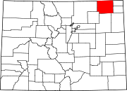
Towns CDPs Unincorporated
communityCategories:- National Register of Historic Places in Colorado by county
- Logan County, Colorado
- Buildings and structures in Logan County, Colorado
-


Wikimedia Foundation. 2010.