- National Register of Historic Places listings in Lucas County, Ohio
-
 Location of Lucas County in Ohio
This is a list of the National Register of Historic Places listings in Lucas County, Ohio.
This is intended to be a complete list of the properties and districts on the National Register of Historic Places in Lucas County, Ohio, United States. The locations of National Register properties and districts for which the latitude and longitude coordinates are included below, may be seen in a Google map.[1]
There are 85 properties and districts listed on the National Register in the county, including 3 National Historic Landmarks.
-
- This National Park Service list is complete through NPS recent listings posted November 10, 2011.[2]
Current listings
[3] Landmark name [4] Image Date listed Location City or town Summary 1 Ashland Avenue Baptist Church November 26, 1980 Ashland and Woodruff Sts.
41°39′38″N 83°32′59″W / 41.660556°N 83.549722°WToledo 2 B'nai Israel Synagogue October 6, 2005 2146 N. 12th St. at Bancroft St.
41°39′50″N 83°32′23″W / 41.663889°N 83.539722°WToledo 3 Berdan Building May 29, 1975 601 Washington St.
41°38′54″N 83°32′27″W / 41.648333°N 83.540833°WToledo 4 Birckhead Place Historic District October 13, 1983 Birckhead Pl.
41°40′33″N 83°32′43″W / 41.675833°N 83.545278°WToledo 5 Birmingham Historic District August 8, 1996 Roughly bounded by Genesee, York, Esther, Magyar, Consaul, and the Conrail tracks
41°39′42″N 83°29′47″W / 41.661667°N 83.496389°WToledo 6 R. Brand and Company 
May 27, 1975 120-124 St. Clair St.
41°38′57″N 83°32′10″W / 41.649167°N 83.536111°WToledo 7 Brandville School June 17, 1994 1133 Grasser St.
41°37′49″N 83°29′18″W / 41.630278°N 83.488333°WOregon 8 Bronson Place November 29, 1984 Roughly bounded by Cherry St. and Central and Franklin Aves.
41°40′39″N 83°32′50″W / 41.6775°N 83.547222°WToledo 9 Burt's Theater November 1, 1977 719-723 Jefferson St.
41°39′06″N 83°32′23″W / 41.651667°N 83.539722°WToledo 10 Bush Street Historic District June 1, 1982 Bush and Erie Sts.
41°39′51″N 83°31′13″W / 41.664167°N 83.520278°WToledo 11 Central YMCA April 15, 1982 1110 Jefferson Ave.
41°39′13″N 83°32′34″W / 41.653611°N 83.542778°WToledo 12 Columbian House 
December 17, 1969 River and Farnsworth Rds.
41°29′58″N 83°43′03″W / 41.499444°N 83.7175°WWaterville 13 Commodore Perry Hotel October 24, 1997 505 Jefferson Ave.
41°39′01″N 83°32′15″W / 41.650278°N 83.5375°WToledo 14 East Side Commercial Block May 3, 1976 107-117 Main St.
41°38′53″N 83°31′22″W / 41.648056°N 83.522778°WToledo 15 East Toledo Historic District August 8, 1996 Roughly bounded by Front, Platt, Starr, and Spring Grove
41°38′35″N 83°30′48″W / 41.643056°N 83.513333°WToledo 16 Eckenrode and Breisach Houses April 6, 1978 202 and 204 E. Dudley St.
41°33′48″N 83°39′06″W / 41.563333°N 83.651667°WMaumee 17 Englewood Historic District May 29, 1998 Roughly bounded by W. Bancroft, Lawrence, Oakwood, Hoag, and Detroit Sts.
41°39′48″N 83°34′11″W / 41.663333°N 83.569722°WToledo 18 Fallen Timbers Battlefield 
October 15, 1966 2 mi (3.2 km) west of Maumee on U.S. Route 24
41°32′39″N 83°41′51″W / 41.544167°N 83.6975°WMonclova Township 19 First Church of Christ, Scientist November 29, 1978 2704 Monroe St.
41°39′42″N 83°33′56″W / 41.661667°N 83.565556°WToledo 20 First Presbyterian Church of Maumee Chapel August 13, 1973 200 E. Broadway
41°33′41″N 83°39′02″W / 41.561389°N 83.650556°WMaumee 21 Forsythe-Puhl House May 18, 1989 106 E. Harrison Ave.
41°33′36″N 83°39′08″W / 41.56°N 83.652222°WMaumee 22 Fort Industry Square July 23, 1973 Bounded by Summit, Monroe, and Water Sts. and Jefferson Ave.
41°38′55″N 83°32′20″W / 41.648611°N 83.538889°WToledo 23 Fort Miamis Site June 18, 1975 Along the Maumee River at Fort Miamis State Memorial
41°34′21″N 83°37′34″W / 41.5725°N 83.62611°W[5]Maumee 24 Peter Gendron House March 3, 1983 1413 Walnut St.
41°39′49″N 83°32′09″W / 41.663611°N 83.535833°WToledo 25 Gillett-Shoemaker-Welsh House July 18, 1975 133 N. 4th St.
41°30′07″N 83°43′16″W / 41.501944°N 83.721111°WWaterville 26 Governor's Inn October 18, 1974 301 River Rd.
41°33′52″N 83°38′46″W / 41.564444°N 83.646111°WMaumee 27 Peck Griswold House May 22, 1978 228 E. Broadway
41°33′46″N 83°38′51″W / 41.562778°N 83.6475°WMaumee 28 Hanson House May 22, 1978 405 E. Broadway
41°33′42″N 83°39′01″W / 41.561667°N 83.650278°WMaumee 29 Liberty Whitcomb Haskins House July 1, 1975 North of Waterville at 625 Canal Rd.
41°30′33″N 83°43′10″W / 41.509167°N 83.719444°WWaterville 30 Hillcrest Hotel September 18, 1998 1603 Madison Ave.
41°39′19″N 83°32′50″W / 41.655278°N 83.547222°WToledo 31 House Of Four Pillars July 16, 1973 322 E. Broadway
41°33′42″N 83°39′36″W / 41.561667°N 83.66°WMaumee 32 Isaac Hull Store March 30, 1978 114 E. Harrison St.
41°33′37″N 83°39′04″W / 41.560278°N 83.651111°WMaumee 33 Hull-Wolcott House 
January 26, 1970 1031 River Rd.
41°34′20″N 83°38′21″W / 41.572222°N 83.639167°WMaumee 34 Huron-Superior Streets Warehouse-Produce Historic District March 24, 1993 Roughly bounded by Erie, Monroe, Superior and Market Sts.
41°38′49″N 83°32′28″W / 41.646944°N 83.541111°WToledo 35 Interurban Bridge 
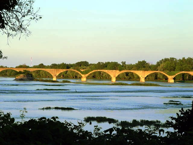
June 19, 1972 1 mi (1.6 km) south of Waterville over the Maumee River
41°29′11″N 83°43′42″W / 41.486389°N 83.728333°WWaterville Extends into Wood County 36 Inverness Club May 10, 1993 4601 Dorr St.
41°38′47″N 83°39′01″W / 41.646389°N 83.650278°WToledo 37 Ira Apartments August 15, 1996 1302 Parkside Boulevard
41°39′10″N 83°35′38″W / 41.652778°N 83.593889°WToledo Demolished in mid-February 2007[6] 38 John Isham Farmstead September 16, 1992 8460 S. River Rd.
41°29′13″N 83°44′43″W / 41.486944°N 83.745278°WWaterville 39 John Isham House August 9, 1982 8460 S. River Rd.
41°28′53″N 83°45′03″W / 41.481389°N 83.750833°WWaterville 40 Lasalle, Koch and Company Department Store August 4, 1995 513 Adams St. at its junction with Huron St.
41°39′11″N 83°32′08″W / 41.653056°N 83.535556°WToledo 41 Edward D. Libbey House May 4, 1983 2008 Scottwood Ave.
41°38′32″N 83°33′29″W / 41.642222°N 83.558056°WToledo 42 Edward Drummond Libbey High School September 15, 2011 1250 Western Ave.
41°38′07″N 83°34′17″W / 41.635278°N 83.571389°WToledo 43 Lucas County Courthouse and Jail 
May 11, 1973 Courthouse Sq. and 810-814 Jackson
41°39′19″N 83°32′14″W / 41.655278°N 83.537222°WToledo 44 Lucas County Hospital and Nurse's Home October 17, 1997 2101 and 2155 Arlington Ave.
41°37′21″N 83°35′44″W / 41.6225°N 83.595556°WToledo 45 Isaac R. Ludwig Historical Mill 
June 28, 1974 Mill Rd. in Providence Park
41°24′55″N 83°51′45″W / 41.415278°N 83.8625°WProvidence Township 46 Madison Avenue Historic District June 26, 1998 Roughly bounded by Madison, Adams and Huron Sts.
41°39′43″N 83°32′29″W / 41.661944°N 83.541389°WToledo 47 Maumee Sidecut April 11, 1973 North of the Maumee River, southwest of Ewing Island
41°33′30″N 83°39′36″W / 41.558333°N 83.66°WMaumee 48 Maumee Theater April 1, 1998 601 Conant St.
41°33′53″N 83°39′19″W / 41.564722°N 83.655278°WMaumee 49 Maumee Uptown Historic District March 1, 1984 Conant, Wayne, and Dudley Sts.
41°33′44″N 83°39′15″W / 41.562222°N 83.654167°WMaumee 50 Monroe Street Commercial Buildings December 12, 1976 513-623 Monroe St.
41°38′57″N 83°32′23″W / 41.649167°N 83.539722°WToledo 51 Morehouse-Downes House May 29, 1975 4 S. River Rd.
41°29′56″N 83°43′03″W / 41.498889°N 83.7175°WWaterville 52 Albert Neukom House March 4, 1971 301 Broadway
41°37′55″N 83°32′27″W / 41.631944°N 83.540833°WToledo 53 Ohio Theatre March 29, 2006 3114 Lagrange St.
41°40′45″N 83°32′26″W / 41.679167°N 83.540556°WToledo 54 Old Central Post Office February 23, 1972 13th St. between Madison and Jefferson Aves.
41°39′17″N 83°32′39″W / 41.654722°N 83.544167°WToledo 55 Old West End District 
March 14, 1973 Roughly bounded by Delaware, Collingwood, and Glenwood Aves. and Grove Pl.; also roughly bounded by Glenwood, Glover, Ashland, Collingwood, and Central Aves.
41°39′45″N 83°36′41″W / 41.6625°N 83.611389°WToledo Second set of boundaries represents a boundary increase of March 30, 1984 56 Pray-Starkweather House May 29, 1975 144 N. River Rd.
41°30′05″N 83°43′00″W / 41.501389°N 83.716667°WWaterville 57 Providence Historic District 
August 13, 1975 Court and Main Sts. and Ludwig and Providence-Neopolis Rds. in Providence
41°25′07″N 83°52′24″W / 41.418611°N 83.873333°WProvidence Township 58 Pythian Castle February 23, 1972 801 Jefferson Ave.
41°39′08″N 83°32′25″W / 41.652222°N 83.540278°WToledo 59 Henry Reed, Jr., House April 20, 1978 511-513 White St.
41°33′57″N 83°38′59″W / 41.565833°N 83.649722°WMaumee 60 Riverview Apartments April 21, 1983 1829-1837 Summit St.
41°39′57″N 83°30′39″W / 41.665833°N 83.510833°WToledo 61 St. Ann Roman Catholic Church Complex May 5, 1983 1105 W. Bancroft and 1120 Horace Sts.
41°39′47″N 83°34′13″W / 41.663056°N 83.570278°WToledo 62 St. Clair Street Historic District May 29, 1975 Both sides of St. Clair St. from Perry St. to the southern side of Lafayette St.
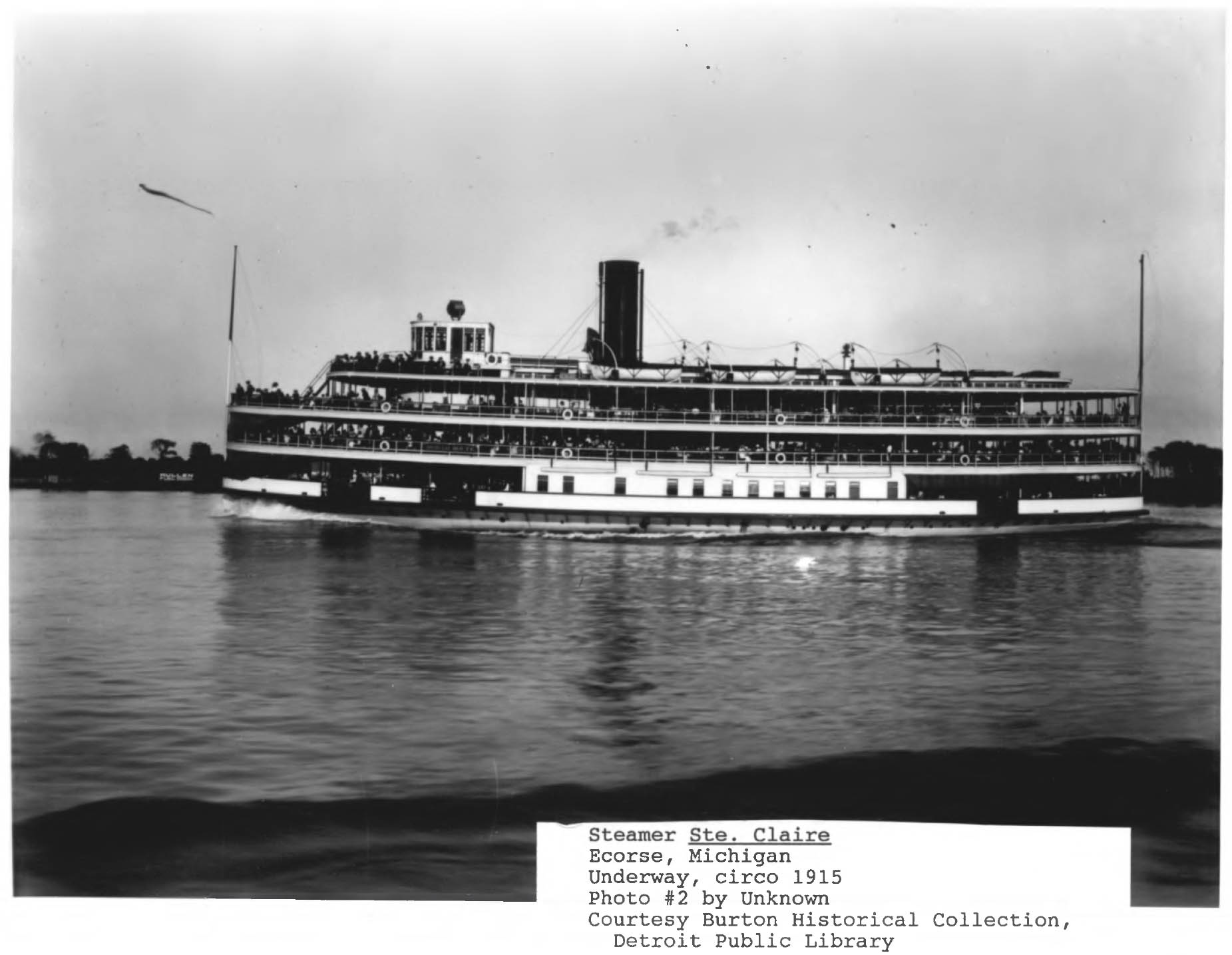
41°38′49″N 83°32′19″W / 41.646944°N 83.538611°WToledo 63 STE. CLAIRE (steamer) 
November 2, 1979 Toledo waterfront[7] Toledo 64 St. Patrick's Catholic Church 
February 23, 1972 13th St. and Avondale Ave.
41°38′56″N 83°32′45″W / 41.648889°N 83.545833°WToledo 65 Saint Peter and Saint Paul Historic District-Oliver's Second addition March 13, 1987 600 and 700 blocks of S. Saint Clair St.
41°38′20″N 83°32′55″W / 41.638889°N 83.548611°WToledo 66 Secor Hotel 
April 30, 1976 413-423 Jefferson Ave.
41°39′01″N 83°32′13″W / 41.650278°N 83.536944°WToledo 67 Joseph K. Secor House June 11, 1979 311 Bush St.
41°39′42″N 83°31′04″W / 41.661667°N 83.517778°WToledo 68 Spitzer Building 
April 21, 1983 514-526 Madison Ave.
41°39′08″N 83°32′11″W / 41.652222°N 83.536389°WToledo 69 Spring Grove Historic District August 8, 1996 Roughly bounded by Mason, Spring Grove, Greenwood, and Conrail tracks
41°39′04″N 83°30′26″W / 41.651111°N 83.507222°WToledo 70 Standart-Simmons Hardware Company May 29, 1975 36 S. Erie St.
41°38′53″N 83°32′32″W / 41.648056°N 83.542222°WToledo 71 Successful Sales May 6, 1971 27 Broadway
41°38′37″N 83°32′16″W / 41.643611°N 83.537778°WToledo 72 Toledo Club 
December 1, 1978 14th St. and Madison Ave.
41°39′20″N 83°32′40″W / 41.655556°N 83.544444°WToledo 73 Toledo Harbor Light 
August 4, 1983 Toledo Harbor
41°43′04″N 83°25′17″W / 41.717778°N 83.421389°WJerusalem Township 74 Toledo Olde Towne Historic District September 21, 1989 Roughly bounded by Central Ave., Cherry St., Franklin Ave., Bancroft St., and Collingwood Ave.
41°40′13″N 83°33′09″W / 41.670278°N 83.5525°WToledo 75 Toledo Traction Company Power Station June 19, 2003 300 Water St.
41°39′02″N 83°31′56″W / 41.650556°N 83.532222°WToledo 76 Toledo Yacht Club 
December 12, 1976 Bay View Park
41°41′35″N 83°28′32″W / 41.693056°N 83.475556°WToledo 77 Trinity Episcopal Church December 29, 1983 316 Adams St.
41°39′09″N 83°32′00″W / 41.6525°N 83.533333°WToledo 78 Valentine Theater Building May 19, 1987 405-419 Saint Clair and 402-412 Adams
41°39′11″N 83°32′00″W / 41.653056°N 83.533333°WToledo 79 Vistula Historic District December 6, 1978 Roughly bounded by Champlain, Summit, Walnut and Magnolia Sts.
41°39′35″N 83°31′38″W / 41.659722°N 83.527222°WToledo 80 Waterville Commercial District December 12, 1976 3rd St.
41°29′59″N 83°43′12″W / 41.499722°N 83.72°WWaterville 81 West Sister Island Light 
August 4, 1983 West Sister Island
41°44′13″N 83°06′38″W / 41.736944°N 83.110556°WJerusalem Township 82 Westmoreland Historic District February 3, 1986 Roughly bounded by Parkside Boulevard, Bancroft St., Upton Ave., and Oakwood Ave. and Allenby Rd.
41°39′35″N 83°35′29″W / 41.659722°N 83.591389°WToledo 83 Woodlawn Cemetery November 19, 1998 1502 W. Central Ave.
41°40′53″N 83°34′46″W / 41.681389°N 83.579444°WToledo 84 Dr. John A. Wright House October 5, 1978 1822 Cherry St.
41°39′56″N 83°32′21″W / 41.665556°N 83.539167°WToledo 85 Yondota Historic District August 8, 1996 Roughly bounded by Oak, 2nd, Euclid, Starr, White, Delence, and Nevada
41°38′30″N 83°31′09″W / 41.641667°N 83.519167°WToledo See also
References
- ^ The latitude and longitude information provided in this table was derived originally from the National Register Information System, which has been found to be fairly accurate for about 99% of listings. For about 1% of NRIS original coordinates, experience has shown that one or both coordinates are typos or otherwise extremely far off; some corrections may have been made. A more subtle problem causes many locations to be off by up to 150 yards, depending on location in the country: most NRIS coordinates were derived from tracing out latitude and longitudes off of USGS topographical quadrant maps created under the North American Datum of 1927, which differs from the current, highly accurate WGS84 GPS system used by Google maps. Chicago is about right, but NRIS longitudes in Washington are higher by about 4.5 seconds, and are lower by about 2.0 seconds in Maine. Latitudes differ by about 1.0 second in Florida. Some locations in this table may have been corrected to current GPS standards.
- ^ "National Register of Historic Places: Weekly List Actions". National Park Service, United States Department of the Interior. Retrieved on November 10, 2011.
- ^ Numbers represent an ordering by significant words. Various colorings, defined here, differentiate National Historic Landmark sites and National Register of Historic Places Districts from other NRHP buildings, structures, sites or objects.
- ^ "National Register Information System". National Register of Historic Places. National Park Service. . http://nrhp.focus.nps.gov/natreg/docs/All_Data.html.
- ^ Location derived from its GNIS feature record; the NRIS lists the site as "Address Restricted"
- ^ Stiegel, Bob. Will something replace Ira Apartments, Toledo Journal via ZoomInfo.com, 2007-02-20. Accessed 2009-07-26.
- ^ Listed on the NRHP in Detroit, but now in Toledo, according to its NHL profile.
National Register of Historic Places in Ohio Lists by county Adams • Allen • Ashland • Ashtabula • Athens • Auglaize • Belmont • Brown • Butler • Carroll • Champaign • Clark • Clermont • Clinton • Columbiana • Coshocton • Crawford • Cuyahoga • Darke • Defiance • Delaware • Erie • Fairfield • Fayette • Franklin • Fulton • Gallia • Geauga • Greene • Guernsey • Hamilton • Hancock • Hardin • Harrison • Henry • Highland • Hocking • Holmes • Huron • Jackson • Jefferson • Knox • Lake • Lawrence • Licking • Logan • Lorain • Lucas • Madison • Mahoning • Marion • Medina • Meigs • Mercer • Miami • Monroe • Montgomery • Morgan • Morrow • Muskingum • Noble • Ottawa • Paulding • Perry • Pickaway • Pike • Portage • Preble • Putnam • Richland • Ross • Sandusky • Scioto • Seneca • Shelby • Stark • Summit • Trumbull • Tuscarawas • Union • Van Wert • Vinton • Warren • Washington • Wayne • Williams • Wood • Wyandot
Lists by city Other lists Municipalities and communities of Lucas County, Ohio Cities 
Villages Berkey | Harbor View | Holland | Ottawa Hills | Swanton‡ | Waterville | Whitehouse
Townships Harding | Jerusalem | Monclova | Providence | Richfield | Spencer | Springfield | Swanton | Sylvania | Washington | Waterville
Unincorporated
communitiesCurtice | Hopewell Heights | Monclova | Neapolis | Providence | Ryan
Footnotes ‡This populated place also has portions in an adjacent county or counties
Categories:- National Register of Historic Places in Ohio by county
- Lucas County, Ohio
-


Wikimedia Foundation. 2010.