- National Register of Historic Places listings in Marion County, South Carolina
-
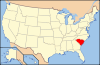
 Location of Marion County in South Carolina
This is a list of the National Register of Historic Places listings in Marion County, South Carolina.
This is intended to be a complete list of the properties and districts on the National Register of Historic Places in Marion County, South Carolina, United States. The locations of National Register properties and districts for which the latitude and longitude coordinates are included below, may be seen in a Google map.[1]
There are 14 properties and districts listed on the National Register in the county, including 2 National Historic Landmarks.
-
- This National Park Service list is complete through NPS recent listings posted November 10, 2011.[2]
Current listings
[3] Landmark name [4] Image Date listed Location City or town Summary 1 A.H. Buchan Company Building August 3, 1984 Laurel St.
34°12′13″N 79°15′12″W / 34.203611°N 79.253333°WMullins 2 Dew Barn August 3, 1984 Northwest of Zion
34°17′04″N 79°21′29″W / 34.284444°N 79.358056°WZion 3 Dillard Barn September 28, 2005 719 Virginia Dr.
34°10′04″N 79°14′09″W / 34.167778°N 79.235833°WMullins 4 Imperial Tobacco Company Building August 3, 1984 416 N. Mullins St.
34°12′21″N 79°15′00″W / 34.205833°N 79.25°WMullins 5 Liberty Warehouse August 3, 1984 Park St.
34°12′10″N 79°15′03″W / 34.202778°N 79.250833°WMullins 6 Marion High School June 6, 2001 719 N. Main St.
34°11′06″N 79°24′05″W / 34.185°N 79.401389°WMarion 7 Marion Historic District October 4, 1973 Roughly bounded by E. and W. Dozier, N. Montgomery, W. Baptist, and N. Wilcox Sts.; also roughly bounded by Railroad and N. Wilcox Aves., N. Main and W. Dozier Sts., and Wheeler, Lee, and Arch Sts.
34°10′40″N 79°23′53″W / 34.177778°N 79.398056°WMarion Second set of boundaries represents a boundary increase of April 20, 1979 8 Mt. Olive Baptist Church June 15, 2000 301 Church St.
34°12′37″N 79°15′01″W / 34.210278°N 79.250278°WMullins 9 Mullins Commercial Historic District July 20, 2003 Along portions of Main, Front, and W. Wine Sts.
34°12′13″N 79°15′20″W / 34.203611°N 79.255556°WMullins 10 Neal and Dixon's Warehouse August 3, 1984 S. Main St.
34°12′09″N 79°15′10″W / 34.2025°N 79.252778°WMullins 11 Old Brick Warehouse August 3, 1984 Main and Wine Sts.
34°12′24″N 79°15′20″W / 34.206667°N 79.255556°WMullins 12 Old Ebenezer Church March 30, 1973 5 miles south of Latta on South Carolina Highway 38
34°17′20″N 79°23′10″W / 34.288889°N 79.386111°WLatta 13 Rasor and Clardy Company Building October 29, 1982 202 S. Main St.
34°12′13″N 79°15′15″W / 34.203611°N 79.254167°WMullins 14 J.C. Teasley House May 30, 2001 131 E. Wine St.
34°12′29″N 79°15′15″W / 34.208056°N 79.254167°WMullins See also
- List of National Historic Landmarks in South Carolina
- National Register of Historic Places listings in South Carolina
References
- ^ The latitude and longitude information provided in this table was derived originally from the National Register Information System, which has been found to be fairly accurate for about 99% of listings. For about 1% of NRIS original coordinates, experience has shown that one or both coordinates are typos or otherwise extremely far off; some corrections may have been made. A more subtle problem causes many locations to be off by up to 150 yards, depending on location in the country: most NRIS coordinates were derived from tracing out latitude and longitudes off of USGS topographical quadrant maps created under the North American Datum of 1927, which differs from the current, highly accurate WGS84 GPS system used by Google maps. Chicago is about right, but NRIS longitudes in Washington are higher by about 4.5 seconds, and are lower by about 2.0 seconds in Maine. Latitudes differ by about 1.0 second in Florida. Some locations in this table may have been corrected to current GPS standards.
- ^ "National Register of Historic Places: Weekly List Actions". National Park Service, United States Department of the Interior. Retrieved on November 10, 2011.
- ^ Numbers represent an ordering by significant words. Various colorings, defined here, differentiate National Historic Landmark sites and National Register of Historic Places Districts from other NRHP buildings, structures, sites or objects.
- ^ "National Register Information System". National Register of Historic Places. National Park Service. . http://nrhp.focus.nps.gov/natreg/docs/All_Data.html.
U.S. National Register of Historic Places in South Carolina Lists by county Abbeville • Aiken • Allendale • Anderson • Bamberg • Barnwell • Beaufort • Berkeley • Calhoun • Charleston • Cherokee • Chester • Chesterfield • Clarendon • Colleton • Darlington • Dillon • Dorchester • Edgefield • Fairfield • Florence • Georgetown • Greenville • Greenwood • Hampton • Horry • Jasper • Kershaw • Lancaster • Laurens • Lee • Lexington • Marion • Marlboro • McCormick • Newberry • Oconee • Orangeburg • Pickens • Richland • Saluda • Spartanburg • Sumter • Union • Williamsburg • York
Lists by city Other lists Municipalities and communities of Marion County, South Carolina Cities 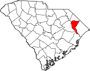
Towns Unincorporated
communitiesCategories:- Marion County, South Carolina
- National Register of Historic Places in South Carolina by county
-


Wikimedia Foundation. 2010.