- National Register of Historic Places listings in Marshall County, West Virginia
-
 Location of Marshall County in West Virginia
This is a list of the National Register of Historic Places listings in Marshall County, West Virginia.
This is intended to be a complete list of the properties and districts on the National Register of Historic Places in Marshall County, West Virginia, United States. The locations of National Register properties and districts for which the latitude and longitude coordinates are included below, may be seen in a Google map.[1]
There are 10 properties and districts listed on the National Register in the county.
-
- This National Park Service list is complete through NPS recent listings posted November 10, 2011.[2]
Contents: Counties in West Virginia Barbour - Berkeley - Boone - Braxton - Brooke - Cabell - Calhoun - Clay - Doddridge - Fayette - Gilmer - Grant - Greenbrier - Hampshire - Hancock - Hardy - Harrison - Jackson - Jefferson - Kanawha - Lewis - Lincoln - Logan - Marion - Marshall - Mason - McDowell - Mercer - Mineral - Mingo - Monongalia - Monroe - Morgan - Nicholas - Ohio - Pendleton - Pleasants - Pocahontas - Preston - Putnam - Raleigh - Randolph - Ritchie - Roane - Summers - Taylor - Tucker - Tyler - Upshur - Wayne - Webster - Wetzel - Wirt - Wood - Wyoming
Current listings
[3] Landmark name[4] Image Date listed Location City or Town Summary 1 B & O Railroad Viaduct 
June 22, 1976 Spans the Ohio River at the southern end of Benwood
40°00′40″N 80°44′13″W / 40.011°N 80.73685°WBenwood Extends into Belmont County, Ohio 2 Cameron City Pool-PWA Project 1196 July 14, 1993 Park St.
39°49′25″N 80°33′35″W / 39.823611°N 80.559722°WCameron 3 Cameron Downtown 
December 4, 1998 Roughly bounded by Church St., Waynesburg Ave., Main St., and Park St.
39°49′35″N 80°33′57″W / 39.826389°N 80.565833°WCameron 4 Bennett Cockayne House December 12, 2002 1111 Wheeling Ave.
39°56′33″N 80°45′17″W / 39.9425°N 80.754722°WGlen Dale 5 Ferrell-Holt House February 3, 1987 609 Jefferson Ave.
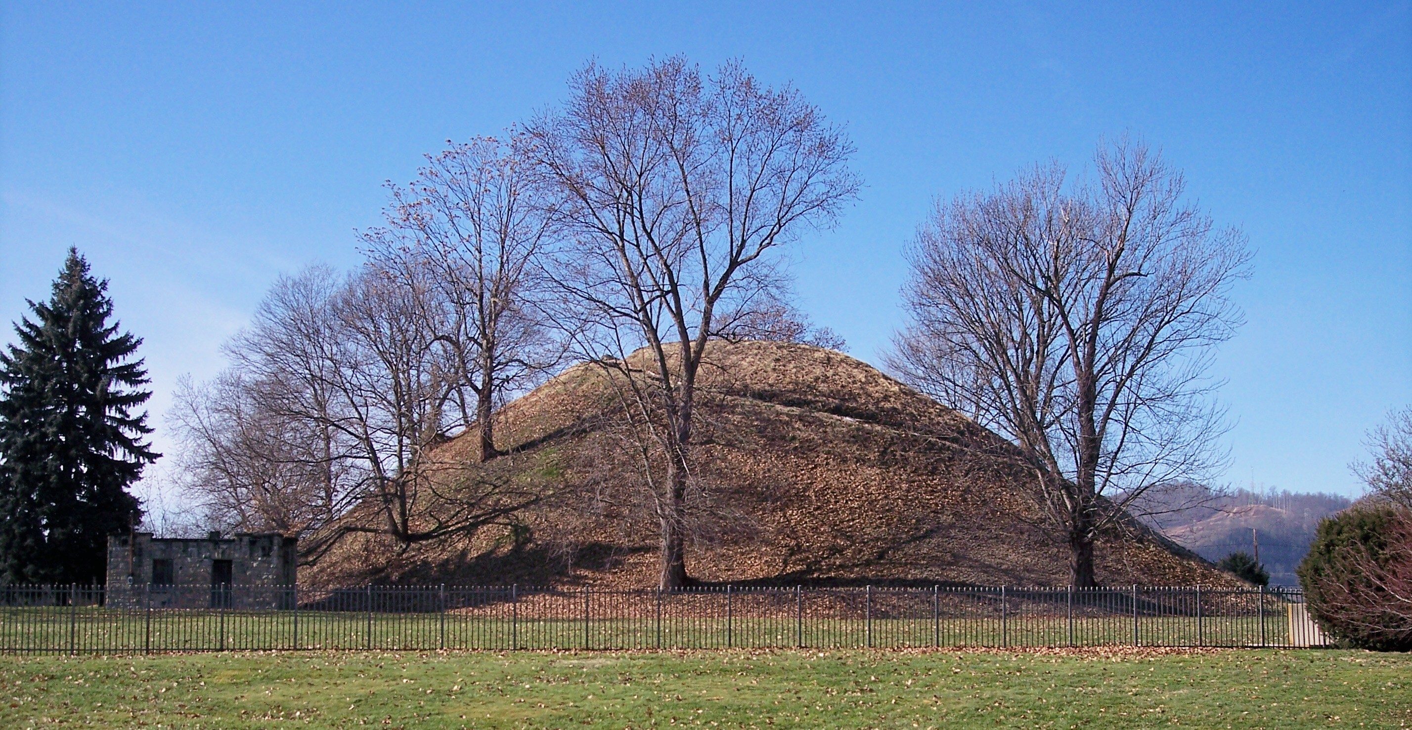
39°55′08″N 80°44′52″W / 39.918889°N 80.747778°WMoundsville 6 Grave Creek Mound 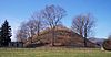
October 15, 1966 Off WV 2
39°55′01″N 80°44′42″W / 39.916944°N 80.745°WMoundsville 7 McMechen Lockmaster Houses on the Ohio River November 12, 1992 623-625 Grant St.
39°59′21″N 80°44′04″W / 39.989167°N 80.734444°WMcMechen 8 Moundsville Commercial Historic District 
March 17, 1995 Roughly Jefferson Ave. from 2nd to 7th Sts., 7th from Jefferson to Lafayette Ave., and Lafayette south of 7th
39°55′15″N 80°44′49″W / 39.920833°N 80.746944°WMoundsville 9 Bushrod Washington Price House November 22, 1995 1803 Virginia St.
39°55′22″N 80°43′59″W / 39.922778°N 80.733056°WMoundsville 10 West Virginia State Penitentiary 
September 19, 1996 818 Jefferson Ave.
39°54′55″N 80°44′34″W / 39.915278°N 80.742778°WMoundsville See also
- List of National Historic Landmarks in West Virginia
- National Register of Historic Places listings in West Virginia
References
- ^ The latitude and longitude information provided in this table was derived originally from the National Register Information System, which has been found to be fairly accurate for about 99% of listings. For about 1% of NRIS original coordinates, experience has shown that one or both coordinates are typos or otherwise extremely far off; some corrections may have been made. A more subtle problem causes many locations to be off by up to 150 yards, depending on location in the country: most NRIS coordinates were derived from tracing out latitude and longitudes off of USGS topographical quadrant maps created under the North American Datum of 1927, which differs from the current, highly accurate WGS84 GPS system used by Google maps. Chicago is about right, but NRIS longitudes in Washington are higher by about 4.5 seconds, and are lower by about 2.0 seconds in Maine. Latitudes differ by about 1.0 second in Florida. Some locations in this table may have been corrected to current GPS standards.
- ^ "National Register of Historic Places: Weekly List Actions". National Park Service, United States Department of the Interior. Retrieved on November 10, 2011.
- ^ Numbers represent an ordering by significant words. Various colorings, defined here, differentiate National Historic Landmark sites and National Register of Historic Places Districts from other NRHP buildings, structures, sites or objects.
- ^ "National Register Information System". National Register of Historic Places. National Park Service. 2008-04-24. http://nrhp.focus.nps.gov/natreg/docs/All_Data.html.
U.S. National Register of Historic Places in West Virginia Lists by county Barbour • Berkeley • Boone • Braxton • Brooke • Cabell • Calhoun • Clay • Doddridge • Fayette • Gilmer • Grant • Greenbrier • Hampshire • Hancock • Hardy • Harrison • Jackson • Jefferson • Kanawha • Lewis • Lincoln • Logan • Marion • Marshall • Mason • McDowell • Mercer • Mineral • Mingo • Monongalia • Monroe • Morgan • Nicholas • Ohio • Pendleton • Pleasants • Pocahontas • Preston • Putnam • Raleigh • Randolph • Ritchie • Roane • Summers • Taylor • Tucker • Tyler • Upshur • Wayne • Webster • Wetzel • Wirt • Wood • Wyoming

Other lists Municipalities and communities of Marshall County, West Virginia Cities 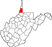
Unincorporated
communitiesBig Run | Dallas | Georgetown | Glen Easton | Limestone | Mount Olivet | Mozart‡ | New Vrindaban | Sherrard
Footnotes ‡This populated place also has portions in an adjacent county or counties
Categories:- National Register of Historic Places in West Virginia by county
- Marshall County, West Virginia
-


Wikimedia Foundation. 2010.