- National Register of Historic Places listings in Montgomery County, Indiana
-
 Location of Montgomery County in Indiana
This is a list of the National Register of Historic Places listings in Montgomery County, Indiana.
This is intended to be a complete list of the properties and districts on the National Register of Historic Places in Montgomery County, Indiana, United States. Latitude and longitude coordinates are provided for many National Register properties and districts; these locations may be seen together in a Google map.[1]
There are 21 properties and districts listed on the National Register in the county, including 1 National Historic Landmark.
-
- This National Park Service list is complete through NPS recent listings posted November 10, 2011.[2]
Current listings
[3] Landmark name [4] Image Date listed Location City or town Summary 1 Ashby July 17, 1980 Southwest of Ladoga on County Road 350E
39°53′54″N 86°50′52″W / 39.898333°N 86.847778°WLadoga 2 Bethel AME Church of Crawfordsville 
September 16, 2001 213 W. North St.
40°02′41″N 86°54′14″W / 40.044722°N 86.903889°WCrawfordsville 3 Crawfordsville Commercial Historic District 
March 25, 1992 Roughly bounded by Walnut, North, and Water Sts., and Wabash Ave.
40°02′32″N 86°53′59″W / 40.042222°N 86.899722°WCrawfordsville 4 Crawfordsville High School 
June 22, 2003 201 E. Jefferson St.
40°02′15″N 86°53′59″W / 40.0375°N 86.899722°WCrawfordsville 5 Culver Union Hospital 
April 25, 2001 306 Binford St.
40°02′40″N 86°53′48″W / 40.044444°N 86.896667°WCrawfordsville 6 Darlington Covered Bridge 
November 28, 1990 County Roads 500N and 500E over Sugar Creek
40°06′29″N 86°47′37″W / 40.108056°N 86.793611°WDarlington 7 Elston Grove Historic District 
March 25, 1992 Roughly bounded by Green, College, and Main Sts., and the former Monon railroad tracks
40°02′24″N 86°53′43″W / 40.04°N 86.895278°WCrawfordsville 8 Col. Isaac C. Elston House 
April 15, 1982 400 E. Pike St.
40°02′23″N 86°53′48″W / 40.039722°N 86.896667°WCrawfordsville 9 William Fisher Polygonal Barn April 2, 1993 County Road 850N just east of its junction with County Road 800E
40°09′38″N 86°44′51″W / 40.160556°N 86.7475°WBowers 10 Henry S. Lane House 
November 23, 1981 212 S. Water St.
40°02′24″N 86°53′50″W / 40.04°N 86.897222°WCrawfordsville 11 Linden Depot 
November 28, 1990 202 N. James St.
40°11′35″N 86°54′17″W / 40.193056°N 86.904722°WLinden 12 McClelland-Layne House 
September 12, 1985 602 Cherry St.
40°02′41″N 86°54′33″W / 40.044722°N 86.909167°WCrawfordsville 13 Montgomery County Jail and Sheriff's Residence 
May 1, 1975 225 N. Washington St.
40°02′38″N 86°54′06″W / 40.043889°N 86.901667°WCrawfordsville 14 Normal Hall 
January 11, 1996 Northwestern corner of the junction of W. Main and Harrison Sts.
39°54′50″N 86°48′15″W / 39.913889°N 86.804167°WLadoga 15 Abijah O'Neall II House September 15, 2005 4040 W. 300S
40°01′28″N 86°59′03″W / 40.024444°N 86.984167°WCrawfordsville 16 Saint John's Episcopal Church 
March 21, 1985 212 S. Green St.
40°02′25″N 86°53′58″W / 40.040278°N 86.899444°WCrawfordsville 17 Otto Schlemmer Building 
November 28, 1978 129-131 N. Green St.
40°02′34″N 86°54′00″W / 40.042778°N 86.9°WCrawfordsville 18 George Seybold House 
October 16, 2002 111 E. Main St.
39°52′33″N 87°02′40″W / 39.875833°N 87.044444°WWaveland 19 T.C. Steele Boyhood Home December 24, 2003 110 S. Cross St.
39°52′32″N 87°02′40″W / 39.875556°N 87.044444°WWaveland 20 Gen. Lew Wallace Study 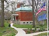
May 11, 1976 Pike St. and Wallace Ave.
40°02′26″N 86°53′40″W / 40.040556°N 86.894444°WCrawfordsville 21 Yount's Woolen Mill and Boarding House 
January 4, 1989 3729 Old State Road 32 W.
40°01′22″N 86°58′29″W / 40.022778°N 86.974722°WCrawfordsville See also
- List of National Historic Landmarks in Indiana
- National Register of Historic Places listings in Indiana
References
- ^ The latitude and longitude information provided in this table was derived originally from the National Register Information System, which has been found to be fairly accurate for about 99% of listings. For about 1% of NRIS original coordinates, experience has shown that one or both coordinates are typos or otherwise extremely far off; some corrections may have been made. A more subtle problem causes many locations to be off by up to 150 yards, depending on location in the country: most NRIS coordinates were derived from tracing out latitude and longitudes off of USGS topographical quadrant maps created under the North American Datum of 1927, which differs from the current, highly accurate WGS84 GPS system used by Google maps. Chicago is about right, but NRIS longitudes in Washington are higher by about 4.5 seconds, and are lower by about 2.0 seconds in Maine. Latitudes differ by about 1.0 second in Florida. Some locations in this table may have been corrected to current GPS standards.
- ^ "National Register of Historic Places: Weekly List Actions". National Park Service, United States Department of the Interior. Retrieved on November 10, 2011.
- ^ Numbers represent an ordering by significant words. Various colorings, defined here, differentiate National Historic Landmark sites and National Register of Historic Places Districts from other NRHP buildings, structures, sites or objects.
- ^ "National Register Information System". National Register of Historic Places. National Park Service. . http://nrhp.focus.nps.gov/natreg/docs/All_Data.html.
U.S. National Register of Historic Places Topics Lists by states Alabama • Alaska • Arizona • Arkansas • California • Colorado • Connecticut • Delaware • Florida • Georgia • Hawaii • Idaho • Illinois • Indiana • Iowa • Kansas • Kentucky • Louisiana • Maine • Maryland • Massachusetts • Michigan • Minnesota • Mississippi • Missouri • Montana • Nebraska • Nevada • New Hampshire • New Jersey • New Mexico • New York • North Carolina • North Dakota • Ohio • Oklahoma • Oregon • Pennsylvania • Rhode Island • South Carolina • South Dakota • Tennessee • Texas • Utah • Vermont • Virginia • Washington • West Virginia • Wisconsin • WyomingLists by territories Lists by associated states Other Municipalities and communities of Montgomery County, Indiana City 
Towns Alamo | Darlington | Ladoga | Linden | New Market | New Richmond | New Ross | Waveland | Waynetown | Wingate
Townships Unincorporated
communitiesBalhinch | Beckville | Bowers | Browns Valley | Cherry Grove | Darlington Woods | Deer's Mill | Elmdale | Fiskville | Garfield | Hibernia | Kirkpatrick | Lake Holiday | Lapland | Linnsburg | Log Cabin Crossroads | Mace | Manchester | North Union | Parkersburg | Shannondale | Smartsburg | Sycamore Ford | Taylor Corner | Wesley | Whitesville | Yountsville
Categories:- Montgomery County, Indiana
- National Register of Historic Places in Indiana by county
-


Wikimedia Foundation. 2010.