- National Register of Historic Places listings in Moody County, South Dakota
-
 Location of Moody County in South Dakota
This is a list of the National Register of Historic Places listings in Moody County, South Dakota.
This is intended to be a complete list of the properties on the National Register of Historic Places in Moody County, South Dakota, United States. The locations of National Register properties for which the latitude and longitude coordinates are included below, may be seen in a Google map.[1]
There are 14 properties listed on the National Register in the county. Another 2 properties were once listed but have been removed.
-
- This National Park Service list is complete through NPS recent listings posted November 10, 2011.[2]
Current listings
[3] Landmark name [4] Image Date listed Location City or town Summary 1 Crystal Theatre October 12, 2000 215 E. 2nd Ave.
44°02′57″N 96°35′32″W / 44.049167°N 96.592222°WFlandreau 2 Egan Park June 19, 2003 2nd St.
43°59′58″N 96°38′18″W / 43.999444°N 96.638333°WEgan 3 George Few House August 18, 1983 208 1st Ave., E.
44°03′03″N 96°35′32″W / 44.050833°N 96.592222°WFlandreau 4 First Scandinavian Baptist Church August 16, 2000 2.5 miles south of Trent
43°52′15″N 96°38′41″W / 43.870833°N 96.644722°WTrent 5 Flandreau Masonic Temple October 19, 1989 300 E. 2nd Ave.
44°02′59″N 96°35′27″W / 44.049722°N 96.590833°WFlandreau 6 Japanese Gardens Dance Pavilion December 1, 1994 City park
44°03′29″N 96°34′15″W / 44.058056°N 96.570833°WFlandreau 7 Little Village Farm Sale Barn December 14, 1995 Off U.S. Route 77 northeast of Dell Rapids
43°54′24″N 96°41′18″W / 43.906667°N 96.688333°WDell Rapids 8 Moody County Courthouse February 10, 1993 Pipestone Ave. between Crescent and Wind Sts.
44°02′53″N 96°35′38″W / 44.048056°N 96.593889°WFlandreau 9 Pettigrew Barns May 19, 2004 309 E. Broad
44°02′41″N 96°35′26″W / 44.044722°N 96.590556°WFlandreau 10 St. Mary's Episcopal Church September 13, 2001 North Crescent St.
44°03′29″N 96°35′38″W / 44.058056°N 96.593889°WFlandreau 11 St. Vincent's Hotel January 27, 1983 100 N. Wind
44°02′55″N 96°35′44″W / 44.048611°N 96.595556°WFlandreau 12 South Dakota Department of Transportation Bridge No. 51-051-000 January 14, 2000 Local road over the Big Sioux River
44°11′44″N 96°47′04″W / 44.195556°N 96.784444°WLake Campbell Resort 13 South Dakota Department of Transportation Bridge No. 51-102-010 January 14, 2000 Local road over Local Creek
44°10′54″N 96°41′18″W / 44.181667°N 96.688333°WRiverview Township 14 South Dakota Dept. of Trans. Br. No. 51-124-136 February 9, 2001 2nd St. over the Big Sioux River
43°59′54″N 96°38′19″W / 43.998333°N 96.638611°WEgan Former listings
Landmark name Image Date removed Location City or Town Summary 1 South Dakota Department of Transportation Bridge No. 51-140-078 March 26, 2008 Flandreau 2 Sioux River Bridge March 26, 2008 Trent 3 Ward Hall November 18, 2009 Main St.
44°9′17″N 96°27′35″W / 44.15472°N 96.45972°WWard Listed November 8, 2001 See also
- List of National Historic Landmarks in South Dakota
- National Register of Historic Places listings in South Dakota
References
- ^ The latitude and longitude information provided in this table was derived originally from the National Register Information System, which has been found to be fairly accurate for about 99% of listings. For about 1% of NRIS original coordinates, experience has shown that one or both coordinates are typos or otherwise extremely far off; some corrections may have been made. A more subtle problem causes many locations to be off by up to 150 yards, depending on location in the country: most NRIS coordinates were derived from tracing out latitude and longitudes off of USGS topographical quadrant maps created under the North American Datum of 1927, which differs from the current, highly accurate WGS84 GPS system used by Google maps. Chicago is about right, but NRIS longitudes in Washington are higher by about 4.5 seconds, and are lower by about 2.0 seconds in Maine. Latitudes differ by about 1.0 second in Florida. Some locations in this table may have been corrected to current GPS standards.
- ^ "National Register of Historic Places: Weekly List Actions". National Park Service, United States Department of the Interior. Retrieved on November 10, 2011.
- ^ Numbers represent an ordering by significant words. Various colorings, defined here, differentiate National Historic Landmark sites and National Register of Historic Places Districts from other NRHP buildings, structures, sites or objects.
- ^ "National Register Information System". National Register of Historic Places. National Park Service. . http://nrhp.focus.nps.gov/natreg/docs/All_Data.html.
U.S. National Register of Historic Places Topics Lists by states Alabama • Alaska • Arizona • Arkansas • California • Colorado • Connecticut • Delaware • Florida • Georgia • Hawaii • Idaho • Illinois • Indiana • Iowa • Kansas • Kentucky • Louisiana • Maine • Maryland • Massachusetts • Michigan • Minnesota • Mississippi • Missouri • Montana • Nebraska • Nevada • New Hampshire • New Jersey • New Mexico • New York • North Carolina • North Dakota • Ohio • Oklahoma • Oregon • Pennsylvania • Rhode Island • South Carolina • South Dakota • Tennessee • Texas • Utah • Vermont • Virginia • Washington • West Virginia • Wisconsin • WyomingLists by territories Lists by associated states Other Municipalities and communities of Moody County, South Dakota Cities 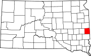
Towns Indian reservations Flandreau Indian Reservation
Categories:- Moody County, South Dakota
- National Register of Historic Places in South Dakota by county
- Buildings and structures in Moody County, South Dakota
-

Wikimedia Foundation. 2010.