- National Register of Historic Places listings in Nash County, North Carolina
-

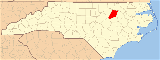
This list includes properties and districts listed on the National Register of Historic Places in Nash County, North Carolina. Click the "Map of all coordinates" link to the right to view a Google map of all properties and districts with latitude and longitude coordinates in the table below.[1]
-
- This National Park Service list is complete through NPS recent listings posted November 10, 2011.[2]
[3] Landmark name[4] Image Date listed Location City or Town Summary 1 Gen. Joseph Arrington House July 15, 1974 SE of Hilliardston on SR 1500
36°6′56″N 77°54′41″W / 36.11556°N 77.91139°WHilliardston 2 Bellamy's Mill November 5, 1974 SW of Enfield
36°9′16″N 77°44′36″W / 36.15444°N 77.74333°WEnfield 3 Bellamy-Philips House July 12, 1982 SR 1522
36°3′7″N 77°47′0″W / 36.05194°N 77.783333°WBattleboro 4 Bellemonte December 21, 1989 3400 N. Wesleyan Blvd.
36°0′56.48″N 77°46′16.64″W / 36.0156889°N 77.7712889°WRocky Mount 5 Benvenue April 29, 1982 330 Southern Blvd.
35°58′35″N 77°49′20″W / 35.97639°N 77.82222°WRocky Mount 6 Bissette-Cooley House September 19, 1985 N. First & E. Washington Sts.
35°58′28″N 77°57′57″W / 35.97444°N 77.96583°WNashville 7 Black Jack July 31, 1974 N of Red Oak
36°5′43″N 77°52′31″W / 36.09528°N 77.87528°WRed Oak 8 Dr. Hassell Brantley House August 14, 1986 301 Branch St.
35°56′45″N 78°6′30″W / 35.94583°N 78.10833°WSpring Hope 9 Dortch House December 26, 1972 SR 1527 off NC 43
36°0′35″N 77°51′36″W / 36.00972°N 77.86°WDortches 10 Falls Road Historic District November 12, 1999 500-600 Avent St., 100-200 Braswell St., 100 Earl St., 400-700 Falls Rd., 500 Peachtree St. and 100 Wilkinson St.
35°57′3″N 77°47′52″W / 35.95083°N 77.79778°WRocky Mount 11 Dr. Franklin Hart Farm July 21, 1988 NC 48
36°2′3″N 77°48′16″W / 36.03417°N 77.80444°WDrake 12 Machaven November 25, 1980 306, S. Grace St.
35°56′26″N 77°48′11″W / 35.94056°N 77.80306°WRocky Mount 13 The Meadows May 16, 1974 NW of Battleboro on SR 1510
36°5′23″N 77°47′14″W / 36.08972°N 77.78722°WBattleboro 14 Morgan School September 15, 2006 7427 Winters Rd.
35°49′18″N 78°8′14″W / 35.82167°N 78.13722°WBailey 15 Nash County Courthouse May 10, 1979 Washington St. between Drake and N. Court Sts.
35°58′34″N 77°58′4″W / 35.97611°N 77.96778°WNashville 16 Nashville Historic District July 22, 1987 Roughly 100-400 W. Washington and 100-300 E. Washington Sts.
35°58′20″N 77°57′54″W / 35.97222°N 77.965°WNashville 17 Red Oak Community House April 19, 2006 E. Side, Church St., approx. 0.1 N of jct. with NC 43
36°2′16″N 77°54′19″W / 36.03778°N 77.90528°WRed Oak 18 Rocky Mount Central City Historic District June 19, 1980 Portions of 26 blocks on Main, Washington, Church, Battle, Hammond, Hill, Howard, Ivy, Gay, Goldleaf, and Thomas Sts.
35°56′49.94″N 77°47′25.83″W / 35.9472056°N 77.7905083°WRocky Mount Present boundaries reflect a boundary increase and decrease of August 27, 2009; original boundaries were "roughly bounded by Robinson and Atlantic Aves. and Holly and Franklin Sts." 19 Rocky Mount Electric Power Plant July 15, 1982 217 Andrews St.
35°56′11″N 77°48′2″W / 35.93639°N 77.80056°WRocky Mount 20 Rocky Mount Mills February 1, 1980 NC 43 and NC 48
35°57′33″N 77°48′10″W / 35.95917°N 77.80278°WRocky Mount 21 Rocky Mount Mills Village Historic District April 22, 1999 Bounded by Tar R., Columbia Ave., Spring St., and Carr St.
35°57′26″N 77°48′15″W / 35.95722°N 77.80417°WRocky Mount 22 Rose Hill April 28, 1982 N of Nashville off NC 58
36°0′4″N 78°1′31″W / 36.00111°N 78.02528°WNashville 23 Spring Hope Historic District September 15, 1988 Roughly bounded by Franklin, Louisburg, Second and Community Sts.
35°56′37″N 78°6′36″W / 35.94361°N 78.11°WSpring Hope 24 Stonewall June 2, 1970 Falls Rd. extension
35°57′26″N 77°48′29″W / 35.95722°N 77.80806°WRocky Mount 25 Taylor's Mill May 28, 1980 SR 1120 W of SR 1124
35°46′38.11″N 78°14′23.63″W / 35.7772528°N 78.2398972°WMiddlesex 26 Villa Place Historic District November 12, 1999 200-300 S. Grace St., 400-600 Hammond St., 200-300 Howell St., 400-600 Nash St, 200-300 Pearl St., 200-300 Villa St.; also roughly along Chester St., Tillery St., NC 64, and Pearl St.
35°56′28″N 77°48′14″W / 35.94111°N 77.80389°WRocky Mount Second set of boundaries represents a boundary increase of September 6, 2002 27 West Haven Historic District September 6, 2002 Roughly bounded by Lafayetter and Pinecrest Aves., and the Tar River
35°56′41″N 77°49′19″W / 35.94472°N 77.82194°WRocky Mount See also
- National Register of Historic Places listings in North Carolina
- List of National Historic Landmarks in North Carolina
References
- ^ The latitude and longitude information provided in this table was derived originally from the National Register Information System, which has been found to be fairly accurate for about 99% of listings. For about 1% of NRIS original coordinates, experience has shown that one or both coordinates are typos or otherwise extremely far off; some corrections may have been made. A more subtle problem causes many locations to be off by up to 150 yards, depending on location in the country: most NRIS coordinates were derived from tracing out latitude and longitudes off of USGS topographical quadrant maps created under the North American Datum of 1927, which differs from the current, highly accurate WGS84 GPS system used by Google maps. Chicago is about right, but NRIS longitudes in Washington are higher by about 4.5 seconds, and are lower by about 2.0 seconds in Maine. Latitudes differ by about 1.0 second in Florida. Some locations in this table may have been corrected to current GPS standards.
- ^ "National Register of Historic Places: Weekly List Actions". National Park Service, United States Department of the Interior. Retrieved on November 10, 2011.
- ^ Numbers represent an ordering by significant words. Various colorings, defined here, differentiate National Historic Landmark sites and National Register of Historic Places Districts from other NRHP buildings, structures, sites or objects.
- ^ "National Register Information System". National Register of Historic Places. National Park Service. 2008-04-24. http://nrhp.focus.nps.gov/natreg/docs/All_Data.html.
U.S. National Register of Historic Places Topics Lists by states Alabama • Alaska • Arizona • Arkansas • California • Colorado • Connecticut • Delaware • Florida • Georgia • Hawaii • Idaho • Illinois • Indiana • Iowa • Kansas • Kentucky • Louisiana • Maine • Maryland • Massachusetts • Michigan • Minnesota • Mississippi • Missouri • Montana • Nebraska • Nevada • New Hampshire • New Jersey • New Mexico • New York • North Carolina • North Dakota • Ohio • Oklahoma • Oregon • Pennsylvania • Rhode Island • South Carolina • South Dakota • Tennessee • Texas • Utah • Vermont • Virginia • Washington • West Virginia • Wisconsin • WyomingLists by territories Lists by associated states Other Municipalities and communities of Nash County, North Carolina City 
Towns Bailey | Castalia | Dortches | Middlesex | Momeyer | Nashville | Red Oak | Sharpsburg‡ | Spring Hope | Whitakers‡
Footnotes ‡This populated place also has portions in an adjacent county or counties
Categories:- Nash County, North Carolina
- National Register of Historic Places in North Carolina
- Buildings and structures in Nash County, North Carolina
-
Wikimedia Foundation. 2010.