- National Register of Historic Places listings in North Hempstead (town), New York
-
This is a list of all National Register of Historic Places listings in the Town of North Hempstead, New York. The locations of National Register properties for which the latitude and longitude coordinates are included below, may be seen in a Google map.[1]
Listings
Landmark name Image Date listed Location City or Town Summary 1 Cedarmere-Clayton Estates 
September 29, 1986 Bryant Avenue and Northern Boulevard
40°48′36″N 73°38′22″W / 40.81°N 73.63944°WRoslyn Harbor Home of William Cullen Bryant and, later, Childs Frick; now part of the Nassau County Museum of Art 2 Clapham-Stern House June 10, 2005 48 Glenwood Road
40°49′15″N 73°38′49″W / 40.82083°N 73.64694°WRoslyn Harbor 3 Clifton July 22, 1999 355 Bryant Avenue
40°48′44″N 73°38′51″W / 40.81222°N 73.6475°WRoslyn Harbor 4 Cornell-Van Nostrand House August 28, 2007 New Hyde Park Road and Marcus Avenue
40°45′33″N 73°41′15″W / 40.75917°N 73.6875°WNew Hyde Park 5 George W. Denton House August 29, 1985 West Shore Road
40°48′16″N 73°39′19″W / 40.80444°N 73.65528°WFlower Hill 6 Thomas Dodge Homestead June 26, 1986 58 Harbor Road
40°50′20″N 73°41′51″W / 40.83889°N 73.6975°WPort Washington 7 East Williston Village Historic District July 18, 1985 Roughly bounded by East Williston Avenue, Roslyn Road, Atlanta Avenue, and Village Green
40°45′28″N 73°38′18″W / 40.75778°N 73.63833°WEast Williston 8 Eastman Cottage 
October 2, 1986 130 Mott Avenue
40°48′9″N 73°39′16″W / 40.8025°N 73.65444°WRoslyn 9 Execution Rocks Light Station 
February 23, 2007 In Long Island Sound, 0.9 mi. NNW of N end of NY 101 in Nassau Co.
40°52′41″N 73°44′17″W / 40.87806°N 73.73806°WPort Washington 10 Gould-Guggenheim Estate 
September 29, 2006 95 Middle Neck Road
40°51′34″N 73°41′47″W / 40.85944°N 73.69639°WPort Washington 11 Grace and Thomaston Buildings December 14, 1978 11 Middle Neck Road and 8 Bond Street
40°47′15″N 73°43′40″W / 40.7875°N 73.72778°WGreat Neck Plaza 12 Greenridge-Arthur Williams House July 22, 1999 875 Bryant Avenue
40°49′0″N 73°37′49″W / 40.816667°N 73.63028°WRoslyn Harbor 13 Hicks Lumber Company Store 
October 2, 1986 1345 Old Northern Boulevard
40°48′1″N 73°39′1″W / 40.80028°N 73.65028°WRoslyn 14 Mackay Estate Dairyman's Cottage March 14, 1991 40 Elm Drive
40°48′2″N 73°37′32″W / 40.80056°N 73.62556°WEast Hills 15 Mackay Estate Gate Lodge March 14, 1991 Jct. of Harbor Hill and Roslyn Roads
40°47′35″N 73°38′30″W / 40.79306°N 73.64167°WEast Hills 16 Mackay Estate Water Tower March 14, 1991 Redwood Drive between Lincoln Drive and Lufberry Drive
40°47′51″N 73°38′23″W / 40.7975°N 73.63972°WEast Hills 17 Main Street Historic District 
January 21, 1974 Main Street from North Hempstead Turnpike to East Broadway, including Tower Street and portions of Glen Avenue and Paper Mill Road
40°47′50″N 73°38′56″W / 40.79722°N 73.64889°WRoslyn Mostly intact 18th- and 19th-century core of Roslyn 18 Main Street School 
February 10, 1983 Main and South Washington Streets
40°49′50″N 73°41′48″W / 40.83056°N 73.69667°WPort Washington 19 Manhasset Monthly Meeting of the Society of Friends 
September 9, 2009 1421 Northern Boulevard
40°47′37.06″N 73°41′39.79″W / 40.7936278°N 73.6943861°WManhasset New listing; refnum 09000700 20 Monfort Cemetery 
January 7, 1988 E of Main Street and Port Washington Boulevard
40°49′52″N 73°40′57″W / 40.83111°N 73.6825°WPort Washington Cemetery with remains of some early settlers of Cow Neck area. 21 Mudge Farmhouse July 22, 1999 535 Motts Cove Road South
40°48′55″N 73°38′13″W / 40.81528°N 73.63694°WRoslyn Harbor 22 North Hempstead Town Hall 
December 20, 2006 220 Plandome Road
40°47′44″N 73°41′56″W / 40.79556°N 73.69889°WManhasset 23 Old Westbury Gardens 
November 8, 1976 71 Old Westbury Road
40°46′26″N 73°35′47″W / 40.77389°N 73.59639°WWestbury 24 Horatio Gates Onderdonk House 
April 16, 1980 1471 Northern Boulevard
40°47′38″N 73°41′33″W / 40.79389°N 73.6925°WManhasset 25 Rescue Hook & Ladder Company No. 1 Firehouse 
May 6, 1991 Jct. of School Street and Skillman Street
40°48′10″N 73°38′48″W / 40.80278°N 73.64667°WRoslyn 26 Roslyn Cemetery October 28, 1991 Northern Boulevard, W of jct. with Glen Cove Road
40°48′33″N 73°37′56″W / 40.80917°N 73.63222°WRoslyn 27 Roslyn Grist Mill 
October 2, 1986 1347 Old Northern Boulevard
40°48′1″N 73°39′0″W / 40.80028°N 73.65°WRoslyn One of the few remaining Dutch colonial commercial frame buildings in U.S. 28 Roslyn House June 7, 1990 Jct. of Lincoln Avenue and Roslyn Road
40°47′31″N 73°38′28″W / 40.79194°N 73.64111°WRoslyn Heights 29 Roslyn National Bank and Trust Company Building 
October 2, 1986 1432 Old Northern Boulevard
40°48′6.49″N 73°38′48.95″W / 40.8018028°N 73.6469306°WRoslyn 30 Roslyn Savings Bank Building 
October 2, 1986 1400 Old Northern Boulevard
40°48′3″N 73°38′52″W / 40.80083°N 73.64778°WRoslyn 31 Roslyn Village Historic District 
April 15, 1987 Roughly bounded by Old Northern Boulevard, Vernon and East Broadway Streets, Main, Glen Avenue, and Tower Street
40°47′49″N 73°38′54″W / 40.79694°N 73.64833°WRoslyn Later 19th-century western and commercial portion of Roslyn 32 Saddle Rock Grist Mill December 27, 1978 Grist Mill Lane and Little Neck Bay
40°47′51″N 73°45′5″W / 40.7975°N 73.75139°WSaddle Rock 33 Saint Mary's Chapel April 6, 2005 Rushmore Avenue bet Roslyn Avenue and Glen Cove Avenue
40°45′4″N 73°36′35″W / 40.75111°N 73.60972°WCarle Place 34 Sands Family Cemetery March 12, 1992 Off Sands Point Road just S of jct. with Middle Neck Road
40°51′29″N 73°43′24″W / 40.85806°N 73.72333°WSands Point 35 Sands-Willets Homestead September 19, 1985 336 Port Washington Boulevard
40°48′56″N 73°40′51″W / 40.81556°N 73.68083°WPort Washington 36 Almeron and Olive Smith House 
July 12, 2006 50 South Drive
40°48′23″N 73°42′11″W / 40.80639°N 73.70306°WPlandome 37 Stephen and Charles Smith House July 22, 1999 450 Bryant Avenue
40°48′47″N 73°38′45″W / 40.81306°N 73.64583°WRoslyn Harbor 38 John Philip Sousa House 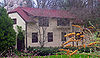
October 15, 1966 14 Hicks Lane, Sands Point
40°50′35″N 73°43′47″W / 40.84306°N 73.72972°WPort Washington Home of John Philip Sousa, bandleader and composer of memorable marches, from 1915 to his death 39 Springbank September 9, 1999 440 Bryant Avenue
40°48′46″N 73°38′45″W / 40.81278°N 73.64583°WRoslyn Harbor 40 Stepping Stones Light Station 
September 15, 2005 Long Island Sound, 0.9 mi. NW of Elm Point at town of Kings Point
40°49′27″N 73°46′30″W / 40.82417°N 73.775°WKings Point 41 Willet Titus House 
October 2, 1986 1441 Old Northern Boulevard
40°48′11″N 73°38′50″W / 40.80306°N 73.64722°WRoslyn 42 Toll Gate House August 16, 1977 Northern Boulevard
40°48′31″N 73°37′56″W / 40.80861°N 73.63222°WGreenvale 43 Trinity Church Complex October 2, 1986 Northern Boulevard
40°48′18″N 73°38′44″W / 40.805°N 73.64556°WRoslyn 44 US Post Office-Great Neck May 11, 1989 1 Welwyn Road
40°47′14″N 73°43′23″W / 40.78722°N 73.72306°WGreat Neck Plaza 45 US Post Office-Mineola 
May 11, 1989 Main and First Streets
40°44′35″N 73°38′21″W / 40.74306°N 73.63917°WMineola Only federal project designed by Peabody, Wilson & Brown, and rare New Deal post office without public art in lobby. 46 Valley Road Historic District April 8, 1977 S of Manhasset on Community Drive
40°46′27″N 73°42′14″W / 40.77417°N 73.70389°WManhasset 47 Samuel Adams Warner House October 2, 1986 1 Railroad Avenue
40°47′34″N 73°38′39″W / 40.79278°N 73.64417°WRoslyn 48 Willowmere July 22, 1999 435 Bryant Avenue
40°48′55″N 73°38′48″W / 40.81528°N 73.64667°WRoslyn Harbor See also
- National Register of Historic Places listings in New York
- National Register of Historic Places listings in Nassau County, New York
References
- ^ The latitude and longitude information provided is primarily from the National Register Information System, and has been found to be fairly accurate for about 99% of listings. For 1%, the location info may be way off. We seek to correct the coordinate information wherever it is found to be erroneous. Please leave a note in the Discussion page for this article if you believe any specific location is incorrect.
Town of North Hempstead, New York County Villages Baxter Estates · East Hills · East Williston · Floral Park · Flower Hill · Garden City · Great Neck · Great Neck Estates · Great Neck Plaza · Kensington · Kings Point · Lake Success · Manorhaven · Mineola · Munsey Park · New Hyde Park · North Hills · Old Westbury · Plandome · Plandome Heights · Plandome Manor · Port Washington North · Roslyn · Roslyn Estates · Roslyn Harbor · Russell Gardens · Saddle Rock · Sands Point · Thomaston · Westbury · Williston Park
Hamlets Albertson · Carle Place · Floral Park Centre · Garden City Park · Glenwood Landing · Great Neck Gardens · Greenvale · Harbor Hills · Herricks · Lakeville Estates · Manhasset · Manhasset Hills · New Cassel · New Hyde Park · North New Hyde Park · Port Washington · Roslyn Heights · Saddle Rock Estates · Searingtown · University Gardens
Website: northhempstead.comCategories:- Town of North Hempstead, New York
- National Register of Historic Places in North Hempstead (town), New York


Wikimedia Foundation. 2010.