- National Register of Historic Places listings in Northampton County, Pennsylvania
-
 Location of Northampton County in Pennsylvania
This is a list of the National Register of Historic Places listings in Northampton County, Pennsylvania.
This is intended to be a complete list of the properties and districts on the National Register of Historic Places in Northampton County, Pennsylvania, United States. The locations of National Register properties and districts for which the latitude and longitude coordinates are included below, may be seen in a Google map.[1]
There are 52 properties and districts listed on the National Register in the county. Two sites are further designated as National Historic Landmarks.
-
- This National Park Service list is complete through NPS recent listings posted November 10, 2011.[2]
Current listings
[3] Landmark name[4] Image Date listed Location City or Town Summary 1 Jacob Arndt House and Barn December 28, 2005 910 Raubsville Road
40°37′35″N 75°13′22″W / 40.62639°N 75.22278°WWilliams Township 2 Bethlehem Silk Mill 
February 15, 2005 238 West Goepp Street
40°37′37″N 75°23′5″W / 40.62694°N 75.38472°WBethlehem 3 Bethlehem Steel Lehigh Plant Mill No. 2 Annex 
May 5, 2004 11 West 2nd Street
40°36′55″N 75°22′46″W / 40.61528°N 75.37944°WBethlehem 4 Bridge in Bangor Borough 
June 22, 1988 Pennsylvania Street over Martins Creek
40°52′10″N 75°12′28″W / 40.86944°N 75.20778°WBangor 5 Bridge in Williams Township 
June 22, 1988 Legislative Route 48007 over Frey's Run near Stouts
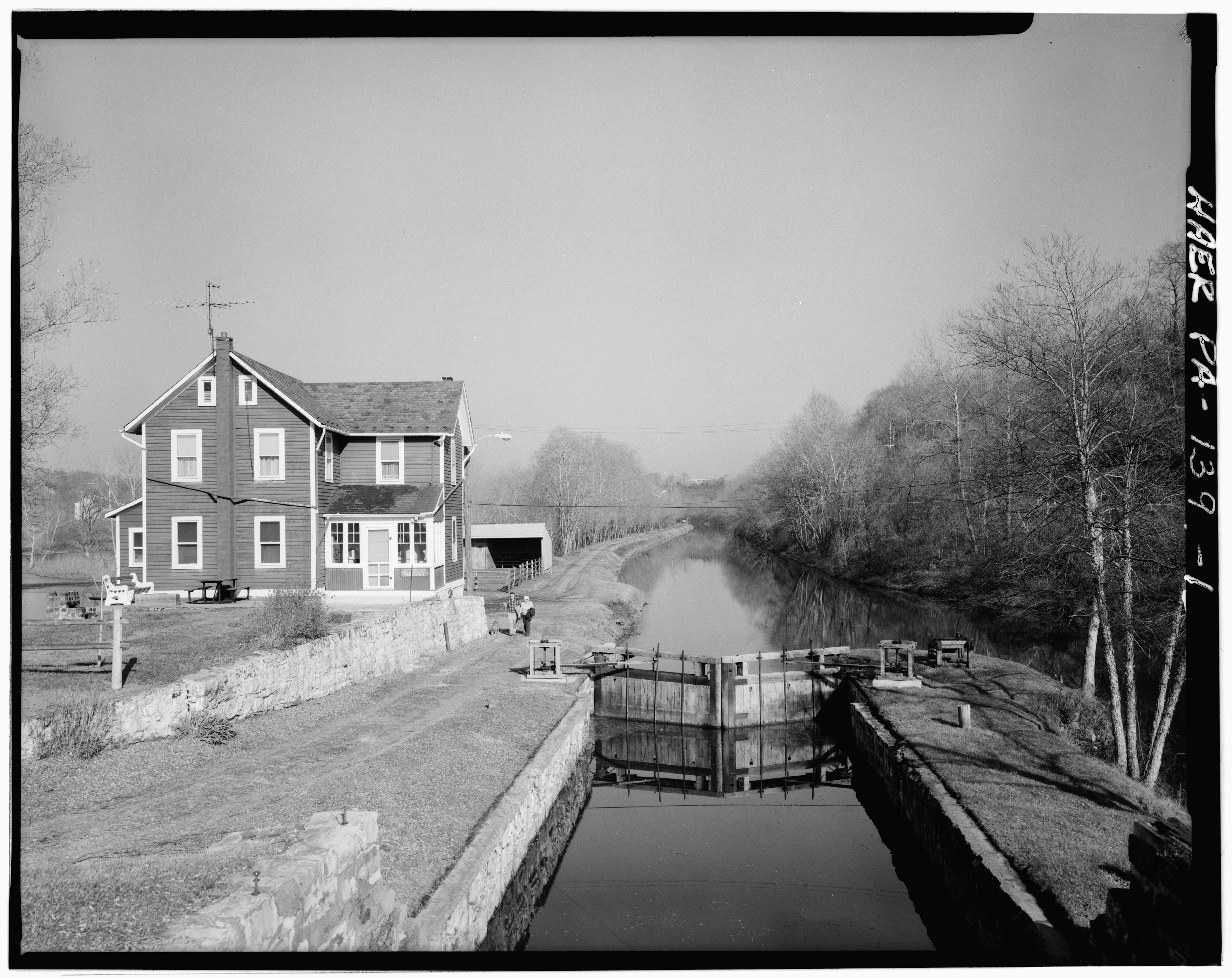
40°36′39″N 75°13′54″W / 40.61083°N 75.23167°WWilliams Township 6 Carbon County Section of the Lehigh Canal 
August 10, 1979 Along the Lehigh River
40°49′3″N 75°40′8″W / 40.8175°N 75.66889°WLehigh Township and Walnutport Extends into Carbon County 7 Central Bethlehem Historic District 
May 5, 1972; boundary increase November 7, 1988 Bounded by Main, Nevada, and East Broad Streets, and the Lehigh River
40°37′6″N 75°22′56″W / 40.61833°N 75.38222°WBethlehem Extends into Lehigh County 8 Chain Bridge February 12, 1974 Southwest of Glendon on Hugh Moore Parkway across the Lehigh River
40°39′14″N 75°14′56″W / 40.65389°N 75.24889°WPalmer Township and Williams Township 9 Coffeetown Grist Mill November 16, 1977 7 miles (11 km) south of Easton at Coffeetown and Kressman Roads
40°37′10″N 75°12′21″W / 40.61944°N 75.20583°WWilliams Township 10 College Hill Residential Historic District May 1, 1991 Roughly bounded by McCartney Street, Pierce Street, Pardee Street, the Forks Township line and the Delaware River
40°42′17″N 75°12′17″W / 40.70472°N 75.20472°WEaston 11 County Bridge No. 36 
June 22, 1988 Township Road 611 over Jacoby Creek
40°55′7″N 75°5′37″W / 40.91861°N 75.09361°WPortland 12 Delaware Division of the Pennsylvania Canal October 29, 1974 Parallels west bank of the Delaware River from Easton to Bristol
40°41′17″N 75°12′18″W / 40.68806°N 75.205°WBristol Extends into Bucks County 13 Easton Cemetery October 25, 1990 401 North Seventh Street
40°41′55″N 75°13′7″W / 40.69861°N 75.21861°WEaston 14 Easton Historic District May 6, 1983 Roughly bounded by Riverside and Bushkill Drives, Ferry and 7th Streets
40°41′27″N 75°12′43″W / 40.69083°N 75.21194°WEaston 15 Easton House December 3, 1980 167–169 Northampton Street
40°41′29″N 75°12′29″W / 40.69139°N 75.20806°WEaston 16 Ehrhart's Mill Historic District April 30, 1987 Old Mill Road
40°33′43″N 75°20′58″W / 40.56194°N 75.34944°WLower Saucon Township 17 Elmwood Park Historic District 
April 21, 1988 Roughly bounded by Goepp Circle, Woodruff Street, Park Place, and Carson Street
40°37′28″N 75°21′56″W / 40.62444°N 75.36556°WBethlehem 18 Fountain Hill Historic District April 21, 1988 Roughly bounded by Brighton, Wyandotte, West Fourth and Seminole Streets, and Delaware Avenue
40°36′40″N 75°23′10″W / 40.61111°N 75.38611°WBethlehem Extends into Lehigh County 19 Gemeinhaus-Lewis David De Schweinitz Residence 
May 15, 1975 66 West Church Street
40°37′7″N 75°22′52″W / 40.61861°N 75.38111°WBethlehem 20 Gristmiller's House 
June 18, 1973 459 Old York Road
40°37′15″N 75°23′0″W / 40.62083°N 75.383333°WBethlehem 21 Michael and Margaret Heller House June 28, 2010 1890-1892 Friedensville Rd.
40°34′44″N 75°20′49″W / 40.57889°N 75.34694°WLower Saucon Township 22 William Jacob Heller House April 20, 1982 501 Mixsell Street
40°42′14″N 75°12′5″W / 40.70389°N 75.20139°WEaston 23 Illick's Mill 
May 20, 2005 130 Illick's Mill Road
40°38′30″N 75°22′51″W / 40.64167°N 75.38083°WBethlehem 24 Jacobsburg Historic District 
October 17, 1977 3 miles (4.8 km) northeast of Nazareth off Pennsylvania Route 115
40°46′57″N 75°17′34″W / 40.7825°N 75.29278°WNazareth 25 Kreidersville Covered Bridge 
December 1, 1980 North of Northampton on Legislative Route 48061
40°43′25″N 75°29′35″W / 40.72361°N 75.49306°WAllen Township 26 Lehigh Canal 
October 2, 1978 Lehigh Gap to south Walnutport boundary
40°44′49″N 75°36′18″W / 40.74694°N 75.605°WWalnutport 27 Lehigh Canal: Eastern Section Glendon and Abbott Street Industrial Sites October 2, 1978 Lehigh River from Hopeville to confluence of Lehigh and Delaware Rivers
40°39′24″N 75°17′41″W / 40.65667°N 75.29472°WEaston Extends into Lehigh County 28 Lehigh Canal; Allentown to Hopeville Section December 17, 1979 Along Lehigh River
40°36′55″N 75°24′52″W / 40.61528°N 75.41444°WBethlehem 29 Lehigh Valley Railroad Headquarters Building 
May 24, 1984 425 Brighton Street
40°36′48″N 75°23′7″W / 40.61333°N 75.38528°WBethlehem 30 Lehigh Valley Silk Mills April 29, 1993 Junction of Seneca and Clewell Streets
40°36′16″N 75°23′37″W / 40.60444°N 75.39361°WFountain Hill 31 Lutz-Franklin School December 30, 2008 4216 Countryside Lane
40°37′28″N 75°16′49″W / 40.62444°N 75.28028°WLower Saucon Township 32 McCollum and Post Silk Mill July 27, 2005 368 Madison Avenue
40°44′21″N 75°19′8″W / 40.73917°N 75.31889°WNazareth 33 Jacob Mixsell House February 14, 1980 101 South 4th Street
40°40′50″N 75°12′37″W / 40.68056°N 75.21028°WEaston 34 Moravian Sun Inn 
October 2, 1973 564 Main Street
40°37′19″N 75°22′54″W / 40.62194°N 75.38167°WBethlehem 35 Nazareth Hall Tract November 28, 1980 Zizendorf Square
40°44′40″N 75°18′54″W / 40.74444°N 75.315°WNazareth 36 Nazareth Historic District August 11, 1988 Centered on Center and Main Streets
40°44′31″N 75°18′39″W / 40.74194°N 75.31083°WNazareth 37 Jacob Nicholas House November 21, 1976 458 Ferry Street
40°41′22″N 75°12′47″W / 40.68944°N 75.21306°WEaston 38 Old Waterworks 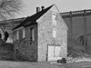
June 19, 1972 Within Historic Subdistrict A near Monocacy Creek
40°37′9″N 75°23′0″W / 40.61917°N 75.383333°WBethlehem 39 Packer Memorial Chapel 
November 20, 1979 Packer Avenue, Lehigh University
40°36′27″N 75°22′41″W / 40.6075°N 75.37806°WBethlehem 40 Parsons-Taylor House 
August 22, 1980 4th and Ferry Streets
40°41′23″N 75°12′38″W / 40.68972°N 75.21056°WEaston 41 Pembroke Village Historic District 
May 9, 1988 Roughly bounded by Radclyffe Street, Carlisle Street, Stefko Boulevard, Arcadia Street and Minsi Trail
40°37′52″N 75°21′35″W / 40.63111°N 75.35972°WBethlehem 42 Real Estate Building February 20, 1986 2–8 North Main Street
40°52′1″N 75°12′20″W / 40.86694°N 75.20556°WBangor 43 Seipsville Hotel May 6, 1977 2912 Old Nazareth Road
40°41′37″N 75°15′45″W / 40.69361°N 75.2625°WPalmer Township 44 Herman Simon House June 27, 1980 41 North 3rd Street
40°39′24″N 75°12′34″W / 40.65667°N 75.20944°WEaston 45 South Bethlehem Downtown Historic District 
January 3, 2006 Roughly bounded by Wyandotte, Columbia, Hayes, and Morton Street
40°36′45″N 75°22′30″W / 40.6125°N 75.375°WBethlehem 46 State Theatre March 4, 1982 454 Northampton Street
40°41′29″N 75°12′45″W / 40.69139°N 75.2125°WEaston 47 Daniel Steckel House March 8, 1982 207 West Northampton Street
40°43′38″N 75°23′40″W / 40.72722°N 75.39444°WBath 48 Isaac Stout House August 11, 2004 50 Durham Road
40°36′37″N 75°13′59″W / 40.61028°N 75.23306°WWilliams Township 49 The Tannery 
June 19, 1972 Within Bethlehem Historic Subdistrict A near Monocacy Creek
40°37′11″N 75°23′2″W / 40.61972°N 75.38389°WBethlehem 50 Weona Park Carousel August 4, 1999 Pennsylvania Route 512
40°52′15″N 75°14′55″W / 40.87083°N 75.24861°WPen Argyl 51 Whitefield House and Gray Cottage May 1, 1980 214 East Center Street
40°44′28″N 75°18′28″W / 40.74111°N 75.30778°WNazareth 52 Zeta Psi Fraternity House May 21, 2001 49 South College Drive
40°41′51″N 75°12′28″W / 40.6975°N 75.20778°WEaston Former listings
[3] Landmark name[4] Image Date delisted Location City or Town Summary 1 Fountain Hill Opera House August 11, 1987 405 Wyandotte Street Bethlehem See also
- List of National Historic Landmarks in Pennsylvania
- National Register of Historic Places listings in Pennsylvania
- List of Pennsylvania state historical markers in Northampton County
References
- ^ The latitude and longitude information provided in this table was derived originally from the National Register Information System, which has been found to be fairly accurate for about 99% of listings. For about 1% of NRIS original coordinates, experience has shown that one or both coordinates are typos or otherwise extremely far off; some corrections may have been made. A more subtle problem causes many locations to be off by up to 150 yards, depending on location in the country: most NRIS coordinates were derived from tracing out latitude and longitudes off of USGS topographical quadrant maps created under North American Datum of 1927, which differs from the current, highly accurate GPS system used by Google maps. Chicago is about right, but NRIS longitudes in Washington are higher by about 4.5 seconds, and are lower by about 2.0 seconds in Maine. Latitudes differ by about 1.0 second in Florida. Some locations in this table may have been corrected to current GPS standards.
- ^ "National Register of Historic Places: Weekly List Actions". National Park Service, United States Department of the Interior. Retrieved on November 10, 2011.
- ^ a b Numbers represent an ordering by significant words. Various colorings, defined here, differentiate National Historic Landmark sites and National Register of Historic Places Districts from other NRHP buildings, structures, sites or objects.
- ^ a b "NPS Focus". National Register of Historic Places. National Park Service. http://nrhp.focus.nps.gov. Retrieved November 20, 2009.
Municipalities and communities of Northampton County, Pennsylvania County seat: Easton Cities 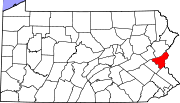
Boroughs Bangor | Bath | Chapman | East Bangor | Freemansburg | Glendon | Hellertown | Nazareth | North Catasauqua | Northampton | Pen Argyl | Portland | Roseto | Stockertown | Tatamy | Walnutport | West Easton | Wilson | Wind Gap
Townships CDPs Unincorporated
communitiesCherryville | Colesville‡ | Hollo | Lehigh Gap‡ | Martins Creek | Newburg | Schoenersville‡ | Slateford
Footnotes ‡This populated place also has portions in an adjacent county or counties
Categories:- Northampton County, Pennsylvania
- National Register of Historic Places in Pennsylvania by county
-


Wikimedia Foundation. 2010.