- National Register of Historic Places listings in Northeast Denver, Colorado
-
This is a list of the National Register of Historic Places listings in Northeast Denver, Colorado.
This is intended to be a complete list of the properties and districts on the National Register of Historic Places in northeastern Denver, Colorado, United States. Northeast Denver is defined as being all of the city east of the Platte River north of Sixth Avenue, excluding the downtown neighborhoods of Capitol Hill, Central Business District, Civic Center, Five Points, North Capitol Hill, and Union Station. The locations of National Register properties and districts may be seen in a Google map.[1]
There are 288 properties and districts listed on the National Register in Denver. Northeast Denver includes 68 of these properties and districts, including 4 that extend into other regions; the city's remaining properties and districts are listed elsewhere. Another property in Northeast Denver was once listed but has since been removed from the National Register.
-
- This National Park Service list is complete through NPS recent listings posted November 10, 2011.[2]
Current listings
[3] Landmark name[4] Image Date listed Location Neighborhood Summary 1 Altamaha Apartments 
May 5, 2004 1490 Lafayette St.
39°44′23″N 104°58′11″W / 39.73972°N 104.96972°WCheesman Park 2 Annunciation Church 
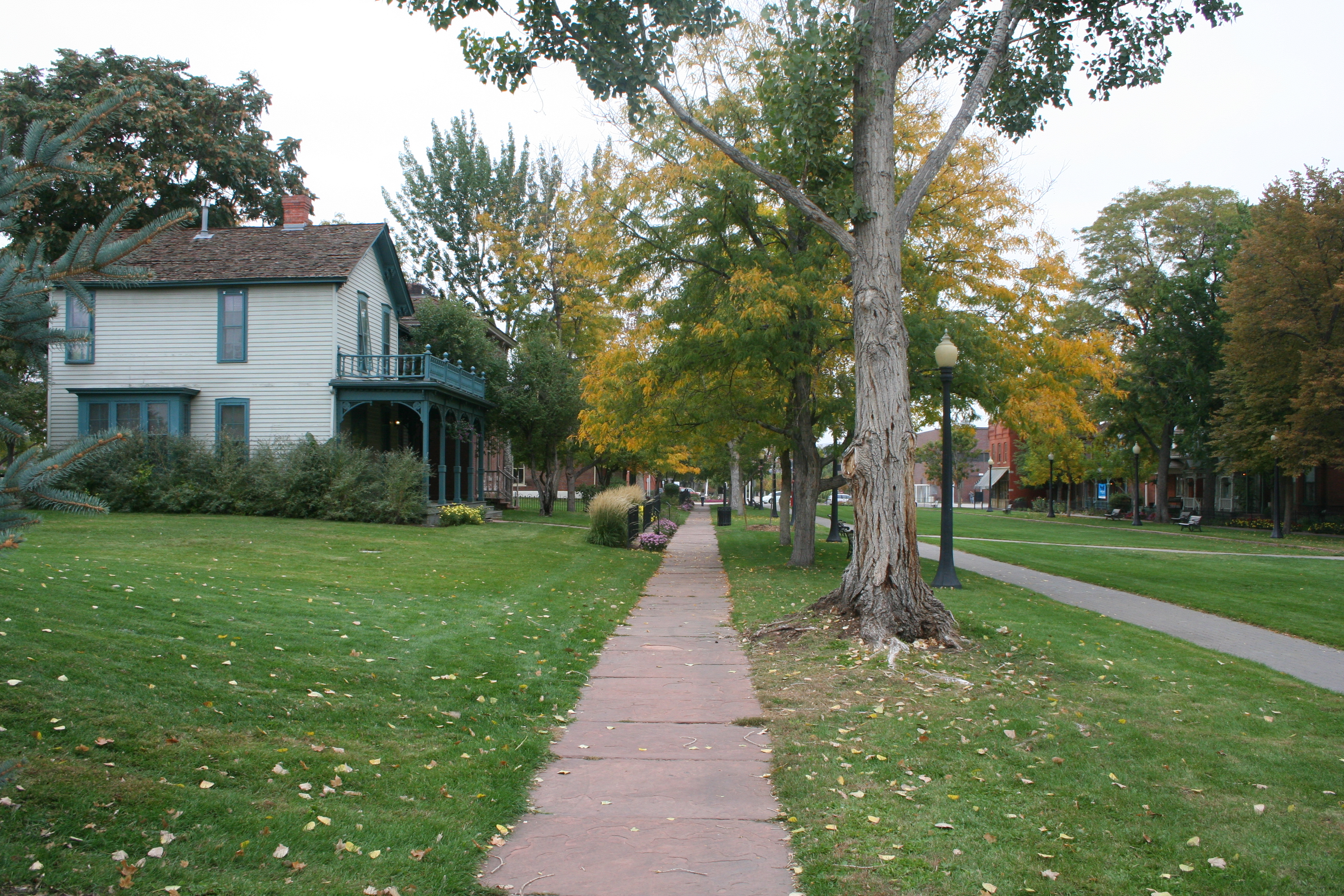
June 21, 1990 3601 Humboldt St.
39°46′2″N 104°58′11″W / 39.76722°N 104.96972°WCole 3 Auraria 9th Street Historic District 
March 26, 1973 9th St. from Curtis to Champa St.
39°44′30″N 105°0′12″W / 39.74167°N 105.00333°WAuraria 4 Austin Building 
January 11, 1996 2400-2418 E. Colfax and 1472 Josephine St.
39°44′24″N 104°57′28″W / 39.74°N 104.95778°WCongress Park 5 Bastien's Restaurant 
September 30, 2009 3503 E. Colfax Ave.
39°44′25.78″N 104°56′46.33″W / 39.7404944°N 104.9462028°WCity Park 6 Bats Grocery Store 
January 28, 1988 4336 Clayton St.
39°46′37″N 104°57′12″W / 39.77694°N 104.95333°WElyria Swansea 7 Bluebird Theater 
January 31, 1997 3315-3317 E. Colfax Ave.
39°44′26″N 104°56′52″W / 39.74056°N 104.94778°WCity Park 8 Bonfils Memorial Theater 
December 27, 2006 1475 Elizabeth St.
39°44′24″N 104°57′21″W / 39.74°N 104.95583°WCongress Park 9 Richard Crawford Campbell House 
July 3, 1979 909 York St.
39°43′51″N 104°57′35″W / 39.73083°N 104.95972°WCheesman Park 10 Delos Allen Chappell House 
June 3, 1982 1555 Race St.
39°44′28″N 104°57′47″W / 39.74111°N 104.96306°WCity Park West 11 Cheesman Park 
September 17, 1986 Roughly bounded by E. 13th Ave., High St., E. 8th Ave., and Franklin St.
39°43′58″N 104°57′57″W / 39.73278°N 104.96583°WCheesman Park 12 City Park 
September 17, 1986 Roughly bounded by E. 23rd Ave., Colorado Boulevard, E. 17th Ave., and York St.
39°44′50″N 104°56′59″W / 39.74722°N 104.94972°WCity Park 13 City Park Esplanade 
September 17, 1986 City Park Esplanade from E. Colfax Ave. to E. 17th Ave.
39°44′31″N 104°57′22″W / 39.74194°N 104.95611°WCity Park 14 City Park Golf 
September 17, 1986 Roughly bounded by E. 26th Ave., Colorado Boulevard, E. 23rd Ave., and York St.
39°45′10″N 104°57′0″W / 39.75278°N 104.95°WSkyland 15 George W. Clayton Trust and College 
May 2, 2006 3801 Martin Luther King Boulevard
39°45′46″N 104°56′34″W / 39.76278°N 104.94278°WClayton 16 Cole Neighborhood Historic District 
March 31, 1995 3200-3300 Vine and Race Sts.
39°45′48″N 104°57′45″W / 39.76333°N 104.9625°WCole 17 Denver Medical Depot 
June 3, 1998 3800 York St.
39°46′13″N 104°57′15″W / 39.77028°N 104.95417°WClayton 18 Denver Orphans' Home 
January 15, 1999 1501 Albion St.
39°44′27″N 104°56′20″W / 39.74083°N 104.93889°WSouth Park Hill 19 Dow-Rosenzweig House 
June 3, 1982 1129 E. 17th Ave.
39°44′37″N 104°58′20″W / 39.74361°N 104.97222°WCity Park West 20 Doyle-Benton House 
January 18, 2006 1301 Lafayette St.
39°44′13″N 104°58′13″W / 39.73694°N 104.97028°WCheesman Park 21 East High School 
July 27, 2006 1545 Detroit St.
39°44′32″N 104°57′19″W / 39.74222°N 104.95528°WCity Park 22 East Sixth Avenue Parkway 
September 17, 1986 E. 6th Ave. Parkway from Colorado Boulevard to Quebec St.
39°43′7″N 104°55′38″W / 39.71861°N 104.92722°WHale and Montclair Extends into Hilltop in Southeast Denver 23 East Seventh Avenue Parkway 
September 17, 1986 E. 7th Ave. Parkway from Williams St. to Colorado Boulevard
39°43′37″N 104°57′6″W / 39.72694°N 104.95167°WCountry Club and Congress Park 24 East Seventeenth Avenue Parkway 
September 17, 1986 E. 17th Ave. Parkway from Colorado Boulevard to the Monaco St. Parkway
39°44′36″N 104°55′35″W / 39.74333°N 104.92639°WSouth Park Hill 25 Emmanuel Shearith Israel Chapel 
December 1, 1969 1201 10th St.
39°44′39″N 105°0′12″W / 39.74417°N 105.00333°WAuraria 26 Forest Street Parkway 
September 17, 1986 Forest St. Parkway from 17th Ave. to Montview Boulevard
39°44′44″N 104°55′36″W / 39.74556°N 104.92667°WSouth Park Hill 27 Ernest LeNeve Foster House 
September 4, 1980 2105 Lafayette St.
39°44′54″N 104°58′14″W / 39.74833°N 104.97056°WCity Park West 28 Russell and Elinor Gates Mansion 
March 7, 2002 1365-1375 Josephine
39°44′17″N 104°57′30″W / 39.73806°N 104.95833°WCongress Park 29 House at 1750 Gilpin Street 
July 7, 2004 1750 Gilpin St.
39°44′39″N 104°57′59″W / 39.74417°N 104.96639°WCity Park West 30 Humboldt Street Historic District 
December 29, 1978 Humboldt St. between E. 10th and E. 12th Sts.
39°44′1″N 104°58′7″W / 39.73361°N 104.96861°WCheesman Park 31 Owen E. LeFevre House 
August 13, 1976 1311 York St.
39°44′14″N 104°57′35″W / 39.73722°N 104.95972°WCheesman Park 32 Peter McCourt House 
May 9, 1983 1471 High St.
39°44′24″N 104°57′51″W / 39.74°N 104.96417°WCheesman Park 33 Midwest Steel and Iron Works Company Complex 
April 10, 1985 25 Larimer St.
39°44′27″N 105°0′55″W / 39.74083°N 105.01528°WLincoln Park 34 Monaco Street Parkway 
September 17, 1986 Monaco St. Parkway from E. 1st Ave. to Montview Boulevard
39°43′58″N 104°54′43″W / 39.73278°N 104.91194°WMontclair and South Park Hill Extends into Hilltop in Southeast Denver 35 Montclair Park 
September 17, 1986 Roughly bounded by E. 12th Ave., Onieda St., and the Richthofen Parkway
39°44′6″N 104°54′30″W / 39.735°N 104.90833°WMontclair 36 Montview Boulevard 
October 1, 1986 Montview Boulevard from Colorado Boulevard to Monaco St. Parkway
39°44′51″N 104°55′36″W / 39.7475°N 104.92667°WSouth Park Hill 37 Montview Boulevard Presbyterian Church 
April 6, 2004 1980 Dahlia St.
39°44′49″N 104°55′52″W / 39.74694°N 104.93111°WSouth Park Hill 38 Motor Coach Division Building-Denver Tramway Company 
December 17, 1998 3500 Gilpin St.
39°46′0″N 104°58′2″W / 39.766667°N 104.96722°WCole 39 Park Hill 
December 16, 2004 Bounded by Colorado Boulevard, E. 26th Ave., Dahlia St., and E. Montview Boulevard
39°45′4″N 104°56′9″W / 39.75111°N 104.93583°WNorth Park Hill and South Park Hill 40 Pearce-McAllister Cottage 
June 20, 1972 1880 Gaylord St.
39°44′46″N 104°57′37″W / 39.74611°N 104.96028°WCity Park West 41 Wilbur S. Raymond House 
November 21, 1974 1572 Race St.
39°44′29″N 104°57′54″W / 39.74139°N 104.965°WCity Park West 42 Richthofen Castle 
April 21, 1975 7020 E. 12th Ave.
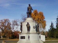
39°44′7″N 104°54′22″W / 39.73528°N 104.90611°WMontclair 43 Richthofen Monument 
September 17, 1986 Richthofen Parkway at Oneida St.
39°44′3″N 104°54′27″W / 39.73417°N 104.9075°WMontclair 44 Richthofen Place Parkway 
September 17, 1986 Richthofen Pl. Parkway from the Monaco St. Parkway to Oneida St.
39°44′3″N 104°54′32″W / 39.73417°N 104.90889°WMontclair 45 Riverside Cemetery 
October 28, 1994 5201 Brighton Boulevard
39°47′39″N 104°57′33″W / 39.79417°N 104.95917°WElyria-Swansea Extends into North Washington in Adams County 46 Robinson House 
February 12, 2003 3435 Albion St.
39°45′55″N 104°56′20″W / 39.76528°N 104.93889°WNortheast Park Hill 47 St. Elizabeth's Church 
December 1, 1969 1062 11th St.
39°44′34″N 105°0′6″W / 39.74278°N 105.00167°WAuraria 48 St. Ignatius Loyola Church 
December 23, 1994 Junction of E. 23rd Ave. and York St.
39°45′5″N 104°57′35″W / 39.75139°N 104.95972°WWhittier 49 St. Joseph's Roman Catholic Church of Denver 
June 3, 1982 600 Galapago
39°43′34″N 104°59′44″W / 39.72611°N 104.99556°WLincoln Park 50 Saint Philomena Catholic Parish School 
May 4, 2011 940 Fillmore St.
39°43′54″N 104°57′8″W / 39.73167°N 104.95222°WCongress Park 51 Schlessinger House 
November 14, 1979 1544 Race St.
39°44′28″N 104°57′46″W / 39.74111°N 104.96278°WCity Park West 52 Smith House 
September 26, 1985 1801 York St.
39°44′42″N 104°57′35″W / 39.745°N 104.95972°WCity Park West 53 Milo A. Smith House 
July 3, 1997 1360 Birch St.
39°44′15″N 104°56′9″W / 39.7375°N 104.93583°WHale 54 Pierce T. Smith House 
September 20, 1984 1751 Gilpin St.
39°44′40″N 104°58′1″W / 39.74444°N 104.96694°WCity Park West 55 South Platte River Bridges 
October 15, 2002 Interstate 25 at milepost 210.53
39°44′36″N 105°0′56″W / 39.74333°N 105.01556°WAuraria Extends into Jefferson Park and Sun Valley in West Denver 56 Speer Boulevard 
September 17, 1986 Speer Boulevard from W. Colfax Ave. to Downing St.
39°43′42″N 104°59′9″W / 39.72833°N 104.98583°WLincoln Park Extends into Civic Center in Downtown Denver and Speer in Southeast Denver 57 Stanley Arms 
July 15, 1999 1321-1333 E. 10th Ave.
39°43′57″N 104°58′13″W / 39.7325°N 104.97028°WCheesman Park 58 Stanley School-Montclair School 
February 13, 2007 1301 Quebec St.
39°44′15″N 104°54′12″W / 39.7375°N 104.90333°WMontclair 59 Sunken Gardens 
September 17, 1986 Roughly bounded by Speer Boulevard, W. 8th Ave., Delaware, and Elati Sts.
39°43′49″N 104°59′30″W / 39.73028°N 104.99167°WLincoln Park 60 Tears-McFarlane House 
January 11, 1976 1200 Williams St.
39°44′12″N 104°57′59″W / 39.73667°N 104.96639°WCheesman Park 61 Tivoli Brewery Company 
April 11, 1973 1320-1348 10th St.
39°44′43″N 105°0′17″W / 39.74528°N 105.00472°WAuraria 62 Treat Hall at Johnson & Wales University 
August 10, 1978 E. 18th Ave. and Pontiac St.
39°44′44″N 104°54′15″W / 39.74556°N 104.90417°WSouth Park Hill 63 Vine Street Houses 
December 16, 1974 1415, 1429, 1435, 1441, and 1453 Vine St.
39°44′21″N 104°58′1″W / 39.73917°N 104.96694°WCheesman Park 64 Manuella C. Walters Duplex 
September 30, 2009 1728 and 1732 Gilpin St.
39°44′38.13″N 104°58′1.92″W / 39.743925°N 104.9672°WCity Park West 65 West Side Court Building 
May 5, 2004 924 W. Colfax Ave.
39°44′23″N 104°59′57″W / 39.73972°N 104.99917°WLincoln Park 66 Westside Neighborhood 
April 17, 1975 1311-1466 Lipan St., 1305-1370 Kalamath St., 931-1126 W. 14th Ave., 1312-1438 Maraposa St., and 1008-1118 W. 13th Ave.
39°44′17″N 105°0′8″W / 39.73806°N 105.00222°WLincoln Park 67 Zall House 
November 9, 2005 5401 E. 6th Ave. Parkway
39°43′33″N 104°55′27″W / 39.72583°N 104.92417°WHale 68 Zeitz Buckhorn Exchange 
April 21, 1983 1000 Osage St.
39°43′56″N 105°0′58″W / 39.73222°N 105.01611°WLincoln Park Former listing
Landmark name Image Date listed Location City or Town Summary 1 Beierle Farm December 23, 1992 Hudson Rd. north of Irondale Rd., near Watkins
39°51′49.212″N 104°37′14.844″W / 39.86367°N 104.62079°WAirport Delisted on November 7, 2007 after demolition[5] See also
- List of National Historic Landmarks in Colorado
- National Register of Historic Places listings in Denver, Colorado
References
- ^ The latitude and longitude information provided in this table was derived originally from the National Register Information System, which has been found to be fairly accurate for about 99% of listings. For about 1% of NRIS original coordinates, experience has shown that one or both coordinates are typos or otherwise extremely far off; some corrections may have been made. A more subtle problem causes many locations to be off by up to 150 yards, depending on location in the country: most NRIS coordinates were derived from tracing out latitude and longitudes off of USGS topographical quadrant maps created under the North American Datum of 1927, which differs from the current, highly accurate WGS84 GPS system used by Google maps. Chicago is about right, but NRIS longitudes in Washington are higher by about 4.5 seconds, and are lower by about 2.0 seconds in Maine. Latitudes differ by about 1.0 second in Florida. Some locations in this table may have been corrected to current GPS standards.
- ^ "National Register of Historic Places: Weekly List Actions". National Park Service, United States Department of the Interior. Retrieved on November 10, 2011.
- ^ Numbers represent an ordering by significant words. Various colorings, defined here, differentiate National Historic Landmark sites and National Register of Historic Places Districts from other NRHP buildings, structures, sites or objects.
- ^ "National Register Information System". National Register of Historic Places. National Park Service. 2008-04-24. http://nrhp.focus.nps.gov/natreg/docs/All_Data.html.
- ^ Removals, Colorado Historical Society. Accessed 2009-08-28.
Categories:- Buildings and structures in Denver, Colorado
- National Register of Historic Places in Denver, Colorado
-


Wikimedia Foundation. 2010.