- National Register of Historic Places listings in Oahu
-
 Location of Oahu
This is a list of properties and districts on the Hawaiian island of Oahu that are listed on the National Register of Historic Places. Oahu is the only major island in Honolulu County. The location of the city of Honolulu, Oahu is the most populous island in the state. There are 149 properties and districts on the island, including 16 National Historic Landmarks. Two formerly listed sites were demolished and have been removed from the Register.
Current listings
Landmark name Image Date listed Location Community Summary 1 Alexander and Baldwin Building 
September 7, 1979 822 Bishop St.
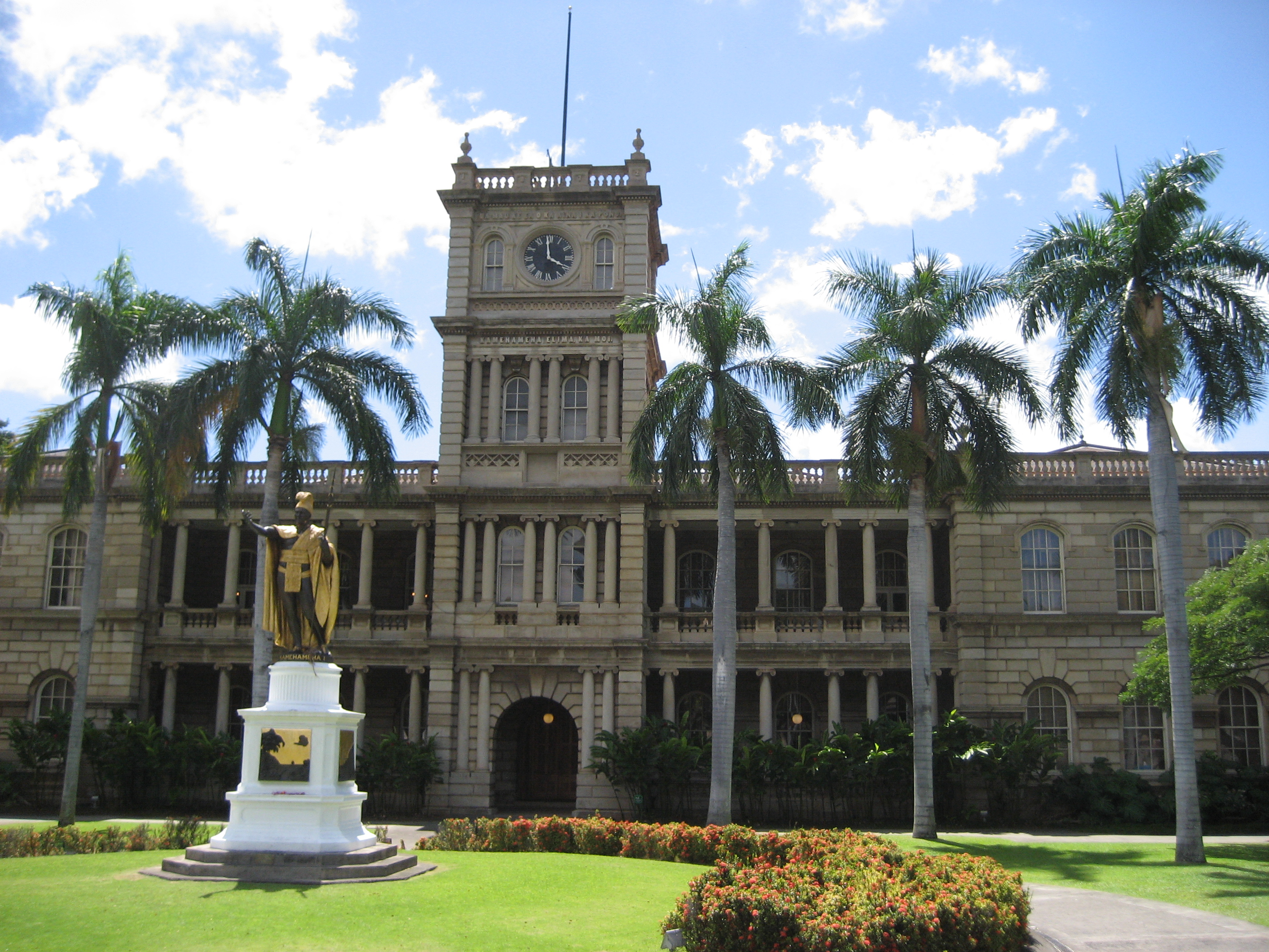
21°18′46″N 157°51′54″W / 21.31278°N 157.865°WHonolulu 2 Aliiolani Hale 
February 2, 1972 King St.
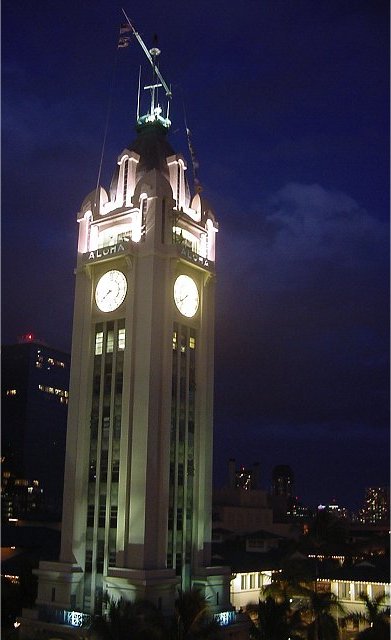
21°18′31″N 157°51′46″W / 21.30861°N 157.86278°WHonolulu 3 Aloha Tower 
May 13, 1976 Pier 9 in Honolulu Harbor
21°18′32″N 157°51′56″W / 21.30889°N 157.86556°WHonolulu 4 Battery Hasbrouck June 5, 1984 Fort Kamehameha
21°19′30″N 157°57′40″W / 21.325°N 157.96111°WHonolulu Site of coastal artillery in Fort Kamehameha 5 Battery Hawkins June 5, 1984 440 Nelson Avenue
21°19′12″N 157°57′36″W / 21.32°N 157.96°WHonolulu Site of coastal artillery in Fort Kamehameha 6 Battery Hawkins Annex June 5, 1984 Fort Kamehameha
21°19′12″N 157°57′36″W / 21.32°N 157.96°WHonolulu Site of bunker in Fort Kamehameha 7 Battery Jackson June 5, 1984 Fort Kamehameha
21°19′6″N 157°57′22″W / 21.31833°N 157.95611°WHonolulu Site of coastal artillery in Fort Kamehameha 8 Battery Randolph 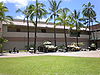
June 5, 1984 32 Kalia Road
21°16′58″N 157°50′11″W / 21.28278°N 157.83639°WHonolulu Site of coastal artillery in Fort DeRussy, now a museum 9 Battery Selfridge June 5, 1984 Fort Kamehameha
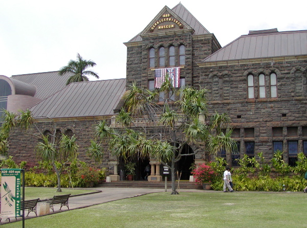
21°19′5″N 157°57′9″W / 21.31806°N 157.9525°WHonolulu Site of coastal artillery in Fort Kamehameha 10∞ Bellows Field Archeological Area August 14, 1973 Address Restricted Waimanalo 11 Bernice P. Bishop Museum 
July 26, 1982 1355 Kalihi St.
21°20′16″N 157°52′25″W / 21.33778°N 157.87361°WHonolulu 12 Boettcher Estate 
April 26, 2002 248 North Kalaheo
21°24′12″N 157°44′17″W / 21.40333°N 157.73806°WKailua 13 C. Brewer Building 
April 2, 1980 827 Fort St.
21°18′47″N 157°51′57″W / 21.31306°N 157.86583°WHonolulu 14 Burial Platform August 14, 1973 Address Restricted Kahuku 15 Thomas Alexander Burningham House 
October 13, 1993 2849 Pali Highway
21°20′18″N 157°50′34″W / 21.33833°N 157.84278°WHonolulu 16 Georges de S. Canavarro House 
May 28, 1980 2756 Rooke Ave.
21°20′28″N 157°50′53″W / 21.34111°N 157.84806°WHonolulu Now a Korean Cultural Center 17 Lloyd Case House 
June 5, 1987 3581 Woodlawn Dr.
21°19′25″N 157°48′2″W / 21.32361°N 157.80056°WHonolulu 18 Central Fire Station 
December 2, 1980 104 S. Beretania St.
21°18′58″N 157°51′42″W / 21.31611°N 157.86167°WHonolulu renovated 1934, architects Dickey & Young 19 Central Intermediate School 
February 11, 2004 1302 Queen Emma St.
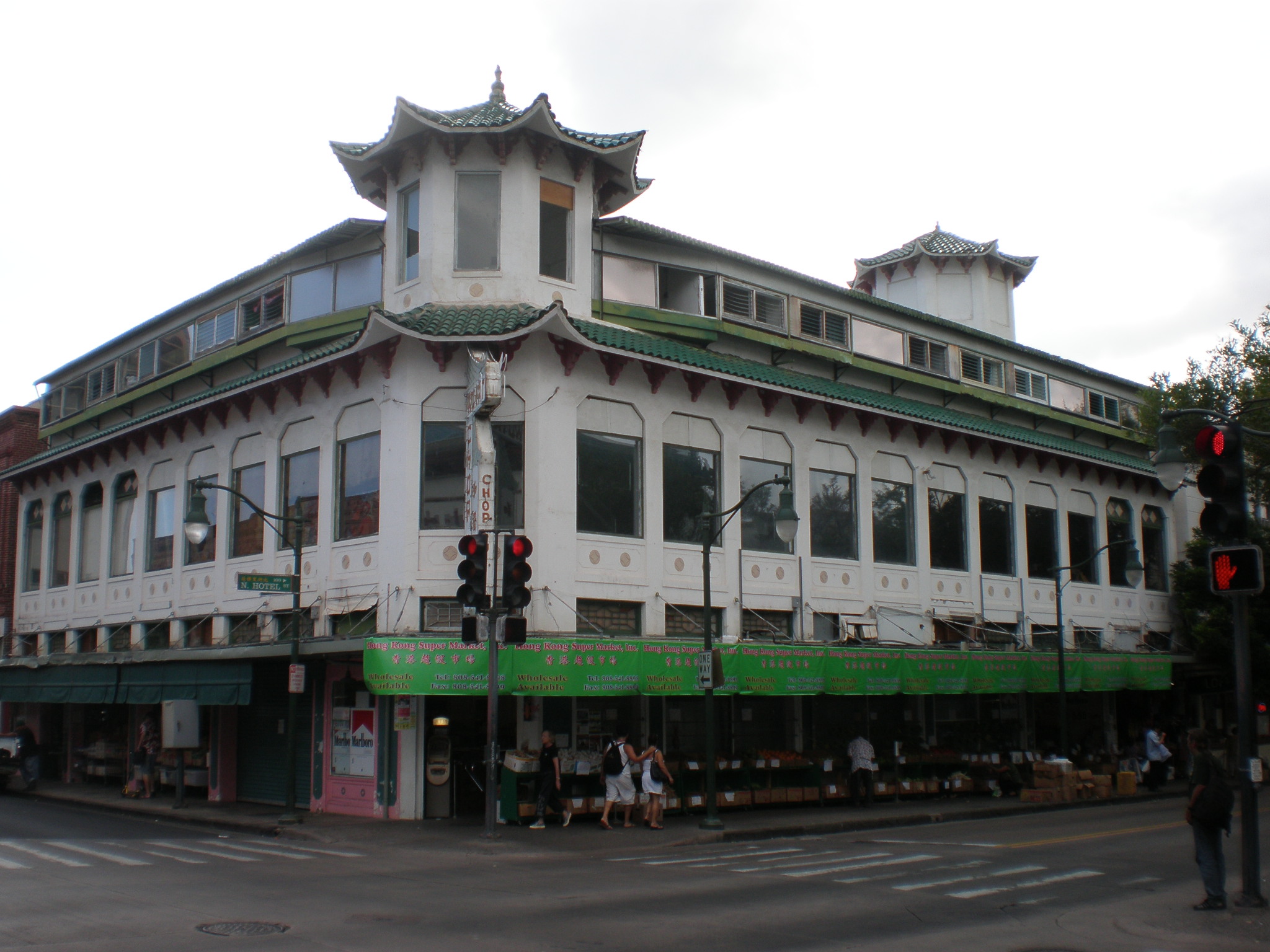
21°18′41″N 157°51′24″W / 21.31139°N 157.85667°WHonolulu 20 Jean Charlot House November 30, 2000 Address Restricted Honolulu 21∞ Chinatown Historic District 
January 17, 1973 Bounded roughly by Beretania St. on the northeast, Nuuanu Stream on the north, Nuuanu Ave. on the southeast, and Honolulu Harbor
21°18′55″N 157°51′59″W / 21.31528°N 157.86639°WHonolulu 22 Church of the Crossroads 
November 20, 1992 1212 University Ave.
21°17′56″N 157°49′28″W / 21.29889°N 157.82444°WHonolulu 23† CINCPAC Headquarters 
May 28, 1987 Pearl Harbor Naval Base
21°22′3″N 157°56′18″W / 21.3675°N 157.93833°WPearl Harbor 24 James L. Coke House 
August 20, 1986 3649 Nuuanu Pali Dr.
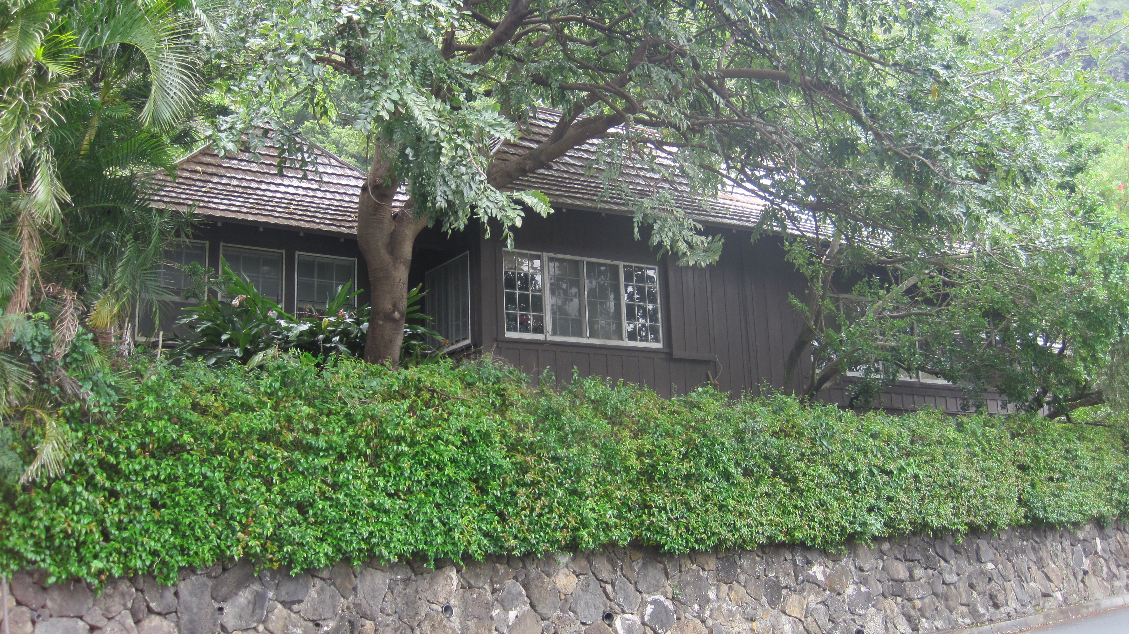
21°20′55″N 157°49′53″W / 21.34861°N 157.83139°WHonolulu Also called Waipuna, built 1934, architects Richard Tongg and C.W. Dickey 25 Grace Cooke House 
October 24, 1983 2365 Oahu Ave.
21°18′39″N 157°49′16″W / 21.31083°N 157.82111°WHonolulu Bungalow style built in 1912 26 Charles Montague Cooke, Jr., House and Kuka'o'o Heiau 
October 31, 1985 2859 Manoa Rd.
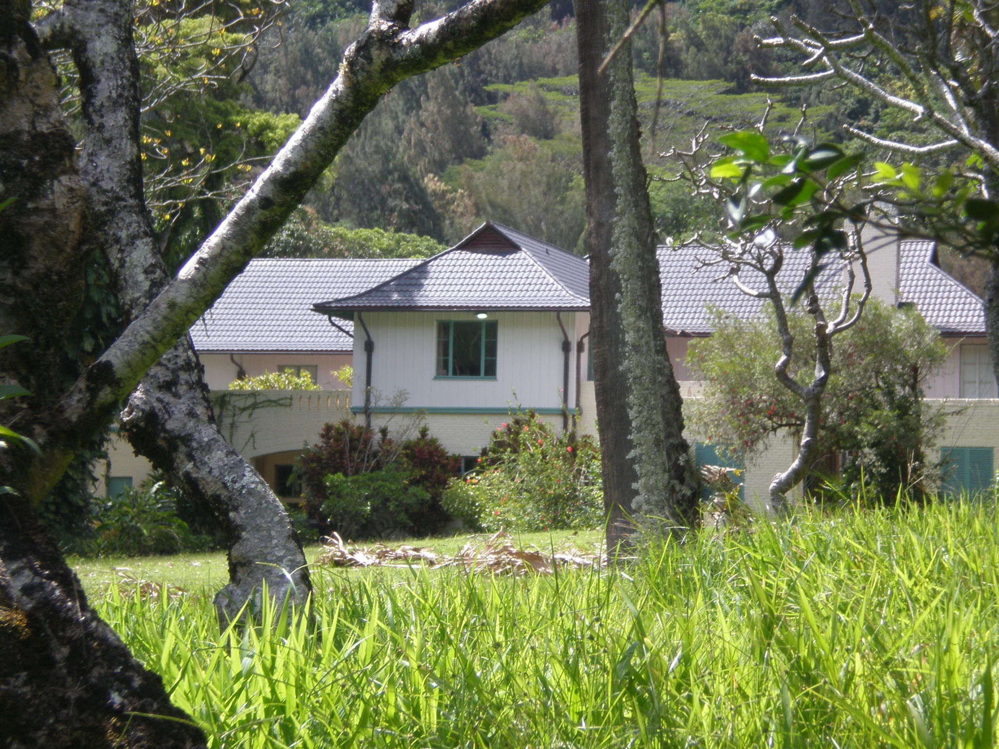
21°18′29″N 157°49′0″W / 21.30806°N 157.816667°WHonolulu Grand Tudor Revival residence built in 1912 by architects Emory & Webb 27 Clarence H. Cooke House 
August 20, 1986 3860 Old Pali Rd.
21°21′8″N 157°49′42″W / 21.35222°N 157.82833°WHonolulu 28 Bartlett Cooper House 
June 5, 1987 4850 Kahala Ave.
21°15′55″N 157°46′54″W / 21.26528°N 157.78167°WHonolulu 29 C.W. Dickey House 
November 1, 1984 3030 Kalakaua Ave.
21°15′43″N 157°49′16″W / 21.26194°N 157.82111°WHonolulu 30 Dillingham Transportation Building 
September 7, 1979 735 Bishop St.
21°18′44″N 157°51′54″W / 21.31222°N 157.865°WHonolulu 31 James D. Dole Homestead 
June 23, 1978 Waipahu Cultural Garden
21°23′7″N 158°0′43″W / 21.38528°N 158.01194°WWaipahu 1901 house of Pineapple planter 32 Carl H. Duhrsen House 
June 5, 1987 3029 Felix St.
21°18′3″N 157°48′35″W / 21.30083°N 157.80972°WHonolulu 33 Jessie Eyman–Wilma Judson House 
August 20, 1986 3114 Paty Dr.
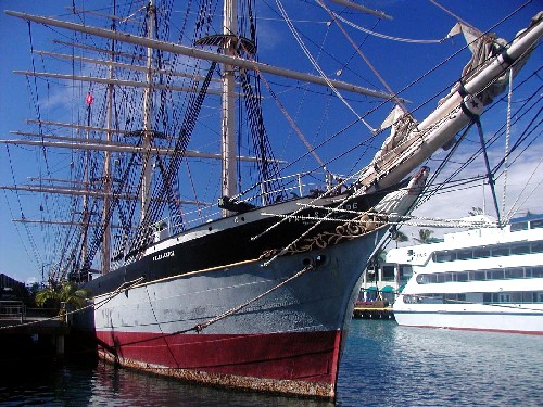
21°18′53″N 157°48′12″W / 21.31472°N 157.80333°WHonolulu built 1926, architect C.W. Dickey 34† Falls of Clyde 
July 2, 1973 Pier 7 in Honolulu Harbor
21°18′6″N 157°52′19″W / 21.30167°N 157.87194°WHonolulu Only surviving iron-hulled, four-masted full rigged ship, and only surviving sail-driven oil tanker in the world. 35 Dr. Robert Faus House 
June 5, 1987 2311 Ferdinand Ave.
21°18′47″N 157°49′35″W / 21.31306°N 157.82639°WHonolulu 36∞ Fort Ruger Historic District 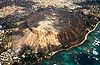
July 14, 1983 Diamond Head Rd.
21°16′3″N 157°48′31″W / 21.2675°N 157.80861°WHonolulu 37∞ Foster Botanical Garden 
May 13, 1993 50 N. Vineyard Boulevard
21°19′15″N 157°51′34″W / 21.32083°N 157.85944°WHonolulu 38 John Guild House 
August 1, 1980 2001 Vancouver Dr.
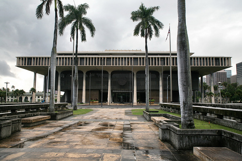
21°18′20″N 157°49′30″W / 21.30556°N 157.825°WHonolulu 39∞ Hawaii Capital Historic District 
December 1, 1978 Beretania, Richards, King, Queen, Punchbowl, and Kawaiahao Sts.
21°18′38″N 157°51′39″W / 21.31056°N 157.86083°WHonolulu 40 Hawaii Shingon Mission 
April 26, 2002 915 Sheridan St.
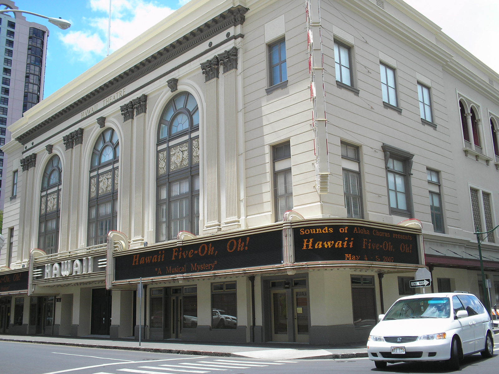
21°17′5″N 157°41′57″W / 21.28472°N 157.69917°WHonolulu 41 Hawaii Theatre 
November 14, 1978 1130 Bethel St.
21°18′56″N 157°51′50″W / 21.31556°N 157.86389°WHonolulu 42 Heeia Fishpond 
January 17, 1973 Address Restricted Kaneohe 43 Edgar and Lucy Henriques House 
November 1, 1984 20 Old Pali Pl.
21°21′9″N 157°49′44″W / 21.3525°N 157.82889°WHonolulu 44‡ Hickam Field 
September 16, 1985 Southeast of Pearl Harbor Naval Base
21°20′7″N 157°56′54″W / 21.33528°N 157.94833°WHonolulu 45 Alfred Hocking House 
November 15, 1984 1302 Nehoa St.
21°18′48″N 157°50′15″W / 21.31333°N 157.8375°WHonolulu Built 1903, designed by E.A.P. Newcomb and C.W. Dickey in Queen Anne style architecture 46 Lemon Wond Holt House 
May 24, 2006 3704 Anuhea St.
21°17′11″N 157°47′42″W / 21.286318°N 157.795054°WHonolulu 47 Honolulu Academy of Arts 
March 25, 1972 900 S. Beretania St.
21°18′25″N 157°51′5″W / 21.30694°N 157.85139°WHonolulu 48 House at 3023 Kalakaua Avenue 
June 5, 1987 3023 Kalakaua Ave.
21°15′51″N 157°49′18″W / 21.26417°N 157.82167°WHonolulu Built 1932 by Earl Williams 49 House at 3023A Kalakaua Avenue 
June 5, 1987 3023A Kalakaua Ave.
21°15′51″N 157°49′18″W / 21.26417°N 157.82167°WHonolulu Built 1932 by Earl Williams 50 House at 3023B Kalakaua Avenue 
June 5, 1987 3023B Kalakaua Ave.
21°15′51″N 157°49′18″W / 21.26417°N 157.82167°WHonolulu Built 1932 by Earl Williams 51 House at 3027 Kalakaua Avenue 
June 5, 1987 3027 Kalakaua Ave.
21°15′51″N 157°49′18″W / 21.26417°N 157.82167°WHonolulu Built 1932 by Earl Williams 52 House at 3033 Kalakaua Avenue 
June 5, 1987 3033 Kalakaua Ave.
21°15′51″N 157°49′18″W / 21.26417°N 157.82167°WHonolulu Built 1932 by Earl Williams 53 House at 3033B Kalakaua Avenue 
June 5, 1987 3033B Kalakaua Ave.
21°15′51″N 157°49′18″W / 21.26417°N 157.82167°WHonolulu Built 1932 by Earl Williams 54 House at 4109 Black Point Road June 5, 1987 4109 Black Point Rd.
21°15′45″N 157°48′16″W / 21.2625°N 157.80444°WHonolulu 55† Huilua Fishpond 
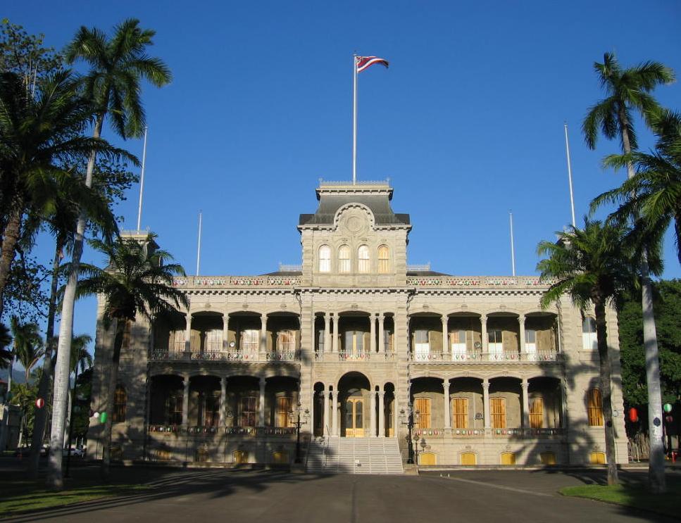
October 15, 1966 In Kahana Bay, 13 miles north of Kaneohe on Hawaii Route 83 adjacent to Ahupuaʻa O Kahana State Park Kaneohe 56† Iolani Palace 
October 15, 1966 364 S. King St.
21°18′41″N 157°51′40″W / 21.31139°N 157.86111°WHonolulu 57 Kahaluu Fish Pond 
March 14, 1973 Northwest of Laenani St. off Kamehameha Highway
21°27′45″N 157°50′18″W / 21.4625°N 157.83833°WKahaluu Private property 58∞ Kahaluu Taro Lo'i 
March 14, 1973 West of the western end of Hui Kelu St.
21°25′57″N 157°50′36″W / 21.4325°N 157.84333°WKahaluu Camouflaged trail access beside Ahuimanu Stream between Heno Pl. and Lile Pl. on mountain side of Hui Kelu St. 59 Kahuku Habitation Area September 11, 1972 Address Restricted Kahuku 60 Kaimuki Fire Station 
December 2, 1980 971 Koko Head Ave.
21°16′9″N 157°48′38″W / 21.26917°N 157.81056°WHonolulu built 1924, architect G. Robert Miller 61 Kakaako Fire Station 
December 2, 1980 620 South St.
21°18′26″N 157°51′43″W / 21.30722°N 157.86194°WHonolulu built 1929, architect Solomon F. Kenn 62 Kakaako Pumping Station 
October 4, 1978 653 Ala Moana Boulevard
21°18′10″N 157°51′56″W / 21.30278°N 157.86556°WHonolulu 63 Kalihi Fire Station 
December 2, 1980 1742 N. King St.
21°20′43″N 157°52′42″W / 21.34528°N 157.87833°WHonolulu built 1924, architect G. Robert Miller 64 Kamehameha V Post Office 
May 5, 1972 Corner of Merchant and Bethel Sts.
21°18′45″N 157°51′48″W / 21.3125°N 157.86333°WHonolulu 65‡ Kaneohe Naval Air Station 
May 28, 1987 Area between 1st St. and Kāne'ohe Bay
21°26′45″N 157°46′11″W / 21.44583°N 157.76972°WKailua 66 Kaneohe Ranch Building 
June 5, 1987 Castle junction
21°22′46″N 157°46′58″W / 21.37944°N 157.78278°WKailua 67 Kaniakapupu 
October 15, 1986 Address Restricted Nuuanu Ruins of the summer palace of King Kamehameha III 68∞ Kapapa Island Complex August 21, 1972 Address Restricted Kapapa Island 69 Kapuaiwa Building 
July 2, 1973 426 Queen St.
21°18′34″N 157°51′46″W / 21.30944°N 157.86278°WHonolulu Built 1884, architect George Lucas 70 Kaumakapili Church 
May 5, 2008 766 N. King St.
21°19′17.45″N 157°51′59.27″W / 21.3215139°N 157.8664639°WHonolulu 71 August 21, 1972 On hill above dead end of Lipalu Street[1] Kaneohe 72† Kawaiahao Church and Mission Houses 
October 15, 1966 957 Punchbowl St., 553 S. King St.
21°18′12″N 157°45′10″W / 21.30333°N 157.75278°WHonolulu 73 Kawailoa Ryusenji Temple November 21, 1978 North of Haleiwa at 179-A Kawailoa Dr.
21°36′37″N 158°5′2″W / 21.61028°N 158.08389°WHaleiwa Demolished[2] 74 Kea'au Talus Sites Archeological District May 4, 1987 Address Restricted Waianae 75 Keaiwa Heiau 
November 9, 1972 At top of Aiea Heights Dr.
21°24′1″N 157°54′26″W / 21.40028°N 157.90722°WAiea Temple site with many plants used for healing 76 John and Kate Kelly House August 27, 1991 4117 Blackpoint Rd.
21°15′40″N 157°47′43″W / 21.26111°N 157.79528°WHonolulu 77∞ Kualoa Ahupua'a Historical District 
October 16, 1974 Kamehameha Highway
21°31′29″N 157°50′39″W / 21.52472°N 157.84417°WKaneohe 78 Kukaniloko Birth Site 
April 11, 1973 At corner of Kamehameha Highway and Whitmore Ave.
21°30′28″N 158°2′22″W / 21.50778°N 158.03944°WWahiawa 79 Kukuipilau Heiau November 16, 1984 On grounds of Hawaiʻi Youth Correctional Facility off Kailua In gulch below buildings of Hawaiʻi Youth Correctional Facility[3] 80 Kupopolo Heiau June 4, 1973 Address Restricted Haleiwa 81 Kyoto Gardens of Honolulu Memorial Park 
February 11, 2004 22 Craigside Place
21°19′39″N 157°51′2″W / 21.3275°N 157.85056°WHonolulu 82 Leleahina Heiau March 20, 1973 South of Haiku Plantation Dr.
21°25′28″N 157°49′37″W / 21.42444°N 157.82694°WKaneohe 83 Lihiwai 
July 26, 1982 and June 5, 1987 51 Kepola Pl. and 41C Kepola Pl.
21°20′44″N 157°50′3″W / 21.34556°N 157.83417°WHonolulu 84 Liljestrand House 
March 26, 2008 3300 Tantalus Dr.
21°25′19″N 157°50′18″W / 21.42194°N 157.83833°WHonolulu 85 Linekona School 
May 28, 1980 Victoria and Beretania Sts.
21°18′27″N 157°51′2″W / 21.3075°N 157.85056°WHonolulu 86 R.N. Linn House 
August 20, 1986 2013 Kakela Dr.
21°18′30″N 157°49′38″W / 21.30833°N 157.82722°WHonolulu 87 Lishman Building September 13, 1978 Makiki Park, Keeaumoku St.
21°18′29″N 157°50′22″W / 21.30806°N 157.83944°WHonolulu Demolished[4] 88 Makiki Fire Station 
December 2, 1980 1202 Wilder Ave.
21°17′26″N 157°52′45″W / 21.29056°N 157.87917°WHonolulu built 1929, architect Solomon F. Kenn 89 Mālia (Hawaiian canoe) December 17, 1993 Southeastern corner of the junction of Kapiolani Boulevard and McCully St.
21°17′30″N 157°50′5″W / 21.29167°N 157.83472°WHonolulu Wooden dugout-style Hawaiian canoe built in 1933 by James Takeo Yamasaki 90 Marigold Building 
August 18, 1983 94-837 Waipahu St.
21°23′24″N 158°0′37″W / 21.39°N 158.01028°WWaipahu Original building [1] replaced by Leeward Oahu Pharmacy 91 McKinley High School 
August 11, 1980 1039 S. King St.
21°18′17″N 157°51′1″W / 21.30472°N 157.85028°WHonolulu Designed by Louis Davis 92 J.P. Mendonca House 
October 7, 1986 1942 Judd Hillside Rd.
21°18′42″N 157°49′43″W / 21.31167°N 157.82861°WHonolulu 93∞ Merchant Street Historic District 
June 19, 1973 Along Merchant St. from Nuuanu Ave. through Fort St.
21°18′47″N 157°51′57″W / 21.31306°N 157.86583°WHonolulu 94 Moana Hotel 
August 7, 1972 2365 Kalakaua Ave.
21°16′47″N 157°49′48″W / 21.27972°N 157.83°WHonolulu 95∞ Mokapu Burial Area November 15, 1972 Address Restricted Kaneohe 96 Molii Fishpond 
December 5, 1972 Southeast of Kamehameha Highway between Kualoa and Johnson Rds.
21°30′47″N 157°50′57″W / 21.51306°N 157.84917°WKaneohe 97∞ National Memorial Cemetery of the Pacific 
January 11, 1976 2177 Puowaina Dr.
21°19′2″N 157°50′55″W / 21.31722°N 157.84861°WHonolulu 98∞ Nuuanu Petroglyph Complex March 14, 1973 Address Restricted Honolulu 99 Oahu Railway and Land Company Right-of-Way 
December 1, 1975 Barbers Point
21°21′14″N 158°1′40″W / 21.35389°N 158.02778°WNanakuli also see Oahu Railway and Land Company 100 George D. Oakley House 
November 15, 1984 2110 Kakela Pl.
21°18′27″N 157°49′40″W / 21.3075°N 157.82778°WHonolulu Tudor cottage 101 Frederick Ohrt House 
June 5, 1987 2958 Pali Highway
21°20′30″N 157°48′10″W / 21.34167°N 157.80278°WHonolulu 102 Okiokilepe Pond March 14, 1973 0.3 miles northwest of Iroquois Point at the entrance to Pearl Harbor
21°20′32″N 157°58′42″W / 21.34222°N 157.97833°WPearl Harbor 103† Opana Radar Site September 19, 1991 Off Kamehameha Highway, south of Kawela Bay
21°41′27″N 158°0′43″W / 21.69083°N 158.01194°WKawela Bay 104 Our Lady of Peace Cathedral 
August 7, 1972 1183 Fort St.
21°18′47″N 157°57′42″W / 21.31306°N 157.96167°WHonolulu 105 Pahukini Heiau 
September 11, 1972 Southwest of Kapaa Quarry
21°23′41″N 157°46′11″W / 21.39472°N 157.76972°WKailua 106 Palama Fire Station 
April 21, 1976 879 N. King St.
21°19′38″N 157°52′14″W / 21.32722°N 157.87056°WHonolulu built 1901, architect Oliver G. Traphagen 107† Palm Circle Historic District 
October 26, 1984 Roughly bounded by Carter Dr., Richardson and Funston Rds., and A and B Sts.
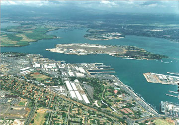
21°21′0″N 157°53′25″W / 21.35°N 157.89028°WHonolulu 108‡ Pearl Harbor, U.S. Naval Base 
October 15, 1966 3 miles south of Pearl City on Hawaii Route 73
21°20′38″N 157°58′30″W / 21.34389°N 157.975°WPearl City 109 Joseph W. Podmore Building 
March 24, 1983 202-206 Merchant St.
21°18′44″N 157°51′50″W / 21.31222°N 157.86389°WHonolulu built 1902, architect Lee Wai 110 Pohaku ka luahine July 23, 1973 Address Restricted Kaneohe 111∞ Punahou School Campus 
August 7, 1972 1601 Punahou St.
21°18′24″N 157°49′54″W / 21.30667°N 157.83167°WHonolulu 112† Puu o Mahuka Heiau 
October 15, 1966 4 miles northeast of Haleiwa on Hawaii Route 83, overlooking Waimea Bay
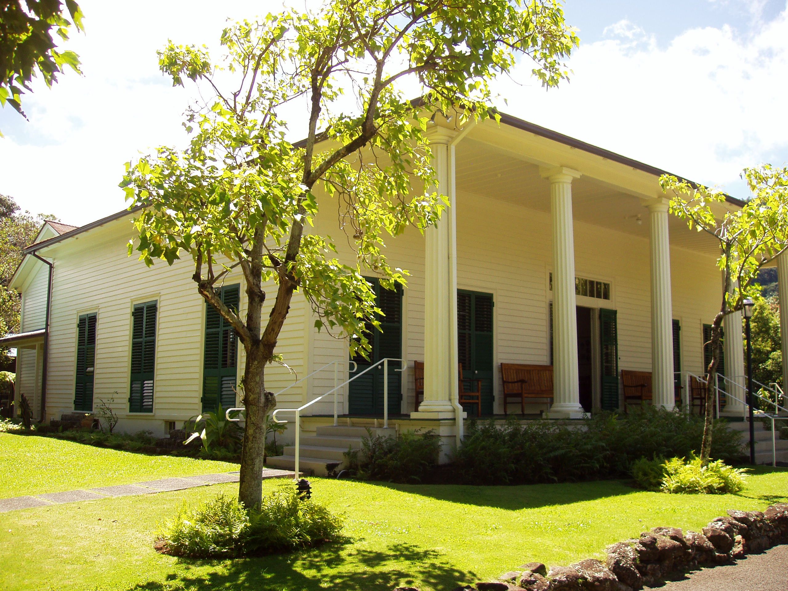
21°38′49″N 158°3′48″W / 21.64694°N 158.06333°WHaleiwa 113 Queen Emma's Summer Home 
August 7, 1972 2913 Pali Highway
21°20′22″N 157°50′27″W / 21.33944°N 157.84083°WHonolulu 114 Royal Brewery 
November 29, 1972 553 S. Queen St.
21°18′22″N 157°51′42″W / 21.30611°N 157.86167°WHonolulu 115 Royal Mausoleum 
August 7, 1972 2261 Nuuanu Ave.
21°19′30″N 157°50′50″W / 21.325°N 157.84722°WHonolulu burial site of royal family known as Mauna ʻAla bilt in 1863 116 Sacred Heart Church 
February 6, 2001 1701 Wilder Ave.
21°18′24″N 157°50′2″W / 21.30667°N 157.83389°WHonolulu 117 Salvation Army Waioli Tea Room 
October 30, 1998 3016 Oahu Ave.
21°19′9″N 157°48′54″W / 21.31917°N 157.815°WHonolulu built 1926, architects Emory & Webb, founded as a girls home and bakery 118∞ Schofield Barracks Historic District July 31, 1998 Roughly bounded by Foote Ave., Wright Ave., McMahon Rd., and Wright-Smith Rd.
21°29′52″N 158°3′30″W / 21.49778°N 158.05833°WSchofield Barracks 119 Schofield Barracks Stockade August 24, 1998 Lyman Rd.
21°29′12″N 158°3′19″W / 21.48667°N 158.05528°WSchofield Barracks 120 J. Alvin Shadinger House 
June 5, 1987 4584 Kahala Ave.
21°16′7″N 157°47′16″W / 21.26861°N 157.78778°WHonolulu also known as The Gingerbread House 121 Charles A. Simpson House 
June 5, 1987 4354 Kahala Ave.
21°15′59″N 157°47′32″W / 21.26639°N 157.79222°WHonolulu 122 Dr. Archibald Neil Sinclair House 
October 13, 1983 2726 Hillside Ave.
21°18′52″N 157°49′8″W / 21.31444°N 157.81889°WHonolulu built 1917, architects Emory & Webb, Colonial Revival style 123 Small Heiau March 14, 1973 1 mile south of Kaaawa off Kaaawa Valley Rd.
21°32′32″N 157°51′21″W / 21.54222°N 157.85583°WKaaawa 124 Mabel Smyth Memorial Building 
February 3, 1994 510 South Beretania St.
21°18′32″N 157°51′34″W / 21.30889°N 157.85944°WHonolulu built 1941, architect C.W. Dickey, renovated 1999[5] 125 St. Andrew's Cathedral 
July 2, 1973 Beretania St. (Queen Emma Sq.)
21°19′58″N 157°51′36″W / 21.33278°N 157.86°WHonolulu 126 Tantalus-Round Top Road 
August 14, 2009 Tantalus Dr., Round Top Dr.
21°19′48.02″N 157°48′51.48″W / 21.3300056°N 157.8143°WHonolulu 127 Frank Tavares House 
June 5, 1987 2826 Coconut Ave.
21°15′51″N 157°49′13″W / 21.26417°N 157.82028°WHonolulu 128 Thomas Square 
April 25, 1972 Bounded by King, S. Beretania, and Victoria Sts. and Ward Ave.
21°18′20″N 157°51′6″W / 21.30556°N 157.85167°WHonolulu 129 U.S. Coast Guard Diamond Head Lighthouse 
October 31, 1980 3399 Diamond Head Rd.
21°15′25″N 157°48′34″W / 21.25694°N 157.80944°WHonolulu 130 U.S. Coast Guard Makapuu Point Light 
December 7, 1977 Southeast of Waimanalo off the Kalanianaole Highway
21°18′53″N 157°39′9″W / 21.31472°N 157.6525°WWaimanalo 131 U.S. Immigration Office 
August 14, 1973 595 Ala Moana Boulevard
21°18′16″N 157°52′0″W / 21.30444°N 157.866667°WHonolulu 132 U.S. Post Office, Customhouse, and Courthouse 
January 27, 1975 335 Merchant St.
21°18′39″N 157°51′48″W / 21.31083°N 157.86333°WHonolulu 133 Ukanipo Heiau August 13, 1982 Address Restricted Makaha 134 Ulu Po Heiau 
November 9, 1972 Off Route 61 northeast of the Castle Medical Center
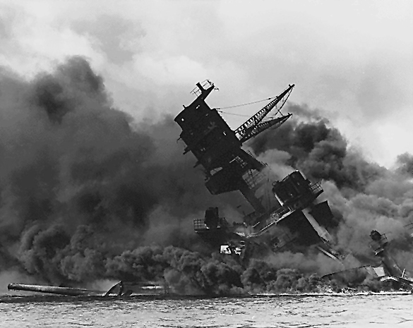
21°23′21″N 157°45′20″W / 21.38917°N 157.75556°W[6]Kailua 135 USS Arizona Memorial 
October 15, 1966 3 miles south of Pearl City on Hawaii Route 73
21°22′4″N 157°57′10″W / 21.36778°N 157.95278°WPearl City 136† USS Arizona Wreck 
May 5, 1989 Off Ford Island in Pearl Harbor
21°22′4″N 157°57′10″W / 21.36778°N 157.95278°WHonolulu 137† USS Bowfin 
November 16, 1982 11 Arizona Memorial Dr.
21°22′7″N 157°56′22″W / 21.36861°N 157.93944°WHonolulu a submarine 138 USS Missouri 
May 14, 1971 63 Cowpens St.
21°21′43″N 157°57′13″W / 21.36194°N 157.95361°WHonolulu Moved from Bremerton, Washington and opened as a museum ship in 1999[7] 139† USS Utah Wreck 
May 5, 1989 Off Ford Island in Pearl Harbor
21°22′18″N 157°57′55″W / 21.37167°N 157.96528°WHonolulu 140 Ernest Shelton Van Tassel House December 16, 1981 3280 Round Top Dr.
21°19′12″N 157°49′29″W / 21.32°N 157.82472°WHonolulu Former macadamia nut plantation, also called Nutridge, built 1922, architect Hart Wood 141 Waialua Agricultural Company Engine No. 6 August 19, 1974 Off Hawaii Route 78
21°25′42″N 158°8′22″W / 21.42833°N 158.13944°WLualualei 142 Waialua Fire Station 
December 2, 1980 66-420 Haleiwa Rd.
21°35′15″N 158°6′43″W / 21.5875°N 158.11194°WHaleiwa built 1932, architect A.W. Heen 143 Waialua School 
August 11, 1980 66-505 Haleiwa Rd.
21°35′10″N 158°6′49″W / 21.58611°N 158.11361°WHaleiwa 144∞ Waianae District January 21, 1974 Address Restricted Waianae 145∞ Waikane Taro Flats April 11, 1973 1 mile northwest of Waikane in Upper Waikane Valley
21°30′16″N 157°52′39″W / 21.50444°N 157.8775°WNorth Ko'olaupoko 146 Wakamiya Inari Shrine 
January 8, 1980 Waipahu Cultural Garden
21°23′29″N 158°0′58″W / 21.39139°N 158.01611°WWaipahu 147 H. Alexander Walker Residence April 24, 1973 2616 Pali Highway
21°20′14″N 157°50′52″W / 21.33722°N 157.84778°WHonolulu 148 War Memorial Natatorium 
August 11, 1980 Kalakaua Ave.
21°16′9″N 157°49′31″W / 21.26917°N 157.82528°WHonolulu 149† Washington Place 
June 18, 1973 320 Beretania St.
21°18′49″N 157°51′35″W / 21.31361°N 157.85972°WHonolulu 150‡ Wheeler Field 
May 28, 1987 Area around Wright Ave. and the flight line
21°29′12″N 158°2′38″W / 21.48667°N 158.04389°WSchofield Barracks Delisted
Landmark name Image Date removed Location City or Town Summary 1 Aiea Sugar Mill October 14, 2009 99-197 Aiea Heights Dr.
21°23′5″N 157°55′43″W / 21.38472°N 157.92861°WAiea Listed January 11, 1996; demolished in 1998[8][9][10] 2 Alexander Young Building October 14, 2009 Bishop St.
21°18′48″N 157°51′48″W / 21.31333°N 157.86333°WHonolulu Listed August 5, 1980; demolished in 1981[11] Key
NRHP-listed property ∞ NRHP-listed Historic district † NRHP-listed National Historic Landmark property ‡ NRHP-listed National Historic Landmark District References
- ^ "Protecting Kaneohe from Hawaiian Memorial Expansion: Proposed Development". Hui O' Pikoiloa / SaveKaneohe.org. http://savekaneohe.org/development.aspx.
- ^ John R. K. Clark (2007) Guardian of the sea: Jizo in Hawaiʻi (University of Hawaii Press), p. 76
- ^ Hamasaki, Mark; Landgraf, Kapuani (2009). Kailua. Kailua Historical Society. pp. 127, 130. ISBN 9781883528393.
- ^ Makiki District Park Master Plan, 8 December 1999
- ^ Environmental Impact Statement, Jan N. Sullivan to Gary Gill, 1 April 1999 (1999-04-23-OA-FEA-MABEL-SMYTH-CONFERENCE-CENTER.pdf)
- ^ Location derived from its GNIS feature record; the NRIS lists the site as "Address Restricted".
- ^ "USS Missouri (BB 63)". The Dictionary of American Naval Fighting Ships. Naval Historical Center. 2009-07-29. http://www.navy.mil/navydata/navy_legacy_hr.asp?id=131. Retrieved 2010-07-04.
- ^ "Governor Lingle approves $2.5 million for former Aiea Sugar Mill site". 14 November 2003. http://hawaii.gov/gov/news/releases/2003/News_Item.2003-11-14.4721. Retrieved 2009-05-24.
- ^ "Wikimapia: Demolished Sugar Mill (Aiea)". http://wikimapia.org/1199834/Demolished-Sugar-Mill.
- ^ Malia Zimmerman (6 September 2002). "The Demise of an Entrepreneurial Dream: Crazy Shirts Founder Watched Company Bleed to Death Financially as City Seized His Property". Hawaii Reporter. http://www.hawaiireporter.com/story.aspx?148f63e9-8d94-4e82-8401-2a93df048d04. Retrieved 2009-05-24.[dead link]
- ^ Linda Arakawa (2 July 2006). "Alexander Young". The Honolulu Advertiser. http://the.honoluluadvertiser.com/150/sesq2young. Retrieved 2009-05-03.
External links
- Historic Hawaii Foundation
- Aviation: From sand dunes to sonic booms – (Hawaii) National Register
U.S. National Register of Historic Places Topics Lists by states Alabama • Alaska • Arizona • Arkansas • California • Colorado • Connecticut • Delaware • Florida • Georgia • Hawaii • Idaho • Illinois • Indiana • Iowa • Kansas • Kentucky • Louisiana • Maine • Maryland • Massachusetts • Michigan • Minnesota • Mississippi • Missouri • Montana • Nebraska • Nevada • New Hampshire • New Jersey • New Mexico • New York • North Carolina • North Dakota • Ohio • Oklahoma • Oregon • Pennsylvania • Rhode Island • South Carolina • South Dakota • Tennessee • Texas • Utah • Vermont • Virginia • Washington • West Virginia • Wisconsin • WyomingLists by territories Lists by associated states Other  Category:National Register of Historic Places •
  Portal:National Register of Historic Places
 State of Hawaii
Honolulu (capital) Topics Geography · Government · Delegations · History · Islands · Music · Language · People · Visitor Attractions
Society Main Islands Northwestern
IslandsFrench Frigate Shoals · Gardner · Kure · Laysan · Lisianski · Maro Reef · Necker · Nihoa · Pearl and Hermes
Communities Counties Categories:- Hawaii-related lists
- National Register of Historic Places in Hawaii


Wikimedia Foundation. 2010.