- National Register of Historic Places listings in Okmulgee County, Oklahoma
-
 Location of Okmulgee County in Oklahoma
This is a list of the National Register of Historic Places listings in Okmulgee County, Oklahoma.
This is intended to be a complete list of the properties and districts on the National Register of Historic Places in Okmulgee County, Oklahoma, United States. The locations of National Register properties and districts for which the latitude and longitude coordinates are included below, may be seen in a Google map.[1]
There are 18 properties and districts listed on the National Register in the county, including 1 National Historic Landmark.
-
- This National Park Service list is complete through NPS recent listings posted November 10, 2011.[2]
Current listings
[3] Landmark name [4] Image Date listed Location City or town Summary 1 Creek National Capitol October 15, 1966 6th St. and Grand Ave.
35°37′21″N 95°58′18″W / 35.6225°N 95.971667°WOkmulgee 2 Eastside Baptist Church November 23, 1984 219 N. Osage Ave.
35°37′33″N 95°57′30″W / 35.625833°N 95.958333°WOkmulgee 3 First Baptist Central Church November 23, 1984 521 N. Central Ave.
35°37′39″N 95°58′11″W / 35.6275°N 95.969722°WOkmulgee 4 Harmon Athletic Field January 25, 1999 North of the junction of 12th St. and Creek Ave.
35°37′05″N 95°57′51″W / 35.618056°N 95.964167°WOkmulgee 5 Hugh Henry House August 18, 1983 N. 3rd St.
35°27′02″N 95°59′00″W / 35.450556°N 95.983333°WHenryetta 6 Isparhecher House and Grave July 12, 1976 About 4 miles west of Beggs off State Highway 16
35°44′15″N 96°07′50″W / 35.7375°N 96.130556°WBeggs 7 Lake Okmulgee Dam Spillway Cascade January 25, 1999 State Highway 56, 10 miles west of U.S. Route 62
35°37′19″N 96°03′32″W / 35.621944°N 96.058889°WOkmulgee 8 Nichols Park December 6, 2006 1.9 miles south of the junction of Lake Rd. and Main St.
35°24′23″N 95°58′35″W / 35.406389°N 95.976389°WHenryetta 9 Nuyaka Mission April 13, 1972 9 miles west of Okmulgee
35°38′59″N 96°09′46″W / 35.649722°N 96.162778°WOkmulgee 10 Okmulgee Armory January 25, 1999 Junction of 2nd and Alabama Sts.
35°37′37″N 95°58′35″W / 35.626944°N 95.976389°WOkmulgee 11 Okmulgee Colored Hospital June 22, 1984 320 N. Wood Dr.
35°38′03″N 95°57′39″W / 35.634167°N 95.960833°WOkmulgee 12 Okmulgee County Courthouse August 23, 1984 300 W. 7th St.
35°37′20″N 95°58′27″W / 35.622222°N 95.974167°WOkmulgee 13 Okmulgee Downtown Historic District 
December 17, 1992 Roughly bounded by 4th St., Frisco Ave., 8th St., and Okmulgee Ave.
35°37′22″N 95°58′12″W / 35.622778°N 95.97°WOkmulgee 14 Okmulgee Public Library July 28, 1983 218 S. Okmulgee Ave.
35°37′17″N 95°58′31″W / 35.621389°N 95.975278°WOkmulgee 15 Okmulgee Stock Pavilion January 25, 1999 Junction of Lagonda and Okmulgee Sts.
35°38′14″N 95°58′29″W / 35.637222°N 95.974722°WOkmulgee 16 St. Anthony's Catholic Church July 14, 1983 515 S. Morton St.
35°37′06″N 95°58′20″W / 35.618333°N 95.972222°WOkmulgee 17 Severs Block March 22, 1991 101 E. 6th St.
35°37′24″N 95°58′16″W / 35.623333°N 95.971111°WOkmulgee 18 Wilson School January 28, 1981 Northwest of Henryetta
35°30′28″N 96°02′06″W / 35.507778°N 96.035°WHenryetta See also
- List of National Historic Landmarks in Oklahoma
- National Register of Historic Places listings in Oklahoma
References
- ^ The latitude and longitude information provided in this table was derived originally from the National Register Information System, which has been found to be fairly accurate for about 99% of listings. For about 1% of NRIS original coordinates, experience has shown that one or both coordinates are typos or otherwise extremely far off; some corrections may have been made. A more subtle problem causes many locations to be off by up to 150 yards, depending on location in the country: most NRIS coordinates were derived from tracing out latitude and longitudes off of USGS topographical quadrant maps created under the North American Datum of 1927, which differs from the current, highly accurate WGS84 GPS system used by Google maps. Chicago is about right, but NRIS longitudes in Washington are higher by about 4.5 seconds, and are lower by about 2.0 seconds in Maine. Latitudes differ by about 1.0 second in Florida. Some locations in this table may have been corrected to current GPS standards.
- ^ "National Register of Historic Places: Weekly List Actions". National Park Service, United States Department of the Interior. Retrieved on November 10, 2011.
- ^ Numbers represent an ordering by significant words. Various colorings, defined here, differentiate National Historic Landmark sites and National Register of Historic Places Districts from other NRHP buildings, structures, sites or objects.
- ^ "National Register Information System". National Register of Historic Places. National Park Service. . http://nrhp.focus.nps.gov/natreg/docs/All_Data.html.
U.S. National Register of Historic Places Topics Lists by states Alabama • Alaska • Arizona • Arkansas • California • Colorado • Connecticut • Delaware • Florida • Georgia • Hawaii • Idaho • Illinois • Indiana • Iowa • Kansas • Kentucky • Louisiana • Maine • Maryland • Massachusetts • Michigan • Minnesota • Mississippi • Missouri • Montana • Nebraska • Nevada • New Hampshire • New Jersey • New Mexico • New York • North Carolina • North Dakota • Ohio • Oklahoma • Oregon • Pennsylvania • Rhode Island • South Carolina • South Dakota • Tennessee • Texas • Utah • Vermont • Virginia • Washington • West Virginia • Wisconsin • WyomingLists by territories Lists by associated states Other Municipalities and communities of Okmulgee County, Oklahoma Cities 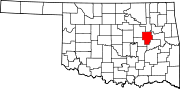
Towns Unincorporated
communitiesBaldhill | Bartlett | Bryant | Coalton | Dighton | Eram | Four Corners | Gulftown | Kusa | Natura | Nuyaka | Preston | Pumpkin Center | Spelter City | Wilson
Footnotes ‡This populated place also has portions in an adjacent county or counties
Categories:- Okmulgee County, Oklahoma
- National Register of Historic Places in Oklahoma by county
- Buildings and structures in Okmulgee County, Oklahoma
-


Wikimedia Foundation. 2010.