National Register of Historic Places listings in Park County, Colorado
- National Register of Historic Places listings in Park County, Colorado
-

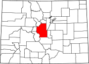
Location of Park County in Colorado
This is a list of the National Register of Historic Places listings in Park County, Colorado.
This is intended to be a complete list of the properties and districts on the National Register of Historic Places in Park County, Colorado, United States. The locations of National Register properties and districts for which the latitude and longitude coordinates are included below, may be seen in a Google map.[1]
There are 19 properties and districts listed on the National Register in the county.
-
- This National Park Service list is complete through NPS recent listings posted November 10, 2011.[2]
Current listings
| [3] |
Landmark name [4] |
Image |
Date listed |
Location |
City or town |
Summary |
| 1 |
Boreas Railroad Station Site |
|
01993-10-28October 28, 1993 |
Boreas Pass Rd. northwest of Como in the Pike National Forest
39°24′40″N 105°58′05″W / 39.411111°N 105.968056°W / 39.411111; -105.968056 (Boreas Railroad Station Site) |
Como |
|
| 2 |
Buckley Ranch |
|
02000-01-28January 28, 2000 |
County Road 59
39°00′55″N 105°43′48″W / 39.015278°N 105.73°W / 39.015278; -105.73 (Buckley Ranch) |
Hartsel |
|
| 3 |
Colorado Salt Works |
|
02001-02-02February 2, 2001 |
3858 U.S. Route 285
38°57′11″N 105°56′43″W / 38.953056°N 105.945278°W / 38.953056; -105.945278 (Colorado Salt Works) |
Hartsel |
|
| 4 |
Como Roundhouse, Railroad Depot and Hotel Complex |
|
01983-05-20May 20, 1983 |
Off U.S. Route 285
39°19′01″N 105°53′29″W / 39.316944°N 105.891389°W / 39.316944; -105.891389 (Como Roundhouse, Railroad Depot and Hotel Complex) |
Como |
|
| 5 |
Como School |
|
02000-06-30June 30, 2000 |
Spruce St.
39°19′01″N 105°53′48″W / 39.316944°N 105.896667°W / 39.316944; -105.896667 (Como School) |
Como |
|
| 6 |
EM Ranch |
|
02002-10-15October 15, 2002 |
County Road 439
39°04′40″N 105°48′33″W / 39.077778°N 105.809167°W / 39.077778; -105.809167 (EM Ranch) |
Hartsel |
|
| 7 |
Estabrook Historic District |
|
01980-10-20October 20, 1980 |
Northeast of Bailey
39°22′51″N 105°25′42″W / 39.380833°N 105.428333°W / 39.380833; -105.428333 (Estabrook Historic District) |
Bailey |
|
| 8 |
Fairplay Hotel |
|
02008-01-16January 16, 2008 |
500 Main St.
39°13′29″N 106°00′03″W / 39.224722°N 106.000833°W / 39.224722; -106.000833 (Fairplay Hotel) |
Fairplay |
|
| 9 |
Glenisle |
|
01985-01-18January 18, 1985 |
Off U.S. Route 285
39°24′34″N 105°30′00″W / 39.409444°N 105.5°W / 39.409444; -105.5 (Glenisle) |
Bailey |
|
| 10 |
Jefferson Denver South Park and Pacific Railroad Depot |
|
01998-12-31December 31, 1998 |
Junction of U.S. Route 285 and County Road 35
39°22′38″N 105°48′02″W / 39.377222°N 105.800556°W / 39.377222; -105.800556 (Jefferson Denver South Park and Pacific Railroad Depot) |
Jefferson |
|
| 11 |
Park County Courthouse and Jail |
|
01979-05-25May 25, 1979 |
418 Main St.
39°13′32″N 106°00′06″W / 39.225556°N 106.001667°W / 39.225556; -106.001667 (Park County Courthouse and Jail) |
Fairplay |
|
| 12 |
Salt Works Ranch |
|
02001-02-02February 2, 2001 |
3858 U.S. Route 285
38°57′19″N 105°56′59″W / 38.955278°N 105.949722°W / 38.955278; -105.949722 (Salt Works Ranch) |
Hartsel |
|
| 13 |
Shawnee |
|
02010-07-08July 8, 2010 |
56016-56114 Frontage Rd.; 55919-56278 U.S. Route 285; 31-36 W. Shawnee Rd.; 54-152 Waterworks Rd.
39°25′16″N 105°53′15″W / 39.421111°N 105.8875°W / 39.421111; -105.8875 (Shawnee) |
Shawnee |
|
| 14 |
South Park Community Church |
|
01977-11-22November 22, 1977 |
6th and Hathaway Sts.
39°13′29″N 105°59′57″W / 39.224722°N 105.999167°W / 39.224722; -105.999167 (South Park Community Church) |
Fairplay |
|
| 15 |
South Park Lager Beer Brewery |
|
01974-06-25June 25, 1974 |
3rd and Front Sts.
39°13′32″N 106°00′12″W / 39.225556°N 106.003333°W / 39.225556; -106.003333 (South Park Lager Beer Brewery) |
Fairplay |
|
| 16 |
Summer Saloon |
|
01974-05-08May 8, 1974 |
3rd and Front Sts.
39°13′29″N 106°00′17″W / 39.224722°N 106.004722°W / 39.224722; -106.004722 (Summer Saloon) |
Fairplay |
|
| 17 |
Tarryall School |
|
01985-05-16May 16, 1985 |
31000 County Rd.
39°07′14″N 105°28′25″W / 39.120556°N 105.473611°W / 39.120556; -105.473611 (Tarryall School) |
Tarryall |
|
| 18 |
Threemile Gulch |
|
02011-09-13September 13, 2011 |
Feeding into the Middle Fork South Platte River, 3 miles (4.8 km) north of Hartsel
39°3′42″N 105°47′34″W / 39.06167°N 105.79278°W / 39.06167; -105.79278 (Threemile Gulch)[5]
|
Hartsel |
|
| 19 |
Wahl Ranch |
|
02000-10-12October 12, 2000 |
U.S. Route 285 and Lost Park Rd.
39°23′31″N 105°47′23″W / 39.391944°N 105.789722°W / 39.391944; -105.789722 (Wahl Ranch) |
Jefferson |
|
See also
References
- ^ The latitude and longitude information provided in this table was derived originally from the National Register Information System, which has been found to be fairly accurate for about 99% of listings. For about 1% of NRIS original coordinates, experience has shown that one or both coordinates are typos or otherwise extremely far off; some corrections may have been made. A more subtle problem causes many locations to be off by up to 150 yards, depending on location in the country: most NRIS coordinates were derived from tracing out latitude and longitudes off of USGS topographical quadrant maps created under North American Datum of 1927, which differs from the current, highly accurate GPS system used by Google maps. Chicago is about right, but NRIS longitudes in Washington are higher by about 4.5 seconds, and are lower by about 2.0 seconds in Maine. Latitudes differ by about 1.0 second in Florida. Some locations in this table may have been corrected to current GPS standards.
- ^ "National Register of Historic Places: Weekly List Actions". National Park Service, United States Department of the Interior. Retrieved on November 10, 2011.
- ^ Numbers represent an ordering by significant words. Various colorings, defined here, differentiate National Historic Landmark sites and National Register of Historic Places Districts from other NRHP buildings, structures, sites or objects.
- ^ "National Register Information System". National Register of Historic Places. National Park Service. . http://nrhp.focus.nps.gov/natreg/docs/All_Data.html.
- ^ Location derived from its GNIS feature record; the NRIS lists the site as "Address Restricted".
Wikimedia Foundation.
2010.
Look at other dictionaries:
National Register of Historic Places listings in Larimer County, Colorado — Location of Larimer County in Colorado This is a list of the National Register of Historic Places listings in Larimer County, Colorado. It is intended to be a complete list of the properties and districts on the National Register of Historic… … Wikipedia
National Register of Historic Places listings in Boulder County, Colorado — Location of Boulder County in Colorado This is a list of the National Register of Historic Places listings in Boulder County, Colorado. This is intended to be a complete list of the properties and districts on the National Register of Historic… … Wikipedia
National Register of Historic Places listings in Jefferson County, Colorado — Location of Jefferson County in Colorado This is a list of the National Register of Historic Places listings in Jefferson County, Colorado. It is intended to be a complete list of the properties and districts on the National Register of Historic… … Wikipedia
National Register of Historic Places listings in Pitkin County, Colorado — Location of Pitkin County in Colorado This is a list of the National Register of Historic Places listings in Pitkin County, Colorado. This is intended to be a complete list of the properties and districts on the National Register of Historic… … Wikipedia
National Register of Historic Places listings in Douglas County, Colorado — Location of Douglas County in Colorado This is a list of the National Register of Historic Places listings in Douglas County, Colorado. It is intended to be a complete list of the properties and districts on the National Register of Historic… … Wikipedia
National Register of Historic Places listings in Grand County, Colorado — Location of Grand County in Colorado This is a list of the National Register of Historic Places listings in Grand County, Colorado. This is intended to be a complete list of the properties and districts on the National Register of Historic Places … Wikipedia
National Register of Historic Places listings in Mesa County, Colorado — Location of Mesa County in Colorado This is a list of the National Register of Historic Places listings in Mesa County, Colorado. It is intended to be a complete list of the properties and districts on the National Register of Historic Places in… … Wikipedia
National Register of Historic Places listings in Pueblo County, Colorado — Location of Pueblo County in Colorado This is a list of the National Register of Historic Places listings in Pueblo County, Colorado. It is intended to be a complete list of the properties and districts on the National Register of Historic Places … Wikipedia
National Register of Historic Places listings in Adams County, Colorado — Location of Adams County in Colorado This is a list of the National Register of Historic Places listings in Adams County, Colorado. This is intended to be a complete list of the properties and districts on the National Register of Historic Places … Wikipedia
National Register of Historic Places listings in Chaffee County, Colorado — Location of Chaffee County in Colorado This is a list of the National Register of Historic Places listings in Chaffee County, Colorado. It is intended to be a complete list of the properties and districts on the National Register of Historic… … Wikipedia

 Category:National Register of Historic Places •
  Portal:National Register of Historic Places