- National Register of Historic Places listings in Park County, Montana
-
 Location of Park County in Montana
This is a list of the National Register of Historic Places listings in Park County, Montana.
This is intended to be a complete list of the properties and districts on the National Register of Historic Places in Park County, Montana, United States. The locations of National Register properties and districts for which the latitude and longitude coordinates are included below, may be seen in a Google map.[1]
There are 26 properties and districts listed on the National Register in the county, including 1 National Historic Landmark.
-
- This National Park Service list is complete through NPS recent listings posted November 10, 2011.[2]
Current listings
[3] Landmark name Image Date listed Location City or town Summary 1 B Street District September 5, 1979 B St.
45°39′35″N 110°33′18″W / 45.659722°N 110.555°WLivingston 2 Oliver and Lucy Bonnell Gothic Arch Roofed Barn September 15, 2004 247 Shields River Road, E.
45°47′31″N 110°29′55″W / 45.791944°N 110.498611°WClyde Park 3 Carbella Bridge January 4, 2010 Milepost 0 on Tom Miner Rd., near its junction with U.S. Route 89
45°12′16″N 110°54′06″W / 45.204514°N 110.901558°WGardiner 4 Carter Bridge April 28, 2011 Milepost 31.6 on MT 540
45°35′49″N 110°34′02″W / 45.596944°N 110.567222°WLivingston vicinity Reinforced Concrete Bridges in Montana, 1900-1958 MPS 5 Chicken Creek Farmstead Historic District December 12, 2008 790 Rock Creek Rd., N.
45°53′23″N 110°25′32″W / 45.889772°N 110.425686°WClyde Park 6 Chico Hot Springs August 21, 1998 2 miles northeast of Chico, 3.5 miles southeast of Emigrant
45°20′10″N 110°41′35″W / 45.336111°N 110.693056°WPray 7 Commercial District 
September 5, 1979 Roughly bounded by Park, C, Clark, 3rd, and Callendar Sts.
45°39′34″N 110°33′48″W / 45.659444°N 110.563333°WLivingston 8 Cooke City Store March 27, 1986 Main St.
45°01′10″N 109°56′02″W / 45.019444°N 109.933889°WCooke City 9 Detention Hospital September 5, 1979 325 E. Gallatin St.
45°40′04″N 110°33′35″W / 45.667778°N 110.559722°WLivingston 10 East Side Residential District September 5, 1979 Roughly bounded by I, Clark, E, and Park Sts.
45°39′53″N 110°33′07″W / 45.664722°N 110.551944°WLivingston 11 Ebert Ranch September 5, 1979 U.S. Route 89
45°42′03″N 110°31′11″W / 45.700833°N 110.519722°WLivingston 12 Harvat Ranch September 5, 1979 Southeast of Livingston off U.S. Route 89
45°40′05″N 110°31′59″W / 45.668056°N 110.533056°WLivingston 13 John Hepburn Place October 19, 2005 626 E. River Rd.
45°17′40″N 110°49′53″W / 45.294444°N 110.831389°WEmigrant 14 KPRK Radio September 5, 1979 East of Livingston off U.S. Route 89
45°40′22″N 110°32′24″W / 45.672778°N 110.54°WLivingston 15 Krohne Island House September 5, 1979 Krohne Island
45°40′15″N 110°32′30″W / 45.670833°N 110.541667°WLivingston 16 Krohne Spring House September 5, 1979 329 S. H St.
45°39′47″N 110°32′53″W / 45.663056°N 110.548056°WLivingston 17 North Entrance Road Historic District 
May 22, 2002 Yellowstone National Park
45°00′24″N 110°41′58″W / 45.006667°N 110.699444°WYellowstone National Park 18 Northeast Entrance Station 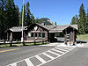
May 28, 1987 U.S. Route 212
45°00′17″N 110°00′33″W / 45.004722°N 110.009167°WYellowstone National Park 19 Northside School September 5, 1979 118 W. Chinook St.
45°39′51″N 110°33′49″W / 45.664167°N 110.563611°WLivingston 20 OTO Homestead and Dude Ranch 
October 12, 2004 15 miles north of Gardiner
45°08′41″N 110°21′13″W / 45.144722°N 110.353611°WGardiner 21 Rolfson House September 5, 1979 West of Livingston on Bozeman Rd.
45°39′42″N 110°40′17″W / 45.661667°N 110.671389°WLivingston 22 Sixty-Three Ranch December 7, 1982 Address Restricted Livingston 23 Trowbridge Dairy September 5, 1979 207 S. M St.
45°40′04″N 110°32′40″W / 45.667778°N 110.544444°WLivingston 24 Urbach Cabin September 5, 1979 9th St. Island
45°38′54″N 110°33′34″W / 45.648333°N 110.559444°WLivingston 25 US Post Office-Livingston Main March 14, 1986 105 N. 2nd St.
45°39′39″N 110°33′40″W / 45.660833°N 110.561111°WLivingston 26 West Side Residential District September 5, 1979 Roughly bounded by Sacajawea Park, 7th, Park, and 3rd Sts.
45°39′26″N 110°33′42″W / 45.657222°N 110.561667°WLivingston See also
- List of National Historic Landmarks in Montana
- National Register of Historic Places listings in Montana
References
- ^ The latitude and longitude information provided in this table was derived originally from the National Register Information System, which has been found to be fairly accurate for about 99% of listings. For about 1% of NRIS original coordinates, experience has shown that one or both coordinates are typos or otherwise extremely far off; some corrections may have been made. A more subtle problem causes many locations to be off by up to 150 yards, depending on location in the country: most NRIS coordinates were derived from tracing out latitude and longitudes off of USGS topographical quadrant maps created under the North American Datum of 1927, which differs from the current, highly accurate WGS84 GPS system used by Google maps. Chicago is about right, but NRIS longitudes in Washington are higher by about 4.5 seconds, and are lower by about 2.0 seconds in Maine. Latitudes differ by about 1.0 second in Florida. Some locations in this table may have been corrected to current GPS standards.
- ^ "National Register of Historic Places: Weekly List Actions". National Park Service, United States Department of the Interior. Retrieved on November 10, 2011.
- ^ Numbers represent an ordering by significant words. Various colorings, defined here, differentiate National Historic Landmark sites and National Register of Historic Places Districts from other NRHP buildings, structures, sites or objects.
U.S. National Register of Historic Places Topics Lists by states Alabama • Alaska • Arizona • Arkansas • California • Colorado • Connecticut • Delaware • Florida • Georgia • Hawaii • Idaho • Illinois • Indiana • Iowa • Kansas • Kentucky • Louisiana • Maine • Maryland • Massachusetts • Michigan • Minnesota • Mississippi • Missouri • Montana • Nebraska • Nevada • New Hampshire • New Jersey • New Mexico • New York • North Carolina • North Dakota • Ohio • Oklahoma • Oregon • Pennsylvania • Rhode Island • South Carolina • South Dakota • Tennessee • Texas • Utah • Vermont • Virginia • Washington • West Virginia • Wisconsin • WyomingLists by territories Lists by associated states Other Municipalities and communities of Park County, Montana City 
Town CDPs Unincorporated
communitiesEmigrant | Jardine
Ghost town Aldridge
Categories:- National Register of Historic Places in Montana by county
- Park County, Montana
-


Wikimedia Foundation. 2010.