- National Register of Historic Places listings in Patrick County, Virginia
-
This list includes properties and districts listed on the National Register of Historic Places in Patrick County, Virginia. Click the "Map of all coordinates" link to the right to view a Google map of all properties and districts with latitude and longitude coordinates in the table below.[1]
-
- This National Park Service list is complete through NPS recent listings posted November 10, 2011.[2]
[3] Landmark name [4] Image Date listed Location City or town Summary 1 Aurora 
February 4, 1991 VA 629 S of jct. with US 58
36°36′03″N 80°03′11″W / 36.600833°N 80.053056°WPenn's Store 2 Barnard Farm May 21, 2009 2878 VA 648 Ararat 3 Bluemont Presbyterian Church and Cemetery March 30, 2007 Blue Ridge Pkwy, Mile Post No. 192
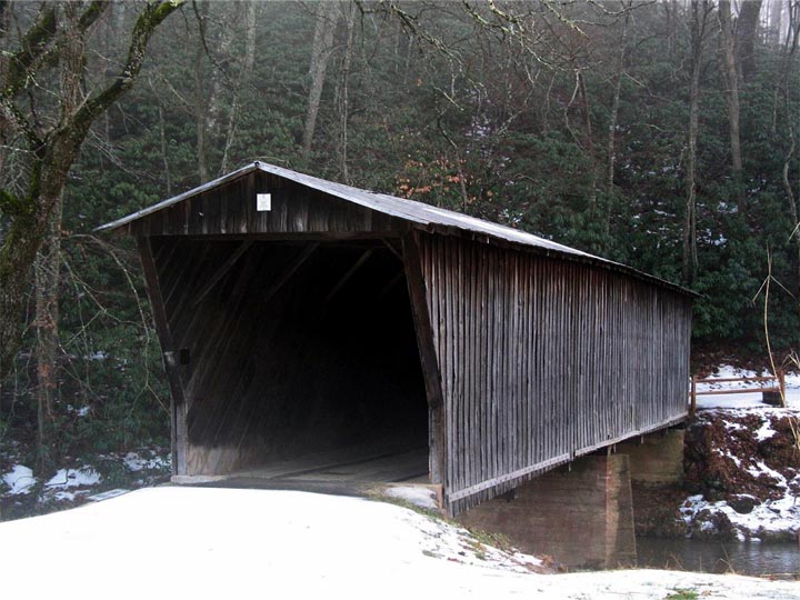
36°39′27″N 80°34′22″W / 36.6575°N 80.572886°WFancy Gap 4 Bob White Covered Bridge 
May 22, 1973 About 2.5 mi. S of Woolwine off VA 618, over Smith River
36°46′45″N 80°14′53″W / 36.779167°N 80.248056°WWoolwine 5 Cockram Mill December 6, 1990 US 58 E of jct. with VA 632
36°44′13″N 80°22′49″W / 36.736944°N 80.380278°WMeadows of Dan 6 Goblintown Mill November 26, 2004 888 Iron Bridge Rd.
36°47′38″N 80°09′36″W / 36.793889°N 80.16°WStuart 7 Jack's Creek Covered Bridge 
May 22, 1973 About 2 mi. S of Woolwine off VA 8, over Jack
36°45′51″N 80°16′25″W / 36.764167°N 80.273611°WWoolwine 8 Mayberry Presbyterian Church March 30, 2007 1127 Mayberry Church Rd.
36°42′44″N 80°26′20″W / 36.712225°N 80.438917°WMeadows of Dan 9 Patrick County Courthouse 
December 27, 1974 SE corner of Main and Blue Ridge Sts.
36°38′29″N 80°16′13″W / 36.641389°N 80.270278°WStuart 10 Reynolds Homestead 
September 22, 1971 N of Critz on VA 798
36°38′39″N 80°08′55″W / 36.644167°N 80.148611°WCritz Also known as Rock Spring Plantation 11 Stuart Uptown Historic District 
January 24, 2002 Main St. and Blue Ridge St.
36°38′29″N 80°16′12″W / 36.641389°N 80.27°WStuart 12 J.E.B. Stuart Birthplace September 24, 1998 N side of VA 773, W of jct. with VA 617
36°33′48″N 80°33′16″W / 36.563333°N 80.554444°WArarat See also
- National Register of Historic Places listings in Virginia
- List of National Historic Landmarks in Virginia
References
- ^ The latitude and longitude information provided in this table was derived originally from the National Register Information System, which has been found to be fairly accurate for about 99% of listings. For about 1% of NRIS original coordinates, experience has shown that one or both coordinates are typos or otherwise extremely far off; some corrections may have been made. A more subtle problem causes many locations to be off by up to 150 yards, depending on location in the country: most NRIS coordinates were derived from tracing out latitude and longitudes off of USGS topographical quadrant maps created under the North American Datum of 1927, which differs from the current, highly accurate WGS84 GPS system used by Google maps. Chicago is about right, but NRIS longitudes in Washington are higher by about 4.5 seconds, and are lower by about 2.0 seconds in Maine. Latitudes differ by about 1.0 second in Florida. Some locations in this table may have been corrected to current GPS standards.
- ^ "National Register of Historic Places: Weekly List Actions". National Park Service, United States Department of the Interior. Retrieved on November 10, 2011.
- ^ Numbers represent an ordering by significant words. Various colorings, defined here, differentiate National Historic Landmark sites and National Register of Historic Places Districts from other NRHP buildings, structures, sites or objects.
- ^ "National Register Information System". National Register of Historic Places. National Park Service. . http://nrhp.focus.nps.gov/natreg/docs/All_Data.html.
U.S. National Register of Historic Places Topics Lists by states Alabama • Alaska • Arizona • Arkansas • California • Colorado • Connecticut • Delaware • Florida • Georgia • Hawaii • Idaho • Illinois • Indiana • Iowa • Kansas • Kentucky • Louisiana • Maine • Maryland • Massachusetts • Michigan • Minnesota • Mississippi • Missouri • Montana • Nebraska • Nevada • New Hampshire • New Jersey • New Mexico • New York • North Carolina • North Dakota • Ohio • Oklahoma • Oregon • Pennsylvania • Rhode Island • South Carolina • South Dakota • Tennessee • Texas • Utah • Vermont • Virginia • Washington • West Virginia • Wisconsin • WyomingLists by territories Lists by associated states Other Municipalities and communities of Patrick County, Virginia Town 
CDP Unincorporated
communitiesArarat | Claudville | Meadows of Dan | Vesta | Mayberry | Russel Creek | Woolwine
Categories:- Patrick County, Virginia
- National Register of Historic Places in Virginia
- Virginia-related lists
-


Wikimedia Foundation. 2010.