- National Register of Historic Places listings in Pender County, North Carolina
-

This list includes properties and districts listed on the National Register of Historic Places in Pender County, North Carolina. Click the "Map of all coordinates" link to the right to view a Google map of all properties and districts with latitude and longitude coordinates in the table below.[1]
-
- This National Park Service list is complete through NPS recent listings posted November 10, 2011.[2]
[3] Landmark name[4] Image Date listed Location City or Town Summary 1 Gov. Samuel Ashe Grave October 12, 2001 Farm Ln., from S side of NC 1411, 0.7 miles E of crossing of Pike Creek
34°28′41″N 77°51′9″W / 34.47806°N 77.8525°WRocky Point 2 Bannerman House May 31, 1974 NE of Burgaw off NC 53 on SR 1520
34°36′7″N 77°47′26″W / 34.60194°N 77.79056°WBurgaw 3 Beatty-Corbett House March 17, 1986 SR 701 at SR 1200
34°33′11″N 78°15′9″W / 34.55306°N 78.2525°WIvanhoe 4 Belvidere Plantation House June 14, 1982 Off SR 1565
34°23′5″N 77°38′51″W / 34.38472°N 77.6475°WHampstead 5 Burgaw Depot July 24, 1986 102 E. Fremont
34°33′0″N 77°55′43″W / 34.55°N 77.92861°WBurgaw 6 Burgaw Historic District August 27, 1999 Roughly bounded by Cowan St., Fremont St., Dudley St., and Ashe St.
34°33′5″N 77°55′35″W / 34.55139°N 77.92639°WBurgaw 7 Cape Fear Civil War Shipwreck Discontiguous District December 23, 1985 Address Restricted Topsail Beach 8 Moores Creek National Battlefield 
October 15, 1966 25 miles NW of Wilmington on NC 210
34°27′27″N 78°6′36″W / 34.4575°N 78.11°WWilmington Boundary increased on February 13, 1987, the Moore's Creek National Military Park 9 Pender County Courthouse May 10, 1979 Wright, Wilmington, Walker, and Fremont Sts.
34°33′2″N 77°55′34″W / 34.55056°N 77.92611°WBurgaw 10 Poplar Grove July 16, 1979 US 17
34°19′12.99″N 77°45′54.97″W / 34.320275°N 77.7652694°WScotts Hill 11 Sloop Point January 20, 1972 NE of Vista off SR 1561
34°24′58″N 77°35′55″W / 34.41611°N 77.59861°WVista 12 US Naval Ordnance Testing Facility Assembly Building 
September 14, 1993 Jct. Of Channel Blvd. and Flake Ave.
34°22′2″N 77°37′49″W / 34.36722°N 77.63028°WTopsail Beach 13 US Naval Ordnance Testing Facility Control Tower 
September 14, 1993 SW corner of S. Anderson Blvd. and Flake Ave.
34°21′58″N 77°37′45″W / 34.36611°N 77.62917°WTopsail Beach 14 US Naval Ordnance Testing Facility Observation Tower No. 2 
September 14, 1993 1000 blk. S. Anderson Blvd.
34°22′53″N 77°36′47″W / 34.38139°N 77.61306°WTopsail Beach See also
- National Register of Historic Places listings in North Carolina
- List of National Historic Landmarks in North Carolina
References
- ^ The latitude and longitude information provided in this table was derived originally from the National Register Information System, which has been found to be fairly accurate for about 99% of listings. For about 1% of NRIS original coordinates, experience has shown that one or both coordinates are typos or otherwise extremely far off; some corrections may have been made. A more subtle problem causes many locations to be off by up to 150 yards, depending on location in the country: most NRIS coordinates were derived from tracing out latitude and longitudes off of USGS topographical quadrant maps created under North American Datum of 1927, which differs from the current, highly accurate GPS system used by Google maps. Chicago is about right, but NRIS longitudes in Washington are higher by about 4.5 seconds, and are lower by about 2.0 seconds in Maine. Latitudes differ by about 1.0 second in Florida. Some locations in this table may have been corrected to current GPS standards.
- ^ "National Register of Historic Places: Weekly List Actions". National Park Service, United States Department of the Interior. Retrieved on November 10, 2011.
- ^ Numbers represent an ordering by significant words. Various colorings, defined here, differentiate National Historic Landmark sites and National Register of Historic Places Districts from other NRHP buildings, structures, sites or objects.
- ^ "National Register Information System". National Register of Historic Places. National Park Service. 2008-04-24. http://nrhp.focus.nps.gov/natreg/docs/All_Data.html.
U.S. National Register of Historic Places Topics Lists by states Alabama • Alaska • Arizona • Arkansas • California • Colorado • Connecticut • Delaware • Florida • Georgia • Hawaii • Idaho • Illinois • Indiana • Iowa • Kansas • Kentucky • Louisiana • Maine • Maryland • Massachusetts • Michigan • Minnesota • Mississippi • Missouri • Montana • Nebraska • Nevada • New Hampshire • New Jersey • New Mexico • New York • North Carolina • North Dakota • Ohio • Oklahoma • Oregon • Pennsylvania • Rhode Island • South Carolina • South Dakota • Tennessee • Texas • Utah • Vermont • Virginia • Washington • West Virginia • Wisconsin • WyomingLists by territories Lists by associated states Other Municipalities and communities of Pender County, North Carolina Towns 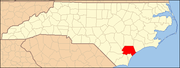
Village Unincorporated
communitiesCurrie | Hampstead | Maple Hill | Montague | Rocky Point | Sloop Point | Yamacraw
Footnotes ‡This populated place also has portions in an adjacent county or counties
Categories:- Pender County, North Carolina
- National Register of Historic Places in North Carolina
- Buildings and structures in Pender County, North Carolina
-


Wikimedia Foundation. 2010.