- National Register of Historic Places listings in Perry County, Pennsylvania
-
 Location of Perry County in Pennsylvania
This is a list of the National Register of Historic Places listings in Perry County, Pennsylvania.
This is intended to be a complete list of the properties and districts on the National Register of Historic Places in Perry County, Pennsylvania, United States. The locations of National Register properties and districts for which the latitude and longitude coordinates are included below, may be seen in a Google map.[1]
There are 21 properties and districts listed on the National Register in the county.
-
- This National Park Service list is complete through NPS recent listings posted November 10, 2011.[2]
Current listings
[3] Landmark name[4] Image Date listed Location City or Town Summary 1 Adairs Covered Bridge 
August 25, 1980 East of Andersonburg on Legislative Route 50009
40°21′2″N 77°25′27″W / 40.35056°N 77.42417°WSouthwest Madison Township 2 Bistline Covered Bridge August 25, 1980 South of Andersonburg on Legislative Route 50008
40°20′2″N 77°28′14″W / 40.33389°N 77.47056°WSouthwest Madison Township 3 Book's Covered Bridge 
August 25, 1980 Southwest of Blain on Legislative Route 50004
40°19′28″N 77°31′29″W / 40.32444°N 77.52472°WJackson Township 4 Bridge in Newport Borough 
June 22, 1988 Legislative Route 31 over Little Buffalo Creek
40°28′27″N 77°7′48″W / 40.47417°N 77.13°WNewport and Oliver Township 5 Dellville Covered Bridge August 25, 1980 Township 456
40°21′49″N 77°7′0″W / 40.36361°N 77.116667°WWheatfield Township 6 Dunbar-Creigh House 
June 27, 1980 Water Street
40°20′30″N 77°18′25″W / 40.34167°N 77.30694°WLandisburg 7 Fleisher Covered Bridge 
August 25, 1980 Northwest of Newport on Township 477
40°29′22″N 77°9′31″W / 40.48944°N 77.15861°WOliver Township 8 Kochendefer Covered Bridge 
August 25, 1980 Southeast of Saville on Township 332
40°25′27″N 77°23′15″W / 40.42417°N 77.3875°WSaville Township 9 Little Buffalo Historic District April 3, 1978 Southwest of Newport off Pennsylvania Route 34
40°27′19″N 77°10′13″W / 40.45528°N 77.17028°WCentre and Juniata Townships 10 Israel and Samuel Lupfer Tannery Site and House May 30, 2003 Black Hollow Road
40°16′54.4″N 77°32′1.6″W / 40.281778°N 77.533778°WJackson and Toboyne Townships 11 Millersburg Ferry 
August 2, 2006 Over the Susquehanna River between Millersburg and Buffalo Township
40°32′39″N 76°58′25″W / 40.54417°N 76.97361°WBuffalo Township Extends into Millersburg in Dauphin County 12 Mt. Pleasant Covered Bridge 
August 25, 1980 East of New Germantown on Township 304
40°18′54″N 77°32′44″W / 40.315°N 77.54556°WJackson Township 13 New Germantown Covered Bridge 
August 25, 1980 South of New Germantown on Township 302
40°18′24″N 77°34′6″W / 40.30667°N 77.56833°WJackson Township 14 Newport Historic District 
March 12, 1999 Roughly bounded by Fickes Lane, Oliver Street, Front Street, Little Buffalo Run, Bloomfield Avenue, and Sixth Street
40°28′39″N 77°7′58″W / 40.4775°N 77.13278°WNewport and Oliver Township 15 O'Donel House and Farm 
July 17, 1986 West of New Germantown on Pennsylvania Route 274
40°16′53″N 77°37′19″W / 40.28139°N 77.62194°WToboyne Township 16 Perry County Courthouse 
February 24, 1975 Center Square
40°25′12″N 77°11′15″W / 40.42°N 77.1875°WBloomfield 17 Red Covered Bridge August 25, 1980 East of Millerstown on Legislative Route 50023
40°33′57.8″N 77°0′14.2″W / 40.566056°N 77.003944°WLiverpool Township 18 Rice Covered Bridge 
August 25, 1980 South of Landisburg on Legislative Route 50023
40°20′9″N 77°18′34″W / 40.33583°N 77.30944°WTyrone Township 19 Rockville Bridge 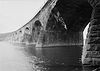
August 15, 1975 0.5 miles south of central Marysville over the Susquehanna River
40°19′59″N 76°54′42″W / 40.33306°N 76.91167°WMarysville Extends into Dauphin County 20 Saville Covered Bridge 
August 25, 1980 Legislative Route 50037
40°26′17″N 77°23′47″W / 40.43806°N 77.39639°WSaville Township 21 Waggoner Covered Bridge 
August 25, 1980 West of Loysville on Township 579
40°21′34″N 77°22′23″W / 40.35944°N 77.37306°WNortheast Madison Township See also
- List of National Historic Landmarks in Pennsylvania
- National Register of Historic Places listings in Pennsylvania
- List of Pennsylvania state historical markers in Perry County
References
- ^ The latitude and longitude information provided in this table was derived originally from the National Register Information System, which has been found to be fairly accurate for about 99% of listings. For about 1% of NRIS original coordinates, experience has shown that one or both coordinates are typos or otherwise extremely far off; some corrections may have been made. A more subtle problem causes many locations to be off by up to 150 yards, depending on location in the country: most NRIS coordinates were derived from tracing out latitude and longitudes off of USGS topographical quadrant maps created under the North American Datum of 1927, which differs from the current, highly accurate WGS84 GPS system used by Google maps. Chicago is about right, but NRIS longitudes in Washington are higher by about 4.5 seconds, and are lower by about 2.0 seconds in Maine. Latitudes differ by about 1.0 second in Florida. Some locations in this table may have been corrected to current GPS standards.
- ^ "National Register of Historic Places: Weekly List Actions". National Park Service, United States Department of the Interior. Retrieved on November 10, 2011.
- ^ Numbers represent an ordering by significant words. Various colorings, defined here, differentiate National Historic Landmark sites and National Register of Historic Places Districts from other NRHP buildings, structures, sites or objects.
- ^ "NPS Focus". National Register of Historic Places. National Park Service. http://nrhp.focus.nps.gov. Retrieved November 20, 2009.
Municipalities and communities of Perry County, Pennsylvania Boroughs Blain | Bloomfield | Duncannon | Landisburg | Liverpool | Marysville | Millerstown | New Buffalo | Newport

Townships Unincorporated
communitiesCove | Ickesburg | Perdix | Shermans Dale
Categories:- Perry County, Pennsylvania
- National Register of Historic Places in Pennsylvania by county
-


Wikimedia Foundation. 2010.