- National Register of Historic Places listings in Phoenix, Arizona
-
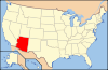
 Location of Phoenix in Arizona
This is a list of the National Register of Historic Places listings in Phoenix, Arizona.
This is intended to be a complete list of the properties and districts on the National Register of Historic Places in Phoenix, the largest city in Maricopa County, Arizona, United States. The locations of National Register properties and districts for which the latitude and longitude coordinates are included below, may be seen in a Google map.[1]
There are 372 properties and districts listed on the National Register in Maricopa County, including 3 that are also National Historic Landmarks. The city of Phoenix is the location of 206 of these properties and districts, including 1 National Historic Landmark, are located in the city of Phoenix; they are listed here, while the remaining 166 properties and districts and 2 National Historic Landmarks are located elsewhere in the county and are listed separately.
-
- This National Park Service list is complete through NPS recent listings posted November 10, 2011.[2]
Current listings
[3] Landmark name[4] Image Date listed Location Summary 1 6th Avenue Hotel-Windsor Hotel September 4, 1985 546 W. Adams
33°26′57″N 112°4′50″W / 33.44917°N 112.08056°W2 915 E. Pierce Street/Grand Pyramid House July 17, 2002 915 E. Pierce St.
33°26′47″N 112°3′37″W / 33.44639°N 112.06028°W3 Salim Ackel House June 10, 1994 94 E. Monte Vista Rd.
33°28′12″N 112°4′9″W / 33.47°N 112.06917°W4 Adams School November 29, 1979 800 W. Adams St.
33°26′58″N 112°4′58″W / 33.44944°N 112.08278°W5 W. E. Adams House January 12, 1995 1014 S. 1st Ave.
33°26′15″N 112°4′28″W / 33.4375°N 112.07444°W6 Alvarado Historic District December 21, 1994 Roughly bounded by Central Ave., Oak St., 3rd St., and Palm Ln.
33°28′15″N 112°4′12″W / 33.47083°N 112.07°W7 Anchor Manufacturing Co. September 4, 1985 551 S. Central
33°26′32″N 112°4′22″W / 33.44222°N 112.07278°W8 Helen Anderson House November 30, 1983 149 W. McDowell Rd.
33°27′56″N 112°4′37″W / 33.46556°N 112.07694°W9 Anderson-Johannes House January 12, 1995 127 N. 10th Ave.
33°27′0″N 112°5′5″W / 33.45°N 112.08472°W10 Arizona Academy-North Hall and South Hall August 12, 1993 1325 N. 14th St.
33°27′49″N 112°3′3″W / 33.46361°N 112.05083°W11 Arizona Army National Guard Arsenal March 31, 2010 5636 E. McDowell Rd., M5320
33°27′56.08″N 111°57′45.99″W / 33.4655778°N 111.962775°W12 Arizona Citrus Growers Association Warehouse September 4, 1985 601 E. Jackson
33°26′41″N 112°3′54″W / 33.44472°N 112.065°W13 Arizona Compress & Warehouse Co. Warehouse September 4, 1985 215 S. 13th St.
33°26′45″N 112°3′11″W / 33.44583°N 112.05306°W14 Arizona State Capitol Building 
October 29, 1974 1700 W. Washington St.
33°26′53″N 112°5′47″W / 33.44806°N 112.09639°W15 Arizona State Hospital Building July 15, 2009 2500 E. Van Buren St.
33°27′7.57″N 112°1′38.46″W / 33.4521028°N 112.02735°W16 Arvizu's El Fresnal Grocery Store September 4, 1985 310 E. Buchanan
33°26′36″N 112°4′6″W / 33.44333°N 112.06833°W17 Cline R. Asbury/Riney B. Salmon House April 8, 2010 7801 N. Central Ave.
33°33′2.31″N 112°4′24.09″W / 33.5506417°N 112.0733583°W18 Ashland Place Historic District December 21, 1994 Roughly bounded by Central Ave., Vernon Ave., 3rd St., and Oak St.
33°28′26″N 112°4′14″W / 33.47389°N 112.07056°W19 F.S. Baird Machine Shop September 4, 1985 623 E. Adams
33°26′57″N 112°3′54″W / 33.44917°N 112.065°W20 Samuel L. Bartlett House October 3, 1996 325 W. Northern Ave.
33°33′11″N 112°4′48″W / 33.55306°N 112.08°W21 J. B. Bayless Store No. 7 September 4, 1985 825 N. 7th St.
33°27′26″N 112°3′50″W / 33.45722°N 112.06389°W22 Bennitt Mansion August 12, 2009 126 E. County Club Dr.
33°28′51.58″N 112°3′29.47″W / 33.4809944°N 112.0581861°W23 Bethlehem Baptist Church August 10, 1993 1402 E. Adams St.
33°26′59″N 112°1′46″W / 33.44972°N 112.02944°W24 Blount Addition Historic District February 27, 1986 Northern side of W. Culver St. between Central and 3rd Aves.
33°27′48″N 112°4′31″W / 33.46333°N 112.07528°W25 Louis J. Bohn and Gertrude Lee House January 24, 2011 750 E. Northern Ave.
33°33′11″N 112°3′53″W / 33.55306°N 112.06472°WNorth Central Phoenix Farmhouses and Rural Estate Homes, 1895-1959 MPS 26 Bragg's Pies Building January 16, 2009 1301 Grand Ave.
33°27′25.71″N 112°5′23.4″W / 33.4571417°N 112.089833°W27 Brentwood Historic District June 9, 2010 Roughly bounded by Brill St. to the north, 20th St. to the east, Culver St. to the south, 16th St. to the west
33°27′49.52″N 112°2′35.98″W / 33.4637556°N 112.0433278°W28 Brophy College Chapel August 10, 1993 4701 N. Central Ave.
33°30′18″N 112°4′19″W / 33.505°N 112.07194°W29 Brown's Pharmacy September 4, 1985 1000 E. Pierce
33°27′21″N 112°3′35″W / 33.45583°N 112.05972°W30 Burgess Lateral Historic District April 16, 2009 Adjacent to Arcadia Dr. between the Arizona Canal and Lafayette Boulevard, between 47th Pl. and 47th St.
33°29′56.55″N 111°58′32.28″W / 33.4990417°N 111.9756333°W31 Clinton Campbell House January 12, 1995 361 N. 4th Ave.
33°27′12″N 112°4′41″W / 33.45333°N 112.07806°W32 Campus Vista Historic District June 10, 2010 Roughly bounded by Thomas Rd. and Flower St., 7th and 11th Aves. and Flower St., and Osborn Rd. and 10th and 15th Aves.
33°29′2.44″N 112°5′13.43″W / 33.4840111°N 112.0870639°WResidential neighborhood of primarily ranch-style homes adjacent to Phoenix College and Encanto Park; developed between 1939 and 1956[5] 33 Cartwright School August 12, 1993 5833 W. Thomas Rd.
33°28′48″N 112°11′7″W / 33.48°N 112.18528°W34 William Edward Cavness House November 3, 2001 606 N. 4th Ave.
33°27′16″N 112°4′6″W / 33.45444°N 112.06833°W35 Celora Stoddard/Lon Harmon House November 30, 1983 801 N. 1st Ave.
33°27′24″N 112°4′26″W / 33.45667°N 112.07389°W36 Chambers Transfer & Storage Co. September 4, 1985 309 S. 4th Ave.
33°26′41″N 112°4′41″W / 33.44472°N 112.07806°W37 Chambers Transfer & Storage Co.-Central Warehouse September 4, 1985 15-39 E. Jackson
33°26′41″N 112°4′20″W / 33.44472°N 112.07222°W38 Cheery Lynn Historic District December 21, 1994 16th St. to Randolph Rd. and Earll Dr. to Flower St.
33°29′4″N 112°2′57″W / 33.48444°N 112.04917°W39 Chelsea Place Historic District November 30, 1983 Roughly bounded by W. Lynwood and W. Willetta Sts. between Central and 3rd Aves.
33°27′51″N 112°4′31″W / 33.46417°N 112.07528°W40 C. W. Cisney House January 12, 1995 2011 W. Madison St.
33°26′41″N 112°6′7″W / 33.44472°N 112.10194°W41 George E. Cisney House January 12, 1995 916 E. McKinley St.
33°27′25″N 112°3′39″W / 33.45694°N 112.06083°W42 H. M. Coe House January 11, 1995 365 N. 4th Ave.
33°27′13″N 112°4′41″W / 33.45361°N 112.07806°W43 Concrete Block House November 30, 1983 614 N. 4th Ave.
33°27′20″N 112°4′42″W / 33.45556°N 112.07833°W44 Concrete Block House November 30, 1983 618-620 N. 4th Ave.
33°27′19″N 112°4′42″W / 33.45528°N 112.07833°W45 Concrete Block House November 30, 1983 640 N. 6th Ave.
33°27′22″N 112°4′51″W / 33.45611°N 112.08083°W46 Ralph Converse House April 8, 2010 6617 N. Central Ave.
33°32′0.52″N 112°4′22.75″W / 33.5334778°N 112.0729861°W47 Colonel Edward Power Conway House January 24, 2011 7625 N. 10th St.
33°32′51″N 112°3′38″W / 33.5475°N 112.06056°WNorth Central Phoenix Farmhouses and Rural Estate Homes, 1895-1959 MPS 48 Copeland & Tracht Service Station September 4, 1985 1702 W. Van Buren
33°27′6″N 112°5′43″W / 33.45167°N 112.09528°W49 Coronado Neighborhood Historic District February 13, 1986 Roughly bounded by Virginia Ave., 14th St., McDowell Rd., and 7th St.; also roughly bounded by 13th St., Coronado Rd., 14th St., and Monte Vista Rd., and the western side of 13th St. between Monte Vista and Oak
33°28′17″N 112°3′28″W / 33.47139°N 112.05778°WSecond set of addresses represents a boundary increase 50 Country Club Park Historic Subdivision December 21, 1994 Thomas Rd. to Virginia Ave. and 7th St. to Dayton St.
33°28′41″N 112°3′41″W / 33.47806°N 112.06139°W51 Craig Mansion August 18, 1992 131 E. Country Club Dr.
33°28′48″N 112°3′25″W / 33.48°N 112.05694°W52 Del Norte Place Historic District December 21, 1994 Virginia Ave. to Encanto Boulevard and 15th to 17th Aves.
33°28′30″N 112°5′34″W / 33.475°N 112.09278°W53 Lester D. DeMund House January 6, 1995 363 E. Monte Vista
33°28′17″N 112°3′57″W / 33.47139°N 112.06583°W54 Adam Diller House January 24, 2011 8702 N. 7th Ave.
33°33′51″N 112°4′59″W / 33.56417°N 112.08306°WNorth Central Phoenix Farmhouses and Rural Estate Homes, 1895-1959 MPS 55 J. B. Doughterty and C. W. Peterson House January 12, 1995 2141-2143 W. Washington St.
33°26′53″N 112°6′13″W / 33.44806°N 112.10361°W56 Lewis Douglas House February 8, 1985 815 E. Orangewood Ave.
33°32′57″N 112°4′2″W / 33.54917°N 112.06722°W57 Dunbar School August 12, 1993 707 W. Grant
33°26′31″N 112°5′4″W / 33.44194°N 112.08444°W58 Charles H. Dunlap House November 30, 1983 650 N. 1st Ave.
33°27′23″N 112°4′28″W / 33.45639°N 112.07444°W59 Durand Grocery October 1, 1985 901 Grand Ave.
33°27′12″N 112°5′5″W / 33.45333°N 112.08472°W60 Earll Place Historic District June 9, 2006 1620-1722 E. Pinchot Ave. and 1617-1731 and 1736 E. Earll Dr.
33°29′1″N 112°2′42″W / 33.48361°N 112.045°W61 East Alvarado Historic District February 18, 2000 E. Alvarado Rd. between 3rd and 7th Sts.
33°28′20″N 112°4′0″W / 33.47222°N 112.066667°W62 East Evergreen Historic District June 10, 2010 Roughly bounded by McDowell Rd., 3rd St., 7th St., and Wiletta St.
33°27′53.15″N 112°4′2.83″W / 33.4647639°N 112.0674528°W63 El Chaparral September 8, 2011 4935 E. Lafayette Blvd.
33°29′51″N 111°58′28″W / 33.4975°N 111.97444°W64 El Zaribah Shrine Auditorium March 9, 1989 1502 W. Washington St.
33°26′55″N 112°5′27″W / 33.44861°N 112.09083°W65 Elder-Moffitt House January 30, 1995 1336 W. Taylor St.
33°27′36″N 112°5′21″W / 33.46°N 112.08917°W66 Elizabeth Seargeant-Emery Oldaker House November 30, 1983 649 N. 3rd Ave.
33°27′24″N 112°4′36″W / 33.45667°N 112.07667°W67 Ellis-Shackelford House November 30, 1983 1242 N. Central Ave.
33°27′44″N 112°5′2″W / 33.46222°N 112.08389°W68 Encanto Manor Historic District June 10, 2010 Roughly bounded by 7th and 15th Aves. and Thomas Rd. and Edgemont Ave.
33°28′47.63″N 112°5′13.29″W / 33.4798972°N 112.087025°WPrimarily post-World War II (1945–1959) upscale residential neighborhood development which also includes Dorris House (Casa de Rosas), built in 1911[5][6] 69 Encanto-Palmcroft Historic District February 16, 1984 Roughly bounded by N. 7th and 15th Aves., McDowell and Thomas Rds.; also Holly St. from 15th Ave. to 12th Ave. and 12th from Holly to Encanto Boulevard; also roughly bounded by Encanto Blvd., Coronado Rd., 7th Ave. and 15th Ave.
33°28′21″N 112°5′10″W / 33.4725°N 112.08611°WSecond and third sets of addresses represent boundary increases 70 Encanto Vista Historic District June 10, 2010 Roughly bounded by 7th Ave, Encanto Blvd, Windsor Ave, and Encanto Park Municipal Golf Course
33°28′33″N 112°5′1.2″W / 33.47583°N 112.083667°W71 Abner Elliot England-Guy Hidden Lawrence House January 24, 2011 6234 N. Central Ave.
33°31′43″N 112°4′28″W / 33.52861°N 112.07444°WNorth Central Phoenix Farmhouses and Rural Estate Homes, 1895-1959 MPS 72 Evans House 
September 1, 1976 1108 W. Washington St.
33°26′54″N 112°5′11″W / 33.44833°N 112.08639°W73 Eyrich-Kohl House January 12, 1995 1015 Woodland Ave.
33°27′3″N 112°5′8″W / 33.45083°N 112.08556°W74 Fairview Place Historic District December 21, 1994 Encanto Boulevard to McDowell Rd., 15th Ave. to the alley west of 17th Ave.
33°28′10″N 112°5′34″W / 33.46944°N 112.09278°W75 Firestone October 1, 1985 302 W. Van Buren
33°27′6″N 112°4′38″W / 33.45167°N 112.07722°W76 First Baptist Church February 8, 1982 302 W. Monroe St.
33°27′2″N 112°4′39″W / 33.45056°N 112.0775°W77 First Church of Christ, Scientist August 10, 1993 924 N. 1st St.
33°27′30″N 112°4′20″W / 33.45833°N 112.07222°W78 First Presbyterian Church August 10, 1993 402 W. Monroe St.
33°27′2″N 112°4′43″W / 33.45056°N 112.07861°W79 Franklin School August 12, 1993 1625 W. McDowell Rd.
33°27′55″N 112°5′39″W / 33.46528°N 112.09417°W80 Fry Building-Baxter Block September 4, 1985 146 E. Washington
33°26′54″N 112°4′15″W / 33.44833°N 112.07083°W81 Garfield Historic District June 10, 2010 Roughly bounded by 7th St. on the west, 16th St. on the east, Roosevelt St. on the north, and Van Buren St. on the south
33°27′18.4″N 112°3′23.2″W / 33.455111°N 112.056444°W82 Garfield Methodist Church August 10, 1993 1302 E. Roosevelt St.
33°27′33″N 112°3′11″W / 33.45917°N 112.05306°W83 Neil H. Gates House August 11, 1986 4602 N. Elsie Ave.
33°30′15″N 111°57′11″W / 33.50417°N 111.95306°W84 Gerardo's Building September 4, 1985 421 S. 3rd St.
33°26′36″N 112°4′8″W / 33.44333°N 112.06889°W85 Carter W. Gibbes House August 25, 1983 2233 N. Alvarado
33°28′19″N 112°4′11″W / 33.47194°N 112.06972°W86 Grace Lutheran Church August 12, 1993 1124 N. 3rd St.
33°27′39″N 112°4′9″W / 33.46083°N 112.06917°W87 Lois Grunow Memorial Clinic September 4, 1985 926 E. McDowell
33°27′58″N 112°3′38″W / 33.46611°N 112.06056°W88 Burgess A. Hadsell House January 12, 1995 1001 E. Fillmore St.
33°27′17″N 112°3′34″W / 33.45472°N 112.05944°W89 George M. Halm and Mary Alverda Howard House January 24, 2011 6850 North Central Ave.
33°32′16″N 112°4′28″W / 33.53778°N 112.07444°WNorth Central Phoenix Farmhouses and Rural Estate Homes, 1895-1959 MPS 90 Hanny's September 6, 1985 44 N. 1st St.
33°26′57″N 112°4′19″W / 33.44917°N 112.07194°W91 Sarah and Jack Harelson House April 6, 2010 4437 E. Arlington Rd.
33°31′1.41″N 111°59′5.65″W / 33.5170583°N 111.9849028°W92 Heard Building September 4, 1985 112 N. Central
33°26′59″N 112°4′24″W / 33.44972°N 112.07333°W93 Hedgpeth Hills Petroglyph Site February 16, 1984 Address Restricted 94 George Hidden House January 11, 1995 763 E. Moreland St.
33°27′40″N 112°3′48″W / 33.46111°N 112.06333°W95 Higuera Grocery October 1, 1985 923 S. 2nd Ave.
33°26′17″N 112°4′30″W / 33.43806°N 112.075°W96 Hohokam-Pima Irrigation Sites October 15, 1966 Address Restricted 97 Hotel St. James September 4, 1985 21 E. Madison
33°26′45″N 112°4′21″W / 33.44583°N 112.0725°W98 Hotel Westward Ho 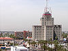
February 19, 1982 618 N. Central Ave.
33°27′18″N 112°4′26″W / 33.455°N 112.07389°W99 House at 818 South 1st Avenue January 12, 1995 818 S. 1st Ave.
33°26′22″N 112°4′28″W / 33.43944°N 112.07444°W100 L. Ron Hubbard House November 23, 2009 5501 N. 44th St.
33°31′1.65″N 111°59′9.97″W / 33.517125°N 111.9861028°W101 William K. Humbert House December 1, 1983 2238 N. Alvarado Rd.
33°28′21″N 112°4′14″W / 33.4725°N 112.07056°W102 Hunt Bass Hatchery Caretaker's House January 23, 2003 Phoenix Zoo grounds, 455 N. Galvin Parkway
33°27′6″N 111°56′49″W / 33.45167°N 111.94694°W103 Hurley Building September 4, 1985 536 and 544-548 W. McDowell and 1601 N. 7th Ave.
33°27′57″N 112°4′54″W / 33.46583°N 112.08167°W104 Idylwilde Park Historic District February 5, 1998 Roughly bounded by 11th and 12th Sts., Weldon, and Fairmont Aves.
33°29′27″N 112°3′23″W / 33.49083°N 112.05639°W105 Immaculate Heart of Mary August 10, 1993 909 E. Washington St.
33°26′53″N 112°3′40″W / 33.44806°N 112.06111°W106 Judge Fred C. Jacobs House January 24, 2011 6224 N. Central Ave.
33°31′41″N 112°4′28″W / 33.52806°N 112.07444°WNorth Central Phoenix Farmhouses and Rural Estate Homes, 1895-1959 MPS 107 Kaler House December 17, 1992 301 W. Frier Dr.
33°32′56″N 112°4′40″W / 33.54889°N 112.07778°W108 Kenilworth Elementary School March 25, 1982 1210 N. 5th Ave.
33°27′44″N 112°4′49″W / 33.46222°N 112.08028°W109 Kenilworth Historic District November 30, 1983 Roughly bounded by W. Lynwood and W. Willetta Sts. between 3rd and 7th Aves., and W. Culver St. between 5th and 7th Aves.; also 312 W. Culver St.
33°27′49″N 112°4′48″W / 33.46361°N 112.08°WCulver St. address represents a boundary increase 110 King's Rest Hotel Motor Court August 26, 1987 801 S. 17th Ave.
33°26′21″N 112°5′41″W / 33.43917°N 112.09472°W111 Denison Kitchell House May 19, 1994 2912 E. Sherran Ln.
33°29′24″N 112°1′4″W / 33.49°N 112.01778°W112 Knights of Pythias Building September 4, 1985 829 N. 1st Ave.
33°27′27″N 112°4′27″W / 33.4575°N 112.07417°W113 Kinter K. Koontz House July 20, 2011 7620 N. 7th St.
33°32′52″N 112°3′57″W / 33.54778°N 112.06583°WNorth Central Phoenix Farmhouses and Rural Estate Homes, 1895-1959, MPS 114 La Hacienda Historic District February 13, 2009 Bounded by N. 3rd St. to the west, N. 7th St. to the east, E. Catalina Dr. to the north, and E. Thomas Rd. to the south
33°28′52″N 112°04′02″W / 33.481156°N 112.067295°W115 C. A. Larson House January 12, 1995 710 S. 1st Ave.
33°26′27″N 112°4′28″W / 33.44083°N 112.07444°W116 Lightning Delivery Co. Warehouse September 4, 1985 425 E. Jackson
33°26′41″N 112°4′1″W / 33.44472°N 112.06694°W117 Los Olivos Historic District June 10, 2010 The 300 block of E Monte Vista Rd.
33°28′16.23″N 112°4′2.16″W / 33.471175°N 112.0672667°W118 Margarita Place Historic District April 12, 2007 Bounded by Thomas Rd., Windsor Ave., 15th And 16th Ave.
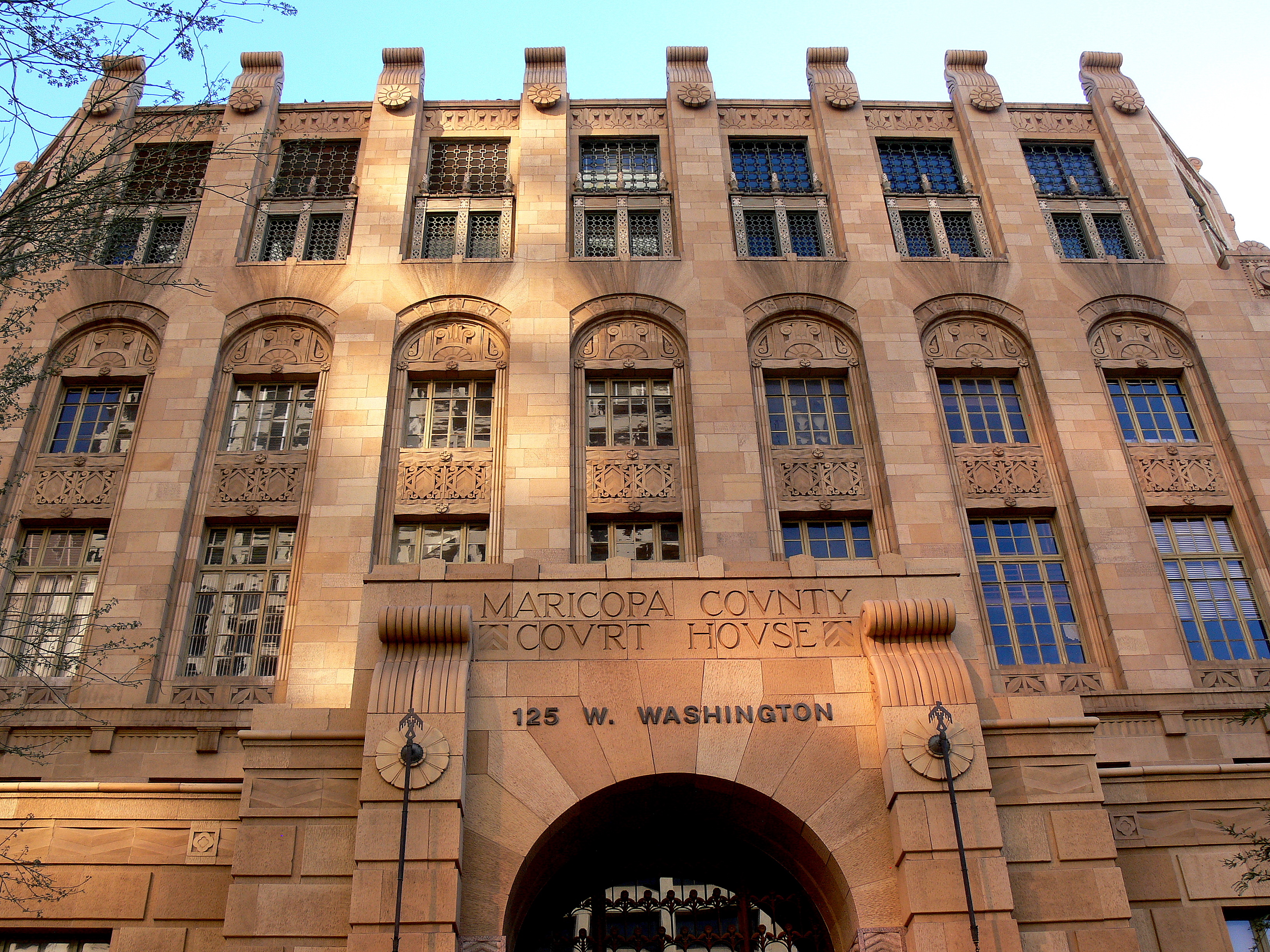
33°28′46.53″N 112°5′33.2″W / 33.4795917°N 112.092556°W119 Maricopa County Courthouse 
February 10, 1989 125 W. Washington St.
33°26′53″N 112°4′29″W / 33.44806°N 112.07472°W120 James H. McClintock House October 4, 1990 323 E. Willetta St.
33°27′49″N 112°3′56″W / 33.46361°N 112.06556°W121 Medlock Place Historic District June 1, 2006 Roughly bounded by Missouri Ave., Camelback Rd., 7th Ave., and Central Ave.
33°29′42″N 112°4′39″W / 33.495°N 112.0775°W122 Monroe School August 26, 1977 215 N. 7th St.
33°27′0″N 112°3′50″W / 33.45°N 112.06389°W123 David Morgan-Earl A. Bronson House January 24, 2011 8030 N. Central Ave.
33°33′15″N 112°4′28″W / 33.55417°N 112.07444°WNorth Central Phoenix Farmhouses and Rural Estate Homes, 1895-1959 MPS 124 North Central Avenue Streetscape Historic District November 30, 2005 Central Ave. between Bethany Home Rd. and the Arizona Canal
33°31′25.7″N 112°4′25.27″W / 33.523806°N 112.0736861°W125 North Encanto Historic District January 24, 2007 Roughly bounded by 15th and 18th Aves., Thomas to Osborn Rds.
33°29′2.82″N 112°5′40.78″W / 33.4841167°N 112.0946611°W126 North Garfield Historic District June 10, 2010 Roughly bounded by 7th St. on the west, 16th St. on the east, Roosevelt St. on the south, and Interstate 10 on the north
33°27′35.79″N 112°3′23.21″W / 33.4599417°N 112.0564472°W127 Oakland Historic District July 10, 1992 Roughly bounded by Fillmore St., 19th Ave., Van Buren St., and Grand Ave.
33°27′12″N 112°5′31″W / 33.45333°N 112.09194°W128 George A. Olney/Everett E. Ellinwood House April 8, 2010 6810 N. Central Ave.
33°32′13.22″N 112°4′28.2″W / 33.5370056°N 112.0745°W129 Ong Yut Geong Wholesale Market September 4, 1985 502 S. 2nd St.
33°26′35″N 112°4′10″W / 33.44306°N 112.06944°W130 Jim Ong's Market July 8, 1982 1110 E. Washington St.
33°26′55″N 112°3′28″W / 33.44861°N 112.05778°W131 Orpheum Theater 
September 4, 1985 209 W. Adams
33°26′57″N 112°4′33″W / 33.44917°N 112.07583°W132 William Lewis Osborn House May 15, 1991 1266 W. Pierce Ave.
33°27′23″N 112°5′23″W / 33.45639°N 112.08972°W133 Overland Arizona Co. October 1, 1985 12 N. 4th Ave.
33°26′54″N 112°4′43″W / 33.44833°N 112.07861°W134 Palm Lane Gardens December 22, 2009 101-115 E. Palm La.
33°28′9.7″N 112°4′16.14″W / 33.469361°N 112.07115°W135 E. Payne Palmer House May 2, 2002 6012 N. Central Ave.
33°31′28″N 112°4′27″W / 33.52444°N 112.07417°W136 Pay'n Takit No. 5 September 4, 1985 1012 N. 7th Ave.
33°27′32″N 112°4′55″W / 33.45889°N 112.08194°W137 Pay'n Takit No. 13 September 4, 1985 1402 E. Van Buren
33°27′6″N 112°3′4″W / 33.45167°N 112.05111°W138 Pay'n Takit No. 25 September 5, 1985 1753-1755 W. Van Buren
33°27′4″N 112°5′50″W / 33.45111°N 112.09722°W139 Phoenix Building and Loan House January 12, 1995 1138-1140 E. Taylor St.
33°27′14″N 112°3′24″W / 33.45389°N 112.05667°W140 Phoenix Carnegie Library and Library Park November 19, 1974 1101 W. Washington St.
33°26′51″N 112°5′10″W / 33.4475°N 112.08611°W141 Phoenix Elementary School District No. 1 Administration Building October 17, 1997 331 N. 1st Ave.
33°27′8″N 112°4′25″W / 33.45222°N 112.07361°W142 Phoenix Homesteads Historic District October 13, 1987 Roughly bounded by Flower and 28th Sts., Pinchot Ave., and 26th St.; boundary increase (listed October 15, 2010): Roughly bounded by Pinchot and Flower Sts., 26th to 28th Sts.
33°29′1″N 112°1′21″W / 33.48361°N 112.0225°W143 Phoenix Indian School Historic District 
May 31, 2001 300 E. Indian School Rd.
33°29′51″N 112°4′10″W / 33.4975°N 112.06944°W144 Phoenix LDS Second Ward Church November 30, 1983 1120 N. 3rd Ave.
33°27′56″N 112°4′37″W / 33.46556°N 112.07694°W145 Phoenix Seed & Feed Company September 4, 1985 411 S. 2nd St.
33°26′38″N 112°4′11″W / 33.44389°N 112.06972°W146 Phoenix Towers January 2, 2008 2201 N. Central Ave.
33°28′17″N 112°4′21″W / 33.47139°N 112.0725°W147 Phoenix Townsite November 7, 1978 Bounded by 6th, 7th, Monroe, and Adams Sts.
33°26′59″N 112°3′54″W / 33.44972°N 112.065°W148 Phoenix Union Colored High School May 2, 1991 415 E. Grant St.
33°26′21.58″N 112°3′59.69″W / 33.4393278°N 112.0665806°W149 Phoenix Union High School Historic District July 15, 1982 512 E. Van Buren
33°27′10″N 112°3′51″W / 33.45278°N 112.06417°W150 Harry E. Pierce House November 30, 1983 632 N. 3rd Ave.
33°27′22″N 112°4′37″W / 33.45611°N 112.07694°W151 N. Clyde Pierce House January 8, 1998 4505 E. Osborn Rd.
33°29′13″N 111°58′59″W / 33.48694°N 111.98306°W152 Pieri-Elliot House December 29, 1983 767 E. Moreland St.
33°27′40″N 112°3′41″W / 33.46111°N 112.06139°W153 Pioneer Military and Memorial Park February 1, 2007 13th to 15th Aves., Jefferson to Harrison Aves.
33°26′44.33″N 112°5′24.91″W / 33.4456472°N 112.0902528°W154 Portland Street Historic District November 30, 1983 W. Portland St. between 3rd and 7th Aves.
33°27′35″N 112°4′46″W / 33.45972°N 112.07944°W155 Charles H. Pratt House November 7, 1996 4979 E. Camelback Rd.
33°30′20″N 111°58′20″W / 33.50556°N 111.97222°W156 Professional Building 
January 8, 1993 137 N. Central
33°27′0″N 112°4′22″W / 33.45°N 112.07278°W157 Pueblo Grande Ruin 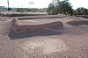
October 15, 1966 4619 E. Washington Ave.
33°26′32″N 111°59′0″W / 33.44222°N 111.983333°W158 Rancho Arroyo September 12, 2003 6737 N. 20th St.
33°32′10″N 112°2′15″W / 33.53611°N 112.0375°W159 Rancho Joaquina House July 9, 1984 4630 E. Cheery Lynn Rd.
33°29′7″N 111°58′8″W / 33.48528°N 111.96889°W160 Rehbein Grocery October 1, 1985 1231 Grand Ave.
33°27′24″N 112°5′19″W / 33.45667°N 112.08861°W161 Roosevelt Historic District November 30, 1983 Roughly bounded by Portland and Fillmore Sts., Central and 7th Aves.
33°27′29″N 112°4′40″W / 33.45806°N 112.07778°W162 John M. Ross House February 24, 2000 6722 N. Central Ave.
33°31′36″N 112°4′27″W / 33.52667°N 112.07417°W163 Dr. Roland Lee Rosson House 
June 3, 1971 139 N. 6th St.
33°27′0.324″N 112°3′58.428″W / 33.45009°N 112.06623°W164 Sacred Heart Home for the Aged February 2, 2010 1110 N. 16th St.
33°27′39.5″N 112°2′55.58″W / 33.460972°N 112.0487722°W165 St. Mary's Church 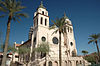
November 29, 1978 231 N. 3rd St.
33°27′2″N 112°4′6″W / 33.45056°N 112.06833°W166 San Carlos Hotel 
December 8, 1983 202 N. Central Ave.
33°27′2″N 112°4′23″W / 33.45056°N 112.07306°W167 Security Building September 12, 1985 234 N. Central
33°27′4″N 112°4′24″W / 33.45111°N 112.07333°W168 M. J. Sharp House January 12, 1995 1012 S. 1st Ave.
33°26′15″N 112°4′28″W / 33.4375°N 112.07444°W169 Shell Oil Co. September 4, 1985 425 S. 16th Ave.
33°26′34″N 112°5′31″W / 33.44278°N 112.09194°W170 E. W. Skinner House January 12, 1995 917 E. Roosevelt St.
33°27′31″N 112°3′38″W / 33.45861°N 112.06056°W171 Walter Lee Smith House January 24, 2011 7202 N. 7th Ave.
33°32′30″N 112°5′8″W / 33.54167°N 112.08556°WNorth Central Phoenix Farmhouses and Rural Estate Homes, 1895-1959 MPS 172 Smurthwaite House (Jefferson Street) May 17, 2001 317 W. Jefferson St.
33°26′48″N 112°5′21″W / 33.44667°N 112.08917°W173 Smurthwaite House (Seventh Street) January 12, 1995 602 N. 7th St.
33°27′17″N 112°3′54″W / 33.45472°N 112.065°W174 Squaw Peak Inn July 19, 1996 4425 E. Horseshoe Rd.
33°33′56″N 111°59′2″W / 33.56556°N 111.98389°W175 Steinegger Lodging House June 19, 1986 27 E. Monroe
33°27′0″N 112°4′20″W / 33.45°N 112.07222°W176 Judge W. H. Stillwell House January 12, 1995 2039 W. Monroe St.
33°27′0″N 112°6′9″W / 33.45°N 112.1025°W177 Storage Warehouse September 4, 1985 429 W. Jackson
33°26′41″N 112°4′44″W / 33.44472°N 112.07889°W178 F. Q. Story Neighborhood Historic District March 24, 1988 McDowell Rd., 7th Ave., Roosevelt St., and 16th Ave.; also roughly bounded by 17th Ave., Culver St., 15th Ave. and Lynwood St., plus lots on Roosevelt St. and McDowell Rd.
33°27′41″N 112°5′15″W / 33.46139°N 112.0875°WSecond set of addresses represents a boundary increase 179 Ralph H. Stoughton Estate July 3, 1985 805 W. South Mountain Ave.
33°22′12″N 112°5′9″W / 33.37°N 112.08583°W180 Courtney and Hilda Stubbs House January 24, 2011 1245 E. Ocotillo Rd.
33°32′4″N 112°3′16″W / 33.53444°N 112.05444°WNorth Central Phoenix Farmhouses and Rural Estate Homes, 1895-1959 MPS 181 Sun Mercantile Building 
September 4, 1985 232 S. 3rd St.
33°26′43″N 112°4′13″W / 33.44528°N 112.07028°W182 Swindall Tourist Inn September 7, 1995 1021 E. Washington St.
33°26′53″N 112°3′31″W / 33.44806°N 112.05861°W183 Temple Beth Israel February 22, 2011 122 E Culver St.
33°27′46″N 112°4′18″W / 33.46278°N 112.07167°W184 Title and Trust Building September 4, 1985 112 N. 1st Ave.
33°26′58″N 112°4′29″W / 33.44944°N 112.07472°W185 Tovrea Castle 
March 28, 1996 5041 E. Van Buren
33°26′55″N 111°58′16″W / 33.44861°N 111.97111°W186 Judge Charles Austin Tweed House May 14, 1987 1611 W. Fillmore Ave.
33°27′17″N 112°5′37″W / 33.45472°N 112.09361°W187 U.S. Post Office 
February 10, 1983 522 N. Central Ave.
33°27′15″N 112°4′25″W / 33.45417°N 112.07361°W188 Union Station 
November 25, 1985 4th Ave. and Southern Pacific railroad tracks
33°26′39″N 112°4′42″W / 33.44417°N 112.07833°W189 Valley Plumbing & Sheet Metal October 1, 1985 530 W. Adams
33°26′58″N 112°4′48″W / 33.44944°N 112.08°W190 Verde Park Pumphouse September 7, 1995 Junction of 9th St. and Van Buren Ave.
33°27′9″N 112°3′37″W / 33.4525°N 112.06028°W191 Victoria Place Historic District April 18, 1988 700 block of E. McKinley St.
33°27′24″N 112°3′46″W / 33.45667°N 112.06278°W192 Villa del Coronado December 22, 2009 100-190 E. Coronado Rd.
33°28′3.13″N 112°4′14.01″W / 33.4675361°N 112.0705583°W193 Villa Verde Plat A and Villa Verde Plat B Historic District June 10, 2010 Roughly bounded by Monte Vista Rd., Granada Rd., 19th Ave., and 20th Ave.
33°28′10.92″N 112°6′4.36″W / 33.4697°N 112.1012111°W194 George H. Vradenburg House April 8, 2010 1600 W. Colter St.
33°30′48.96″N 112°5′37.59″W / 33.5136°N 112.093775°W195 J. W. Walker Building-Central Arizona Light & Power September 4, 1985 10 N. 3rd Ave. and 300 W. Washington
33°26′54″N 112°4′38″W / 33.44833°N 112.07722°W196 Webster Auditorium June 14, 1990 1201 N. Galvin Parkway
33°27′35″N 111°56′30″W / 33.45972°N 111.94167°W197 Western Wholesale Drug Co. Warehouse September 4, 1985 101 E. Jackson
33°26′41″N 112°4′16″W / 33.44472°N 112.07111°W198 J. T. Whitney Funeral Home September 4, 1985 330 N. 2nd Ave.
33°27′9″N 112°4′33″W / 33.4525°N 112.07583°W199 John G. Whittier School August 12, 1993 2004 N. 16th St.
33°28′12″N 112°2′50″W / 33.47°N 112.04722°W200 Willo Historic District January 9, 1991 Roughly bounded by Central Ave., McDowell Rd., 7th Ave., and Thomas Rd.; also roughly bounded by Edgemont and Cambridge Rds. and 7th and 3rd Aves.
33°28′23″N 112°4′42″W / 33.47306°N 112.07833°WSecond set of addresses represents a boundary increase 201 Windsor Square Historic District December 13, 2000 Roughly bounded by 7th St., Camelback Rd., Central St., and Oregon Ave.
33°30′44″N 112°4′5″W / 33.51222°N 112.06806°W202 Woodland Historic District July 10, 1992 Roughly bounded by Van Buren St., 7th Ave., Adams St., and 15th Ave.
33°27′1″N 112°5′11″W / 33.45028°N 112.08639°W203 Woodlea Historic District June 10, 2010 Roughly bounded by Glenrosa Ave. and Mackenzie Dr. on the north and south, and 9th Ave. on the east and west
33°29′51.38″N 112°5′4.94″W / 33.4976056°N 112.0847056°WResidential neighborhood developed between 1928 and 1949 including a range of architectural styles from bungalow to ranch[5] 204 William Wrigley, Jr., Winter Cottage 
August 16, 1989 2501 E. Telawa Trail
33°31′22″N 112°1′34″W / 33.52278°N 112.02611°W205 Yaple Park Historic District June 10, 2010 Roughly bounded by 3rd and 7th Aves. and Turney and Minnezona Aves.
33°30′5.74″N 112°4′49.04″W / 33.5015944°N 112.0802889°W206 Yaun Ah Gim Groceries July 8, 1986 1002 S. 4th Ave.
33°26′16″N 112°4′44″W / 33.43778°N 112.07889°WSee also
- List of National Historic Landmarks in Arizona
- National Register of Historic Places listings in Arizona
References
- ^ The latitude and longitude information provided in this table was derived originally from the National Register Information System, which has been found to be fairly accurate for about 99% of listings. For about 1% of NRIS original coordinates, experience has shown that one or both coordinates are typos or otherwise extremely far off; some corrections may have been made. A more subtle problem causes many locations to be off by up to 150 yards, depending on location in the country: most NRIS coordinates were derived from tracing out latitude and longitudes off of USGS topographical quadrant maps created under North American Datum of 1927, which differs from the current, highly accurate GPS system used by Google maps. Chicago is about right, but NRIS longitudes in Washington are higher by about 4.5 seconds, and are lower by about 2.0 seconds in Maine. Latitudes differ by about 1.0 second in Florida. Some locations in this table may have been corrected to current GPS standards.
- ^ "National Register of Historic Places: Weekly List Actions". National Park Service, United States Department of the Interior. Retrieved on November 10, 2011.
- ^ Numbers represent an ordering by significant words. Various colorings, defined here, differentiate National Historic Landmark sites and National Register of Historic Places Districts from other NRHP buildings, structures, sites or objects.
- ^ "National Register Information System". National Register of Historic Places. National Park Service. 2008-04-24. http://nrhp.focus.nps.gov/natreg/docs/All_Data.html.
- ^ a b c Steckner, Susie (January 21, 2011). "11 Phoenix neighborhoods get coveted historic status". The Arizona Republic. Phoenix, Arizona. http://www.azcentral.com/style/hfe/decor/articles/2011/01/21/20110121phoenix-historic-neighborhoods-woodlea-encanto.html. Retrieved January 27, 2011.
- ^ "The History of Encanto Manor Historic District (excerpted from National Register of Historic Places nomination form)". historicphoenix.com. Phoenix, Arizona. June 19, 2009. http://historicphoenix.com/historic-districts/encanto-vista/history-encanto-vista-historic-district/encanto-manor-history.html. Retrieved January 27, 2011.
U.S. National Register of Historic Places Topics Lists by states Alabama • Alaska • Arizona • Arkansas • California • Colorado • Connecticut • Delaware • Florida • Georgia • Hawaii • Idaho • Illinois • Indiana • Iowa • Kansas • Kentucky • Louisiana • Maine • Maryland • Massachusetts • Michigan • Minnesota • Mississippi • Missouri • Montana • Nebraska • Nevada • New Hampshire • New Jersey • New Mexico • New York • North Carolina • North Dakota • Ohio • Oklahoma • Oregon • Pennsylvania • Rhode Island • South Carolina • South Dakota • Tennessee • Texas • Utah • Vermont • Virginia • Washington • West Virginia • Wisconsin • WyomingLists by territories Lists by associated states Other  Category:National Register of Historic Places •
  Portal:National Register of Historic Places
Properties on the National Register of Historic Places in Arizona 
 Categories:
- National Register of Historic Places in Arizona
- History of Phoenix, Arizona
-


Wikimedia Foundation. 2010.