- National Register of Historic Places listings in Pittsylvania County, Virginia
-
This list includes properties and districts listed on the National Register of Historic Places in Pittsylvania County, Virginia. Click the "Map of all coordinates" link to the right to view a Google map of all properties and districts with latitude and longitude coordinates in the table below.[1]
-
- This National Park Service list is complete through NPS recent listings posted November 10, 2011.[2]
[3] Landmark name[4] Image Date listed Location City or Town Summary 1 Berry Hill 
May 6, 1980 SW of Berry Hill
36°32′44″N 79°37′11″W / 36.54556°N 79.61972°WBerry Hill 2 Bill's Diner December 16, 1996 1 Depot St.
36°49′30″N 79°23′55″W / 36.825°N 79.39861°WChatham 3 Burnett's Diner December 16, 1996 19 S. Main St.
36°49′32″N 79°23′55″W / 36.82556°N 79.39861°WChatham 4 Chatham Historic District July 13, 2001 Main, Payne, Pruden, Reid, Whittle Sts.; Lanier Ave., Court Place; Gilmer Dr.
36°49′28″N 79°23′50″W / 36.82444°N 79.39722°WChatham 5 Clerk's Office July 8, 1982 Main St.
36°49′36″N 79°24′1″W / 36.82667°N 79.40028°WChatham 6 Dan's Hill 
May 30, 1979 4 mi. (6.4 km) W of Danville
36°35′17″N 79°28′48″W / 36.58806°N 79.48°WDanville 7 Hill Grove School February 25, 2004 2580 Wards rd.
37°4′4″N 79°14′59″W / 37.06778°N 79.24972°WHurt 8 Leesville Dam Archeological Site (44PY30) November 2, 1989 Address Restricted Altavista 9 Little Cherrystone 
November 12, 1969 N of jct. of Rtes. 703 and 832
36°49′19″N 79°21′27″W / 36.82194°N 79.3575°WChatham 10 Locust Hill November 27, 2002 7408 Ward's Rd.
37°5′54″N 79°14′55″W / 37.09833°N 79.24861°WHurt 11 Mountain View September 10, 1979 2 mi. S of Chatham on VA 703
36°47′0″N 79°24′13″W / 36.783333°N 79.40361°WChatham 12 North Danville Historic District January 15, 2004 Roughly bounded by Riverside Dr., Claiborne St., Leemont Cemetery, Novle Ave., and Scales St.
36°35′51″N 79°23′5″W / 36.5975°N 79.38472°WDanville 13 Pittsylvania County Courthouse 
October 29, 1981 US 29
36°49′31″N 79°23′54″W / 36.82528°N 79.39833°WChatham 14 Windsor July 30, 1980 Address Restricted Cascade 15 Woodlawn May 26, 2005 5321 Henrys Mill Rd.
36°46′35″N 79°9′47″W / 36.77639°N 79.16306°WVernon Hill 16 Yates Tavern 
December 19, 1974 S of Gretna on U.S. 29
36°56′8″N 79°22′5″W / 36.93556°N 79.36806°WGretna 17 John and Nancy Yeatts House March 25, 2009 VA 756 Chatham See also
- National Register of Historic Places listings in Virginia
- List of National Historic Landmarks in Virginia
References
- ^ The latitude and longitude information provided in this table was derived originally from the National Register Information System, which has been found to be fairly accurate for about 99% of listings. For about 1% of NRIS original coordinates, experience has shown that one or both coordinates are typos or otherwise extremely far off; some corrections may have been made. A more subtle problem causes many locations to be off by up to 150 yards, depending on location in the country: most NRIS coordinates were derived from tracing out latitude and longitudes off of USGS topographical quadrant maps created under the North American Datum of 1927, which differs from the current, highly accurate WGS84 GPS system used by Google maps. Chicago is about right, but NRIS longitudes in Washington are higher by about 4.5 seconds, and are lower by about 2.0 seconds in Maine. Latitudes differ by about 1.0 second in Florida. Some locations in this table may have been corrected to current GPS standards.
- ^ "National Register of Historic Places: Weekly List Actions". National Park Service, United States Department of the Interior. Retrieved on November 10, 2011.
- ^ Numbers represent an ordering by significant words. Various colorings, defined here, differentiate National Historic Landmark sites and National Register of Historic Places Districts from other NRHP buildings, structures, sites or objects.
- ^ "National Register Information System". National Register of Historic Places. National Park Service. 2008-04-24. http://nrhp.focus.nps.gov/natreg/docs/All_Data.html.
U.S. National Register of Historic Places Topics Lists by states Alabama • Alaska • Arizona • Arkansas • California • Colorado • Connecticut • Delaware • Florida • Georgia • Hawaii • Idaho • Illinois • Indiana • Iowa • Kansas • Kentucky • Louisiana • Maine • Maryland • Massachusetts • Michigan • Minnesota • Mississippi • Missouri • Montana • Nebraska • Nevada • New Hampshire • New Jersey • New Mexico • New York • North Carolina • North Dakota • Ohio • Oklahoma • Oregon • Pennsylvania • Rhode Island • South Carolina • South Dakota • Tennessee • Texas • Utah • Vermont • Virginia • Washington • West Virginia • Wisconsin • WyomingLists by territories Lists by associated states Other Municipalities and communities of Pittsylvania County, Virginia Towns 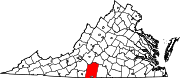
CDPs Blairs | Motley | Mount Hermon
Unincorporated
communitiesAjax | Andersons Mill | Bachelors Hall | Banister | Berry Hill | Beverly Heights | Birnam Wood | Brights | Brosville | Brutus | Buford | Callahans Hills | Callands | Cartersville | Cascade | Cedar Forest | Cedar Hill | Chalk Level | Climax | Coles Hill | Dry Fork | Dundee | Ebenezer | Eldon Knolls | Fairfield Park | Farmers | Flint Hill | Fox Hollow | Galveston | Gilmer Terrace | Glenland | Glenwood | Grady | Green Acres | Green Pond | Greenfield | Grit | Halifax Hills | Henrys Mill | Hermosa | Hill Grove | Hinesville | Hollys Mill | Hollywood | Hopewell | Java | Jones Mill | Keeling | Kentuck | Lakewood | Laniers Mill | Laurel Grove | Leaksville Junction | Level Run | Lucks | Lumpkin Forest | Markham | Motleys Mill | Mt. Airy | Mount Cross | Mountain Hill | Museville | Natal | New Mount Cross | Oak Hill | Oak Hills | Oak Ridge | Oakland | Olde Hunting Hills | Peytonsburg | Pickaway | Pickerel | Pine Ridge | Pittsville | Pleasant Gap | Pleasant Grove | Pullens | Ray | Red Oak Hollow | Redeye | Renan | Riceville | Ridgecrest | Ridgeway | Ringgold | Rondo | Sandy River | Sharon | Sheva | Shockoe | Smothers | Soapstone | Sonans | Spring Garden | Stony Mill | Straightstone | Surry Hills | Sutherlin | Swansons Mill | Swansonville | Sycamore | Tightsqueeze | Toshes | Transco Village | Turkey Fork | Vadens Mill | Vance | Vandola | Weal | West Fork | Whitfield | Whitmell | Whittles | Whittletown | Witt | Woodlake Park | Woodlawn | Woodlawn Heights | Worlds | Wyndover Woods
Categories:- Pittsylvania County, Virginia
- National Register of Historic Places in Virginia
- Virginia-related lists
-


Wikimedia Foundation. 2010.