- National Register of Historic Places listings in Putnam County, Ohio
-
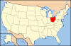
 Location of Putnam County in Ohio
This is a list of the National Register of Historic Places listings in Putnam County, Ohio.
This is intended to be a complete list of the properties and districts on the National Register of Historic Places in Putnam County, Ohio, United States. The locations of National Register properties and districts for which the latitude and longitude coordinates are included below, may be seen in a Google map.[1]
There are 10 properties and districts listed on the National Register in the county.
-
- This National Park Service list is complete through NPS recent listings posted November 10, 2011.[2]
Current listings
[3] Landmark name [4] Image Date listed Location City or town Summary 1 Bridenbaugh District No. 3 Schoolhouse 
April 28, 2005 Junction of County Road 6 and Township Road M6, north of Pandora
41°58′40″N 83°58′37″W / 41.977778°N 83.976944°WRiley Township 2 Columbus Grove Municipal Pool 
May 30, 1997 47510 Road P, northeast of Columbus Grove
40°55′37″N 84°01′31″W / 40.926944°N 84.025278°WPleasant Township 3 John Edwards House 
November 27, 1978 305 W. Main St.
41°06′05″N 83°59′27″W / 41.101389°N 83.990833°WLeipsic 4 Gilboa Main Street Historic District 
February 27, 1979 Main St.
41°00′59″N 83°55′21″W / 41.016389°N 83.9225°WGilboa 5 Dr. H. Huber Block 
June 4, 1980 Main St. and Taft Ave.
41°01′09″N 84°02′52″W / 41.019167°N 84.047778°WOttawa 6 Leipsic City Hall 
June 20, 1979 Belmore St.
41°05′52″N 83°59′06″W / 41.097889°N 83.985°WLeipsic Destroyed 7 Ottawa Waterworks Building 
September 13, 1976 1035 E. 3rd St.
41°01′17″N 84°02′12″W / 41.021389°N 84.036667°WOttawa 8 Putnam County Courthouse 
May 3, 1974 Courthouse Sq.
41°01′11″N 84°02′47″W / 41.019722°N 84.046389°WOttawa 9 Round Barn 
April 17, 1980 Road 17N south of Kalida
40°57′00″N 84°11′38″W / 40.95°N 84.193889°WUnion Township Destroyed 10 St. John the Baptist Roman Catholic Church 
June 17, 1977 State Route 694 and Main St.
41°01′50″N 84°04′46″W / 41.030556°N 84.079444°WGlandorf See also
References
- ^ The latitude and longitude information provided in this table was derived originally from the National Register Information System, which has been found to be fairly accurate for about 99% of listings. For about 1% of NRIS original coordinates, experience has shown that one or both coordinates are typos or otherwise extremely far off; some corrections may have been made. A more subtle problem causes many locations to be off by up to 150 yards, depending on location in the country: most NRIS coordinates were derived from tracing out latitude and longitudes off of USGS topographical quadrant maps created under the North American Datum of 1927, which differs from the current, highly accurate WGS84 GPS system used by Google maps. Chicago is about right, but NRIS longitudes in Washington are higher by about 4.5 seconds, and are lower by about 2.0 seconds in Maine. Latitudes differ by about 1.0 second in Florida. Some locations in this table may have been corrected to current GPS standards.
- ^ "National Register of Historic Places: Weekly List Actions". National Park Service, United States Department of the Interior. Retrieved on November 10, 2011.
- ^ Numbers represent an ordering by significant words. Various colorings, defined here, differentiate National Historic Landmark sites and National Register of Historic Places Districts from other NRHP buildings, structures, sites or objects.
- ^ "National Register Information System". National Register of Historic Places. National Park Service. . http://nrhp.focus.nps.gov/natreg/docs/All_Data.html.
National Register of Historic Places in Ohio Lists by county Adams • Allen • Ashland • Ashtabula • Athens • Auglaize • Belmont • Brown • Butler • Carroll • Champaign • Clark • Clermont • Clinton • Columbiana • Coshocton • Crawford • Cuyahoga • Darke • Defiance • Delaware • Erie • Fairfield • Fayette • Franklin • Fulton • Gallia • Geauga • Greene • Guernsey • Hamilton • Hancock • Hardin • Harrison • Henry • Highland • Hocking • Holmes • Huron • Jackson • Jefferson • Knox • Lake • Lawrence • Licking • Logan • Lorain • Lucas • Madison • Mahoning • Marion • Medina • Meigs • Mercer • Miami • Monroe • Montgomery • Morgan • Morrow • Muskingum • Noble • Ottawa • Paulding • Perry • Pickaway • Pike • Portage • Preble • Putnam • Richland • Ross • Sandusky • Scioto • Seneca • Shelby • Stark • Summit • Trumbull • Tuscarawas • Union • Van Wert • Vinton • Warren • Washington • Wayne • Williams • Wood • Wyandot
Lists by city Other lists Municipalities and communities of Putnam County, Ohio Villages Belmore | Cloverdale | Columbus Grove | Continental | Dupont | Ft. Jennings | Gilboa | Glandorf | Kalida | Leipsic | Miller City | Ottawa | Ottoville | Pandora | West Leipsic

Townships Unincorporated
communitiesCategories:- National Register of Historic Places in Ohio by county
- Putnam County, Ohio
-


Wikimedia Foundation. 2010.