- National Register of Historic Places listings in Sampson County, North Carolina
-

This list includes properties and districts listed on the National Register of Historic Places in Sampson County, North Carolina. Click the "Map of all coordinates" link to the right to view a Google map of all properties and districts with latitude and longitude coordinates in the table below.[1]
-
- This National Park Service list is complete through NPS recent listings posted November 10, 2011.[2]
[3] Landmark name[4] Image Date listed Location City or Town Summary 1 Beatty-Corbett House March 17, 1986 SR 701 at SR 1200
34°33′11″N 78°15′9″W / 34.55306°N 78.2525°WIvanhoe 2 Bethune-Powell Buildings March 17, 1986 118-120 E. Main St.
34°59′38″N 78°19′26″W / 34.99389°N 78.32389°WClinton 3 Asher W. Bizzell House May 21, 1986 US 13 and SR 1845
35°12′34.79″N 78°24′58.43″W / 35.2096639°N 78.4162306°WRosin 4 Black River Presbyterian and Ivanhoe Baptist Churches March 17, 1986 SR 1102 E of SR 1100
34°36′12″N 78°14′25″W / 34.60333°N 78.24028°WIvanhoe 5 Gen. Thomas Boykin House March 17, 1986 SR 1214 SW of SR 1222
34°57′43″N 78°22′26″W / 34.96194°N 78.37389°WClinton 6 Marion Butler Birthplace March 17, 1986 NC 242 at SR 1414
35°2′25″N 78°27′59″W / 35.04028°N 78.46639°WSalemburg 7 Dan E. Caison, Sr., House May 21, 1986 Broad St.
34°57′11″N 78°30′53″W / 34.95306°N 78.51472°WRoseboro 8 Cherrydale March 17, 1986 SR 1919 at SR 1952
35°1′6″N 78°12′6″W / 35.01833°N 78.20167°WTurkey 9 Clear Run March 17, 1986 NC 411 at Black River
34°44′23″N 78°15′56″W / 34.73972°N 78.26556°WClear Run 10 Clinton Commercial Historic District May 30, 2002 Roughly bounded bu Vance, Elizabeth, Wall, and Sampson Sts.
34°59′51″N 78°19′28″W / 34.9975°N 78.32444°WClinton 11 Clinton Depot March 17, 1986 W. Elizabeth St.
34°59′38″N 78°19′24″W / 34.99389°N 78.32333°WClinton 12 College Street Historic District March 17, 1986 600-802 College St.
34°59′54″N 78°18′49″W / 34.99833°N 78.31361°WClinton 13 Dell School Campus May 21, 1986 US 421 and SR 1003
34°48′5″N 78°12′54″W / 34.80139°N 78.215°WDelway 14 Delta Farm March 17, 1986 SR 1100 N of SR 1105
34°38′8″N 78°14′24″W / 34.63556°N 78.24°WIvanhoe 15 William E. Faison House January 20, 2005 NC 50 at jct. with NC 1757 (10901 Suttontown Rd.)
35°9′32″N 78°10′18″W / 35.15889°N 78.17167°WGiddensville 16 Graves-Stewart House September 8, 1983 600 College St.
34°59′33″N 78°19′11″W / 34.9925°N 78.31972°WClinton 17 Robert Herring House March 17, 1986 216 Sampson St.
35°0′3″N 78°19′29″W / 35.00083°N 78.32472°WClinton 18 Troy Herring House March 17, 1986 Broad St. S of NC 24
34°57′25″N 78°31′0″W / 34.95694°N 78.516667°WRoseboro 19 Lewis Highsmith Farm March 17, 1986 US 421 S of NC 41
34°42′43″N 78°11′17″W / 34.71194°N 78.18806°WHarrells 20 Hollingsworth-Hines Farm March 17, 1986 SR 1926 S of SR 1004
34°56′37″N 78°10′5″W / 34.94361°N 78.16806°WTurkey 21 Howard-Royal House March 17, 1986 202 N. Main St.
35°0′58″N 78°30′12″W / 35.01611°N 78.50333°WSalemburg 22 Howell-Butler House March 17, 1986 Broad and McLamb Sts.
34°57′2″N 78°30′49″W / 34.95056°N 78.51361°WRoseboro 23 Johnson Building May 11, 2000 102-104 E. Main St.
34°59′51″N 78°19′27″W / 34.9975°N 78.32417°WClinton 24 Samuel Johnson House and Cemetery March 17, 1986 SR 1157 S of SR 1004
34°49′9″N 78°19′31″W / 34.81917°N 78.32528°WIngold 25 James Kerr House March 17, 1986 SR 1005 S of SR 1007
34°39′3″N 78°15′31″W / 34.65083°N 78.25861°WKerr 26 Marcheston Killett Farm March 17, 1986 SR 1222 N of US 701
34°56′31″N 78°20′21″W / 34.94194°N 78.33917°WClinton 27 Marshall Kornegay House and Cemetery March 17, 1986 SR 1725 and SR 1720
35°12′33″N 78°12′10″W / 35.20917°N 78.20278°WSuttontown 28 James H. Lamb House March 17, 1986 SR 1135 N of NC 411
34°47′10″N 78°20′23″W / 34.78611°N 78.33972°WGarland 29 Lovett Lee House March 17, 1986 SR 1725 and SR 1730
35°10′22″N 78°13′1″W / 35.17278°N 78.21694°WGiddensville 30 Dr. James O. Matthews Office March 17, 1986 SR 1960 S of SR 1004
34°51′53″N 78°15′12″W / 34.86472°N 78.25333°WTaylors Bridge 31 Fleet Matthis Farm March 17, 1986 US 421 S of SR 1146
34°52′1″N 78°16′37″W / 34.86694°N 78.27694°WTaylors Bridge 32 Jonas McPhail House and Annie McPhail Store March 17, 1986 US 13 E of SR 1845
35°12′32.11″N 78°24′57.7″W / 35.2089194°N 78.416028°WRosin 33 Murphy-Lamb House and Cemetery March 17, 1986 SR 1135 S of US 701
34°47′46″N 78°21′36″W / 34.79611°N 78.36°WGarland 34 Oak Plain Presbyterian Church May 21, 1986 SR 1943 S of SR 1945
34°50′17″N 78°10′10″W / 34.83806°N 78.16944°WWaycross 35 Livingston Oates Farm March 17, 1986 SR 1748 W of NC 403
35°4′12″N 78°15′28″W / 35.07°N 78.25778°WClinton 36 Owen Family House and Cemetery March 17, 1986 SR 1212 N of SR 1214
34°53′44″N 78°27′2″W / 34.89556°N 78.45056°WMcDaniels Destroyed[5] 37 Patrick-Carr-Herring House January 14, 1993 226 McKoy St.
35°0′2″N 78°19′41″W / 35.00056°N 78.32806°WClinton 38 Pigford House March 17, 1986 SR 1751 S of US 701
35°2′40″N 78°19′29″W / 35.04444°N 78.32472°WClinton 39 Pope House March 17, 1986 SR 1146 N of SR 1145
34°54′51″N 78°18′30″W / 34.91417°N 78.30833°WClinton Burned[5] 40 Francis Pugh House March 17, 1986 SR 1751 at NC 403
35°0′34.31″N 78°18′7.73″W / 35.0095306°N 78.3021472°WClinton 41 Pugh-Boykin House March 17, 1986 306 Elizabeth St.
34°59′39″N 78°19′32″W / 34.99417°N 78.32556°WClinton 42 Royal-Crumpler-Parker House March 17, 1986 512 Sunset Ave.
34°59′51″N 78°19′54″W / 34.9975°N 78.33167°WClinton 43 Dr. John B. Seavey House and Cemetery May 21, 1986 SR 1100 S of SR 1007
34°40′38″N 78°13′3″W / 34.67722°N 78.2175°WHarrells 44 Dr. David Dickson Sloan Farm March 17, 1986 US 701 N of the South River
34°46′12″N 78°23′41″W / 34.77°N 78.39472°WGarland 45 Thirteen Oaks June 7, 1990 Jct. of US 13 and SR 1647
35°13′7″N 78°23′50″W / 35.21861°N 78.39722°WNewton Grove 46 West Main-North Chesnutt Streets Historic District March 17, 1986 Roughly N. Chesnutt, Fayetteville, and Williams Sts. between W. Main and Margaret Sts.
34°59′51″N 78°19′42″W / 34.9975°N 78.32833°WClinton 47 Isaac Williams House March 1, 1984 NC 55; also NC 55 at its junction with NC 50
35°14′52″N 78°22′55″W / 35.24778°N 78.38194°WNewton Grove Second location represents a boundary increase of June 12, 1989 48 John E. Wilson House March 17, 1986 SR 1631 at SR 1630
35°15′37″N 78°30′29″W / 35.26028°N 78.50806°WDunn See also
- National Register of Historic Places listings in North Carolina
- List of National Historic Landmarks in North Carolina
References
- ^ The latitude and longitude information provided in this table was derived originally from the National Register Information System, which has been found to be fairly accurate for about 99% of listings. For about 1% of NRIS original coordinates, experience has shown that one or both coordinates are typos or otherwise extremely far off; some corrections may have been made. A more subtle problem causes many locations to be off by up to 150 yards, depending on location in the country: most NRIS coordinates were derived from tracing out latitude and longitudes off of USGS topographical quadrant maps created under the North American Datum of 1927, which differs from the current, highly accurate WGS84 GPS system used by Google maps. Chicago is about right, but NRIS longitudes in Washington are higher by about 4.5 seconds, and are lower by about 2.0 seconds in Maine. Latitudes differ by about 1.0 second in Florida. Some locations in this table may have been corrected to current GPS standards.
- ^ "National Register of Historic Places: Weekly List Actions". National Park Service, United States Department of the Interior. Retrieved on November 10, 2011.
- ^ Numbers represent an ordering by significant words. Various colorings, defined here, differentiate National Historic Landmark sites and National Register of Historic Places Districts from other NRHP buildings, structures, sites or objects.
- ^ "National Register Information System". National Register of Historic Places. National Park Service. 2008-04-24. http://nrhp.focus.nps.gov/natreg/docs/All_Data.html.
- ^ a b "North Carolina Listings in the National Register of Historic Places by County". North Carolina State Historic Preservation Office. 22 October 2008. http://www.hpo.ncdcr.gov/nrlist.htm. Retrieved 14 July 2009.
U.S. National Register of Historic Places Topics Lists by states Alabama • Alaska • Arizona • Arkansas • California • Colorado • Connecticut • Delaware • Florida • Georgia • Hawaii • Idaho • Illinois • Indiana • Iowa • Kansas • Kentucky • Louisiana • Maine • Maryland • Massachusetts • Michigan • Minnesota • Mississippi • Missouri • Montana • Nebraska • Nevada • New Hampshire • New Jersey • New Mexico • New York • North Carolina • North Dakota • Ohio • Oklahoma • Oregon • Pennsylvania • Rhode Island • South Carolina • South Dakota • Tennessee • Texas • Utah • Vermont • Virginia • Washington • West Virginia • Wisconsin • WyomingLists by territories Lists by associated states Other Municipalities and communities of Sampson County, North Carolina City 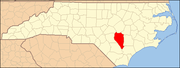
Towns Autryville | Faison‡ | Falcon‡ | Garland | Harrells‡ | Newton Grove | Roseboro | Salemburg | Turkey
CDPs Bonnetsville | Delway | Ingold | Ivanhoe | Keener | Plain View | Spivey's Corner | Vann Crossroads
Unincorporated
communitiesFootnotes ‡This populated place also has portions in an adjacent county or counties
Categories:- Sampson County, North Carolina
- National Register of Historic Places in North Carolina
- Buildings and structures in Sampson County, North Carolina
-

Wikimedia Foundation. 2010.