- National Register of Historic Places listings in Seneca County, Ohio
-
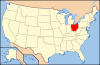
 Location of Seneca County in Ohio
This is a list of the National Register of Historic Places listings in Seneca County, Ohio.
This is intended to be a complete list of the properties and districts on the National Register of Historic Places in Seneca County, Ohio, United States. The locations of National Register properties and districts for which the latitude and longitude coordinates are included below, may be seen in a Google map.[1]
There are 45 properties and districts listed on the National Register in the county.
-
- This National Park Service list is complete through NPS recent listings posted November 10, 2011.[2]
Current listings
[3] Landmark name [4] Image Date listed Location City or town Summary 1 Aigler Alumni Building 
February 12, 1979 315 E. Market St.
41°06′58″N 83°10′10″W / 41.116111°N 83.169444°WTiffin 2 Bagby-Hossler House July 10, 1986 530 Sycamore St.
41°06′09″N 83°10′56″W / 41.1026°N 83.18225°WTiffin 3 Beatty Glass Company January 7, 1980 4th Ave. and Vine St.
41°07′20″N 83°11′01″W / 41.122222°N 83.183611°WTiffin 4 Black Student Union Center February 12, 1979 120 Hedges St.
41°06′50″N 83°10′04″W / 41.113889°N 83.167778°WTiffin 5 Bowman's Distillery 
January 7, 1980 215 Riverside Dr.
41°07′20″N 83°10′18″W / 41.122222°N 83.171667°WTiffin 6 College Hall 
February 12, 1979 310 E. Market St.
41°06′59″N 83°10′04″W / 41.116389°N 83.167778°WTiffin 7 Ambrose Cory House 
June 20, 1979 957 N. Union St.
41°10′08″N 83°25′09″W / 41.168889°N 83.419167°WFostoria 8 Daughters of America National Home January 23, 2003 652 N. Sandusky St.
41°08′04″N 83°10′07″W / 41.134444°N 83.168611°WTiffin 9 Downtown Tiffin Historic District 
May 2, 1978 Roughly bounded by Riverside Dr., Jefferson, S. Washington St., E. Market, Madison, and Court Sts.
41°06′46″N 83°10′33″W / 41.112778°N 83.175833°WTiffin 10 Fine Arts Building February 12, 1979 338 E. Perry St.
41°07′00″N 83°09′58″W / 41.116667°N 83.166111°WTiffin 11 Fort Ball-Railroad Historic District June 20, 1979 Roughly bounded by the Sandusky River and Perry, Sandusky and Washington Sts.
41°07′01″N 83°10′53″W / 41.116944°N 83.181389°WTiffin 12 Fostoria Downtown Historic District 
September 28, 2001 Roughly bounded by North St., South St., and the alleys east and west of Main St.
41°09′23″N 83°24′52″W / 41.156389°N 83.414444°WFostoria 13 Founders Hall, Heidelberg College 
March 20, 1973 Perry St. (State Route 18)
41°06′59″N 83°10′02″W / 41.116389°N 83.167222°WTiffin 14 France Hall 
February 12, 1979 119 Greenfield St.
41°06′55″N 83°09′52″W / 41.115278°N 83.164444°WTiffin 15 Gerhart-Rust Residence 
February 12, 1979 285 E. Perry St.
41°07′00″N 83°10′06″W / 41.116667°N 83.168333°WTiffin 16 Great Hall 
February 12, 1979 44 Greenfield St.
41°06′53″N 83°10′06″W / 41.114778°N 83.168333°WTiffin 17 Hanson Machinery Company January 7, 1980 235 Miami St.
41°07′13″N 83°11′18″W / 41.120278°N 83.188333°WTiffin 18 Hedges-Hunter-Keller-Bacon Gristmill 
January 7, 1980 255 Riverside Dr.
41°07′25″N 83°10′14″W / 41.123611°N 83.170556°WTiffin 19 Henny Barn November 6, 1979 Western half of the southwestern corner of section 1, on the northern side of County Road 34 east of the northwestern railroad tracks and east of Flat Rock
41°14′26″N 82°51′11″W / 41.240556°N 82.853056°WThompson Township 20 Heter Farm March 29, 1979 8531 N. County Road 29, southwest of Bellevue
41°14′45.6″N 82°51′32.4″W / 41.246°N 82.859°W[5]Thompson Township 21 William Hunter House 
January 7, 1980 260 Riverside Dr.
41°07′23″N 83°10′12″W / 41.123056°N 83.17°WTiffin 22 Junior Order United American Mechanics National Orphans' Home October 1, 1990 600 N. River Rd.
41°07′53″N 83°09′53″W / 41.13125°N 83.164722°WTiffin 23 Laird Hall 
February 12, 1979 70 Greenfield St.
41°06′54″N 83°09′59″W / 41.115°N 83.166389°WTiffin 24 Miami Street Grade School March 21, 1979 155 Miami St.
41°07′06″N 83°11′05″W / 41.118333°N 83.184722°WTiffin 25 Michaels Farm November 29, 1979 South of Kansas on State Route 635
41°13′47″N 83°16′56″W / 41.229722°N 83.282222°WLiberty Township 26 Mueller Brewery 
January 7, 1980 146-164 Riverside Dr.
41°07′11″N 83°10′21″W / 41.119722°N 83.1725°WTiffin 27 Christ Mueller House 
January 7, 1980 140-142 Riverside Dr.
41°07′11″N 83°10′22″W / 41.119722°N 83.172778°WTiffin 28 North Sandusky Street Historic District 
May 27, 1980 N. Sandusky St.
41°07′23″N 83°10′49″W / 41.123056°N 83.180278°WTiffin 29 Northeast Tiffin Historic District 
May 28, 1980 Clinton, Ohio, and Hunter Sts.
41°07′12″N 83°10′09″W / 41.12°N 83.169167°WTiffin 30 The Octagon 
February 12, 1979 297 E. Perry St.
41°07′00″N 83°10′05″W / 41.116667°N 83.168056°WTiffin 31 Ohio Lantern Company January 7, 1980 60-72 Hudson St.
41°07′13″N 83°10′06″W / 41.120278°N 83.168333°WTiffin 32 Omar Chapel November 5, 1987 408 State Route 4, north of Attica
41°07′06″N 82°51′46″W / 41.118333°N 82.862778°WReed Township 33 Pfleiderer Center for Religion and the Humanities 
February 12, 1979 28 Greenfield St.
41°06′55″N 83°10′05″W / 41.115278°N 83.168056°WTiffin 34 Pleasant Ridge United Methodist Church and Cemetery September 10, 1993 Junction of State Route 101 and County Road 38, northeast of Tiffin
41°10′05″N 83°05′58″W / 41.168056°N 83.099444°WPleasant Township 35 President's House 
February 12, 1979 67 Greenfield St.
41°06′56″N 83°09′59″W / 41.115556°N 83.166389°WTiffin 36 St. Boniface Roman Catholic Church, School, Rectory, and Convent of the Sisters of the Precious Blood 
November 17, 1982 N. Perry St.
41°03′16″N 83°19′17″W / 41.054333°N 83.321333°WNew Riegel 37 Social Science House 
February 12, 1979 266 E. Market St.
41°06′55″N 83°10′12″W / 41.115333°N 83.170111°WTiffin 38 Springdale August 26, 1993 318 Sycamore St.
41°06′10″N 83°10′56″W / 41.102778°N 83.182222°WTiffin 39 Tiffin Agricultural Works January 7, 1980 40 Harrison St.
41°07′13″N 83°10′31″W / 41.120278°N 83.175278°WTiffin 40 Tiffin Art Metal Company January 7, 1980 450 Wall St.
41°07′40″N 83°11′16″W / 41.127778°N 83.187778°WTiffin 41 Tiffin Waterworks January 7, 1980 170 Ella St.
41°06′16″N 83°11′14″W / 41.104444°N 83.187222°WTiffin 42 Umsted Farm April 27, 1979 North of Tiffin on State Route 38
41°10′06″N 83°09′38″W / 41.168333°N 83.160556°WPleasant Township 43 Wagner Brothers Bottling Works January 7, 1980 250-258 Benner St.
41°06′53″N 83°11′02″W / 41.114722°N 83.183889°WTiffin 44 Webster Manufacturing January 7, 1980 325 Hall St.
41°07′29″N 83°11′22″W / 41.124722°N 83.189444°WTiffin 45 Williard Hall 
February 12, 1979 116 Greenfield St.
41°06′52″N 83°09′52″W / 41.114444°N 83.164444°WTiffin See also
References
- ^ The latitude and longitude information provided in this table was derived originally from the National Register Information System, which has been found to be fairly accurate for about 99% of listings. For about 1% of NRIS original coordinates, experience has shown that one or both coordinates are typos or otherwise extremely far off; some corrections may have been made. A more subtle problem causes many locations to be off by up to 150 yards, depending on location in the country: most NRIS coordinates were derived from tracing out latitude and longitudes off of USGS topographical quadrant maps created under the North American Datum of 1927, which differs from the current, highly accurate WGS84 GPS system used by Google maps. Chicago is about right, but NRIS longitudes in Washington are higher by about 4.5 seconds, and are lower by about 2.0 seconds in Maine. Latitudes differ by about 1.0 second in Florida. Some locations in this table may have been corrected to current GPS standards.
- ^ "National Register of Historic Places: Weekly List Actions". National Park Service, United States Department of the Interior. Retrieved on November 10, 2011.
- ^ Numbers represent an ordering by significant words. Various colorings, defined here, differentiate National Historic Landmark sites and National Register of Historic Places Districts from other NRHP buildings, structures, sites or objects.
- ^ "National Register Information System". National Register of Historic Places. National Park Service. . http://nrhp.focus.nps.gov/natreg/docs/All_Data.html.
- ^ Location derived from caption on photo at its Ohio Historical Society photograph; the NRIS erroneously lists the property as being northwest of Bellevue
National Register of Historic Places in Ohio Lists by county Adams • Allen • Ashland • Ashtabula • Athens • Auglaize • Belmont • Brown • Butler • Carroll • Champaign • Clark • Clermont • Clinton • Columbiana • Coshocton • Crawford • Cuyahoga • Darke • Defiance • Delaware • Erie • Fairfield • Fayette • Franklin • Fulton • Gallia • Geauga • Greene • Guernsey • Hamilton • Hancock • Hardin • Harrison • Henry • Highland • Hocking • Holmes • Huron • Jackson • Jefferson • Knox • Lake • Lawrence • Licking • Logan • Lorain • Lucas • Madison • Mahoning • Marion • Medina • Meigs • Mercer • Miami • Monroe • Montgomery • Morgan • Morrow • Muskingum • Noble • Ottawa • Paulding • Perry • Pickaway • Pike • Portage • Preble • Putnam • Richland • Ross • Sandusky • Scioto • Seneca • Shelby • Stark • Summit • Trumbull • Tuscarawas • Union • Van Wert • Vinton • Warren • Washington • Wayne • Williams • Wood • Wyandot
Lists by city Other lists Municipalities and communities of Seneca County, Ohio Cities 
Villages Attica | Bettsville | Bloomville | Green Springs‡ | New Riegel | Republic
Townships Unincorporated
communitiesFootnotes ‡This populated place also has portions in an adjacent county or counties
Categories:- National Register of Historic Places in Ohio by county
- Seneca County, Ohio
-


Wikimedia Foundation. 2010.