- National Register of Historic Places listings in Sierra County, California
-
This list includes properties and districts listed on the National Register of Historic Places in Sierra County, California. Click the "Map of all coordinates" link to the right to view a Google map of all properties and districts with latitude and longitude coordinates in the table below.[1]
-
- This National Park Service list is complete through NPS recent listings posted November 10, 2011.[2]
[3] Landmark name [4] Image Date listed Location City or town Summary 1 1872 California-Nevada State Boundary Marker August 27, 1981 NW of Verdi on CA/NV border
39°31′28″N 120°00′07″W / 39.524389°N 120.001861°Wnear Verdi, Nevada 2 Foote's Crossing Road January 29, 1981 Tahoe National Forest
39°25′42″N 120°54′58″W / 39.428333°N 120.916111°WNevada City 3 Forest City 
September 3, 1996 Off of Mountain House Rd., jct. of North and South Forks, Tahoe National Forest
39°29′25″N 120°51′05″W / 39.490278°N 120.851389°WForest City 4 Hawley Lake Petroglyphs May 6, 1971 Address Restricted Gold Lake 5 Kyburz Flat Site November 12, 1971 Address Restricted Loyalton 6 Sardine Valley Archeological District May 6, 1971 Address Restricted Truckee 7 Sierra County Sheriff's Gallows February 15, 1990 Galloway Rd. and Courthouse Sq.
39°33′30″N 120°49′46″W / 39.558333°N 120.829444°WDownieville 8 Stampede Site October 14, 1971 Address Restricted near Verdi, Nevada See also
- List of Registered Historic Places in California
- List of National Historic Landmarks in California
References
- ^ The latitude and longitude information provided in this table was derived originally from the National Register Information System, which has been found to be fairly accurate for about 99% of listings. For about 1% of NRIS original coordinates, experience has shown that one or both coordinates are typos or otherwise extremely far off; some corrections may have been made. A more subtle problem causes many locations to be off by up to 150 yards, depending on location in the country: most NRIS coordinates were derived from tracing out latitude and longitudes off of USGS topographical quadrant maps created under North American Datum of 1927, which differs from the current, highly accurate GPS system used by Google maps. Chicago is about right, but NRIS longitudes in Washington are higher by about 4.5 seconds, and are lower by about 2.0 seconds in Maine. Latitudes differ by about 1.0 second in Florida. Some locations in this table may have been corrected to current GPS standards.
- ^ "National Register of Historic Places: Weekly List Actions". National Park Service, United States Department of the Interior. Retrieved on November 10, 2011.
- ^ Numbers represent an ordering by significant words. Various colorings, defined here, differentiate National Historic Landmark sites and National Register of Historic Places Districts from other NRHP buildings, structures, sites or objects.
- ^ "National Register Information System". National Register of Historic Places. National Park Service. . http://nrhp.focus.nps.gov/natreg/docs/All_Data.html.
U.S. National Register of Historic Places Topics Lists by states Alabama • Alaska • Arizona • Arkansas • California • Colorado • Connecticut • Delaware • Florida • Georgia • Hawaii • Idaho • Illinois • Indiana • Iowa • Kansas • Kentucky • Louisiana • Maine • Maryland • Massachusetts • Michigan • Minnesota • Mississippi • Missouri • Montana • Nebraska • Nevada • New Hampshire • New Jersey • New Mexico • New York • North Carolina • North Dakota • Ohio • Oklahoma • Oregon • Pennsylvania • Rhode Island • South Carolina • South Dakota • Tennessee • Texas • Utah • Vermont • Virginia • Washington • West Virginia • Wisconsin • WyomingLists by territories Lists by associated states Other  Category:National Register of Historic Places •
  Portal:National Register of Historic Places
Municipalities and communities of Sierra County, California County seat: Downieville City 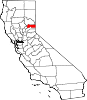
CDPs Alleghany | Calpine | Downieville | Goodyears Bar | Pike | Sattley | Sierra Brooks | Sierra City | Sierraville | Verdi
Unincorporated
communitiesBassetts | Brandy City | Cal-Ida | Campbell Hot Springs | Carvin Creek Homesites | Forest | Gibsonville | Grass Flat | Haskell Creek Homesites | Loganville | Plumbago
Ghost towns Brandy City | Chandlerville | Craig's Flat | Deadwood | Eureka City | Hepsidam | Howland Flat | McMahon | Morristown | Pine Grove | Poker Flat | Poverty Hill | Port Wine | Potosi | Queen City | Shady Flat | Scales | St. Louis | Whiskey Diggings
Categories:- Sierra County, California
- History of the Sierra Nevada (U.S.)
- National Register of Historic Places in California by county
- Lists of National Register of Historic Places in California
-


Wikimedia Foundation. 2010.