National Register of Historic Places listings in Sitka, Alaska
- National Register of Historic Places listings in Sitka, Alaska
-

Location of Sitka in Alaska
This is a list of the National Register of Historic Places listings in Sitka, Alaska.
This is intended to be a complete list of the properties and districts on the National Register of Historic Places in Sitka, Alaska, United States. The locations of National Register properties and districts for which the latitude and longitude coordinates are included below, may be seen in a Google map.[1]
There are 20 properties and districts listed on the National Register in the city, including seven National Historic Landmarks.
-
- This National Park Service list is complete through NPS recent listings posted November 10, 2011.[2]
| [3] |
Landmark name[4] |
Image |
Date listed |
Location |
Community |
Summary |
| 1 |
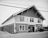
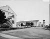
Alaska Native Brotherhood Hall |
 |
01972-02-23 February 23, 1972 |
Katlean St.
57°3′4″N 135°20′22″W / 57.05111°N 135.33944°W / 57.05111; -135.33944 (Alaska Native Brotherhood Hall) |
Sitka |
|
| 2 |
American Flag Raising Site |
 |
01966-10-15 October 15, 1966 |
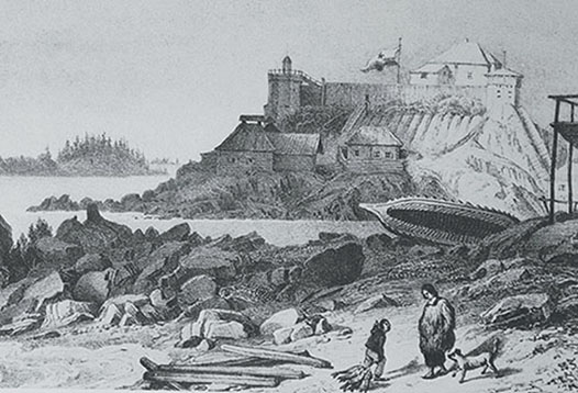
Castle Hill
57°2′56″N 135°20′2″W / 57.04889°N 135.33389°W / 57.04889; -135.33389 (American Flag Raising Site) |
Sitka |
|
| 3 |
Cable House and Station |
|
01979-06-04 June 4, 1979 |
Lincoln St.
57°3′0″N 135°20′15″W / 57.05°N 135.3375°W / 57.05; -135.3375 (Cable House and Station) |
Sitka |
|
| 4 |
Emmons House |
|
01977-12-16 December 16, 1977 |
601 Lincoln St.
57°3′7″N 135°19′41″W / 57.05194°N 135.32806°W / 57.05194; -135.32806 (Emmons House) |
Sitka |
|
| 5 |
Hanlon-Osbakken House |
|
01992-04-27 April 27, 1992 |
419 Lincoln St.
57°3′7″N 135°19′44″W / 57.05194°N 135.32889°W / 57.05194; -135.32889 (Hanlon--Osbakken House) |
Sitka |
|
| 6 |
Mills House |
|
01978-01-31 January 31, 1978 |
315 Seward St.
57°3′5″N 135°20′11″W / 57.05139°N 135.33639°W / 57.05139; -135.33639 (Mills House) |
Sitka |
|
| 7 |
W.P. Mills House |
|
01977-12-16 December 16, 1977 |
1 Maksoutoff St.
57°2′54″N 135°19′42″W / 57.04833°N 135.32833°W / 57.04833; -135.32833 (Mills, W. P., House) |
Sitka |
|
| 8 |
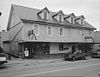
Murray Apartments and Cottages |
|
01992-04-27 April 27, 1992 |
200, 204, and 206 Seward
57°3′2″N 135°20′8″W / 57.05056°N 135.33556°W / 57.05056; -135.33556 (Murray Apartments and Cottages) |
Sitka |
|
| 9 |
Old Sitka Site |
 |
01966-10-15 October 15, 1966 |
6 miles north (9.6 km) of Sitka on Starrigavan Bay
57°7′53″N 135°22′15″W / 57.13139°N 135.37083°W / 57.13139; -135.37083 (Old Sitka Site) |
Sitka |
|
| 10 |
Russian Bishop's House |
 |
01966-10-15 October 15, 1966 |
Lincoln and Monastery Sts.
57°3′7″N 135°19′46″W / 57.05194°N 135.32944°W / 57.05194; -135.32944 (Russian Bishop's House) |
Sitka |
|
| 11 |
Russian-American Building No. 29 |
 |
01987-05-28 May 28, 1987 |
202-204 Lincoln St.
57°2′58″N 135°19′57″W / 57.04944°N 135.3325°W / 57.04944; -135.3325 (Russian-American Building No. 29) |
Sitka |
|
| 12 |
St. Michael's Cathedral |
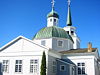 |
01966-10-15 October 15, 1966 |
Lincoln and Maksoutoff District |
Sitka |
|
| 13 |
St. Peter's Church |
|
01978-01-31 January 31, 1978 |
611 Lincoln St.
57°3′5″N 135°19′36″W / 57.05139°N 135.32667°W / 57.05139; -135.32667 (St. Peter's Church) |
Sitka |
|
| 14 |
See House |
|
01978-03-30 March 30, 1978 |
611 Lincoln St.
57°3′7″N 135°19′38″W / 57.05194°N 135.32722°W / 57.05194; -135.32722 (See House) |
Sitka |
|
| 15 |
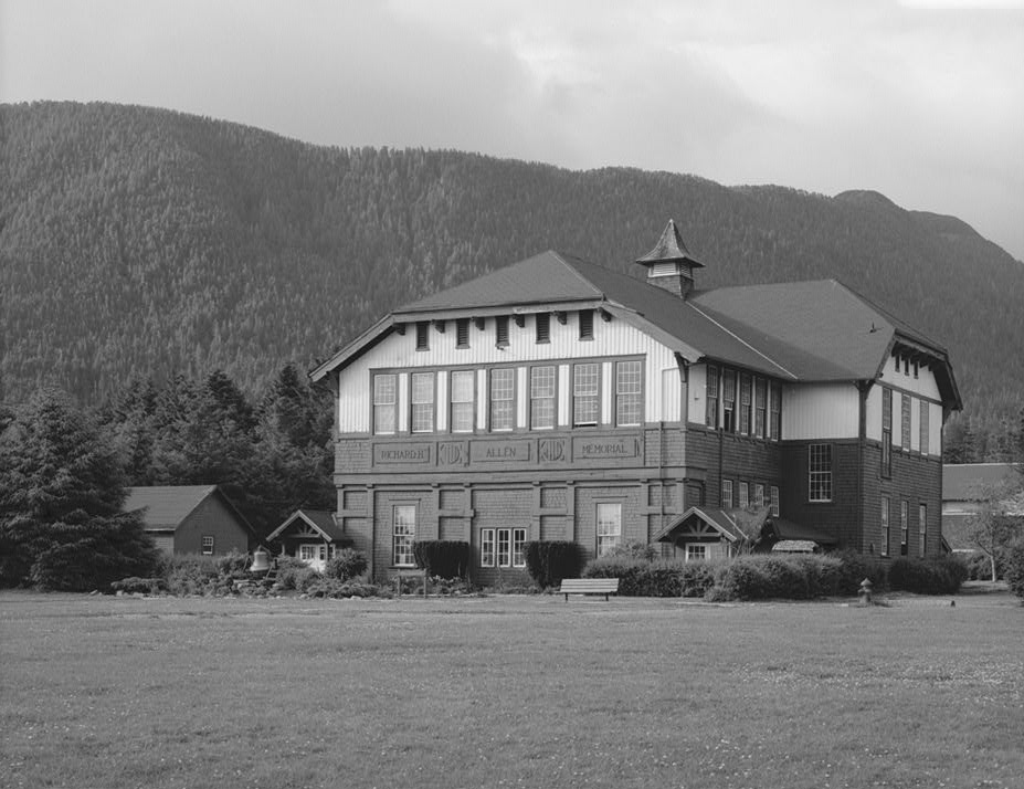
Sheldon Jackson School |
 |
01972-02-23 February 23, 1972 |
Lincoln St.
57°3′3″N 135°19′15″W / 57.05083°N 135.32083°W / 57.05083; -135.32083 (Sheldon Jackson School) |
Sitka |
|
| 16 |
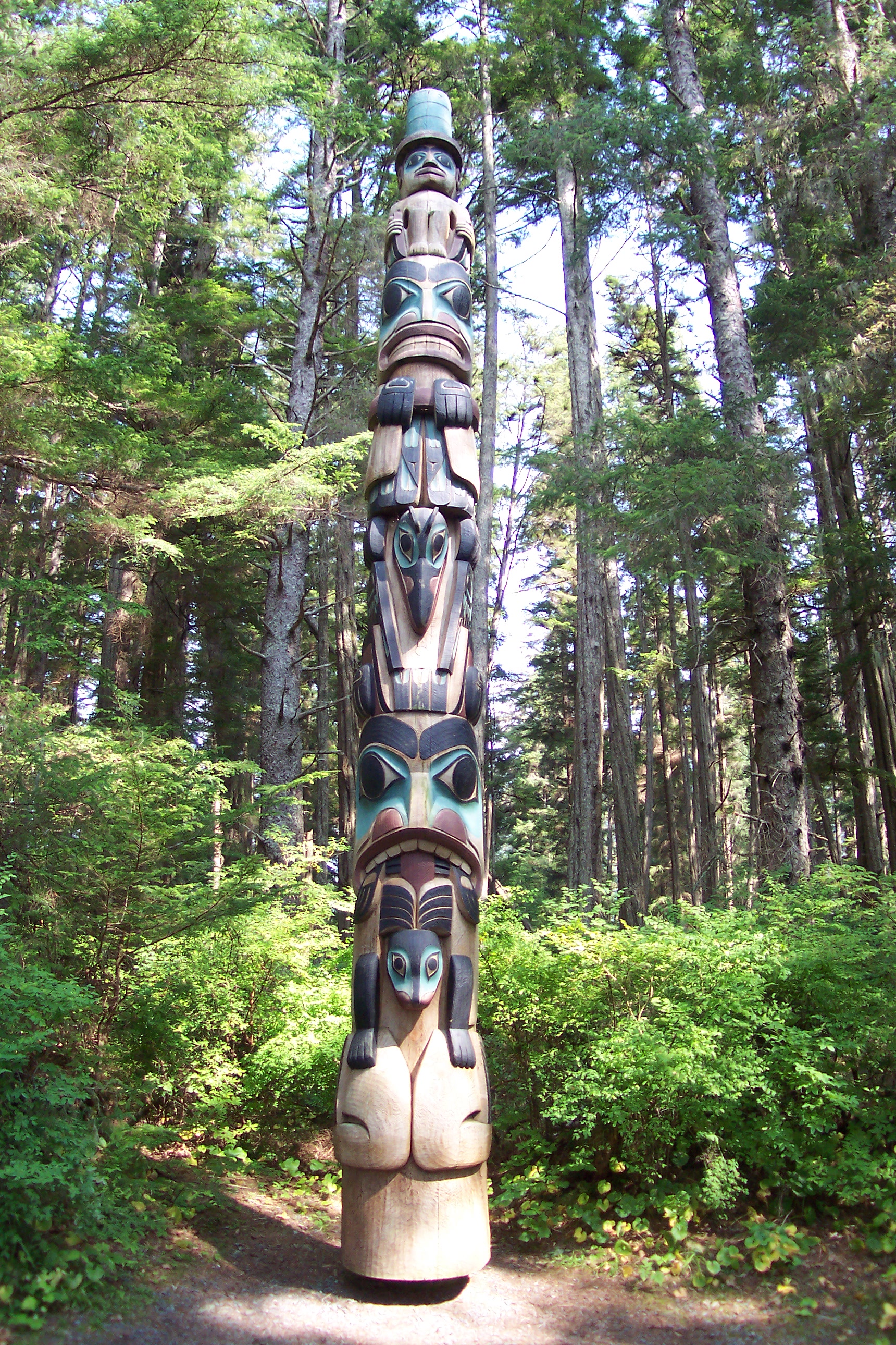
Sitka National Historical Park |
 |
01966-10-15 October 15, 1966 |
106 Metlakatla St.
57°2′51″N 135°18′42″W / 57.0475°N 135.31167°W / 57.0475; -135.31167 (Sitka National Historical Park) |
Sitka |
|
| 17 |
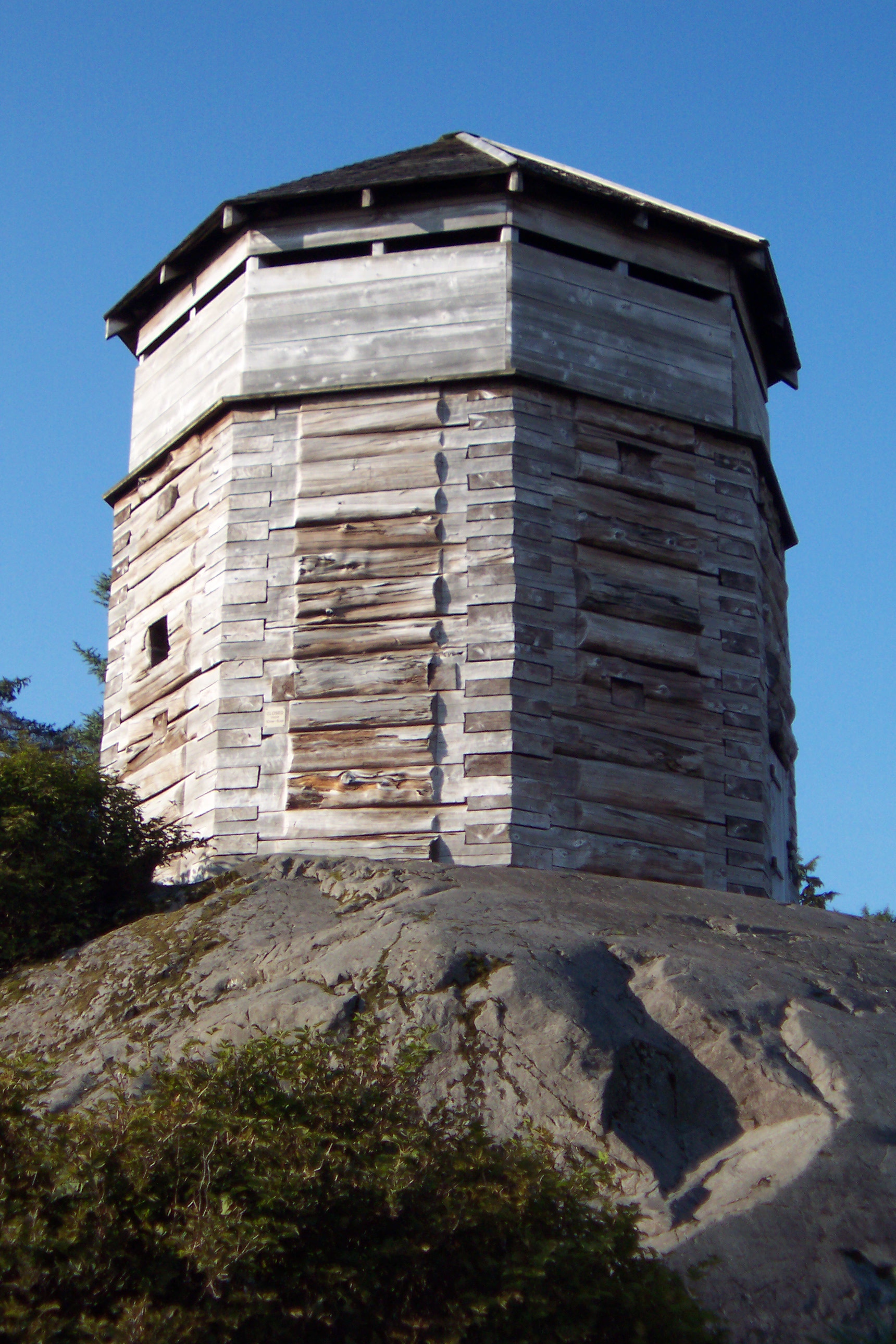
Sitka Naval Operating Base and US Army Coastal Defenses |
 |
01986-08-11 August 11, 1986 |
Japonski Island
57°2′49″N 135°21′52″W / 57.04694°N 135.36444°W / 57.04694; -135.36444 (Sitka Naval Operating Base and US Army Coastal Defenses) |
Sitka |
|
| 18 |
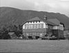
Sitka Pioneers' Home |
 |
01979-10-18 October 18, 1979 |
Katkian Ave. and Lincoln St.
57°3′4″N 135°20′16″W / 57.05111°N 135.33778°W / 57.05111; -135.33778 (Sitka Pioneers' Home) |
Sitka |
|
| 19 |
Sitka US Post Office and Court House |
|
01997-12-31 December 31, 1997 |
100 Lincoln St.
57°2′57″N 135°20′14″W / 57.04917°N 135.33722°W / 57.04917; -135.33722 (Sitka US Post Office and Court House) |
Sitka |
|
| 20 |
US Coast Guard and Geodetic Survey Seismological and Geomagnetic House |
|
01986-11-25 November 25, 1986 |
210 Seward St.
57°3′4″N 135°20′6″W / 57.05111°N 135.335°W / 57.05111; -135.335 (US Coast Guard and Geodetic Survey Seismological and Geomagnetic House) |
Sitka |
|
See also
References
- ^ The latitude and longitude information provided in this table was derived originally from the National Register Information System, which has been found to be fairly accurate for about 99% of listings. For about 1% of NRIS original coordinates, experience has shown that one or both coordinates are typos or otherwise extremely far off; some corrections may have been made. A more subtle problem causes many locations to be off by up to 150 yards, depending on location in the country: most NRIS coordinates were derived from tracing out latitude and longitudes off of USGS topographical quadrant maps created under the North American Datum of 1927, which differs from the current, highly accurate WGS84 GPS system used by Google maps. Chicago is about right, but NRIS longitudes in Washington are higher by about 4.5 seconds, and are lower by about 2.0 seconds in Maine. Latitudes differ by about 1.0 second in Florida. Some locations in this table may have been corrected to current GPS standards.
- ^ "National Register of Historic Places: Weekly List Actions". National Park Service, United States Department of the Interior. Retrieved on November 10, 2011.
- ^ Numbers represent an ordering by significant words. Various colorings, defined here, differentiate National Historic Landmark sites and National Register of Historic Places Districts from other NRHP buildings, structures, sites or objects.
- ^ "National Register Information System". National Register of Historic Places. National Park Service. 2008-04-24. http://nrhp.focus.nps.gov/natreg/docs/All_Data.html.
Categories:
- National Register of Historic Places in Alaska by borough and census area
- Sitka City and Borough, Alaska
Wikimedia Foundation.
2010.
Look at other dictionaries:
National Register of Historic Places listings in Juneau, Alaska — Location of Juneau in Alaska This is a list of the National Register of Historic Places listings in Juneau, Alaska. This is intended to be a complete list of the properties and districts on the National Register of Historic Places in Juneau,… … Wikipedia
National Register of Historic Places listings in Anchorage, Alaska — Location of Anchorage in Alaska This is a list of the National Register of Historic Places listings in Anchorage, Alaska. This is intended to be a complete list of the properties and districts on the National Register of Historic Places in… … Wikipedia
National Register of Historic Places listings in Skagway, Alaska — Location of Skagway in Alaska This is a list of the National Register of Historic Places listings in Skagway, Alaska. This is intended to be a complete list of the districts on the National Register of Historic Places in Skagway, Alaska, United… … Wikipedia
National Register of Historic Places listings in Wrangell, Alaska — Location of Wrangell in Alaska This is a list of the National Register of Historic Places listings in Wrangell, Alaska. This is intended to be a complete list of the properties and districts on the National Register of Historic Places in Wrangell … Wikipedia
National Register of Historic Places listings in Yakutat, Alaska — Location of Yakutat in Alaska This is a list of the National Register of Historic Places listings in Yakutat, Alaska. This is intended to be a complete list of the properties and districts on the National Register of Historic Places in Yakutat,… … Wikipedia
National Register of Historic Places listings in the Alaska Panhandle — This is a list of the National Register of Historic Places listings in the Alaska Panhandle. This is intended to be a complete list of the properties and districts on the National Register of Historic Places in the Alaska Panhandle, Alaska,… … Wikipedia
National Register of Historic Places listings in Alaska — This is a list of properties and districts listed on the National Register of Historic Places in Alaska. There are approximately 400 listed sites in Alaska. Each of the state s 28 boroughs and census areas has at least two listings on the… … Wikipedia
National Register of Historic Places listings in Aleutians West Census Area, Alaska — Location of the Aleutians West Census Area in Alaska This is a list of the National Register of Historic Places listings in Aleutians West Census Area, Alaska. This is intended to be a complete list of the properties and districts on the National … Wikipedia
National Register of Historic Places listings in Petersburg Census Area, Alaska — Location of the Petersburg Census Area in Alaska This is a list of the National Register of Historic Places listings in Petersburg Census Area, Alaska. This is intended to be a complete list of the properties and districts on the National… … Wikipedia
National Register of Historic Places listings in Dillingham Census Area, Alaska — Location of the Dillingham Census Area in Alaska This is a list of the National Register of Historic Places listings in Dillingham Census Area, Alaska. This is intended to be a complete list of the properties and districts on the National… … Wikipedia

 Boroughs
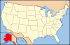 Aleutians East • Anchorage • Bristol Bay • Denali • Fairbanks North Star • Haines • Juneau • Kenai Peninsula • Ketchikan Gateway • Kodiak Island • Lake and Peninsula • Matanuska-Susitna • North Slope • Northwest Arctic • Sitka • Skagway • Wrangell • YakutatCensus areasAleutians West • Bethel • Dillingham • Hoonah-Angoon • Nome • Petersburg • Prince of Wales-Hyder • Southeast Fairbanks • Valdez-Cordova • Yukon-KoyukukThere are no sites listed on the National Register of Historic Places in Wade Hampton Census Area
 State of Alaska