- National Register of Historic Places listings in Somerset County, New Jersey
-
List of the National Register of Historic Places listings in Somerset County, New Jersey
Contents: Counties in New Jersey Atlantic - Bergen - Burlington - Camden - Cape May - Cumberland - Essex - Gloucester - Hudson - Hunterdon - Mercer - Middlesex - Monmouth - Morris - Ocean - Passaic - Salem - Somerset - Sussex - Union - Warren This is intended to be a complete list of properties and districts listed on the National Register of Historic Places in Somerset County, New Jersey. The locations of National Register properties and districts (at least for all showing latitude and longitude coordinates below) may be seen in a Google map by clicking on "Map of all coordinates".[1]
-
- This National Park Service list is complete through NPS recent listings posted November 4, 2011.[2]
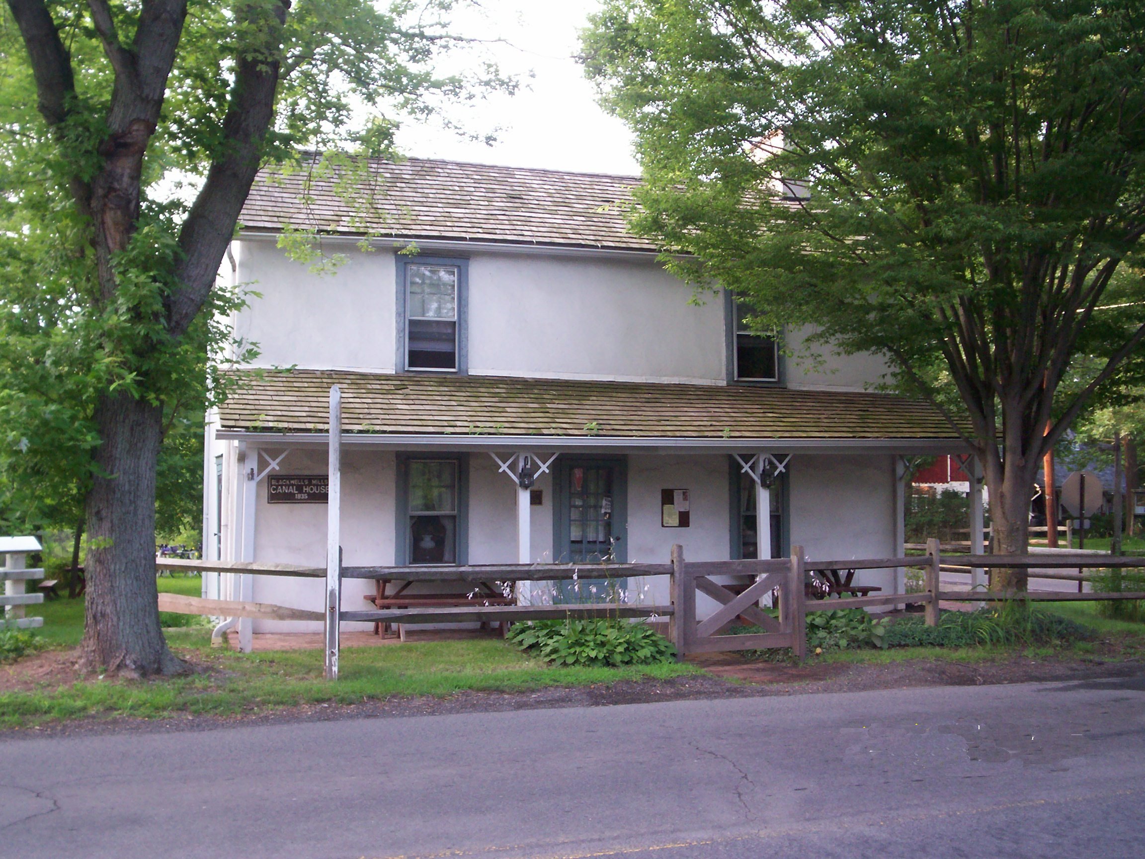
[3] Site name[4] Image Date listed Location[1] City or Town Summary 1 Alward Farmhouse March 13, 1986 40 Mt. Airy Rd.
40°41′39″N 74°34′34″W / 40.69417°N 74.57611°WBasking Ridge 2 Baker-Dauderstadt Farm November 26, 2008 30 DuBois Rd.
40°38′2.67″N 74°29′50.5″W / 40.634075°N 74.497361°WWarren Township 3 Basking Ridge Classical School July 21, 1976 15 W. Oak St.
40°42′23″N 74°33′1″W / 40.70639°N 74.55028°WBasking Ridge 4 Bedens Brook Bridge February 17, 1994 Opossum Rd., .1 mi. S of Orchard Rd., over Bedens's Brook, Montgomery Township
40°24′56″N 74°39′51″W / 40.41556°N 74.66417°WRocky Hill 5 Bedens Brook Road Bridge February 18, 1994 Beden's Brook Rd., .1 mi. E of Province Line Rd., over branch of Beden's Brook, Montgomery Township
40°23′40″N 74°43′47″W / 40.39444°N 74.72972°WStoutsburg 6 Bernardsville Station 
June 22, 1984 U.S. Route 202
40°43′1″N 74°34′18″W / 40.71694°N 74.57167°WBernardsville 7 Blawenburg Historic District December 7, 1990 Georgetown-Franklin Tpk./CR 588, Great Rd./CR 601, and Mountain View Rd.
40°24′29″N 74°42′9″W / 40.40806°N 74.7025°WBlawenburg 8 Boudinot-Southard Farmstead December 18, 2009 135 N. Maple Ave.
40°42′55.52″N 74°32′33.69″W / 40.7154222°N 74.5426917°WBernards Township 9 Bound Brook Station 
June 22, 1984 E. Main St.
40°33′39″N 74°31′51″W / 40.56083°N 74.53083°WBound Brook 10 Bridgepoint Historic District June 10, 1975 North of Rocky Hill off U.S. Route 206
40°25′46″N 74°38′55″W / 40.42944°N 74.64861°WRocky Hill 11 Cat Tail Brook Bridge August 1, 1979 NW of Rocky Hill on Montgomery Rd
40°26′28″N 74°44′37″W / 40.44111°N 74.74361°WRocky Hill 12 Clover Hill Historic District September 29, 1980 Amwell and Wertsville-Clover Hill Rds.
40°29′14″N 74°47′1″W / 40.48722°N 74.78361°WMontgomery 13 Coffee House November 7, 1977 214 N. Maple Ave.
40°43′11″N 74°32′30″W / 40.71972°N 74.54167°WBasking Ridge 14 Delaware and Raritan Canal May 11, 1973 Follows the Delaware River to Trenton, then E to New Brunswick
40°32′40″N 75°2′50″W / 40.54444°N 75.04722°WSomerville 15 East Millstone Historic District March 17, 1983 Amwell Rd. and Delaware & Raritan Canal
40°30′4″N 74°34′50″W / 40.50111°N 74.58056°WEast Millstone 16 Elmendorf House April 16, 1992 1246 Millstone River Rd., Hillsborough Township
40°30′43″N 74°35′17″W / 40.51194°N 74.58806°WMillstone 17 Far Hills Station 
June 22, 1984 U.S. Route 202
40°41′8″N 74°38′3″W / 40.68556°N 74.63417°WFar Hills 18 Franklin Corners Historic District May 12, 1975 North of Bernardsville on Hardscrabble and Childs Rds. and U.S. Route 202
40°43′59″N 74°32′48″W / 40.73306°N 74.54667°WBernardsville 19 Gen. John Frelinghuysen House March 4, 1971 Somerset St. and Wyckoff Ave.
40°34′5″N 74°37′46″W / 40.56806°N 74.62944°WRaritan 20 Gladstone Station 
June 22, 1984 Main St.
40°43′12″N 74°39′58″W / 40.72°N 74.66611°WGladstone 21 Griggstown Historic District 
August 2, 1984 Roughly Canal Rd. from Old Georgetown Rd. to Ten Mile Run
40°25′46″N 74°36′52″W / 40.42944°N 74.61444°WGriggstown 22 Dirck Gulick House December 11, 2003 506 Belle Mead-Blawenburg Rd.
40°27′2″N 74°41′24″W / 40.45056°N 74.69°WMontgomery Township 23 Higginsville Road Bridges August 10, 2000 Higginsville Rd. at the South Branch of the Raritan River
40°30′33″N 74°47′8″W / 40.50917°N 74.78556°WHillsborough 24 Huff House and Farmstead November 7, 1976 River Rd. at S branch of Raritan River
40°31′2″N 74°43′21″W / 40.51722°N 74.7225°WFlagtown 25 Kennedy-Martin-Stelle Farmstead May 5, 2004 450 King George Rd.
40°39′29″N 74°31′44″W / 40.65806°N 74.52889°WBernards Township (Basking Ridge) 26 Kingston Mill Historic District April 10, 1986 Roughly bounded by Herrontown, River, Princeton-Kingston Rds., and lots W of Princeton Twp.
40°22′28″N 74°37′34″W / 40.37444°N 74.62611°WFranklin 27 Kingston Village Historic District January 11, 1990 Roughly New Jersey Route 27 from Raymond Rd. to Delaware & Raritan Canal, Church St., Laurel Ave., Heathcote Brook Rd., & Academy St.
40°22′33″N 74°36′48″W / 40.37583°N 74.61333°WKingston 28 Kirch-Ford House October 20, 1988 1 Reinman Rd.
40°38′3″N 74°30′11″W / 40.63417°N 74.50306°WWarrenville 29 Lamington Historic District June 21, 1984 Lamington, Black River, Rattlesnake Bridge, and Cowperthwaite Rds.
40°39′36″N 74°43′0″W / 40.66°N 74.716667°WLamington 30 Liberty Corner Historic District October 11, 1991 Roughly, jct. of Church St. and Valley and Lyons Rds., and area W and SW, Bernards Township
40°39′49″N 74°34′55″W / 40.66361°N 74.58194°WLiberty Corner 31 Alexander and James Linn Homestead October 27, 1988 Rt. 202/Mine Brook Rd., between Sunnybranch Rd. and Lake Rd.
40°41′31″N 74°37′48″W / 40.69194°N 74.63°WFar Hills 32 Lyons Station 
June 22, 1984 Lyons Rd.
40°41′5″N 74°33′0″W / 40.68472°N 74.55°WLyons 33 Maplewood August 24, 2000 Burnt Hill Rd. at Rock Brook
40°24′50″N 74°41′2″W / 40.41389°N 74.68389°WMontgomery 34 McDonald's-Kline's Mill March 9, 1987 Address Restricted Bedminster 35 The Meadows 
December 4, 1973 1289 Easton Ave.
40°31′22″N 74°29′36″W / 40.52278°N 74.49333°WFranklin 36 Middlebrook Encampment Site July 3, 1975 Address Restricted Bound Brook 37 Middlebush Village Historic District April 24, 2007 Amwell Rd., S. Middlebush Rd., Railroad Ave., Olcott St., and Debow St.
40°29′44.2″N 74°31′44.04″W / 40.495611°N 74.5289°WFranklin 38 Millstone Historic District September 13, 1976 Amwell and River Rds.
40°29′56″N 74°35′18″W / 40.49889°N 74.58833°WMillstone 39 Millstone Valley Agricultural District August 10, 1977 S of Millstone on River Rd.
40°28′46″N 74°35′0″W / 40.47944°N 74.583333°WMillstone 40 Morristown National Historical Park October 15, 1966 At junction of U.S. Route 202 and New Jersey Route 24
40°46′1″N 74°31′43″W / 40.76694°N 74.52861°WSomerset 41 Mount Bethel Baptist Meetinghouse June 3, 1976 About 2 miles north of Martinsville off Interstate 78
40°38′17″N 74°30′53″W / 40.63806°N 74.51472°WMartinsville 42 Neshanic Historic District August 1, 1979 Amwell and Zion Rds
40°29′54″N 74°43′12″W / 40.49833°N 74.72°WNeshanic 43 Neshanic Mills January 9, 1978 Main Rd. and Mill Lane
40°30′31″N 74°43′35″W / 40.50861°N 74.72639°WNeshanic 44 Olcott Avenue Historic District November 20, 2009 Portions of Olcott, Childsworth, and Highview Avenues, and Church St.
40°43′22.08″N 74°33′57.82″W / 40.7228°N 74.5660611°WBernardsville 45 Old Dutch Parsonage 
January 25, 1971 65 Washington Pl.
40°34′5″N 74°37′23″W / 40.56806°N 74.62306°WSomerville 46 Old Stone Arch Bridge June 27, 2008 Railroad Ave., approximately 194 feet east of South Main St.
40°33′37.53″N 74°31′36″W / 40.560425°N 74.52667°WBound Brook Borough, Middlesex 47 John Parker Tavern December 14, 1978 2 Morristown Rd.
40°43′7″N 74°34′8″W / 40.71861°N 74.56889°WBernardsville 48 Pluckemin Village Historic District July 26, 1982 U.S. Route 206 and Burnt Mills Rd.
40°38′51″N 74°38′36″W / 40.6475°N 74.64333°WBedminster 49 Pluckemin Continental Artillery Cantonment Site 
March 14, 2008 Junction of U.S. Route 202 and U.S. Route 206, north of River Rd., Bedminster Twp.
40°40′2″N 74°39′5″W / 40.66722°N 74.65139°WPluckemin, New Jersey 50 Pottersville Village Historic District September 18, 1990 Properties fronting on Black River, Pottersville, McCann Mill and Hacklebarney Rds. and Fairmount Rd. E and Hill St.
40°42′52″N 74°43′21″W / 40.71444°N 74.7225°WPottersville 51 Presbyterian Church at Bound Brook August 28, 2007 409 Mountain Ave.
40°34′1″N 74°31′52″W / 40.56694°N 74.53111°WBound Brook Borough 52 Presbyterian Church in Basking Ridge December 31, 1974 6 E. Oak St.
40°42′26″N 74°32′39″W / 40.70722°N 74.54417°WBasking Ridge 53 Raritan Bridge November 12, 1992 Nevius St. over Raritan R., Bridgewater and Hillsborough Townships
40°33′52″N 74°38′53″W / 40.56444°N 74.64806°WRaritan 54 Raritan Station June 22, 1984 Anderson and Thompson Sts.
40°34′14″N 74°38′4″W / 40.57056°N 74.63444°WRaritan 55 Reformed Dutch Church of Blawenburg September 5, 1985 424 CR 518
40°24′31″N 74°42′14″W / 40.40861°N 74.70389°WBlawenburg 56 Relief Home Company No. 2 Engine House December 14, 2000 16 Anderson St.
40°34′7″N 74°38′3″W / 40.56861°N 74.63417°WRaritan Borough 57 Reynolds-Scherman House April 29, 1989 71 Hardscrabble Rd.
40°44′22″N 74°33′27″W / 40.73944°N 74.5575°WBernardsville 58 River Road Historic Rural District March 21, 1991 Millstone River Rd. from Hillsborough Rd. to Van Horne Rd., Hillsborough and Montgomery Townships
40°25′54″N 74°37′42″W / 40.43167°N 74.62833°WGriggstown 59 Daniel Robert House March 5, 2008 25 West End Ave.
40°34′20″N 74°37′11″W / 40.57222°N 74.61972°WSomerville 60 Rock Brook Bridge February 18, 1994 Jct. of Long Hill and Dutchtown-Zion Rds. over Cat Tail Brook, Montgomery and Hillsborough Townships
40°26′22″N 74°44′23″W / 40.43944°N 74.73972°WZion 61 Rockingham 
December 18, 1970 84 Laurel Ave. (Route 603)
40°24′8″N 74°36′50″W / 40.40222°N 74.61389°WFranklin Township 62 Rocky Hill Historic District July 8, 1982 Washington, Montgomery, and Princeton Aves.
40°24′0″N 74°38′13″W / 40.4°N 74.63694°WRocky Hill 63 Six Mile Run Historic District 
October 25, 1995 Roughly bounded by Grouse Rd., Amwell Rd., Bennetts Ln., New Jersey Route 27, Bunker Hill Rd. and the Millstone R.
40°27′48″N 74°33′29″W / 40.46333°N 74.55806°WFranklin Park 64 Six Mile Run Reformed Church December 18, 2009 3037 New Jersey Route 27
40°22′34.13″N 74°36′43.93″W / 40.3761472°N 74.6122028°WFranklin 65 Smalley-Wormser House October 19, 1978 W of Plainfield at 84 Mountain Ave.
40°39′30″N 74°28′28″W / 40.65833°N 74.47444°WPlainfield 66 J. Harper Smith Mansion December 31, 1998 228 Altamont Place
40°34′29″N 74°37′16″W / 40.57472°N 74.62111°WSomerville Borough 67 Somerset Courthouse Green 
September 7, 1989 Roughly E. Main St. from Grove St. to N. Bridge St.
40°34′5″N 74°36′40″W / 40.56806°N 74.61111°WSomerville 68 South Branch Historic District December 13, 1977 SW of Raritan
40°32′5″N 74°41′42″W / 40.53472°N 74.695°WRaritan 69 South Branch Schoolhouse March 30, 2005 South Branch River Rd.
40°33′0″N 74°42′2″W / 40.55°N 74.70056°WBranchburg Township 70 St. Bernard's Church and Parish House September 6, 2006 88 Claremont Rd.
40°43′26″N 74°34′21″W / 40.72389°N 74.5725°WBernardsville 71 Staats House December 4, 2002 17 Von Steuben Ln.
40°33′6″N 74°31′16″W / 40.55167°N 74.52111°WSouth Bound Brook Borough 72 Lord Stirling Manor Site May 22, 1978 SE of Basking Ridge at 96 Lord Stirling Rd.
40°41′39″N 74°31′50″W / 40.69417°N 74.53056°WBasking Ridge 73 Andrew Ten Eyck House May 6, 2004 671 Old York Rd.
40°33′50″N 74°42′34″W / 40.56389°N 74.70944°WBranchburg 74 Tulipwood 
September 9, 2005 1165 Hamilton St.
40°29′20″N 74°29′41″W / 40.48889°N 74.49472°WSomerset 75 Vail-Trust House October 7, 2008 225 Greenbrook Rd.
40°35′19.72″N 74°29′18.45″W / 40.5888111°N 74.4884583°WGreen Brook Township 76 Van Der Veer-Harris House March 12, 2008 344 U.S. Route 206 (Hillsborough Township)
40°30′39″N 74°38′4″W / 40.51083°N 74.63444°WWoods Tavern 77 Van Horne House March 8, 2002 941 E. Main St.
40°33′42″N 74°33′5″W / 40.56167°N 74.55139°WBridgewater Township 78 Van Veghten House October 10, 1979 South of Somerville off New Jersey Route 28
40°33′25″N 74°35′18″W / 40.55694°N 74.58833°WSomerville 79 Jacobus Vanderveer House September 29, 1995 Junction of U.S. Route 202 and U.S. Route 206, north of River Rd., Bedminster Twp.
40°40′2″N 74°39′5″W / 40.66722°N 74.65139°WBedminster 80 VanDerventer-Brunson House October 27, 2004 614 Greenbrook Rd.
40°36′41″N 74°27′21″W / 40.61139°N 74.45583°WNorth Plainfield Borough 81 Vosseller's-Castner's-Allen's Tavern January 23, 1986 664 Foothill Rd.
40°36′27″N 74°36′57″W / 40.6075°N 74.61583°WBridgewater 82 Wallace House 
December 2, 1970 38 Washington Pl.
40°34′8″N 74°37′19″W / 40.56889°N 74.62194°WSomerville 83 Washington Park Historic District April 9, 1987 Roughly bounded by Green Brook Rd., Grove Ave., E. Front St., and Geraud Ave.
40°37′4″N 74°26′7″W / 40.61778°N 74.43528°WNorth Plainfield 84 West End Hose Company Number 3 
July 17, 2002 15 Doughty Av.
40°33′49″N 74°37′6″W / 40.56361°N 74.61833°WSomerville References
- ^ a b The latitude and longitude information provided in this table was derived originally from the National Register Information System, which has been found to be fairly accurate for about 99% of listings. For about 1% of NRIS original coordinates, experience has shown that one or both coordinates are typos or otherwise extremely far off; some corrections may have been made. A more subtle problem causes many locations to be off by up to 150 yards, depending on location in the country: most NRIS coordinates were derived from tracing out latitude and longitudes off of USGS topographical quadrant maps created under North American Datum of 1927, which differs from the current, highly accurate GPS system used by Google maps. Chicago is about right, but NRIS longitudes in Washington are higher by about 4.5 seconds, and are lower by about 2.0 seconds in Maine. Latitudes differ by about 1.0 second in Florida. Some locations in this table may have been corrected to current GPS standards.
- ^ "National Register of Historic Places: Weekly List Actions". National Park Service, United States Department of the Interior. Retrieved on November 4, 2011.
- ^ Numbers represent an ordering by significant words. Various colorings, defined here, differentiate National Historic Landmark sites, a [[National Historic Site (United States)|]], and several National Register of Historic Places Districts from other NRHP buildings, structures, sites or objects.
- ^ "National Register Information System". National Register of Historic Places. National Park Service. 2008-04-24. http://nrhp.focus.nps.gov/natreg/docs/All_Data.html.
U.S. National Register of Historic Places Topics Lists by states Alabama • Alaska • Arizona • Arkansas • California • Colorado • Connecticut • Delaware • Florida • Georgia • Hawaii • Idaho • Illinois • Indiana • Iowa • Kansas • Kentucky • Louisiana • Maine • Maryland • Massachusetts • Michigan • Minnesota • Mississippi • Missouri • Montana • Nebraska • Nevada • New Hampshire • New Jersey • New Mexico • New York • North Carolina • North Dakota • Ohio • Oklahoma • Oregon • Pennsylvania • Rhode Island • South Carolina • South Dakota • Tennessee • Texas • Utah • Vermont • Virginia • Washington • West Virginia • Wisconsin • WyomingLists by territories Lists by associated states Other  Category:National Register of Historic Places •
  Portal:National Register of Historic Places
 State of New Jersey
Trenton (capital) Topics Delegations · Demographics · Economy · Elections · Geography · Government · History · Media · Municipalities · Music · People · Politics · Symbols · Transportation · Parks
Regions Atlantic Coastal Plain · Central Jersey · Delaware River Region · Delaware Valley · Gateway Region · Gold Coast · Highlands · Jersey Shore · Meadowlands · New York metro area · North Hudson · North Jersey · Pascack Valley · Piedmont · Pine Barrens · Raritan Bayshore · Ridge-and-Valley Appalachians · Southern Shore Region · Skylands Region · South Jersey · Tri‑State Region · West Hudson
Counties Major cities Atlantic City · Camden · Edison · Elizabeth · Hackensack · Jersey City · Newark · New Brunswick · Ocean City · Paterson · Trenton · Vineland
Categories:- National Register of Historic Places in New Jersey
- Somerset County, New Jersey
-


Wikimedia Foundation. 2010.